Hawai‘i Volcanoes National Park
How to Plan a Hawaii Volcanoes National Park Trip: Lava Landscapes, Scenic Drives, and Safety Tips
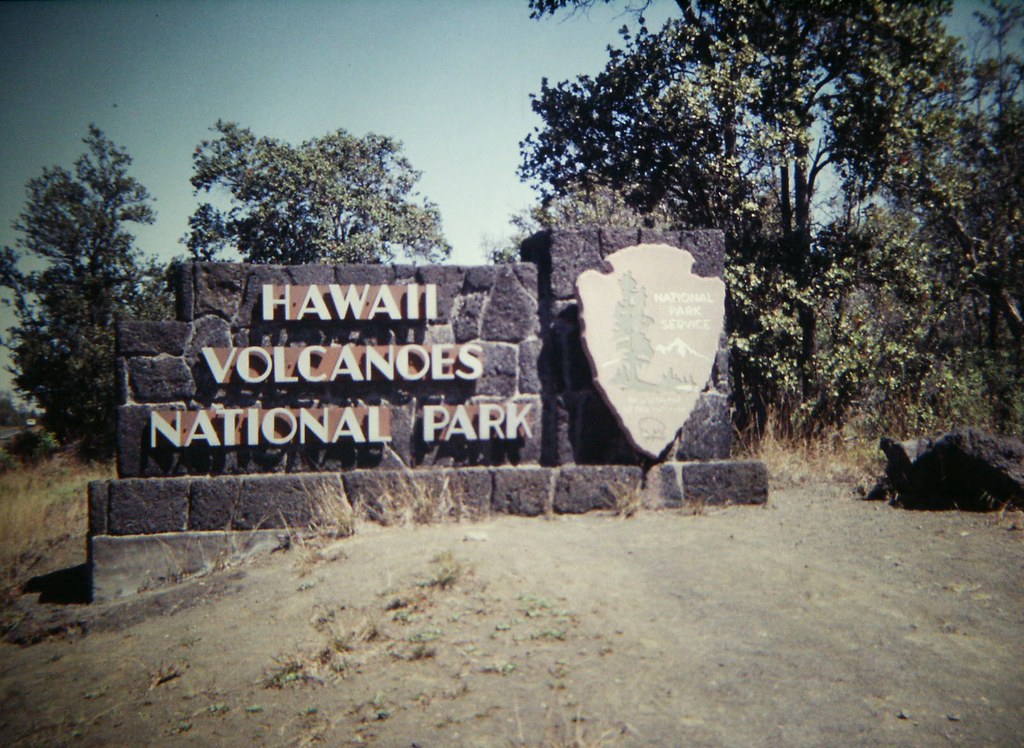
Photo: Gary Lee Todd, Ph.D. via Flickr (CC0 1.0 (Public Domain))
Learning How to Plan a Hawaii Volcanoes National Park Trip starts with one key decision: allow enough time for both Kīlauea’s summit and the long descent to the Pacific on Chain of Craters Road. One full day covers the principal overlooks and a short walk, but two days allow time for Kīlauea Iki, Nāhuku, changing weather, and possible eruption viewing without rushing.
Hawaiʻi Volcanoes National Park occupies a broad elevation range on Hawaiʻi Island, from the coast to the 13,681 foot summit of Mauna Loa. Most first visits center on Kīlauea, whose summit area sits near 4,000 feet. Conditions there can be cool, wet, and windy even when beaches near Hilo or Kona are warm. Active lava is never guaranteed, so build the trip around volcanic landforms, native forest, craters, lava tubes, and coastal scenery rather than a promised eruption.
Start with the right amount of time and a realistic route
Choose one day or two days
With one day, begin at Kīlauea’s summit, walk a section of Crater Rim Trail, visit the Kīlauea Iki area, and then drive Chain of Craters Road as far as daylight permits. Starting early matters because clouds and rain often increase during the day, while parking at popular trailheads becomes more difficult by late morning.
A two-day plan separates the summit from the coast. Use the first day for overlooks, Nāhuku, and a substantial hike such as the Kīlauea Iki Trail. Reserve the second for Chain of Craters Road, Puʻuloa Petroglyphs, sea cliffs, and extra time at recent lava flows. This arrangement also gives you another opportunity to respond if eruption conditions or weather change.
Understand the park’s scale before driving
The summit entrance is roughly a 45 minute drive from central Hilo under ordinary conditions. Kailua-Kona is much farther away, commonly requiring about two hours each way depending on the route, traffic, and stops. Visitors based on the west side should treat a park day as an early start and a late return rather than a casual side trip.
Chain of Craters Road extends approximately 19 miles from the summit area toward the ocean, losing around 3,700 feet of elevation. The return uses the same road, so every mile driven downhill must be retraced. Fuel, food, and water are easier to obtain outside the park than along this route.
Pick dates based on weather, daylight, and volcanic conditions
Plan for elevation rather than beach weather
Kīlauea’s summit receives substantial rain and is frequently wrapped in mist or low cloud. Daytime temperatures can be 15 to 25 degrees Fahrenheit cooler than those along the nearby coast. Winter brings shorter daylight and generally wetter patterns, while summer usually provides more usable evening light. Rain can occur in any month because moist trade winds rise against the island’s eastern slopes.
| Period | Typical planning advantage | Main complication |
|---|---|---|
| December through March | Cool hiking temperatures and lower sun angles | Shorter days, frequent rain, and stronger summit winds |
| April through May | Moderate daylight and generally comfortable trail conditions | Wet forest paths and variable holiday crowds |
| June through September | Longer daylight for Chain of Craters Road | Exposed lava fields become hot by midday |
| October through November | Useful shoulder season for flexible itineraries | Cloud, rain, and eruption conditions remain unpredictable |
Treat lava activity as a changing condition
Kīlauea alternates among eruptive episodes, pauses, and extended periods without visible surface lava. When eruptions occur inside the summit caldera, viewing areas may be adjusted according to gas, wind, ground cracking, and crowd management. An orange glow can sometimes be visible after dark even when individual lava fountains are hidden by crater walls.
Check the park’s alerts, eruption updates, air-quality information, road closures, current entrance requirements, and opening hours shortly before departure, and confirm current details on the official park site. Operational changes also occur during resource management work. Our coverage of planned vegetation burning in the Kahuku-Pōhue section illustrates why conditions elsewhere in the park can affect access and air quality.
Learn the park’s three main landscape zones
Kīlauea summit and the caldera rim
Kīlauea rises to 4,091 feet and contains a summit caldera shaped by repeated collapse, filling, and eruption. The caldera changed dramatically during the 2018 eruption, when magma drained into the lower East Rift Zone and the summit floor dropped in a series of collapses. Overlooks around Crater Rim Drive reveal layered walls, steaming fractures, sulfur deposits, and expanses of younger lava.
Crater Rim Trail
Rather than following the entire rim as a continuous loop, visitors usually walk open segments between overlooks and trail junctions. These sections provide a quieter alternative to moving between every viewpoint by car. Stay behind barriers because apparently solid edges can overhang voids or conceal cracks heated by volcanic steam.
Kīlauea Iki and native rain forest
Kīlauea Iki is a pit crater beside the summit caldera. Its floor preserves the hardened remains of a lava lake created during the 1959 eruption, when fountains reached exceptional heights from the Puʻupuaʻi vent. The approximately 3.3 mile Kīlauea Iki loop descends about 400 feet through forest, crosses the crater floor, and climbs back by switchbacks.
On the crater floor, dark slabs sound hollow beneath your boots, steam slips from narrow cracks, and the open basin makes the opposite rim look farther away than it did from above. The temperature rises once you leave the forest shade. Painted route markers lead across buckled lava toward the green wall of vegetation at the far side.
Chain of Craters Road and the coast
This scenic drive crosses lava from multiple eruptions along Kīlauea’s East Rift Zone. Frequent pullouts reveal spatter ramparts, pit craters, pāhoehoe with smooth or ropy surfaces, and rough ʻaʻā flows made of sharp, unstable fragments. Vegetation becomes shorter and sparser as the road descends from wet upland forest into a hotter coastal environment.
Near the ocean, the route reaches exposed sea cliffs and the Hōlei Sea Arch area. Conditions are typically warmer and windier than at the summit, with little shade. Strong surf, unstable cliff edges, and salt spray make the coast a viewing area rather than a place for swimming.
Build the day around a few high-value stops
Plan Your First Hawaii Volcanoes National Park Visit
- Begin in the summit area: Check current conditions and orient yourself to the caldera before committing to a long hike.
- Walk an open section of Crater Rim Trail: Early morning usually provides cooler temperatures and clearer views into the caldera.
- Continue to Kīlauea Iki and Nāhuku: Allow two to three hours for the crater loop, less if you visit only the overlook and lava tube area.
- Drive Chain of Craters Road: Stop selectively at pit craters, older flows, and signed viewpoints rather than trying to inspect every pullout.
- Return before fatigue sets in: The uphill drive back to the summit takes longer than many visitors expect, especially after hiking in coastal heat.
Decide which walk matches your available time
For a short outing, choose a rim segment or an overlook near Kīlauea Iki. The full crater loop suits hikers comfortable with uneven lava, forest steps, and a sustained climb out. The Puʻuloa Petroglyphs trail is approximately 1.4 miles round trip across exposed lava and leads to a boardwalk overlooking hundreds of carved forms, including cup-shaped depressions associated with Native Hawaiian cultural practices.
Nāhuku, also called Thurston Lava Tube, demonstrates how the exterior of a lava flow can cool while molten rock continues moving inside. After the lava drains, it leaves a tunnel behind. The surrounding forest contains giant hāpuʻu tree ferns, ʻōhiʻa lehua, and other native plants adapted to thin volcanic soils and persistent moisture.
Pack for volcanic terrain and rapid weather changes
How to Plan a Hawaii Volcanoes National Park Trip also means preparing for two climates in one day. Summit rain can soak cotton clothing and lower body temperature, while coastal lava fields radiate heat through shoe soles. Carry water from the start because the driest, hottest portion of the day often occurs farthest from convenient services.
Use a layered packing system
A light waterproof shell, insulating midlayer, sun hat, and breathable shirt cover the most common conditions. Closed shoes with firm soles provide better protection than sandals on ʻaʻā, where loose fragments have sharp edges. Pack more water for the coastal drive than for the summit, plus food that can remain in a warm vehicle.
| Item | Where it matters most | Reason |
|---|---|---|
| Waterproof jacket | Kīlauea summit | Wind-driven rain can arrive quickly |
| Firm-soled shoes | Crater floors and lava fields | Fresh volcanic rock is abrasive and uneven |
| Sun protection | Puʻuloa and the coast | Dark lava reflects heat and provides little shade |
| Headlamp | Evening overlooks | Parking areas and trails can be difficult to read after dark |
Recognize volcanic gas exposure
Sulfur dioxide can irritate the eyes, throat, and lungs, especially downwind of active vents. People with asthma, cardiovascular disease, or other respiratory conditions should avoid lingering where fumes collect. An N95 respirator filters particles but does not remove sulfur dioxide gas, so leaving the affected area is the appropriate response to coughing, chest tightness, or burning eyes.
Manage the hazards visitors commonly underestimate
Marked paths protect both visitors and volcanic resources. Thin crust can cover cracks, steam vents, or hollow lava tubes, while crater rims may fracture beyond the visible edge. Pele’s hair, fine volcanic glass strands produced by lava fountains, can lodge in skin and eyes. Do not touch it or collect rocks, sand, plants, or cultural material.
Drive defensively around wildlife
Nēnē, Hawaiʻi’s endemic goose, often forage beside roads and parking areas. Slow down when birds are present, check beneath and around the vehicle before moving, and never feed them. Food changes their behavior and draws them toward traffic. Keep distance from all wildlife, including nesting seabirds along coastal cliffs.
Use a turnaround plan
Set a return time before descending Chain of Craters Road, accounting for the uphill drive, photography stops, and reduced visibility after sunset. If heavy rain obscures lane markings or a hiker develops heat symptoms, shorten the itinerary rather than racing between remaining stops. Carry an offline map because mobile reception can be inconsistent away from the summit.
Know the warning signs
- Heat exhaustion: Heavy sweating, weakness, nausea, headache, or dizziness.
- Gas exposure: Coughing, throat irritation, breathing difficulty, or burning eyes.
- Hypothermia: Persistent shivering, confusion, or poor coordination after becoming wet.
- Dehydration: Unusual fatigue, dry mouth, headache, or declining concentration.
Keep a flexible backup plan
Rain, volcanic gas, wildfire management, road work, and eruptive activity can alter a carefully planned day. Create separate summit and coastal modules instead of one rigid sequence. If clouds hide the caldera, walk through the native forest near Kīlauea Iki. If heat or poor air affects exposed areas, return to shorter walks at higher elevation.
Avoid the most expensive planning mistakes
Arriving with an almost empty fuel tank, beginning a long hike late, and assuming active lava will be visible cause avoidable problems. Fill the tank before entering, download maps, and identify a firm turnaround time. Leave valuables out of sight, then lock the vehicle before walking away from any trailhead or pullout.
Respect the cultural landscape
Kīlauea is an active geological system and a culturally significant place associated with Pelehonuamea. Remain on designated routes around petroglyphs, stone features, and ceremonial areas. Do not stack rocks, leave offerings, or enter closed spaces. At Puʻuloa, stay on the boardwalk so foot traffic does not abrade carvings made across generations.
Frequently Asked Questions
These practical answers address decisions that frequently affect first visits. They also help separate activities suitable for a general sightseeing day from outings requiring greater fitness, preparation, or flexibility.
How long should I spend in the park?
Allow one long day for the summit, Kīlauea Iki area, and selected coastal stops. Two days provide enough time for a substantial hike and a separate Chain of Craters Road excursion.
Can children visit safely?
Yes, provided adults maintain close supervision near cliffs, craters, steam vents, roads, and sharp lava. Choose short rim walks for younger children and carry sun, rain, food, and water supplies for them.
Are dogs allowed on the trails?
Pets have limited access and generally cannot accompany visitors on most backcountry trails. Never leave an animal in a parked vehicle, since coastal temperatures can rise quickly.
Do I need four-wheel drive?
No. The principal summit roads and Chain of Craters Road are paved, although closures can restrict access. A standard passenger car is suitable for the main first-visit route.
Will I definitely see flowing lava?
No. Eruptions can pause or occur in locations hidden from public viewpoints. Plan around craters, lava flows, native forest, petroglyphs, and coastal geology so the day remains worthwhile without visible molten rock.
Build a safer, better-paced volcano day
A successful visit combines an early summit start, one carefully chosen walk, and enough daylight for the coast. Layers, firm footwear, water, offline navigation, and a predetermined turnaround time address the park’s most predictable difficulties. Flexibility handles the rest, including rain, gas, cloud, and changing volcanic activity.
Give each landscape time to register rather than treating every overlook as a checklist item. The collapsed summit, 1959 lava lake, East Rift Zone flows, native rain forest, and wave-cut coast explain different parts of Kīlauea’s history. A measured itinerary makes those connections clearer while keeping your group away from unstable ground, excessive heat, and rushed driving.
Want to keep exploring? Browse all our Hawaii Volcanoes guides and articles for more trip-planning tips and ideas.
Gear & Essentials
Tell us about your trip and we will add what else you will want:
The basics
Worth having in the car whatever the park.
For this trip
As an Amazon Associate we earn from qualifying purchases, at no extra cost to you.