Indiana Dunes National Park: The Perfect 3-Day Itinerary
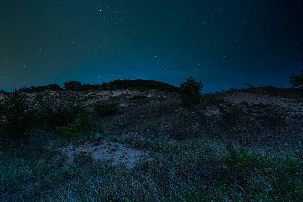
Photo: Don Ski via Flickr (CC BY-NC-SA 2.0)
Indiana Dunes National Park: a place where towering sand dunes rise more than 100 feet above the southern shore of Lake Michigan, placing you inside a genuine ecological crossroads where boreal forests, oak savannas, tallgrass prairie remnants, and freshwater wetlands occupy the same narrow strip of land. That convergence makes it one of the most biodiverse units in the entire National Park System, hosting over 1,100 plant species and serving as a critical flyway corridor for migratory birds along the southern curve of Lake Michigan. Spread across roughly 15,000 acres in northwest Indiana, the park sits just 50 miles from downtown Chicago, making it one of the most accessible national parks in the country for a significant percentage of the U.S. population.
This three-day itinerary is built to move you through the park in a logical west-to-east arc, pairing the most visited dune faces and swimming beaches on Day 1 with the longer interior hiking trails on Day 2, and then dedicating Day 3 to the park’s quieter ecological zones and historic sites. That order matters: the western beaches and Mount Baldy draw the biggest crowds, so hitting them when you are freshest means you can start early, claim space, and push deeper before midday heat sets in. By Day 3, you will be exploring sections most visitors never reach.
Indiana Dunes National Park: Orientation, Boundaries, and Getting There
Geographic Layout and Park Boundaries
The park does not form a single contiguous block. Instead, it stretches roughly 25 miles from west to east along the Lake Michigan shoreline, interspersed with private property, state park land, and industrial zones. Indiana Dunes State Park occupies a 2,182-acre parcel inside the national park’s eastern section near Chesterton, and understanding the distinction matters for your planning: the state park charges a separate admission fee, controls its own parking and access, and is where you will find the iconic Three Dune Challenge trailhead. Confirm current admission details for both units on the official park and state park websites before you go.
Key visitor-facing areas include the Paul H. Douglas Center for Environmental Education near Miller Beach in Gary on the western end, the Portage Lakefront and Riverwalk near the center, and the Mount Baldy trailhead at the far eastern tip. The Dorothy Buell Memorial Visitor Center sits near Chesterton and Dunbar Beach, making it a practical hub for picking up trail maps and checking ranger-posted conditions before you head out each morning.
Getting There: Drive Times and Transit Options
From Chicago’s Loop, the drive to the western trailheads near Miller Beach takes roughly 55 to 65 minutes via I-90/94 East to I-94 East. Reaching the Dorothy Buell Visitor Center near Chesterton adds another 20 minutes. The South Shore Line commuter rail, operated by the Northern Indiana Commuter Transportation District, runs directly from Millennium Station in Chicago to stations including Dune Park and Beverly Shores, dropping you within a short walk or bike ride of several trailheads. That rail connection makes Indiana Dunes genuinely car-optional for day visitors, though a vehicle gives you flexibility that public transit cannot match for a three-day itinerary with multiple access points.
Indiana Dunes National Park: How to Structure Your Perfect 3-Day Route
The west-to-east progression is not arbitrary. Parking at the western access points fills fastest on warm weekends because those lots serve both local day-trippers from Chicago and visitors staying in nearby Portage or Merrillville. By front-loading your time at popular spots like West Beach, you align your visit with early-morning availability. Moving east on Days 2 and 3 takes you progressively into higher dunes, quieter boardwalk trails, and the historic Century of Progress homes at Beverly Shores, all of which reward a slower pace.
Below is an at-a-glance overview of the full three-day route. Drive times between stops are estimates under normal traffic conditions; summer weekends on U.S. 12 can add 15 to 20 minutes between eastern access points.
| Day | Primary Stop | Key Highlights | Approx. Drive from Previous Stop |
|---|---|---|---|
| 1 | West Beach and Portage Lakefront | Long Lake Trail, swimming beach, dune ridges | Base camp arrival |
| 2 | Indiana Dunes State Park and Cowles Bog | Three Dune Challenge, Trail 10, Cowles Bog loop (4.7 mi) | 15 to 20 minutes east |
| 3 | Beverly Shores and Mount Baldy | Century of Progress homes, Mount Baldy (126 ft), Ly-co-ki-we trail | 10 to 15 minutes east |
Day 1: West Beach, Long Lake, and the Portage Lakefront
West Beach: The Park’s Most Complete Day-Use Area
West Beach in Gary offers the clearest introduction to what makes Indiana Dunes ecologically distinct. The 3.4-mile Long Lake Trail loops around a dune-rimmed interdunal pond, passing through blowout zones where wind has scoured the sand down to bare parabola shapes, and through black oak savanna stands where the canopy opens onto grass-and-forb understory. The elevation change on the trail’s dune crossing section reaches roughly 80 feet over a short horizontal distance, enough to shift the microclimate noticeably between the shaded north-facing slopes and the sun-baked south-facing sand.
Practical Notes for West Beach
- Arrive by 8:30 a.m. on summer weekends; the parking lot closes to incoming vehicles once capacity is reached, often before 10 a.m.
- Bring all drinking water you will need. The beach season brings portable facilities, but potable water availability varies by season; confirm on the official park site.
- The swimming beach is staffed by lifeguards during designated summer hours; swimming outside those hours is at your own risk in Lake Michigan’s currents.
- Dogs are not permitted on the swimming beach but are allowed on trails on a 6-foot leash.
- Carry cash or a card for any parking fees; confirm current rates on the park website.
Portage Lakefront and Riverwalk: An Underrated Afternoon Stop
After West Beach, the Portage Lakefront and Riverwalk area, located about 8 miles east, gives you a second access point to Lake Michigan’s shoreline with a very different character. A restored natural shoreline fronts a wide sandy beach, and the 0.8-mile paved riverwalk along the Burns Waterway draws both casual walkers and birders scanning the water for migrating waterfowl. During fall migration in September and October, common loons, red-breasted mergansers, and various gull species concentrate here in numbers that rival dedicated birding refuges.
The afternoon light at Portage facing northwest over the lake is particularly strong for photography in summer, when the sun sets directly over the water rather than behind the dune ridge. Plan to spend an hour here before heading to your lodging in Portage, Valparaiso, or Chesterton, all of which sit within 15 to 25 minutes of the main park access roads and offer a range of hotel, motel, and vacation rental options.
Want to keep exploring? Browse all our Indiana Dunes guides and articles for more trip-planning tips and ideas.
Gear & Essentials
Before you head out, make sure you have the right gear for Indiana Dunes National Park: The Perfect 3-Day Itinerary. These are our picks:
- Sawyer Picaridin Insect Repellent Lotion
- MAXTOP Crossbody Fanny Pack
- Merrell Men's Moab 3 Hiking Shoe
- Merrell Women's Moab 3 Mid Waterproof Boot
- Rainleaf Microfiber Quick-Dry Towel
- BAND-AID Travel Emergency First Aid Kit
As an Amazon Associate, we earn from qualifying purchases at no extra cost to you.