The National Parks of California: A Guide to All 9
Our National Parks California Guide starts with a useful surprise: California’s nine national parks protect everything from open Pacific Ocean to the lowest point in North America. Their boundaries contain wave cut islands, active volcanic terrain, temperate rainforest, giant sequoia groves, granite peaks above 14,000 feet, and desert basins below sea level.
That range makes a single statewide road trip harder than the map initially suggests. Redwood sits near Oregon, Channel Islands requires boat access from the Southern California coast, and Death Valley lies beyond the Sierra Nevada. Most travelers get better experiences by dividing the parks into geographic groups, then matching each group to the right season.
How to Use This Guide
The nine parks form four practical regions. Redwood and Lassen Volcanic occupy Northern California. Yosemite, Kings Canyon, and Sequoia protect adjoining sections of the Sierra Nevada. Pinnacles and Channel Islands sit closer to the central and southern coast, although their landscapes differ completely. Joshua Tree and Death Valley cover vast desert environments in southeastern California.
The National Parks of California: All Nine at a Glance
Distances inside these parks matter as much as distances between them. Death Valley National Park covers approximately 3.4 million acres, while Pinnacles concentrates its principal trailheads into separate east and west entrances that are not connected by an internal road. Channel Islands begins with a harbor crossing rather than a drive.
| National park | Defining landscape | Signature experience | Strongest general season |
|---|---|---|---|
| Redwood | Coast redwood forest and Pacific shoreline | Tall Trees Grove and Fern Canyon | Late spring through early autumn |
| Lassen Volcanic | Volcanic peaks and hydrothermal basins | Bumpass Hell and Lassen Peak | Summer through early autumn |
| Yosemite | Glacial granite valleys and waterfalls | Yosemite Valley and the high country | Spring for waterfalls, summer for Tioga Road |
| Kings Canyon | Deep river canyon and high Sierra wilderness | Generals Highway and Cedar Grove | Summer through early autumn |
| Sequoia | Giant sequoia groves and alpine peaks | Giant Forest and Moro Rock | Late spring through early autumn |
| Pinnacles | Volcanic spires, talus caves, and chaparral | High Peaks Trail | Autumn through spring |
| Channel Islands | Marine islands, cliffs, and sea caves | Boat landing and coastal hiking | Spring through autumn |
| Joshua Tree | Mojave and Colorado Desert ecosystems | Joshua tree woodland and granite formations | October through April |
| Death Valley | Salt flats, dunes, canyons, and mountains | Badwater Basin and Zabriskie Point | November through March |
Do Not Plan All Nine as a Quick Loop
A complete trip deserves at least three weeks, and four weeks allows for meaningful hiking rather than continuous driving. Redwood to Yosemite requires most of a day even without long stops. Reaching Death Valley from the west side of the Sierra can demand a lengthy detour when seasonal mountain roads are closed. Boats to Channel Islands operate on fixed departure patterns and can be disrupted by sea conditions.
For a shorter vacation, our team recommends choosing one of these combinations:
- Northern forests and volcanoes: Redwood and Lassen Volcanic, with five to seven days.
- Sierra Nevada: Yosemite, Kings Canyon, and Sequoia, with seven to ten days.
- Coast and chaparral: Pinnacles and Channel Islands, with four to six days.
- California deserts: Joshua Tree and Death Valley, with five to seven days during cooler months.
When the Nine Parks Actually Fit Together
California has no single ideal national park season. Snow can block Sierra roads while Death Valley is experiencing pleasant hiking weather. By July, Yosemite’s high country may be accessible while exposed desert trails become dangerously hot. Coastal fog keeps Redwood cooler than inland Northern California, and ocean wind can make Channel Islands feel colder than the mainland forecast suggests.
Seasonal Tradeoffs
Spring brings major waterfalls to Yosemite as Sierra snowmelt accelerates. Wildflowers may appear in Pinnacles, Joshua Tree, and Death Valley when winter rainfall and temperature patterns align, but large blooms are never guaranteed. Redwood receives frequent moisture, with muddy trails and lush fern growth. Lassen’s main road and higher trails commonly remain snow covered well into the season.
Summer provides the broadest access to Lassen and the Sierra high country. Tioga Road crosses Yosemite near 9,945 foot Tioga Pass, while trails into Kings Canyon and Sequoia reach alpine lakes and passes. Summer is also the least suitable period for low elevation hiking in Death Valley and much of Joshua Tree. Autumn offers cooler desert temperatures and fewer Sierra mosquitoes, although early snow can close mountain routes.
Reservations, Roads, and Park Entry
Some parks may use timed entry systems, campground reservations, wilderness permits, cave closures, or seasonal road controls. Channel Islands transportation must be arranged separately from park admission, and limited sailings shape any itinerary. Before locking in lodging, confirm current fees, permits, road status, shuttle operations, and boat schedules on the official park sites.
Northern California’s Forest and Fire Landscapes
Redwood and Lassen Volcanic are separated by several hours of mountain and coastal driving, yet together they explain much of Northern California’s natural character. Redwood is governed by ocean moisture and immense biological productivity. Lassen reflects tectonic activity, deep winter snow, wildfire, and the meeting of the Cascade Range with the Great Basin and Sierra Nevada.
Redwood National and State Parks
Redwood functions as a partnership between the national park and three California state parks: Jedediah Smith Redwoods, Del Norte Coast Redwoods, and Prairie Creek Redwoods. The protected landscape extends across old growth forest, the lower Klamath River region, coastal bluffs, and beaches. Coast redwoods can exceed 350 feet, sustained partly by summer fog that reduces moisture loss during California’s dry season.
Where the Forest Experience Is Strongest
Prairie Creek combines cathedral like groves with Roosevelt elk habitat and access toward Gold Bluffs Beach. The roughly 11 mile James Irvine and Miners Ridge loop links old growth forest with Fern Canyon, where vertical walls support ferns and mosses. In Jedediah Smith, the approximately 5.5 mile Boy Scout Tree Trail enters a dense interior forest away from highway noise.
On a damp redwood trail, the ground gives slightly under layers of needles and decaying wood. Sword ferns reach into the path, droplets fall long after rain has stopped, and the canopy hides most of the sky. The scale becomes clearest when a fallen trunk rises beside the trail like a wall, forcing hikers to walk several seconds before passing its root mass.
Lassen Volcanic National Park
Lassen contains all four principal volcano types: shield, composite, cinder cone, and plug dome. Lassen Peak, a 10,457 foot plug dome, last erupted during a series of events from 1914 to 1917. Hydrothermal areas reveal the continuing heat below the landscape through fumaroles, boiling pools, and mud pots.
Choosing Between Summit and Hydrothermal Trails
The Lassen Peak Trail climbs about 2.5 miles each way from the park road, gaining roughly 2,000 feet on exposed volcanic slopes. Bumpass Hell requires a shorter hike to the park’s largest hydrothermal basin, where boardwalks cross unstable ground near steaming vents. Manzanita Lake offers a gentler circuit with reflected views of Lassen Peak, particularly when morning wind remains light.
The Sierra Nevada Core
Yosemite, Kings Canyon, and Sequoia protect a connected sweep of the central and southern Sierra Nevada. Glaciers carved Yosemite Valley and the upper basins, while rivers cut the deep canyons farther south. Elevation controls each visit: foothill oak woodland can be warm while subalpine trails remain buried beneath snow.
Yosemite’s Valley and High Country
Yosemite Valley sits around 4,000 feet beneath El Capitan, Half Dome, Cathedral Rocks, and a sequence of waterfalls fed largely by snowmelt. The Valley Loop Trail allows hikers to connect meadows, riverbanks, and major viewpoints without committing to the steep climbs toward Glacier Point or the canyon rim. Yosemite Falls drops 2,425 feet in three main sections, reaching its strongest flow during spring.
Tioga Road opens a different park when conditions permit. It passes granite domes, subalpine forest, Tenaya Lake, and Tuolumne Meadows before crossing Tioga Pass. The approximately 2.5 mile round trip climb up Lembert Dome provides a compact introduction to high country granite, while longer trails lead toward Cathedral Lakes and the wilderness surrounding the Tuolumne River.
Giant Trees and Deep Canyons in the Southern Sierra
Kings Canyon and Sequoia share a boundary and are commonly visited together, but their road corridors lead to different experiences. Kings Canyon concentrates giant sequoias around Grant Grove before Highway 180 descends toward the Kings River and Cedar Grove. Sequoia’s Generals Highway climbs through Giant Forest, crosses exposed slopes near Moro Rock, and continues toward the high elevation trailheads around Lodgepole. Mountain roads are steep, slow, and substantially longer than their mileage suggests.
Kings Canyon Beyond Grant Grove
General Grant, one of the world’s largest known trees by volume, stands along a roughly half mile paved loop. Farther east, the Kings Canyon Scenic Byway follows the South Fork of the Kings River into one of North America’s deepest river canyons. From Cedar Grove, the approximately eight mile round trip Mist Falls Trail follows the river before climbing beside a powerful granite cascade. Road access into Cedar Grove is seasonal because winter snow and rockfall affect the corridor.
Sequoia’s Giant Forest and Granite Steps
The General Sherman Tree rises about 275 feet and anchors a grove containing numerous exceptionally large sequoias. The Congress Trail extends roughly two miles beyond the busiest viewing area, passing named clusters such as the Senate and House. Nearby Moro Rock requires a climb of approximately 400 stone and concrete steps. Its summit overlooks the Great Western Divide, the Kaweah River drainage, and foothills descending toward California’s Central Valley.
Volcanic Spires and Offshore Islands
Pinnacles and Channel Islands protect landscapes shaped by movement. Pinnacles preserves part of an ancient volcanic field displaced northwest along the San Andreas Fault system. The Channel Islands developed through tectonic uplift, erosion, and long isolation from the mainland. Both reward careful planning because Pinnacles has disconnected road entrances, while every Channel Islands visit depends on crossing open water.
Pinnacles National Park
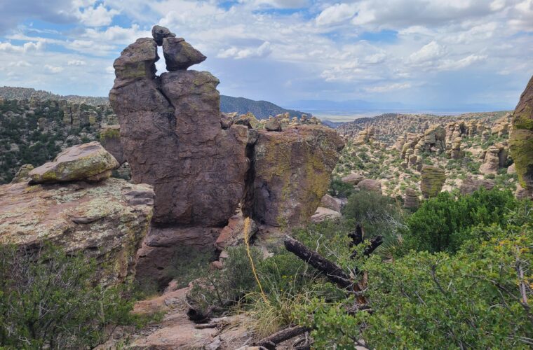
The High Peaks Trail climbs among rust colored monoliths used by prairie falcons and California condors. Steep and Narrow sections include railings and rock cut footholds, so hikers uncomfortable with exposure can use alternate trail segments. Bear Gulch and Balconies caves formed when enormous boulders lodged inside narrow ravines. Cave access can close to protect breeding Townsend’s big eared bats or following storms.
Channel Islands National Park
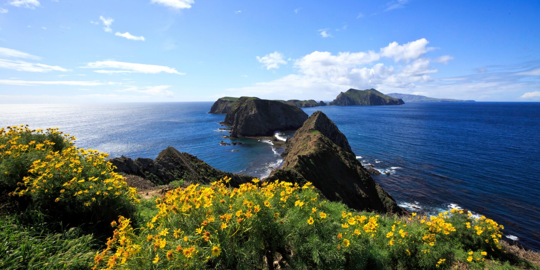
Five islands belong to the national park: Anacapa, Santa Cruz, Santa Rosa, San Miguel, and Santa Barbara. Scorpion Anchorage on Santa Cruz provides access to sea cliffs, coastal scrub, and routes toward Potato Harbor. Anacapa’s compact trail system reaches Inspiration Point above narrow islets and kelp beds. Visitors must carry food and sufficient water for their landing, while wind, swells, and exposed terrain demand warmer layers than mainland temperatures imply.
| Route | Approximate distance | Primary challenge |
|---|---|---|
| Condor Gulch and High Peaks Loop, Pinnacles | 5.3 miles | Steep climbing and exposed rock steps |
| Balconies Cave Loop, Pinnacles | About 2.4 miles | Rock scrambling and seasonal cave conditions |
| Scorpion Anchorage to Potato Harbor, Santa Cruz Island | About 5 miles round trip | Sun, wind, and limited shade |
| East Anacapa Island Loop | About 1.5 miles | Stairs near the landing and exposed cliffs |
Reading California’s Two Desert Parks
Joshua Tree spans the transition between the higher Mojave Desert and lower Colorado Desert. Joshua trees dominate portions of the cooler Mojave, while ocotillo, cholla, and creosote become more prominent toward the southeastern lowlands. Death Valley extends across salt flats, alluvial fans, dunes, and mountain ranges. Elevation runs from Badwater Basin at 282 feet below sea level to 11,043 foot Telescope Peak.
Joshua Tree’s Ecological Divide
Park Boulevard connects major Mojave features including Hidden Valley, Barker Dam, Ryan Mountain, and extensive Joshua tree woodland. Ryan Mountain’s three mile round trip trail gains about 1,050 feet, producing broad views across rocky basins. Keys View overlooks the Coachella Valley and the San Andreas Fault. In the Colorado Desert, the Cholla Cactus Garden reveals how sharply vegetation changes with elevation and rainfall.
Death Valley by Basin and Range
Badwater Basin introduces the salt pan, but nearby Golden Canyon exposes tilted sediments from the Furnace Creek Formation. Zabriskie Point looks across the same eroded badlands from above. Mesquite Flat Sand Dunes are most comfortable near sunrise, when low light defines individual ridges. Dante’s View, more than 5,000 feet above Badwater, demonstrates the park’s vertical scale without requiring a backcountry hike.
Carry a Desert Margin of Safety
- Begin exposed hikes early and turn around before heat starts reducing pace or judgment.
- Carry water in the passenger compartment rather than relying on a bottle left in a hot vehicle.
- Keep extra fuel, since services are separated by long distances in and around Death Valley.
- Check tires, including the spare, before entering remote gravel road corridors.
- Avoid washes and canyon narrows when storms threaten distant drainage basins.
Gear & Essentials
Tell us about your trip and we will add what else you will want:
The basics
Worth having in the car whatever the park.
For this trip
As an Amazon Associate we earn from qualifying purchases, at no extra cost to you.
Building the Right Trip
Use this National Parks California Guide to match geography with season before choosing individual trails. Summer supports high country access in Lassen and the Sierra, while winter favors Joshua Tree and Death Valley. Redwood and Channel Islands require coastal layers in every season. Pinnacles works best when temperatures allow several hours of exposed climbing through chaparral and volcanic rock.
Most travelers will gain more from two or three parks than from rushing through all nine. Choose one landscape group, allow a weather day, and reserve enough time for a trail beyond the primary roadside viewpoint. California’s parks reward that slower approach: redwood forest, Sierra granite, offshore cliffs, volcanic vents, and desert basins each demand a different pace and set of preparations.