North Cascades National Park Road Trip Guide: Scenic Stops, Hikes, and Viewpoints
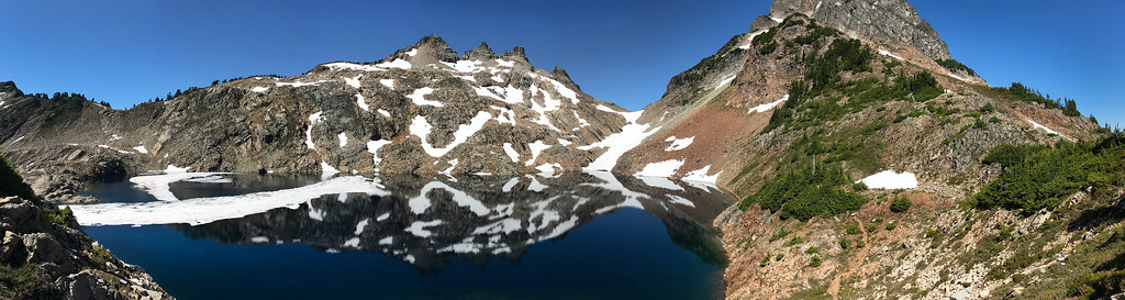
Photo: landscapesinthewest via Flickr (Public Domain Mark)
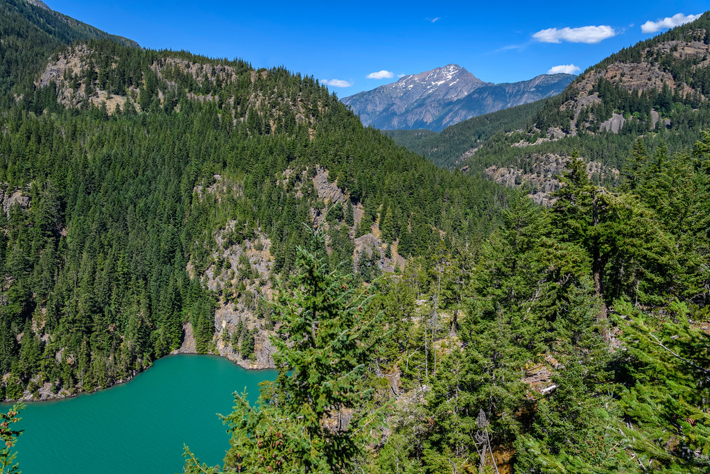
Our North Cascades National Park Road Trip Guide begins at Diablo Lake Vista in early morning, where cold air moves off the water and the lake’s blue-green surface appears between steep walls of dark conifer forest. Across the reservoir, glacier-cut valleys lead toward Colonial Peak and the high country. Highway 20 clings to the slope behind you, a reminder that this landscape is experienced as a sequence of sharp transitions rather than one continuous viewpoint.
The practical route follows the North Cascades Highway from the Skagit Valley through Newhalem, Diablo Lake, Rainy Pass, and Washington Pass, then descends to Winthrop in the Methow Valley. Allow three days for short hikes and major overlooks, or four days if you want a longer alpine trail. The drive covers roughly 140 miles from Burlington to Winthrop, but overlooks, trailheads, and slow mountain traffic can turn three hours of wheel time into a full day.
How the North Cascades Highway route fits together
Drive east for the strongest progression of scenery
Starting near Burlington or Sedro-Woolley makes geographic sense because Highway 20 follows the Skagit River upstream. The road begins among farms and low foothills, enters dense western hemlock and Douglas fir forest, then climbs through the wetter western Cascades to the drier ponderosa pine country east of Washington Pass. This direction also places Newhalem’s visitor facilities early in the trip, before the longest stretch without dependable services.
The sequence works particularly well for hikers. Lower-elevation river walks and forest trails come first, followed by Diablo Lake viewpoints and then higher routes near Rainy Pass. That gradual climb gives you time to assess weather before committing to exposed terrain. It also avoids scheduling an alpine hike immediately after a long arrival drive from Seattle, which is approximately two hours from Burlington before congestion and stops.
Understand where the national park boundaries lie
Much of the Highway 20 corridor passes through Ross Lake National Recreation Area, part of the North Cascades National Park Service Complex. North Cascades National Park itself lies largely north and south of the road, while Lake Chelan National Recreation Area occupies the remote southern end of the complex. There is no paved road into the national park proper. Highway 20 provides access to trailheads, reservoirs, overlooks, and wilderness routes leading into it.
This geography explains why a road trip here feels different from a loop through Yellowstone or Yosemite. There is no central village, lodge district, or road linking every major landscape. Ross, Diablo, and Gorge lakes are hydroelectric reservoirs on the Skagit River. Beyond them, glaciers, deep valleys, and more than 300 named peaks occupy country reached mainly on foot, by boat, or through lengthy backcountry approaches.
A practical three-day route at a glance
Plan around short driving days
Three days let you pair each driving segment with a worthwhile walk instead of collecting overlooks from the car. The schedule below assumes an overnight near the western entrance, a second night around the central corridor or nearby communities, and a final night in Winthrop. Camping and lodging are limited inside the recreation area, so reserve early for summer weekends and confirm current fees, permits, campground status, road conditions, and facility hours on the official park site.
| Day | Route | Main highlight | Approximate driving |
|---|---|---|---|
| 1 | Burlington to Newhalem and Diablo | Skagit River forest, Newhalem, Gorge Creek Falls | 2 hours, excluding stops |
| 2 | Diablo area to Rainy Pass and Washington Pass | Thunder Knob or Blue Lake, alpine overlooks | 1.5 hours, excluding stops |
| 3 | Washington Pass to Winthrop and the Methow Valley | Liberty Bell views, dry-side ecology, historic town center | About 1 hour |
Choose overnight stops that reduce backtracking
For the first night, use lodging or camping around the Skagit Valley, Marblemount, or the western Highway 20 corridor. The second night is best placed near Newhalem, Diablo Lake, or farther east if accommodation is available. Winthrop is the logical final base because it has a broader selection of rooms, campgrounds, groceries, and restaurants than the mountain corridor. Travelers continuing toward eastern Washington can remain on Highway 20 rather than retracing the pass.
Carry essentials before leaving the Skagit Valley
- Fuel: Fill the tank before the long mountain section. Service is sparse between the western communities and the Methow Valley.
- Food: Pack lunch and trail snacks. Dining options along the central corridor are limited and may operate seasonally.
- Water: Carry enough for driving and hiking rather than relying on every trailhead to provide potable water.
- Navigation: Download maps in advance because mobile coverage becomes unreliable beyond the settled valley.
- Layers: Temperatures at Washington Pass can be considerably lower than in Burlington or Winthrop.
Day one follows the Skagit River into the mountains
Use Newhalem as the first orientation stop
From Burlington, Highway 20 runs east through Sedro-Woolley and follows the Skagit River toward Marblemount. The lower valley is broad and agricultural, but the road soon enters a narrow corridor below forested ridges. Newhalem, a company town associated with the Skagit River Hydroelectric Project, provides useful context for the reservoirs and transmission infrastructure visible farther east. The short Trail of the Cedars crosses the river and enters mossy forest near town.
Newhalem also marks the transition into steeper terrain. The surrounding bedrock includes metamorphic rocks and granitic intrusions assembled through tectonic activity, then carved by repeated glaciation. Modern glaciers remain on many high peaks, but they are mostly hidden from the road. Their sediment, known as rock flour, gives Diablo Lake its distinctive turquoise color when suspended particles scatter sunlight.
Stop at Gorge Creek before committing to a longer hike
Gorge Creek Falls is reached from a roadside stop east of Newhalem. The creek drops through a narrow gorge beside the highway before entering Gorge Lake. The stop requires little time, but parking is constrained and traffic moves quickly near the access points. Walk the designated paths and viewpoints rather than crossing the roadway casually. The gorge is especially forceful during spring snowmelt, when runoff from the surrounding slopes increases.
Optional walk at Ladder Creek Falls
Ladder Creek Falls near Newhalem is another short option when daylight remains. The path climbs through a landscaped garden created during the early hydroelectric era, offering a compact combination of industrial history and temperate forest. Wet stairs and roots can be slick. Save longer hikes for the following morning unless you arrived early, since mountain darkness and limited roadside lighting make late returns less comfortable.
Day two combines Diablo Lake with the high passes
Choose Thunder Knob for the best moderate morning hike
Thunder Knob is a practical choice for travelers who want an elevated view without spending the entire day on one trail. The route is approximately 3.6 miles round trip with about 425 feet of elevation gain. It climbs through forest from the Colonial Creek area to openings above Diablo Lake, where the reservoir bends between Sourdough Mountain and the surrounding ridges. Expect switchbacks, exposed roots, and warm conditions on open slopes in midsummer.
For a shorter morning, use Diablo Lake Vista and continue east. The overlook reveals the reservoir’s color most clearly when sunlight reaches the suspended glacial sediment. Clouds can flatten the turquoise tone, but they often expose the scale of the surrounding relief as mist moves among the side valleys. Ross Dam Trail, farther east, descends toward the dam and reservoir, though the return climb should be included in your time estimate.
Cross Rainy Pass before stopping at Washington Pass
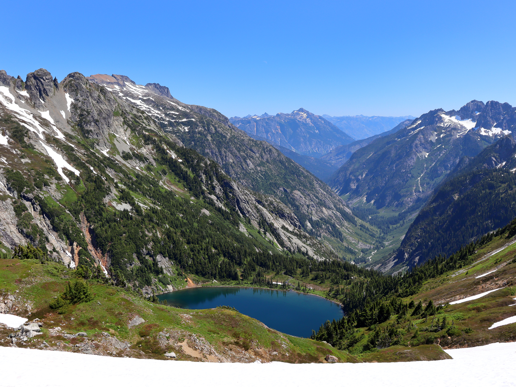
Highway 20 reaches Rainy Pass at 4,875 feet, where trails enter subalpine forest and meadow country. The paved Rainy Lake path is approximately 2 miles round trip and leads to a cirque lake below cliffs. Strong hikers can choose the roughly 7.2-mile Maple Pass Loop, gaining about 2,000 feet through heather meadows and larch habitat. Snow commonly lingers here well into early summer, and autumn weather can cover the trail before the highway closes for winter.
Washington Pass Overlook and Liberty Bell Mountain
At 5,477 feet, Washington Pass is the highway’s highest point. A short paved path reaches viewpoints over the hairpin turn and the Early Winters Creek drainage. Liberty Bell Mountain rises directly above the road, its pale granite forming steep spires used by technical climbers. The overlook is also where the ecological shift becomes obvious: dense west-side forest gives way to more open slopes, drier air, and the pine-dominated Methow Valley below.
Day three descends into the Methow Valley
The final mountain segment drops quickly from Washington Pass through avalanche chutes and the Early Winters Creek drainage. Within about 30 miles, subalpine fir gives way to Douglas fir, ponderosa pine, and open shrub steppe. This change reflects the Cascade rain shadow, which leaves the Methow Valley considerably drier than the Skagit side. Watch for mule deer near the roadway, particularly around dawn and evening.
Make the Mazama junction an optional detour
Mazama sits west of Winthrop near the confluence of several trail and cycling routes. Stop here if you need food, want an easy riverside walk, or plan to spend another day exploring the upper Methow Valley. Travelers keeping to a three day schedule can continue directly to Winthrop. The detour becomes more useful for hikers adding Cutthroat Lake, a roughly 4 mile round trip through forest to a basin beneath Cutthroat Peak.
Finish in Winthrop without rushing the pass
Winthrop provides the route’s most dependable concentration of lodging, groceries, restaurants, and fuel. Its compact center is easy to explore on foot after several days of driving and hiking. Sleep in town for convenience, or choose a cabin, campground, or small lodge elsewhere in the Methow Valley for quieter surroundings.
Decide which stops deserve priority
- Essential: Diablo Lake Vista, Rainy Pass, and Washington Pass Overlook.
- Best moderate hike: Thunder Knob when western trails are dry.
- Best longer hike: Maple Pass Loop after lingering snow has melted.
- Optional detours: Ladder Creek Falls, Ross Dam Trail, Mazama, and Cutthroat Lake.
Adjust the route for snow, heat, and daylight
Elevation controls this itinerary more than the calendar does. Burlington can have mild rain while Rainy Pass remains buried beneath snow. The North Cascades Highway generally closes across the high passes during winter because avalanche paths cross the road. Spring opening dates vary with snow depth, avalanche control work, and storm damage, so early season trips may need to remain west of the closure.
Match hikes to the conditions
| Season | Likely conditions | Best route adjustment |
|---|---|---|
| Late spring | Strong waterfalls, wet forest trails, snow near the passes | Concentrate on Newhalem, Gorge Creek, and Diablo Lake |
| Summer | Longest daylight, accessible alpine trails, busy parking areas | Reach Rainy Pass early and carry extra water |
| Early fall | Cold mornings, changing larches, shorter daylight | Allow extra hiking time and pack insulating layers |
| Winter | Highway closure beyond the lower corridor | Plan separate west side and Methow Valley visits |
Plan around wildfire smoke in late summer
Dry weather can bring wildfire smoke to the Methow Valley and occasionally across the passes. Smoke reduces long distance visibility and can make sustained climbing uncomfortable even when a trail remains open. Carry a flexible alternative such as Rainy Lake instead of Maple Pass, and avoid exposed hikes during extreme heat. Autumn travelers should expect freezing nights at elevation and possible early snow on shaded switchbacks.
Frequently Asked Questions
The practical questions below address the route features most likely to affect timing and trail choices. This North Cascades National Park Road Trip Guide assumes travel on the paved Highway 20 corridor, with day hikes rather than overnight wilderness trips.
Can you drive through the North Cascades in one day?
Yes, but a direct crossing leaves little time for hikes. Allow a full day for Diablo Lake, Rainy Pass, Washington Pass, meals, and short walks.
Is Highway 20 open throughout the year?
No. The mountain section generally closes during winter because of deep snow and avalanche hazards. Lower elevation destinations near Newhalem and Diablo may remain reachable from the west.
Do day hikers need a permit?
Ordinary day hikes generally do not require a wilderness permit. Overnight backcountry camping does, and some trailheads outside the national park may have separate parking pass requirements.
Are dogs allowed on the trails?
Leashed pets are allowed within Ross Lake National Recreation Area, which includes much of the highway corridor. Dogs are generally prohibited on trails inside North Cascades National Park, apart from the Pacific Crest Trail.
Is this road trip suitable for children?
Families can use Diablo Lake Vista, the paved Rainy Lake path, and the short Washington Pass viewpoint trail. Keep children close at overlooks, creek gorges, and reservoir shorelines, where steep drops and cold water create serious hazards.
Build enough time into the crossing
The strongest itinerary divides the highway into three distinct landscapes: the Skagit River forests, the reservoir and pass corridor, and the dry Methow Valley. That structure keeps daily driving manageable while leaving time for one meaningful walk. It also provides alternatives when clouds obscure the high peaks or snow makes an alpine trail impractical.
Fuel before the mountain corridor, carry lunch and water, download navigation, and choose hikes according to elevation rather than valley weather. With those preparations, the drive becomes a coherent journey through hydroelectric history, glaciated terrain, subalpine basins, and rain shadow forest, ending where services are easiest to find in Winthrop.
Want to keep exploring? Browse all our North Cascades guides and articles for more trip-planning tips and ideas.
Gear & Essentials
Tell us about your trip and we will add what else you will want:
The basics
Worth having in the car whatever the park.
For this trip
As an Amazon Associate we earn from qualifying purchases, at no extra cost to you.