











Great Smoky Mountains National Park
Kuwohi Bypass Trail
| Length | about 0.5 miles as mapped by NPS |
|---|---|
| Surface | Native |
| Route | One way (out and back doubles it) |
| High point | about 6,500 ft |
| Low point | about 6,180 ft |
| Up and down (one way) | about 290 ft up, 0 ft down |
| Difficulty | Moderate |
At a glance
- Length: about 0.5 miles as mapped by the National Park Service
- Stated length: 0.8 miles one way
- Route: Point to point
- Difficulty: Moderate
- Surface: Native
- Area: Clingmans Dome Road, NC/TN Border
- Elevation: about 6,180 feet to about 6,500 feet
- Total one-way climb: about 290 feet
Getting to the trailhead
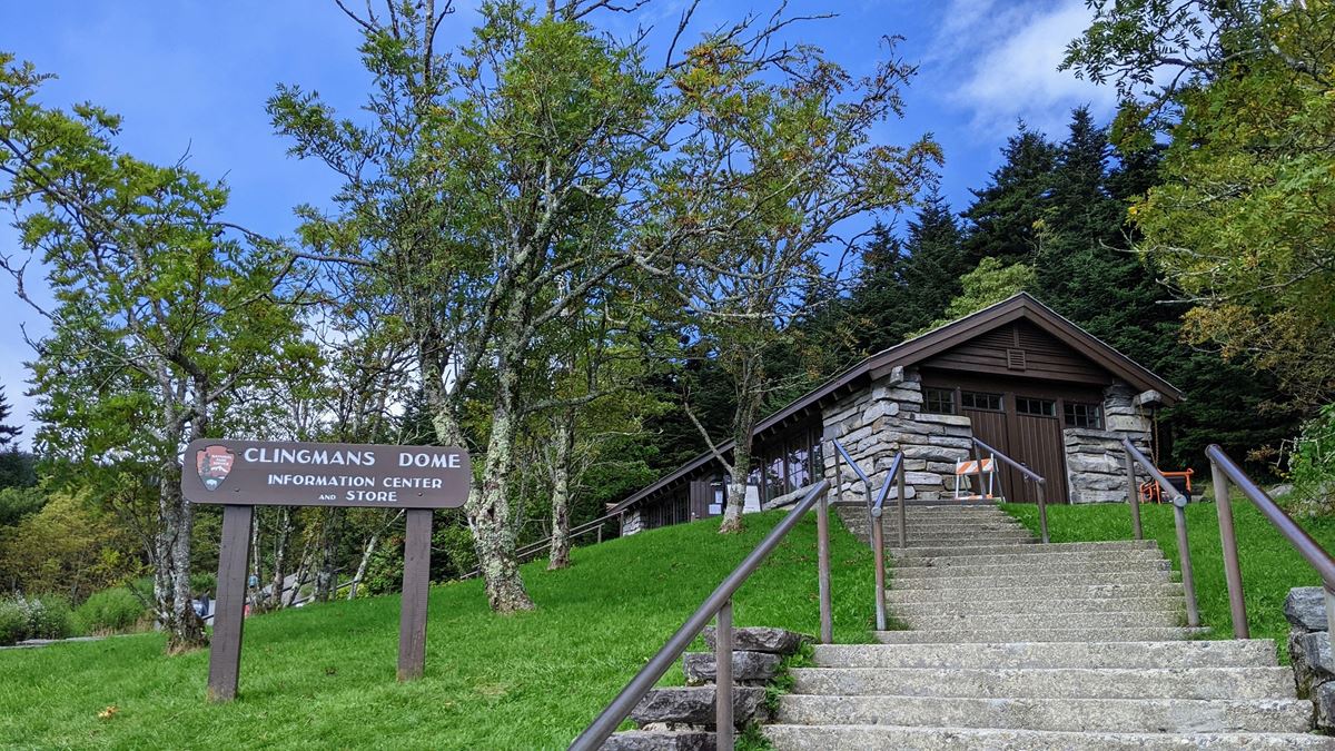
The mapped route begins near Kuwohi Visitor Center. The visitor center, fee booth, restroom, and Kuwohi Trail trailhead are each about 0.1 miles away.
Sugarlands Visitor Center is about 9 miles away. Gatlinburg is about 11 straight-line miles away, Cherokee about 12 miles, and Pigeon Forge about 16 miles.
The listed airports are McGhee Tyson Airport and Asheville Regional Airport.
On the trail
The trail connects the Kuwohi parking area with the Appalachian Trail. It avoids the complete ascent to the summit and observation tower.
The route curves around the summit through dense spruce-fir forest above about 6,000 feet. Appalachian Trail hikers and backcountry travelers use this connection toward Silers Bald and Spence Field.
The mapped route starts near Kuwohi Visitor Center and ends near Mount Buckley. It climbs about 290 feet without mapped descent in that direction.
This is a one-way route with endpoints in different places. Walking to the end and returning doubles the distance.
Forney Ridge Overlook and Mount Buckley are about 0.1 miles away. Kuwohi Overlook, Kuwohi Tower, and Kuwohi peak are about 0.3 miles away.
Kuwohi Trail is about 0.3 miles away and measures about 0.8 miles.
Before you go
Check current conditions and alerts on the park’s National Park Service website. Carry water, pack layers, follow posted rules, and leave no trace.
Questions
How long is Kuwohi Bypass Trail?
It is about 0.5 miles as mapped by the National Park Service. Its stated length is 0.8 miles one way.
Is Kuwohi Bypass Trail difficult?
The trail is rated moderate.
Where does Kuwohi Bypass Trail start and end?
The mapped route begins near Kuwohi Visitor Center and ends near Mount Buckley.
How much elevation does Kuwohi Bypass Trail gain?
The mapped route gains about 290 feet one way.
What is the surface of Kuwohi Bypass Trail?
The surface is native.
Nearby
Trails
Places
- Kuwohi
- Kuwohi Visitor Center
- Kuwohi Trail Trailhead
- Kuwohi Visitor Center
- Mount Buckley
- Forney Ridge Overlook
- Kuwohi
- Kuwohi
On the map
2 trails4 places to see