











Great Smoky Mountains National Park
Kuwohi Trail
| Length | about 0.8 miles as mapped by NPS |
|---|---|
| Surface | Asphalt |
| High point | about 6,650 ft |
| Low point | about 6,180 ft |
| Difficulty | Moderate |
At a glance
- Length: About 0.8 miles as mapped by the National Park Service; the stated trip is 1.0 mile roundtrip.
- Route: Out and back.
- Typical time: 120 minutes, or 2 hours.
- Difficulty: Moderate.
- Surface: Asphalt.
- Elevation: About 6,180 feet to about 6,650 feet along the mapped route.
- Area: Clingmans Dome Road at the North Carolina–Tennessee border.
- Facilities: Restroom near the parking area and historical or interpretive exhibits.
- Parking: A parking tag is required for stays longer than 15 minutes.
- Pets: Pets are not permitted on this trail.
- Access: Kuwohi Road is closed during winter.
Why hike it
Kuwohi Trail reaches the observation tower atop Kuwohi, formerly called Clingmans Dome. The summit is the park’s highest point at 6,643 feet. It is also the highest point anywhere along the Appalachian Trail.
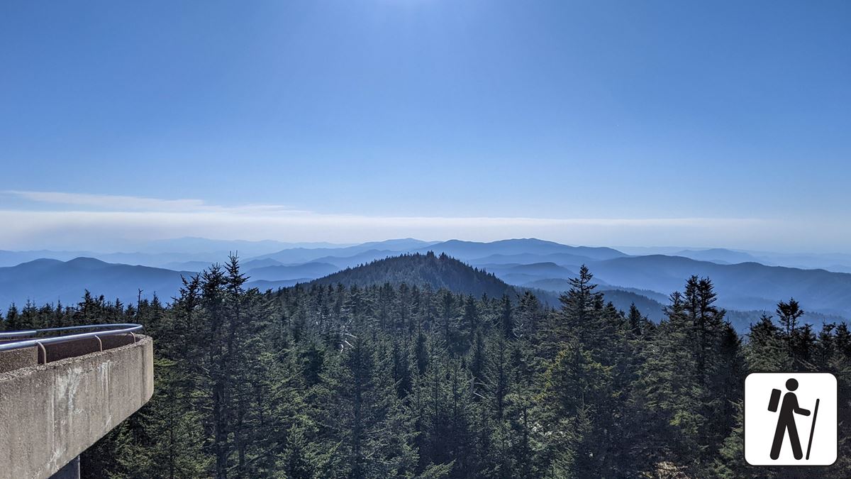
The popular route follows a short, steep, paved path from the Kuwohi parking area. From the concrete tower, visitors get a full-circle panorama of Great Smoky Mountains National Park and surrounding areas. Clear conditions can reveal terrain in 7 states.
Getting to the trailhead
Drive to the end of Kuwohi Road, formerly Clingmans Dome Road. The trail begins near the Kuwohi Visitor Center and information area at the parking lot.
Crowding can be extreme, and parking is limited. The National Park Service recommends using a shuttle to reduce parking stress. A parking tag is required when parking for more than 15 minutes.
Primary park roads operate around the clock throughout the year when weather allows. These include Newfound Gap Road, Little River Road, and Laurel Creek Road. Secondary roads close seasonally, and Kuwohi Road closes in winter.
Sugarlands Visitor Center is about 9 miles away. Gatlinburg, Tennessee, is about 10 miles away in a straight line. Cherokee, North Carolina, is about 12 miles away. Pigeon Forge, Tennessee, is about 16 miles away.
Nearby airports include McGhee Tyson Airport and Asheville Regional Airport.
On the trail
The mapped trail covers about 0.8 miles, while the National Park Service describes the outing as 1.0 mile roundtrip. Walked and mapped measurements can differ.
The paved approach climbs steeply from the parking area to the summit tower. It gains about 330 feet and can feel demanding at this elevation, particularly for visitors arriving from sea level.
The mapped route ranges from about 6,180 feet to about 6,650 feet. Because this is an out-and-back walk, the climb reverses into a descent on the return.
The route passes the Kuwohi Visitor Center, Forney Ridge Overlook, and Kuwohi Overlook before reaching Kuwohi Observation Tower. The tower’s long ramp continues gradually upward to the observation platform.
A restroom is available near the parking lot. The pit toilets there close during winter. Historical and interpretive information is also available in the area.
What you will see
Views along the route include Sugarland Mountain and the Elkmont section of the Smokies. The observation platform provides views in every direction when the weather is clear.
Clouds and precipitation frequently obscure the summit. Clear skies at lower elevations do not ensure clear conditions at Kuwohi.
The summit area includes Kuwohi, Kuwohi Overlook, and Kuwohi Tower. Forney Ridge Overlook provides another viewpoint along the route.
History and nature
Kuwohi Observation Tower was previously known as Clingmans Dome Observation Tower. Built in 1959, the structure rises 45 feet and has a distinctive ramp extending 375 feet to its platform.
The tower represents Modern National Park Service architecture. This design movement shifted away from the traditional rustic style commonly associated with earlier park buildings.
The structure is also connected to Mission 66, a National Park Service initiative active from 1955 through 1966. That program changed park design, administration, and visitor planning while adding hundreds of structures.
Only 9 observation towers were constructed through Mission 66. Kuwohi became the model for 2 later towers: Look Rock Tower in the Smokies and Shark Valley Observation Tower in the Everglades.
Kuwohi Observation Tower is listed on the National Register of Historic Places. Its documented significance includes its lookout function, Modern NPS design, and Mission 66 history.
When to go
Kuwohi Road closes during winter. Pit toilets near the parking area also close in winter. Check current access before planning the trip.
The summit commonly experiences clouds, precipitation, and cold temperatures. Conditions may be 10–20 degrees Fahrenheit cooler than in the surrounding lowlands. Bring layers and a jacket, including during summer.
Park elevations range from about 875 feet to 6,643 feet. Mountain topography can produce sharply different local weather, even when conditions appear pleasant at lower elevations.
Crowding and limited parking are major considerations. A shuttle can simplify access. Alternate hikes may be preferable when the Kuwohi area is congested.
Accessibility
The trail has an asphalt surface, but it is very steep. The paved route and tower ramp do not eliminate the sustained climb.
The path rises about 330 feet to a high-elevation summit. Visitors should account for both the grade and the effects of altitude when deciding whether the route meets their needs.
Permits, fees and rules
A parking tag is required when leaving a vehicle in Great Smoky Mountains National Park for more than 15 minutes. Bring the tag before starting the hike.
Pets are not allowed on Kuwohi Trail. Gatlinburg Trail and Oconaluftee River Trail are the park’s only trails permitting pets. Pets may also use roads, campgrounds, and picnic areas.
Follow posted restrictions and protect the historic tower and interpretive features. Leave no trace during the visit.
Nearby trails and places
Kuwohi Bypass Trail is about 0.3 miles away and is about 0.5 miles long. It begins at Forney Ridge Trailhead and climbs toward the Appalachian Trail.
The bypass offers a quieter high-elevation option in an area that is often congested. It also provides another route to the observation tower.
Pullout Parking at Mile Post 6.37 is about 0.3 miles away. Kuwohi Visitor Center, the fee booth, Kuwohi Trail Trailhead, Mount Love, and Mount Buckley are each about 0.4 miles away. A restroom at Kuwohi is about 0.5 miles away.
Kuwohi peak, Kuwohi Overlook, and Kuwohi Tower are directly associated with the trail. Other alternate outings listed by the National Park Service include Look Rock Tower at about 0.8 miles roundtrip and Andrews Bald at 3.6 miles roundtrip.
Before you go
Check current conditions, seasonal road status, and park alerts on the National Park Service website. Kuwohi Road and nearby pit toilets close in winter.
Carry water and pack layers. Bring a jacket because summit temperatures can be considerably colder than conditions in the lowlands.
Expect limited parking and heavy visitation. Consider a shuttle, obtain the required parking tag, follow posted rules, and leave no trace.
Questions
How long is Kuwohi Trail?
It is about 0.8 miles as mapped by the National Park Service. The stated out-and-back trip is 1.0 mile roundtrip.
How difficult is Kuwohi Trail?
It is rated moderate, but the paved route is very steep and gains about 330 feet at high elevation.
How long does it take to hike Kuwohi Trail?
The typical time is 120 minutes, or 2 hours.
Is Kuwohi Trail paved?
Yes. The trail has an asphalt surface, and the approach to the tower is steep.
Are pets allowed on Kuwohi Trail?
No. Pets are permitted only on Gatlinburg Trail and Oconaluftee River Trail among the park’s trails.
Is Kuwohi Trail open in winter?
Kuwohi Road closes in winter, preventing normal road access to the parking area. Nearby pit toilets also close during winter.
Is parking available at Kuwohi Trail?
Parking is available at the end of Kuwohi Road, but spaces are limited. A parking tag is required for stays longer than 15 minutes.
What can visitors see from Kuwohi Observation Tower?
The platform provides panoramic views of the Smokies and surrounding areas. On clear days, the view can extend into 7 states.
Nearby
Trails
Places
- Kuwohi
- Kuwohi Overlook
- Kuwohi Tower
- Pullout Parking At Mile Post 6.37
- Kuwohi Visitor Center
- Kuwohi Trail Trailhead
- Mount Love
- Kuwohi Visitor Center
On the map
2 trails4 places to see
Facts on this page draw on the National Park Service: Kuwohi Observation Tower (nps.gov)