National Park of American Samoa
Unforgettable Things to Do in National Park of American Samoa
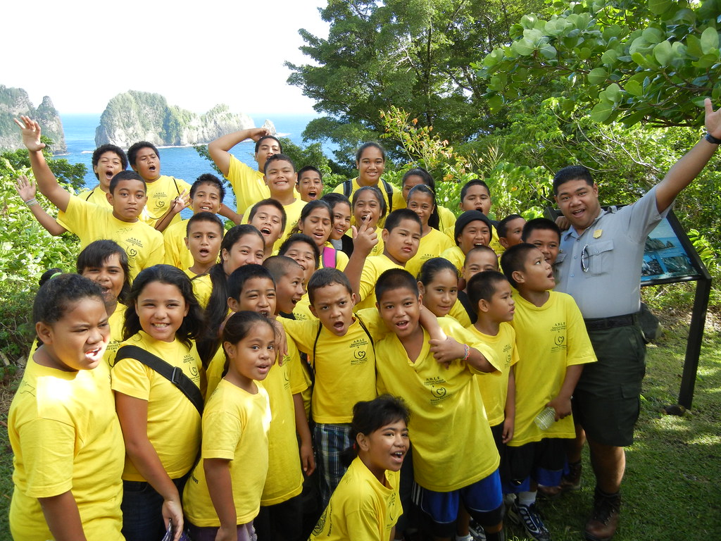
Photo: U.S. Department of the Interior via Flickr (CC BY-SA 2.0)
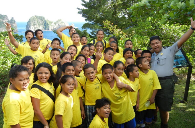
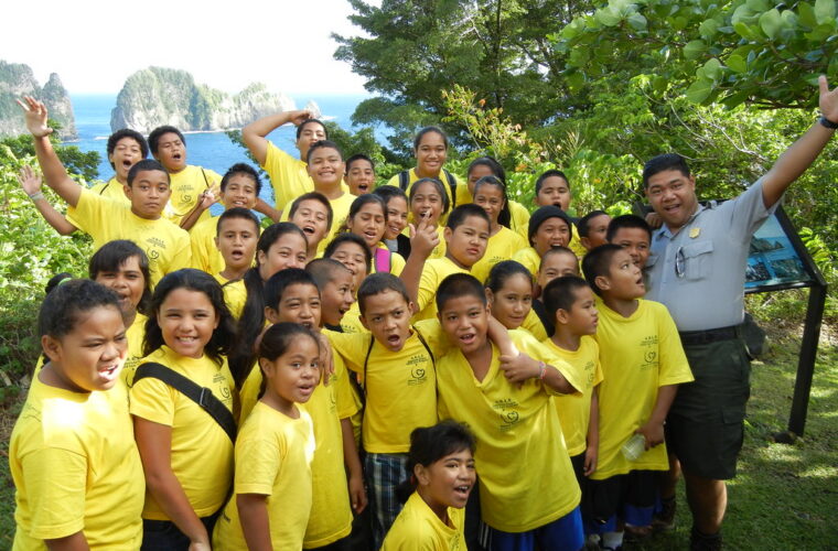
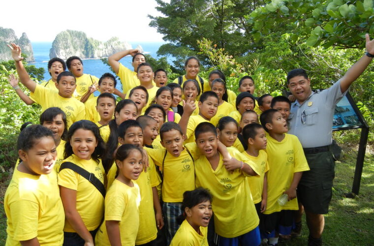
Finding Unforgettable Things to Do in National Park of American Samoa begins with understanding that this park belongs to living villages as much as it does to the National Park Service. Most of its land remains under Samoan communal ownership and is leased to the federal government, an arrangement shaped by faʻa Samoa, the Samoan way of life. Trails pass through landscapes where residents gather food, maintain family land, attend church, and protect customary fishing grounds.
The park spans sections of Tutuila, Ofu, and Taʻū, three volcanic islands separated by open ocean. Across roughly 13,500 acres, it protects tropical rainforest, sea cliffs, fruit bat habitat, coral reefs, and about 4,000 acres of marine environment. Tutuila provides the easiest access and most developed trail network. Ofu has the park’s signature beach and lagoon, while Taʻū contains the wildest terrain and American Samoa’s highest summit.
A national park woven into Samoan village life
Congress authorized the park in 1988, but establishing it required negotiation with village councils and families whose customary tenure differs fundamentally from mainland property systems. The resulting lease arrangement allows conservation without transferring permanent ownership. Visitors therefore encounter homes, churches, plantations, graves, and community gathering areas close to park boundaries.
That relationship affects how you travel. Ask before photographing residents, dress modestly around villages, and avoid entering plantations or taking fruit. Sunday is widely observed as a day of worship and family activity, so village traffic and commercial services may be limited. In the early evening, some communities observe sa, a short period of prayer announced by bells or local wardens. If stopped, wait quietly until it ends.
Rainforest shaped by isolation
The islands are the eroded summits of basaltic volcanoes that rose from the Pacific Plate. Warm temperatures and heavy rainfall support dense lowland and montane forest, including banyans, pandanus, tree ferns, and numerous native shrubs. Because American Samoa lies far from continental landmasses, native terrestrial mammals are scarce. The conspicuous exception is the flying fox, a large fruit bat frequently seen crossing ridges during daylight.
Reefs are part of the park landscape
Fringing reefs shelter lagoons around Ofu and parts of Taʻū, supporting surgeonfish, parrotfish, butterflyfish, giant clams, sea cucumbers, and branching corals. Reef flats can become extremely shallow at low tide, when swimmers are more likely to scrape coral or become stranded behind exposed formations. Check tides before entering, use reef safe sun protection, and never stand on living coral.
Plan around three islands, not one continuous park
Pago Pago International Airport on Tutuila is the principal gateway. From there, roads curve around Pago Pago Harbor and follow the island’s narrow coastal shelf. Steep ridges prevent a simple loop drive, so reaching park areas near Vatia, Afono, and Fagasā involves separate roads over mountain passes. Driving is on the right, and local buses generally operate as independently run vehicles rather than a timed transit network.
Ofu and Taʻū belong to the Manuʻa Islands, roughly 60 miles east of Tutuila. Interisland flights are limited, weather sensitive, and prone to schedule changes. Boats are not a dependable substitute for a short visit. Build at least one buffer day before an international departure and arrange lodging, ground transportation, and food before leaving Tutuila. Confirm current flights, trail access, fees, permits, and visitor services on the official park site.
Choosing the right island for your time
| Park area | Best reason to visit | Time to allow | Main planning issue |
|---|---|---|---|
| Tutuila | Ridge hikes, sea cliffs, villages, and the easiest park access | Two to three days | Heat, rain, and separate road approaches |
| Ofu | Coral lagoon, beach walking, and snorkeling | Three or more nights | Limited flights, lodging, meals, and vehicles |
| Taʻū | Remote rainforest, volcanic cliffs, and cultural sites | Three or more nights | Transport between settlements and trail access |
Pack for heat, rain, and limited supplies
Temperatures commonly remain in the 80s Fahrenheit, with high humidity throughout the year. May through October is generally less wet and breezier, while November through April brings heavier rainfall and greater tropical storm risk. Rain can still arrive during any month, particularly on mountain slopes facing the prevailing trade winds.
- Carry more drinking water than the mileage appears to require.
- Use shoes with reliable grip for mud, roots, and slick basalt.
- Bring a compact rain layer and waterproof protection for electronics.
- Pack snorkeling equipment before traveling to the Manuʻa Islands.
- Carry cash and essential medication because services outside central Tutuila are limited.
- Use a dry bag for interisland travel and beach approaches.
Follow Tutuila’s ridges from Fagasā Pass to Vatia
Tutuila is the practical starting point for most visitors and contains several short outings plus the park’s principal ridge hike. Its volcanic spine rises abruptly behind coastal villages, creating narrow watersheds that funnel rain toward Pago Pago Harbor and the north coast. Cloud, wet roots, and rapid temperature changes are common above the shoreline, even when the harbor is sunny.
Climb Mount Alava for the island’s geography lesson
The Mount Alava Trail begins near Fagasā Pass and follows a broad ridge route for about 3.5 miles each way. The summit area reaches approximately 1,610 feet. Expect repeated climbs rather than one steady ascent, with muddy depressions and exposed sections receiving strong trade winds. From the upper ridge, Pago Pago Harbor’s flooded volcanic caldera lies to the south, while the north coast falls sharply toward Afono and Vatia.
What the old tramway route reveals
The path follows infrastructure once associated with the Mount Alava television facilities and former aerial tramway. That history explains its unusual width compared with narrower forest trails. Look overhead for fruit bats moving between feeding trees, and listen for Samoan starlings and wattled honeyeaters in the canopy. Allow extra time after rain because clay soil and leaf litter make the descent slower than the ascent.
Use Vatia for shorter coastal walks
Vatia sits inside a steep amphitheater of forested ridges on Tutuila’s north coast. The Lower Sauma Ridge Trail is only about 0.4 mile round trip, but it reaches an archaeological star mound and a viewpoint over Vaiʻava Strait. Nearby, the brief Pola Island path approaches the coast opposite the narrow sea stack called Pola, an important nesting area for seabirds. Waves and falling rock make the exposed shoreline unsuitable for casual scrambling.
Tuafanua Trail demands more effort
The Tuafanua Trail begins near Vatia and runs for roughly 2.2 miles round trip through rainforest to a ridge above Pola Island. Steep grades, fixed steps, and humid conditions make it considerably harder than its distance suggests. The payoff is a clearer sense of Tutuila’s scale: knife edged ridges divide tiny coastal watersheds, while cliffs drop directly into deep Pacific water.
Make Ofu’s coral lagoon the center of a Manuʻa visit
Ofu Beach occupies a long, pale strip along the island’s south coast, backed by palms and steep volcanic slopes. Its lagoon contains some of the park’s most accessible coral habitat, protected offshore by a reef crest that absorbs much of the ocean swell. The best swimming conditions generally occur around higher tide, when there is enough water above coral heads to move without touching them.
Read the water before snorkeling
From the beach, the lagoon can appear uniformly calm, but depth changes sharply between sandy channels and coral colonies. Enter over sand, keep fins clear of the bottom, and remain inside protected water unless local conditions and experience support going farther. Currents strengthen near channels through the reef, particularly as the tide falls.
In the shallows, warm water presses around your ankles while broken coral fragments shift underfoot like coarse gravel. A few yards farther out, the sandy floor gives way to branching coral, and the sound changes from shore wash to the small clicks and scrapes of reef fish feeding below. Behind you, Ofu’s green volcanic ridge rises so abruptly that the beach feels like a narrow ledge between rainforest and ocean.
Go deeper into Manuʻa on Taʻū
Taʻū rises to 3,170 feet at Lata Mountain, the highest point in American Samoa. Its southern flank descends through rainforest to cliffs and isolated shoreline, creating the park’s most demanding terrain. Roads connect the island’s villages, but interior routes can be overgrown, muddy, or affected by storm damage. Arrange a knowledgeable local guide for longer hikes, both for navigation and for permission to cross communal land.
Visit the sacred landscape at Saua
Saua, near the eastern end of Taʻū, holds exceptional importance in Samoan tradition. It is associated with Tagaloa and accounts of the creation and settlement of the Samoan islands. Stone features in the area should be observed without climbing, moving rocks, or entering spaces identified as restricted by residents. A local guide can explain why Saua belongs to a continuing cultural landscape rather than a sealed archaeological site.
Approach Laufuti Falls with local knowledge
Laufuti Falls drops from Taʻū’s southern escarpment toward the Pacific, but reaching this coast requires serious planning. Routes may involve steep forest, stream crossings, plantation tracks, and boat access determined by sea conditions. There is little margin for error when heavy rain raises streams or clouds obscure landmarks. Treat the waterfall as a guided full day objective, not an improvised roadside excursion.
Match each outing to the conditions
Several Unforgettable Things to Do in National Park of American Samoa involve short distances with disproportionate physical demands. Tropical heat reduces pace, wet basalt becomes slick, and mobile coverage weakens outside populated areas. Tell your lodging host or another responsible person where you are going, especially on Taʻū and Ofu. Start ridge hikes early enough to avoid descending through forest after dark.
| Activity | Primary difficulty | Best preparation |
|---|---|---|
| Mount Alava | Mud, humidity, repeated climbing | Boots, water, rain protection |
| Tuafanua Trail | Steep steps and exposed ridge terrain | Early start and secure footwear |
| Ofu lagoon | Shallow coral and tidal currents | Tide check, fins, sun protection |
| Remote Taʻū routes | Navigation and limited rescue access | Local guide and conservative turnaround time |
Carry a small emergency kit
Heat illness can develop before a hiker feels exhausted, particularly on windless forest slopes. Drink regularly and replace salts during longer outings. Reef cuts also deserve prompt cleaning because tropical seawater can introduce bacteria into small wounds. A practical day kit should contain:
- At least two liters of water for a substantial hike
- Electrolytes and food that tolerates heat
- Bandages, antiseptic, and blister treatment
- A headlamp, even for a morning departure
- An offline map and fully charged phone
- Insect repellent and broad spectrum sunscreen
Leave room for island delays
Weather can reshape an itinerary without making the trip unsuccessful. Keep one flexible day for a postponed flight, rough water, or a trail made unsafe by rain. On Tutuila, that spare time can be used for short north coast walks or cultural stops around Pago Pago Harbor. In Manuʻa, it provides breathing room when local transport or food deliveries operate on island time rather than a visitor’s schedule.
Frequently Asked Questions
Most planning questions come down to remoteness, village protocol, and realistic pacing. Tutuila can support a compact visit, while the Manuʻa Islands require advance arrangements and schedule flexibility. The answers below address the decisions that most often determine which park experiences are practical.
How many days do you need?
Allow two or three days for Tutuila alone. Add at least three nights for Ofu or Taʻū, plus a buffer day before the flight home.
Do you need a reservation or permit?
General access has traditionally differed from heavily reserved mainland parks, but specific activities, local access, and interisland travel can have separate requirements. Check the park’s official website before booking.
Can children visit the park?
Yes. Ofu’s beach and Tutuila’s shorter walks suit families when adults manage heat, tides, and cliff edges. Steep routes such as Tuafanua and remote Taʻū hikes require stronger judgment and stamina.
Is snorkeling at Ofu safe for beginners?
Protected lagoon water can be suitable when seas are calm and the tide provides clearance over coral. Beginners should stay over sand, avoid reef channels, and leave the water if an outgoing current becomes noticeable.
Can you visit without renting a vehicle?
Local buses can help around Tutuila, but they do not provide a reliable trail schedule. A vehicle or arranged ride gives better control over early starts, pass crossings, and return transport from remote villages.
Visitors should also remember that emergency response takes longer on isolated islands. Conservative choices matter: turn around before fatigue changes your footing, avoid entering rough water alone, and ask residents when a route crosses village or family land.
Top things to do in the National Park of American Samoa
The strongest itinerary begins with Tutuila’s ridges and north coast, then adds Ofu for reef time or Taʻū for cultural landscapes and remote rainforest. Trying to compress all three islands into a rigid schedule creates unnecessary risk. Fewer locations, longer stays, and prearranged transport produce a more rewarding visit.
Respect for faʻa Samoa should guide every part of the journey. Ask before crossing communal land, observe village customs, protect living coral, and leave extra time for weather. Those choices make it possible to experience volcanic ridges, fruit bat forest, sacred places, and one of the South Pacific’s most significant protected reefs with care.
Want to keep exploring? Browse all our National Park of American Samoa guides and articles for more trip-planning tips and ideas.
Gear & Essentials
Tell us about your trip and we will add what else you will want:
The basics
Worth having in the car whatever the park.
For this trip
As an Amazon Associate we earn from qualifying purchases, at no extra cost to you.