The National Parks of Arizona: A Guide to All 4
This National Parks Arizona Guide begins with a useful correction: Arizona’s four national parks are not variations on the same desert landscape. Grand Canyon National Park rises from the Colorado River at roughly 2,400 feet to forested rims above 8,000 feet. Petrified Forest protects high grassland, multicolored badlands, and Triassic fossils rather than a standing forest. Saguaro National Park climbs from Sonoran Desert cactus country to 8,666 foot Mica Mountain, where pine and mixed conifer woodland replace the saguaros. Chiricahua, which became Arizona’s newest national park in October 2026, protects a sky island of volcanic rock spires in the state’s southeastern corner.
The four parks also demand different styles of travel. Grand Canyon rewards careful rim planning and strenuous vertical hiking. Petrified Forest follows a linear road suited to a half day or full day of stops and short walks. Saguaro surrounds Tucson in two separate districts, making it easy to combine scenic drives, desert trails, and city lodging. Chiricahua is remote, with one scenic drive and a dense network of loop trails among its rock pinnacles. Understanding those differences is the key to building a realistic Arizona parks itinerary.
Orienting Your Route
Arizona’s four national parks form a broad north to south arc. Grand Canyon’s South Rim lies in northern Arizona, Petrified Forest sits east of Flagstaff near Interstate 40, Saguaro occupies the Tucson basin in the south, and Chiricahua lies about two hours east of Tucson near Willcox. Driving directly between all four requires roughly 750 miles, depending on the chosen roads and park entrances. Most travelers need at least six days, while eight to ten days allows for meaningful hikes and weather delays.
How the Four Parks Differ
Elevation explains much of what visitors experience. Grand Canyon can be snowy at the rim while the inner canyon is warm. Petrified Forest’s exposed plateau brings persistent wind and rapid temperature changes. Saguaro’s low desert has mild winter afternoons but dangerous summer heat, while its high country can be substantially cooler. The following comparison uses durable geographic details rather than changeable operating schedules.
| Park | Primary elevation range | Defining landscape | Typical visit pattern |
|---|---|---|---|
| Grand Canyon | About 2,400 to more than 8,000 feet | Colorado River gorge, limestone cliffs, conifer rims | Overlooks, rim walks, and steep corridor trails |
| Petrified Forest | About 5,400 to 6,200 feet | Painted badlands, shortgrass prairie, fossil wood | Linear scenic road with short trails and pullouts |
| Saguaro | About 2,180 to 8,666 feet | Sonoran Desert valleys and mountain woodland | Two districts explored by loops and day hikes |
| Chiricahua | About 5,100 to 7,300 feet | Rhyolite spires, oak and pine sky island woodland | One scenic drive with loop hikes among the pinnacles |
Choosing a Season for All Four Parks
March through April and October into early November provide the easiest compromise among the parks. Winter is excellent for low elevation hiking at Saguaro, but snow and ice can affect Grand Canyon’s rims and trails. Summer brings intense heat to Saguaro and the inner Grand Canyon, while Petrified Forest remains exposed to thunderstorms, lightning, and strong winds. Chiricahua sits between roughly 5,000 and 7,300 feet, so it stays cooler than Tucson in summer and can see snow and ice in winter. Park access, entrance charges, road conditions, and any reservation requirements should be confirmed on the official park sites before departure.
- Winter: Favor Saguaro, carry traction for icy Grand Canyon rim paths, and expect cold wind at Petrified Forest.
- Spring: Watch for desert blooms near Tucson and lingering snow on shaded Grand Canyon trails.
- Summer: Begin desert activities near sunrise and avoid descending deep into Grand Canyon during peak heat.
- Autumn: Expect comfortable desert mornings, cooler plateau weather, and possible early snow at the canyon rims.
Grand Canyon: A Park Organized by Elevation
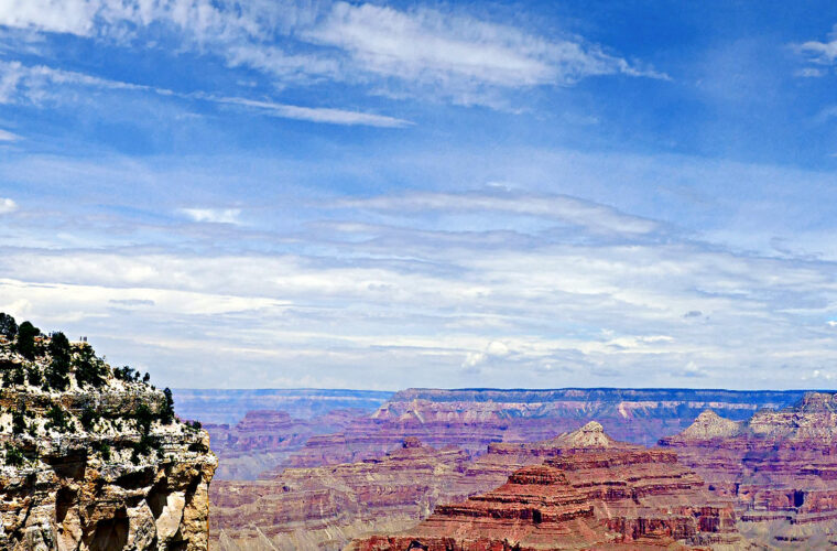
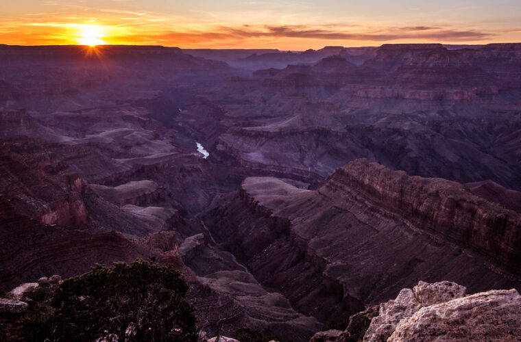
Grand Canyon National Park protects 277 river miles and a gorge that reaches roughly one mile deep. Its visible rock sequence spans close to two billion years, from ancient Vishnu basement rocks near the river to the pale Kaibab Limestone capping the rims. The canyon can measure up to 18 miles across, so points that appear close on a map may require hours of driving or a demanding descent and climb.
Priorities at the South Rim
The South Rim is the practical first visit because it concentrates classic viewpoints, trailheads, and the historic village along a relatively compact corridor. Mather Point gives an immediate sense of scale, while Yavapai Point adds geological interpretation and a clear view toward the Colorado River. The mostly paved Rim Trail connects multiple overlooks, allowing visitors to walk one direction and adjust the distance without committing to a canyon descent.
Corridor Trails and the Reality of the Climb
South Kaibab Trail and Bright Angel Trail are the principal routes below the rim. South Kaibab follows an exposed ridge with broad views but no natural shade. Ooh Aah Point is about 1.8 miles round trip, while Cedar Ridge is roughly 3 miles round trip. Bright Angel follows a fault and offers more shade in its upper reaches, although every return requires a sustained ascent of several thousand feet if hikers descend far enough.
What the First Descent Feels Like
On South Kaibab, packed dirt and stone steps drop beneath your boots almost immediately. The rim’s ponderosa pines disappear behind angular walls, wind moves through the open ridge, and the trail seems suspended above side canyons. At Ooh Aah Point, the view opens in several directions at once. The climb back exposes the practical challenge: thin air near 7,000 feet, direct sun, and tall steps that feel much larger than they did on the descent.
Petrified Forest: Fossils Along a High Desert Corridor
Petrified Forest National Park is crossed by a roughly 28 mile scenic road between Interstate 40 and U.S. Route 180. This layout favors one way travel through the park rather than entering and leaving from the same gate. The northern section overlooks the Painted Desert, while the southern section contains major concentrations of petrified logs, blue and purple badlands, petroglyphs, and remnants of historic Route 66.
Understanding the Petrified Wood
Most of the park’s petrified logs came from trees buried in river channels during the Late Triassic, more than 200 million years ago. Groundwater rich in dissolved silica gradually replaced the original plant tissue with quartz. Iron, manganese, and other minerals produced red, yellow, purple, and dark tones. Rainbow Forest and the Giant Logs area display some of the largest accessible specimens, including logs wider than a person is tall.
Blue Mesa, Newspaper Rock, and the Painted Desert
Blue Mesa’s 1 mile loop descends among rounded hills striped in blue gray, lavender, and white layers of the Chinle Formation. Newspaper Rock overlooks hundreds of petroglyphs created over many centuries, although the carvings are viewed from designated overlooks rather than approached directly. In the north, Painted Desert overlooks reveal broad bands of red mudstone and bentonite clay that change color with cloud cover and low angled light.
Saguaro: Two Desert Districts Around Tucson
Saguaro National Park is divided into Tucson Mountain District on the city’s west side and Rincon Mountain District to the east. Tucson lies between them, and crossing the metropolitan area commonly takes 45 minutes or longer. The western district has denser roadside cactus scenery and rugged volcanic hills. The eastern district includes a broader elevation gradient, longer backcountry routes, and the forested crest of the Rincon Mountains.
West District Loops and Desert Archaeology
The Bajada Loop Drive provides access to short walks and dense saguaro stands in Tucson Mountain District. Valley View Overlook Trail is approximately 0.8 mile round trip, crossing bajadas where runoff concentrates moisture around saguaros, paloverde trees, and bursage. Signal Hill Trail is a short climb to a cluster of Hohokam petroglyphs, with etched spirals, animals, and geometric forms visible on dark desert varnish.
Cactus Forest Drive and the Rincon Foothills
In Rincon Mountain District, the paved Cactus Forest Loop Drive traces an 8 mile route through rolling foothills. Short trails connect with larger networks leading toward Douglas Spring, Bridal Wreath Falls, and the high Rincon backcountry. Saguaros dominate the lower slopes, but elevation steadily changes the plant communities. Creosote and cholla give way to desert grassland, oak woodland, pine forest, and cooler mixed conifer habitat near Mica Mountain.
Chiricahua: A Sky Island of Stone Pinnacles
Chiricahua National Park lies in the Chiricahua Mountains of southeastern Arizona, about 36 miles southeast of Willcox. It was Chiricahua National Monument until October 2026, when it was redesignated as Arizona’s fourth national park. The park protects part of a sky island, an isolated mountain range rising from desert grassland, where Sonoran and Chihuahuan desert species meet plants and wildlife from the Rocky Mountains and Mexico’s Sierra Madre.
How the Pinnacles Formed
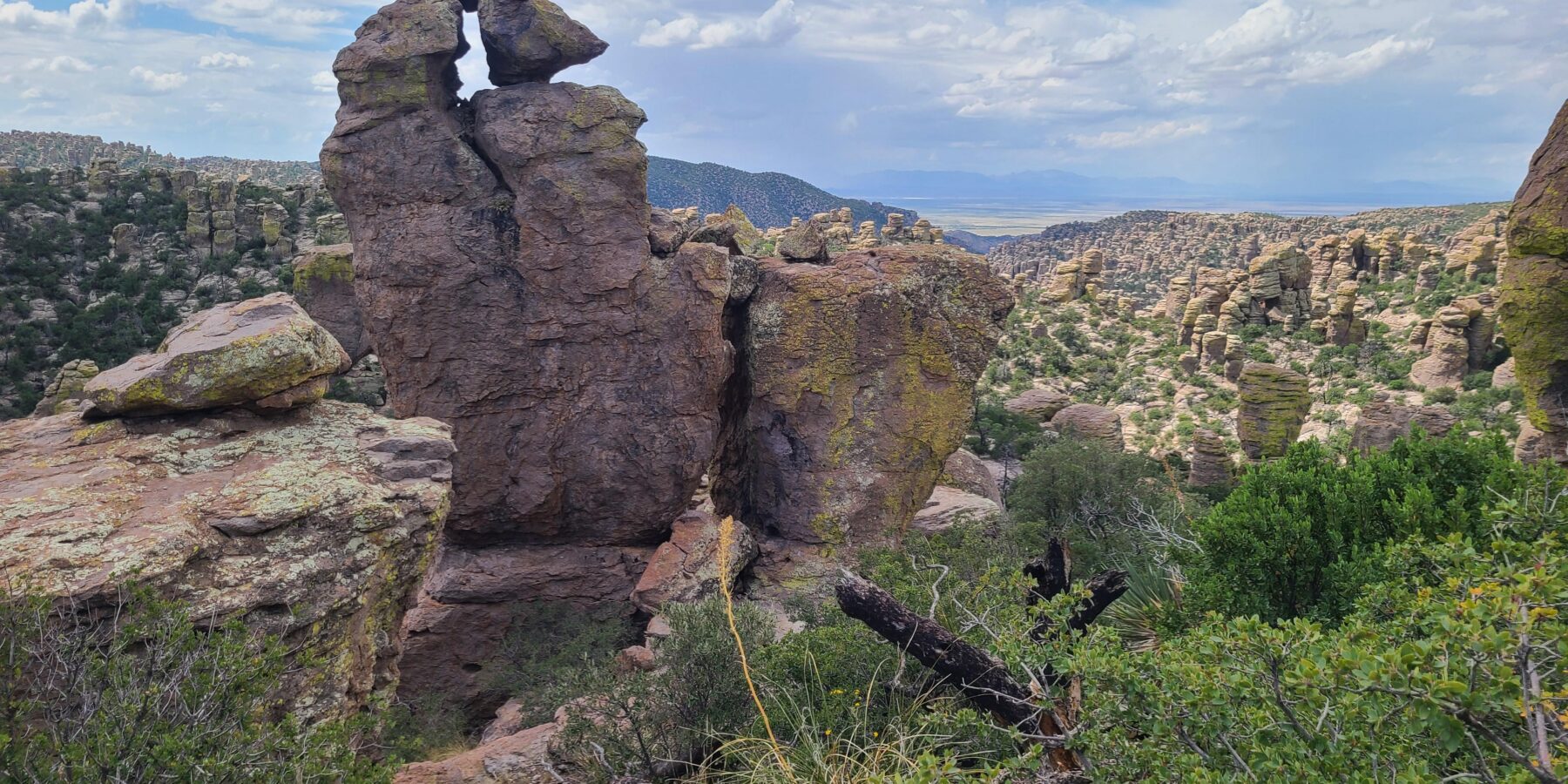
The park’s columns and balanced rocks are rhyolite tuff, laid down by a massive eruption of the Turkey Creek Caldera about 27 million years ago. Hot ash fused into thick layers of rock that later cracked along vertical joints, and erosion widened those cracks into the spires, hoodoos, and perched boulders that gave the area its old nickname, the Wonderland of Rocks.
Bonita Canyon Drive and Massai Point
The paved Bonita Canyon Drive climbs about 8 miles from the visitor center to Massai Point, near 6,870 feet, where a short nature trail looks across the pinnacles toward the Sulphur Springs Valley. The road is narrow and winding, so check vehicle length limits before taking a large RV beyond the visitor center.
Echo Canyon and the Heart of Rocks
The Echo Canyon Loop, roughly 3.3 miles, threads grottoes and narrow passages between towering columns before returning through shaded woodland in Rhyolite Canyon. Hikers with a full day can continue to the Heart of Rocks Loop, a round trip of roughly 7 to 9 miles depending on the trailhead, which passes Big Balanced Rock and some of the park’s most famous formations.
Faraway Ranch
Near the park entrance, the Faraway Ranch historic district preserves a pioneer homestead that later operated as a guest ranch. It is an easy stop on the way in or out, and a reminder that people lived among these rocks long before the park existed.
Quieter Places Beyond the First Viewpoints
Each park contains worthwhile stops beyond its best known corridor. These places demand a little more walking or driving, but they also reveal details that quick visits miss: an eastward view into Grand Canyon, a masonry pueblo beside fossil beds, and a summit above Tucson’s cactus forest. Add one of the following areas when the itinerary includes enough daylight to explore without rushing.
Desert View and the Canyon’s Eastern Reach
Desert View sits near the eastern end of Grand Canyon’s South Rim road. The 70 foot Desert View Watchtower, completed in 1932 and designed by Mary Colter, draws on ancestral Puebloan architectural forms. Nearby viewpoints look toward the Colorado River, the Painted Desert, and the broad opening where the Little Colorado joins the main canyon. Lipan Point is especially useful for seeing long sections of river and the tilted rock layers of the Grand Canyon Supergroup.
Puerco Pueblo and the Southern Fossil Beds
Puerco Pueblo preserves the foundations of a settlement that once contained approximately 100 rooms. Puebloan people occupied the site most intensively between about 1250 and 1380 CE, farming near the Puerco River and creating petroglyphs on nearby sandstone. Farther south, the Long Logs and Agate House trails can be combined into a walk of roughly 2.6 miles. Agate House is a reconstructed pueblo built largely from blocks of petrified wood.
Wasson Peak Above the Tucson Mountains
Wasson Peak reaches 4,687 feet, the highest point in the Tucson Mountains. Routes from the Hugh Norris, Sendero Esperanza, and King Canyon trails can form hikes of approximately 7 to 10 miles, depending on the combination chosen. The ascent crosses exposed slopes with little dependable shade, then reaches broad views over Avra Valley, Tucson, and the Santa Catalina Mountains. Strong hikers should start early and carry all water required for the route.
A Practical Four-Park Itinerary
A nine day trip gives each landscape enough time to register while preserving three days for transfers. Travelers arriving through Phoenix or Tucson can begin at Saguaro, detour east to Chiricahua, continue north to Petrified Forest, and finish at Grand Canyon’s South Rim. Reversing that order works equally well. Avoid treating transfer days as full hiking days, especially when winter ice, summer storms, road construction, or metropolitan traffic can extend the drive.
| Park | Useful minimum | Better allocation | Extra time is best used for |
|---|---|---|---|
| Grand Canyon | One full day | Two to three days | A below rim hike, Desert View, and changing light at multiple overlooks |
| Petrified Forest | Half a day | One full day | Blue Mesa, archaeological sites, and the southern fossil trails |
| Saguaro | One full day | Two days | One day in each district or a longer foothill hike |
| Chiricahua | Half a day | One to two days | Echo Canyon, the Heart of Rocks, and sunset at Massai Point |
A Nine Day Sequence
This schedule keeps the most strenuous walking separate from the longest drives. It also places Petrified Forest between Chiricahua and Grand Canyon, reducing backtracking across Arizona. Lodging in gateway communities or Tucson makes early starts easier than commuting from a distant city each morning.
- Days one and two: Explore both Saguaro districts, reserving one morning for a longer trail.
- Day three: Drive east to Chiricahua, about two hours from Tucson, and take Bonita Canyon Drive to Massai Point for late light.
- Day four: Hike the Echo Canyon Loop or the longer Heart of Rocks route, then stay overnight in Willcox.
- Day five: Drive north and stop overnight near Petrified Forest.
- Day six: Travel the park road from end to end, including Blue Mesa and the fossil beds.
- Day seven: Continue to Grand Canyon’s South Rim and walk part of the Rim Trail near sunset.
- Days eight and nine: Visit Desert View, explore additional overlooks, and complete a carefully chosen below rim hike.
Pack for Elevation, Wind, and Exposed Ground
The same suitcase must cover cold rim mornings and hot desert afternoons. Shoes with firm traction help on loose volcanic gravel at Saguaro, bentonite clay at Petrified Forest, and stone steps below Grand Canyon’s rim. Bentonite becomes exceptionally slick when wet, so stepping off established routes after rain can damage both the soil and your itinerary.
- A wide brimmed hat, sunglasses, and sunscreen for exposed trails
- Insulating layers and a wind resistant shell for high plateaus and canyon rims
- Water containers sized for the full outing, since natural water sources are unreliable
- Electrolyte snacks and substantial food for steep Grand Canyon climbs
- A paper map and downloaded navigation for areas with weak mobile coverage
Gear & Essentials
Tell us about your trip and we will add what else you will want:
The basics
Worth having in the car whatever the park.
For this trip
Traveling with kids
Bringing a pet
RVing
Backcountry
Winter conditions
On the water
Photography
Accessibility
As an Amazon Associate we earn from qualifying purchases, at no extra cost to you.
Building the Right Arizona Parks Trip
The strongest National Parks Arizona Guide itinerary respects the contrast among these protected landscapes. Grand Canyon requires decisions about elevation and climbing effort. Petrified Forest rewards close attention to geology, fossils, and human history along a compact corridor. Saguaro combines accessible desert scenery with mountain routes that can occupy an entire day. Chiricahua adds a remote, cooler sky island of stone pinnacles. Matching daily mileage to those differences produces a safer and more informative trip.
Allow at least six days, choose the season around the most temperature sensitive park, and protect extra time for weather or slower trails. Nine days creates the best balance for most visitors: two days around Tucson, two at Chiricahua, one complete day at Petrified Forest, two or more days at Grand Canyon, and realistic travel intervals between them. That plan leaves room to experience Arizona’s four national parks as distinct ecosystems rather than a checklist of entrances and overlooks.