Theodore Roosevelt National Park
Theodore Roosevelt National Park Itinerary: How to Spend 2 Days Exploring the Badlands

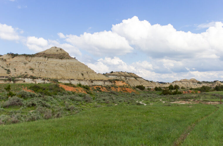
Photo: Matt-Zimmerman via Flickr (CC BY 2.0)
A Theodore Roosevelt National Park itinerary works best when it gives one full day to the South Unit near Medora and a second day to the quieter North Unit, roughly 70 road miles away. That order covers the park’s broadest badlands views, its most rewarding short trails, and the Little Missouri River without wasting time retracing the same highway.
The park protects three separate areas in western North Dakota: the South Unit, the North Unit, and the remote Elkhorn Ranch Unit. Over two days, prioritize the first two. Elkhorn Ranch has historical importance as the site of Theodore Roosevelt’s cattle ranch, but its unpaved approach and limited remains demand several extra hours. Our route instead concentrates on wildlife, accessible overlooks, prairie ecology, and trails through the park’s striped sedimentary formations.
How to divide two days between the park units
Spend the first day in the South Unit, using Medora as your base. This unit has the park’s main visitor services, the Maltese Cross Cabin, a concentration of short trails, and frequent sightings of bison and prairie dogs. Painted Canyon, directly off Interstate 94 east of Medora, fits naturally at the beginning or end of this day.
On day two, drive north through Belfield and along US Highway 85 to the North Unit entrance. The North Unit’s scenic road follows the Little Missouri River before climbing onto badlands plateaus. River Bend Overlook, Caprock Coulee, and Oxbow Overlook make the longer transfer worthwhile, especially for travelers prepared to walk beyond roadside viewpoints.
The route at a glance
| Day | Stop | Primary highlight | Approximate drive time |
|---|---|---|---|
| 1 | Medora to South Unit visitor area | Maltese Cross Cabin and park orientation | 5 minutes |
| 1 | South Unit scenic road | Prairie dog towns, Buck Hill, and Wind Canyon | 2 to 4 hours including stops |
| 1 | Painted Canyon | Layered badlands visible from the Interstate 94 corridor | About 10 minutes from Medora |
| 2 | Medora to North Unit | Transfer through Belfield and the Little Missouri National Grassland | About 1 hour 20 minutes |
| 2 | North Unit scenic road | River Bend Overlook, Caprock Coulee, and Oxbow Overlook | 2 to 3 hours including stops |
Why the South Unit comes first
The South Unit provides the easiest introduction to the landscape’s geology and wildlife. Rivers and streams cut through soft Paleocene sediment deposited roughly 55 to 65 million years ago. Erosion exposed alternating bands of sandstone, siltstone, clay, lignite coal, and iron-stained rock. After learning to recognize those layers here, the deeper cuts and broader plateaus of the North Unit become easier to read.
Starting near Medora also provides flexibility after a long arrival drive. A late arrival can still accommodate the visitor area, Skyline Vista, or Wind Canyon. By contrast, reaching the North Unit requires a longer highway transfer, and services are sparse near its entrance. Saving that unit for a fresh morning reduces the chance that road fatigue will consume valuable hiking time.
When Elkhorn Ranch fits into the plan
Elkhorn Ranch should replace part of a unit visit rather than be squeezed between them. Roosevelt established the ranch beside the Little Missouri River in 1884 after the deaths of his wife and mother. Only foundation stones remain, but the cottonwood bottomland conveys the isolation that shaped his writing and conservation outlook.
The access roads include unpaved sections that can become muddy, deeply rutted, or impassable after heavy rain. Allow at least half a day, carry offline directions, and avoid taking a low-clearance rental vehicle when conditions are poor. Travelers primarily interested in scenery and hiking will gain more from keeping the standard two-unit route.
Arrival planning, fuel, food, and road conditions
Medora sits immediately south of Interstate 94 and serves as the practical base for the South Unit. Dickinson, about 35 miles east, has a broader selection of groceries, fuel, and lodging. Travelers approaching from Montana should fill up before leaving the interstate corridor for the North Unit, where distances between dependable services increase considerably.
Park roads cross open prairie and clay-rich badlands with little shelter from wind or thunderstorms. Cellular coverage weakens in gullies and can disappear away from towns. Download maps before leaving Medora, save the North Unit entrance location offline, and carry enough water and food for the full day. Check entrance requirements, road closures, weather alerts, and seasonal facility status on the official park site before departure.
Where to sleep between the two days
For the least complicated schedule, stay two nights in Medora. This avoids packing after day one and provides access to restaurants and fuel before the northbound drive. It does mean returning toward Interstate 94 after the North Unit, so travelers continuing north toward Watford City or Williston may prefer changing accommodations on the second night.
Campgrounds place visitors closer to dawn and dusk wildlife activity, but shade is limited and summer heat lingers on exposed sites. Wind can also make tent setup difficult. Reservations, seasonal water availability, and campground opening dates vary, so build the itinerary around the sleeping option you can secure rather than assuming a site will be available on arrival.
What to carry in the vehicle
- Water: Carry at least two liters per person for a day of short walks, and more for Caprock Coulee or hot summer conditions.
- Food: Pack lunch and snacks before leaving Medora because the North Unit has no dependable meal stop inside the park.
- Navigation: Download the park map and regional highway map for offline use.
- Sun and wind protection: Bring a brimmed hat, sunscreen, sunglasses, and a shell that blocks prairie wind.
- Footwear: Choose shoes with firm tread. Bentonite-rich clay becomes exceptionally slick when wet and clings heavily to soles.
- Wildlife buffer: Carry binoculars so bison, wild horses, elk, and prairie dog colonies can be observed without approaching them.
Day one in the South Unit
Begin near the South Unit visitor area, then travel the scenic road through prairie dog habitat and eroded badlands. Budget six to eight hours if you plan to combine overlooks with two or three short walks. The road’s exact through-route can change after erosion or construction, but the major western viewpoints remain practical as individual out-and-back stops.
Bison frequently use the pavement and road shoulders, especially during cooler morning hours. Stop well behind any animal blocking the road and remain inside the vehicle. Wild horses also roam the South Unit, while black-tailed prairie dogs occupy several conspicuous colonies. Their alarm calls attract badgers, coyotes, golden eagles, and other predators, although sightings require patience.
Start with Roosevelt’s Maltese Cross Cabin
The Maltese Cross Cabin stood south of Medora during Roosevelt’s ranching years and was later moved to its present location. Its hewn ponderosa pine logs, steep roof, and compact rooms show the practical construction used by relatively prosperous cattle ranchers during the 1880s. Exhibits nearby explain how Roosevelt’s experiences with drought, overgrazing, and the severe winter of 1886 to 1887 influenced his ideas about land stewardship.
Allow about 30 to 45 minutes for the cabin and orientation exhibits. Ask rangers about recent bison locations and road conditions before committing to longer walks. Wildlife positions shift daily, and a current sighting report can help determine which overlooks to visit first.
Walk Skyline Vista before the longer scenic drive
Skyline Vista is a short climb of roughly 0.2 mile round trip from the scenic road. The viewpoint looks over Medora, the Little Missouri River corridor, and the surrounding tablelands. Its modest distance makes it useful early in the day, when you can assess wind, heat, and trail conditions before selecting a longer hike.
From the top, notice how grass-covered uplands end abruptly at branching ravines. Those intact caps slow erosion, while exposed clay slopes below them wash into gullies during cloudbursts. The contrast explains why apparently level prairie can break suddenly into dense badlands terrain.
Prioritize Buck Hill and Wind Canyon
Buck Hill’s open summit
Buck Hill rises to about 2,855 feet and offers one of the South Unit’s broadest panoramas. A short but steep path reaches the top, where resistant sandstone protects the softer layers below. The exposed summit receives strong winds, and thunderstorms can approach quickly across the unobstructed horizon. Skip the climb if lightning is visible or thunder is audible.
Wind Canyon above the Little Missouri
The Wind Canyon Trail forms a roughly 0.4-mile loop to the edge of a river-cut bluff. Fine sand shifts underfoot as the path threads between rounded outcrops, and wind funnels through the gaps with enough force to carry grit against bare legs. At the overlook, the ground falls sharply toward the brown, looping Little Missouri River. Cottonwoods trace the floodplain below, while the opposite bank rises in gray and tan shelves.
Complete the South Unit day at Painted Canyon
After Wind Canyon, continue to any open western overlooks before returning toward Medora. Keep the final two hours flexible because bison often slow traffic, and evening light reveals coal seams and iron-rich red clinker that can appear flat at midday. If the scenic road requires backtracking, leave enough daylight for the drive to Painted Canyon rather than trying to cover every pullout.
Choose the overlook or the nature trail
The Painted Canyon overlook provides an immediate view from the Interstate 94 corridor. Travelers with another hour can follow the approximately 1-mile Painted Canyon Nature Trail, which descends from the rim into grassland and clay gullies. The return climb feels steeper than the mileage suggests, particularly in heat. Use the overlook instead when storms have made the clay slick or when daylight is running short.
Build in time for wildlife delays
Return to Medora before dark if you are uncomfortable driving around large animals. Bison can be difficult to see when their dark bodies blend into shaded road cuts, and mule deer commonly move near pavement around dusk. Eat dinner, refuel, and prepare breakfast and lunch that evening. An early departure keeps the North Unit transfer from consuming its best hiking hours.
Day two in the North Unit
Leave Medora around sunrise and enter the North Unit with a full fuel tank. This portion of the Theodore Roosevelt National Park itinerary follows a road that begins near the Little Missouri River and climbs toward higher grasslands. Allow six hours inside the unit if you plan to hike Caprock Coulee. Travelers concentrating on overlooks can cover the principal stops in roughly four hours.
Hike Caprock Coulee while temperatures are lower
The Caprock Coulee Nature Trail is approximately 1.5 miles and passes through a dry wash, juniper pockets, and slopes protected by harder caprock. For a longer outing, the full Caprock Coulee loop covers about 4.3 miles and climbs onto open prairie. Route finding becomes harder where bison paths cross the tread, so carry the map and watch for trail markers rather than following the widest track.
Study the river from River Bend Overlook
River Bend Overlook combines a broad view of the Little Missouri valley with a stone shelter built by the Civilian Conservation Corps during the 1930s. The structure frames the river’s bends, cottonwood bottoms, and dissected ridges. The nearby slopes also show slumping, a process in which water-saturated sediment shifts downhill and leaves tilted blocks beneath the rim.
Continue to Oxbow and Sperati Point
Oxbow Overlook looks across a large bend abandoned or reshaped as the river migrated through its floodplain. If time and weather permit, walk the old road toward Sperati Point, approximately 2.4 miles round trip. The grade is moderate, but the exposed plateau offers little shelter. Turn around earlier if afternoon thunderstorms develop or strong wind makes walking near the rim uncomfortable.
Adjust the schedule for weather and daylight
Late spring and early autumn usually provide the most comfortable hiking temperatures, although wind and rapid weather changes remain common. Summer afternoons can become hot on exposed clay slopes, so place Caprock Coulee and Buck Hill early. Winter brings short daylight, drifting snow, ice, and potentially limited road access. A two-unit plan may require more driving time after a storm.
A practical seasonal priority list
- Spring: Expect muddy clay after rain and avoid trails when each step damages saturated tread.
- Summer: Start walks early, carry extra water, and use midday for overlooks and cabin exhibits.
- Autumn: Watch for cold mornings, shorter evenings, and yellow cottonwoods along the river.
- Winter: Favor short walks near maintained roads and carry blankets, food, and traction aids in the vehicle.
Smoke, thunderstorms, snow, or road damage can change the best sequence. Preserve the full North Unit day when possible because its transfer is harder to rearrange. On a shortened trip, keep the South Unit visitor area, Wind Canyon, Painted Canyon, River Bend Overlook, and Oxbow Overlook. Treat longer hikes and Sperati Point as additions after those core stops.
Frequently Asked Questions
These answers address the planning issues that most often affect a two-day visit. They also help determine whether the standard route needs to be shortened for children, pets, or limited walking ability.
Are two days enough for Theodore Roosevelt National Park?
Two full days cover the principal roads, several short trails, and both major units. Add a third day for Elkhorn Ranch, a backcountry hike, or a slower wildlife-focused visit.
How far apart are the South and North Units?
The entrances are roughly 70 road miles apart. Most drivers need about 80 minutes without extended stops, construction delays, or wildlife on the road.
Are dogs allowed on park trails?
Pets generally cannot use hiking trails and must remain in permitted developed areas under physical control. Plan roadside viewpoints instead, and never leave an animal in a warm vehicle.
Is this itinerary suitable for children?
Yes, if adults select short walks such as Skyline Vista and Wind Canyon and maintain close supervision near exposed edges. Prairie dog towns, the Maltese Cross Cabin, and wildlife viewing provide useful breaks between hikes.
Can the park be explored without hiking?
Both units have major scenery visible from roads and overlooks. River Bend, Oxbow, Painted Canyon, and several South Unit pullouts make a worthwhile route for travelers who cannot manage uneven trails.
Putting the two-day plan together
This route uses Medora for efficient South Unit access, then reserves a fresh morning for the longer drive to the North Unit. It balances Roosevelt-era history, short walks, badlands geology, and wildlife habitat without forcing Elkhorn Ranch into an already full schedule. Packing food, water, offline maps, and a full fuel tank protects the second day from the region’s limited services.
Keep the order of the major stops, but let weather and wildlife determine the exact pace. Complete Wind Canyon and Painted Canyon on day one, then prioritize Caprock Coulee, River Bend, and Oxbow on day two. With that structure, delays become manageable and each unit receives enough time to show its distinct terrain.
Want to keep exploring? Browse all our Theodore Roosevelt guides and articles for more trip-planning tips and ideas.
Gear & Essentials
Tell us about your trip and we will add what else you will want:
The basics
Worth having in the car whatever the park.
For this trip
As an Amazon Associate we earn from qualifying purchases, at no extra cost to you.