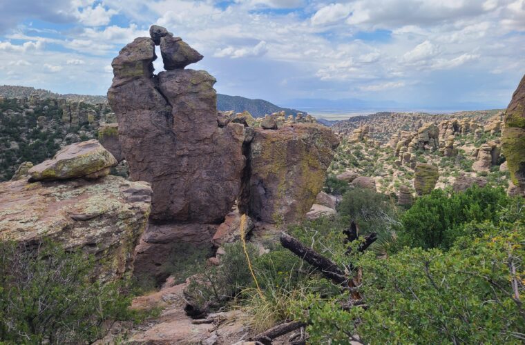
Best Hikes in Chiricahua National Park: Spectacular Rock Formations
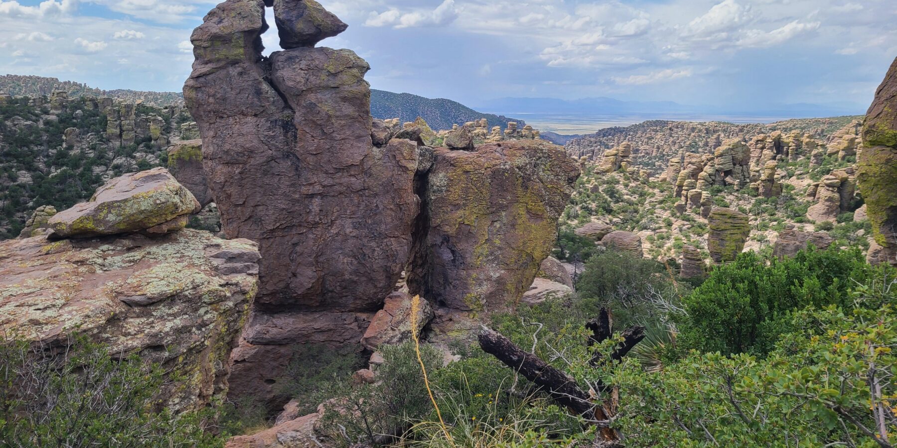
Searching for the Best Hikes Chiricahua National Park has to offer begins with understanding its vertical landscape: rhyolite pinnacles rise hundreds of feet above narrow canyons, while trailheads span elevations from roughly 5,300 to 6,900 feet. The strongest routes enter the formations rather than merely viewing them from the road, revealing balanced rocks, weathered grottoes, stone columns, and passages barely wide enough for a trail.
Our team uses three areas to organize a first visit: Echo Canyon for an accessible introduction, the Heart of Rocks for the park’s most distinctive formations, and the high overlooks along Bonita Canyon Drive for broad views across the Chiricahua Mountains. This guide compares the principal hikes, explains how the trail network connects, and helps you choose a route that matches your available time and comfort with elevation gain.
Why Chiricahua’s Hikes Are All About the Rock Formations
Chiricahua occupies part of a southeastern Arizona “sky island,” an isolated mountain range rising above the surrounding desert grasslands. Elevation creates sharp ecological transitions. Apache plume, agave, and prickly pear grow near the lower canyons, while Arizona cypress, oak, pine, and Douglas fir appear higher on the slopes. A hike can therefore move between exposed desert vegetation and shaded woodland within a few miles.
A landscape built by the Turkey Creek Caldera
The formations began with the eruption of the Turkey Creek Caldera about 27 million years ago. Hot ash and volcanic debris accumulated in thick deposits, then compressed and welded into rhyolite tuff. Cooling fractures divided that rock into blocks. Water, ice, wind, and chemical weathering gradually enlarged the fractures, leaving columns, fins, hoodoos, and precarious looking boulders after softer material eroded away.
These processes explain why the formations change character along the trails. Some cliffs remain massive and relatively continuous, while heavily jointed areas have become forests of separate spires. Rounded openings and bulbous surfaces often form where moisture attacks minerals along cracks. The result is locally called the Wonderland of Rocks, a fitting geographic description rather than a single viewpoint.
How elevation changes the hiking experience
The visitor center area sits at approximately 5,400 feet, while Massai Point is close to 6,900 feet. Sugarloaf Mountain reaches about 7,310 feet, and several interior routes repeatedly descend into drainages before climbing back to a trailhead. Mileage alone can therefore understate difficulty. The Big Loop, for example, combines sustained distance with roughly 1,800 feet of cumulative climbing.
What the formations look like from inside the maze
Inside the Wall Street section of Echo Canyon, the tread turns firm and rocky beneath your boots as rhyolite walls narrow on both sides. Morning shade can keep this passage noticeably cooler than the exposed rim. Footsteps and bird calls rebound between the stone surfaces, then the corridor opens abruptly toward layered pinnacles across Rhyolite Canyon. That transition from enclosure to long views is one reason the loop works especially well as a first hike.
Best Hikes in Chiricahua National Park to Match Any Schedule
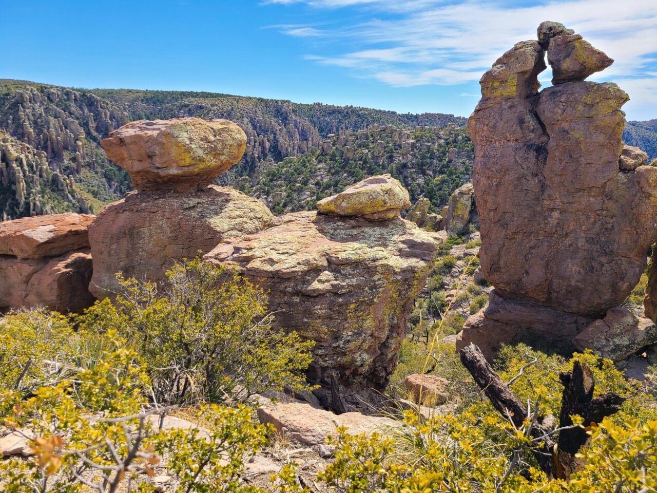
The main trail system is interconnected, so a route name does not always represent a completely separate path. Echo Canyon, Hailstone, Upper Rhyolite Canyon, Sarah Deming, Mushroom Rock, and Ed Riggs can be combined in several ways. Carry a current trail map and identify every junction needed for your route before leaving the trailhead.
The Hikes Compared
| Hike | Approximate distance | Typical difficulty | Primary rock experience |
|---|---|---|---|
| Massai Point Nature Trail | About 0.5 mile | Easy | High overlooks, close pinnacles, and volcanic interpretation |
| Echo Canyon Loop | About 3.3 miles | Moderate | Wall Street, grottoes, fins, and narrow passages |
| Sugarloaf Mountain Trail | About 1.8 miles round trip | Moderate | Summit panorama across the eroded caldera landscape |
| Natural Bridge Trail | About 4.8 miles round trip | Moderate to strenuous | A thick rhyolite span above a side canyon |
| Big Loop with Heart of Rocks | About 9.5 miles | Strenuous | The densest collection of named balanced rocks and hoodoos |
Distances can vary slightly with the exact trailhead and connector used. The short Massai Point route prioritizes overlooks, while Echo Canyon provides the best ratio of scenery to effort. Natural Bridge involves a substantial climb on a sunnier slope. The Big Loop is the complete backcountry style circuit for hikers prepared to manage a long day, route junctions, and repeated elevation changes.
The Best Hike for a First Visit
Echo Canyon Loop
Echo Canyon Loop combines the Echo Canyon, Hailstone, and Ed Riggs trails. Hiking counterclockwise brings the descent through Echo Park and the Wall Street corridor early, followed by a traverse beneath formations along Hailstone. The return climb is steady rather than technical. Starting early improves the chance of finding parking and gives softer light on the rhyolite walls.
Heart of Rocks and the Big Loop
Heart of Rocks is a compact loop deep within the trail network, not a roadside stop. Its named formations include Big Balanced Rock, Pinnacle Balanced Rock, Duck on a Rock, Thor’s Hammer, and Punch and Judy. The side loop contains frequent short climbs, stone steps, and tight turns. Add it only if your pace leaves enough time and water for the return journey.
Choose your route using these three questions
- How much climbing can your group sustain? A short summit trail may feel harder than a longer shaded loop because direct sun and steep grades increase effort.
- Do you want close formations or wide views? Echo Canyon and Heart of Rocks place hikers among hoodoos. Sugarloaf and Massai Point explain the landscape from above.
- How early can you begin? Long interior circuits require enough daylight to accommodate photography, junction checks, and a slower return climb.
Following Bonita Canyon Drive through the park’s key zones
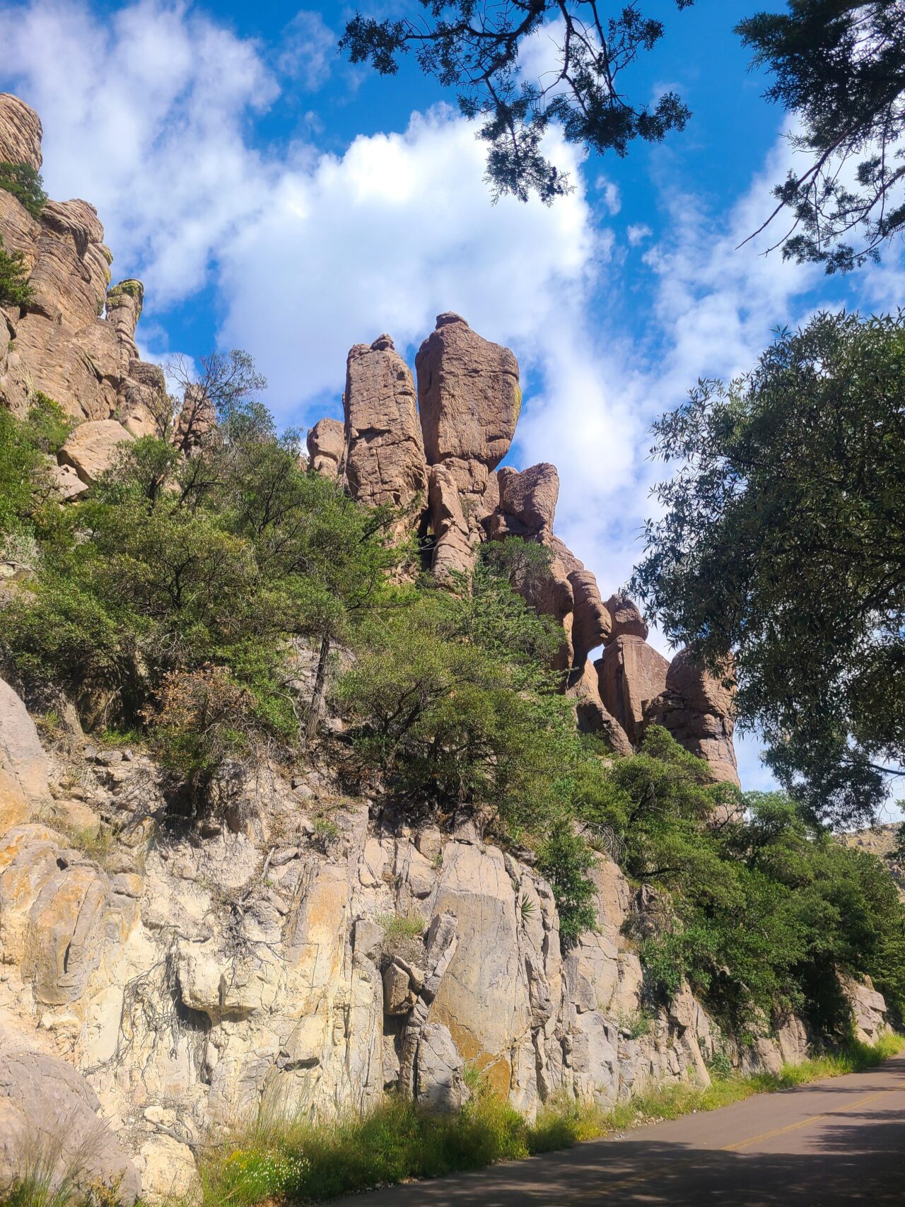
Bonita Canyon Drive is the park’s principal orientation corridor, climbing roughly eight miles from the visitor center area to Massai Point. The paved road is narrow and winding, with limited sight distance around some curves. Trailers and larger vehicles face restrictions on the upper portion. Entrance requirements, road conditions, trail closures, and facility availability can change, so confirm current details on the official park site before arrival.
Lower Bonita Canyon and the visitor center area
The lower canyon provides access to park information, Faraway Ranch, and trails entering Rhyolite Canyon. Cottonwoods and Arizona sycamores mark drainage courses, while oak woodland covers adjacent slopes. This zone is useful for understanding how water shaped human settlement as well as the volcanic terrain. It also provides lower elevation access to longer routes, though beginning here adds climbing compared with the high trailheads.
Echo Canyon trailhead and the upper formations
Echo Canyon trailhead sits high enough to begin among mature woodland and immediate views of eroded spires. It serves the Echo Canyon Loop and longer combinations descending toward Upper Rhyolite Canyon. Because hikers can connect onward to Sarah Deming and Heart of Rocks, careful navigation matters at every signed junction. Photographing the map at the trailhead provides a useful backup to a paper map.
Massai Point and the high rim
Massai Point forms the road’s scenic endpoint and offers views toward Cochise Head, Sugarloaf Mountain, Sulphur Springs Valley, and distant ranges in Arizona and New Mexico. The short nature trail is valuable before a longer hike because exhibits explain welded tuff, erosion, fire ecology, and the sky island setting. Late afternoon light strengthens the texture of the formations, although summer thunderstorm exposure makes an earlier visit the safer choice.
Building a longer route through the interior formations
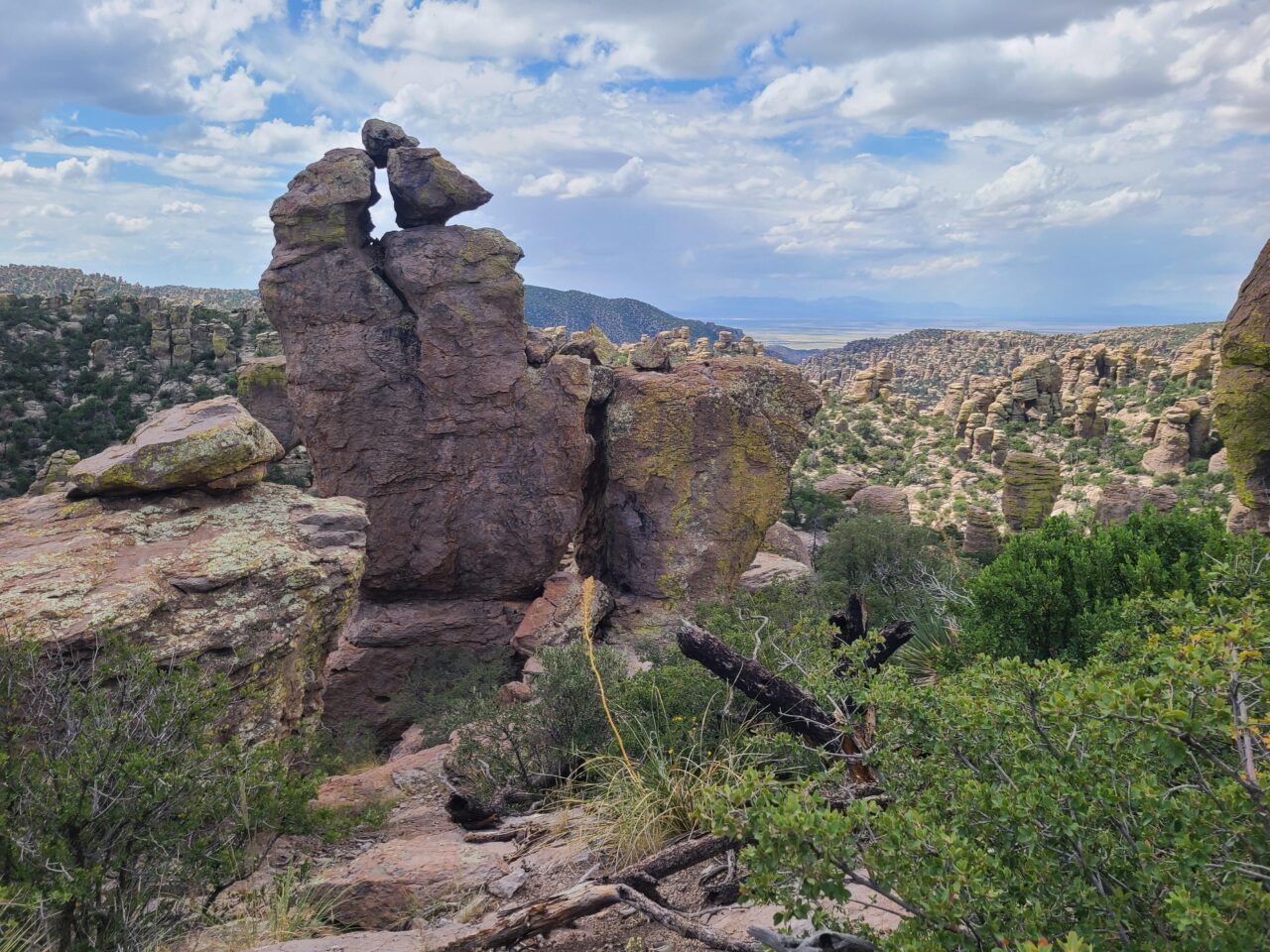
The interior network rewards deliberate sequencing. A strong full-day circuit begins at Echo Canyon, descends Upper Rhyolite Canyon, crosses toward Sarah Deming, and reaches Heart of Rocks before returning by Mushroom Rock and Ed Riggs. This arrangement places the most demanding climbing after the lower canyon crossing, so hikers should assess their remaining water and daylight before entering the Heart of Rocks side loop. Trail signs identify the major connectors, but closely spaced junctions make a printed topographic map valuable.
Allow extra time inside Heart of Rocks
The Heart of Rocks loop covers about one mile, yet its stone steps, short switchbacks, and closely packed formations slow most groups. Photographers often need an hour or longer because Big Balanced Rock, Thor’s Hammer, and Pinnacle Balanced Rock appear from different angles within a compact area. Complete the loop in its signed direction rather than creating shortcuts across fragile slopes. Loose rhyolite gravel makes the steeper steps particularly awkward for hikers carrying heavy packs or managing tired knees.
Use Inspiration Point for a quieter overlook
Inspiration Point lies on a roughly one-mile round-trip spur from the main interior network. Many hikers omit it while concentrating on Heart of Rocks, but the overlook provides a useful perspective across Rhyolite Canyon and the surrounding columns. The spur adds both time and climbing to an already substantial route. It works best for strong groups moving comfortably through the main loop, especially during clear autumn weather when distant ridgelines remain visible beyond the volcanic formations.
Notice Mushroom Rock rather than rushing past it
Mushroom Rock Trail often functions as a connector, but its formations deserve attention. Differential erosion has removed weaker material beneath resistant caps, producing top-heavy profiles that reveal how individual pinnacles evolve. The surrounding slopes also show the effects of wildfire, with open stands and young vegetation mixed among mature oaks and conifers. This segment receives less concentrated foot traffic than Echo Canyon, giving hikers a quieter look at the transition between woodland and exposed rhyolite.
Easy Walks in Lower Bonita Canyon
Bonita Creek Trail
Bonita Creek Trail is the shortest selection and one of the best places to understand why the Chiricahua Mountains support unusual biodiversity. The path begins near the visitor center and follows a shaded drainage where Arizona sycamores, oaks and cypress benefit from concentrated moisture. Look for acorn woodpeckers, Mexican jays, white tailed deer and coatimundis, especially during quiet morning hours.
The trail’s gentle profile makes it suitable as a leg stretcher after the drive into the park. Creek flow varies greatly and may disappear at the surface during dry periods, but the drainage still supports denser vegetation than the surrounding slopes. After heavy rain, mud and moving water can make this tiny route less straightforward than its length implies.
Faraway Ranch Trail
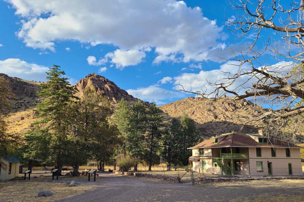
The Faraway Ranch route links the visitor center area with the homestead established by Swedish immigrants Neil and Emma Erickson in the late 1800s. Their daughter Lillian and her husband, Ed Riggs, later developed the property as a guest ranch. Riggs also helped promote the surrounding rock formations and supported the creation of the national monument in 1924.
Walking rather than driving reveals the ranch’s relationship to Bonita Canyon. The broad floor provided water, pasture and comparatively workable land beneath steep volcanic slopes. Cottonwoods and sycamores rustle overhead, while gravel shifts softly underfoot. The air often feels cooler beside the drainage, and the scale changes suddenly when the ranch buildings appear beneath ridges that conceal the hoodoo country above.
Silver Spur Meadow Trail
Silver Spur Meadow provides a quieter alternative near the developed lower canyon. Its mix of open grass, oak woodland and drainage habitat is particularly useful for birders because forest species and grassland species overlap here. The moderate elevation and relatively gentle grade also make it a sensible second walk after Bonita Creek, adding distance without committing hikers to the steeper upper trail system.
Choosing a season for clear views and manageable temperatures
Chiricahua’s elevation moderates southeastern Arizona’s desert heat, although exposed trails still become demanding during warm afternoons. Spring brings flowering agaves, yuccas, and shrubs at lower elevations, while deciduous trees begin leafing out in protected drainages. Autumn commonly supplies comfortable hiking conditions and clearer long-distance views. Winter storms can leave snow and ice on shaded upper trails even when Bonita Canyon is dry, creating a sharp difference between the road corridor and north-facing passages.
Seasonal conditions at a glance
| Season | Likely trail conditions | Best planning approach |
|---|---|---|
| Spring | Cool mornings, warming exposed slopes, occasional strong wind | Carry layers and begin longer loops early |
| Summer | Hot lower canyons, afternoon thunderstorms, lightning exposure | Favor morning hikes and leave summits before storms build |
| Autumn | Milder days, cooler evenings, generally good visibility | Use the stable weather for Heart of Rocks or the Big Loop |
| Winter | Possible snow, frozen shaded tread, short daylight | Choose flexible routes and carry traction after storms |
Read the sky before committing to exposed ground
Summer thunderstorms can form quickly over the Chiricahua Mountains. Sugarloaf Mountain, Massai Point, and open ridges offer little protection from lightning, while runoff can make canyon tread muddy or wash loose stones across the path. Darkening clouds, thunder, and a sudden temperature drop are signals to leave high ground. During dry, windy periods, hikers should also avoid brushing against brittle grasses near the trail because sharp seed heads readily work through mesh shoes and socks.
Preparing for a day among the rhyolite pinnacles
For travelers researching Best Hikes Chiricahua National Park routes, water capacity should influence the final choice as much as mileage. Natural water sources are unreliable and require treatment even when flowing. A long interior circuit can consume several liters per person, particularly in late spring or early summer. Salty snacks help replace electrolytes, while a compact lunch is easier to manage than food requiring preparation. Pack out peels and crumbs because coatis, squirrels, and birds quickly learn to investigate rest areas.
Carry equipment suited to rough volcanic tread
- Footwear with firm traction: Loose rhyolite gravel can slide over hard bedrock on descents.
- Paper map and offline navigation: Canyon walls and remote ridges can interrupt mobile service.
- Sun protection: Many connectors cross exposed slopes with limited overhead cover.
- Warm and waterproof layers: Elevation, wind, and thunderstorms can lower temperatures rapidly.
- Headlamp: Photography and side trips often extend Heart of Rocks outings beyond the planned return time.
Give wildlife room near canyons and woodlands
White-nosed coatis may travel in groups through oak woodland, while black bears, mountain lions, mule deer, and javelinas also occupy the range. Mexican jays are conspicuous around higher picnic and woodland areas. Rattlesnakes may bask on warm tread or shelter beside rocks, particularly during spring and early summer. Step where the ground is visible, avoid placing hands into crevices, and pass wildlife without surrounding it. Food should remain controlled during every stop rather than left beside an unattended pack.
Gear & Essentials
Tell us about your trip and we will add what else you will want:
The basics
Worth having in the car whatever the park.
For this trip
As an Amazon Associate we earn from qualifying purchases, at no extra cost to you.
Plan Your Hike Around the Formations You Want to See
Echo Canyon remains the practical choice for a half-day introduction because it combines enclosed passages, woodland, and open views without requiring a full interior circuit. Heart of Rocks deserves a long day and an early start, especially when Inspiration Point is included. Sugarloaf and Massai Point serve hikers who value broad geological context, while Mushroom Rock rewards visitors willing to slow down along the connecting trails.
The best itinerary matches elevation gain, seasonal weather, and daylight to the group’s actual pace. Choose the primary formation first, identify the necessary connectors, and set a turnaround time before leaving the trailhead. That preparation leaves room to study the welded tuff, notice ecological changes between canyon and rim, and return safely after experiencing the rock corridors that define Chiricahua.