Best Things to Do in Saguaro National Park for First-Time Visitors

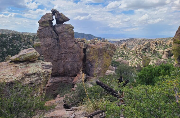
Photo: Molly258 via Flickr (CC BY 2.0)
The Best Things to Do in Saguaro National Park begin with understanding that the park is split into two districts on opposite sides of Tucson. They share the same Sonoran Desert ecosystem, yet they feel markedly different. The western Tucson Mountain District has dense cactus forests, volcanic hills, and short routes to broad desert views. The eastern Rincon Mountain District rises from cactus flats to the 8,666 foot summit of Mica Mountain, passing through oak woodland and conifer forest.
Saguaro National Park protects far more than its namesake cactus. Elevations range from roughly 2,180 feet to more than 8,600 feet, producing one of the greatest ecological transitions in any desert park. A first visit works best when planned around one district per half day. Driving between the two commonly takes 45 to 60 minutes through Tucson traffic, so treating them as adjacent attractions wastes valuable trail time.
Choose the right side of the park for your available time
The two districts sit about 30 road miles apart, with central Tucson between them. Neither district contains a road that crosses the park from west to east. Visitors with one day can see both, but the schedule needs an early start and limited hiking. With only a morning or afternoon, choose one district and explore it properly.
Tucson Mountain District suits short visits and sunset
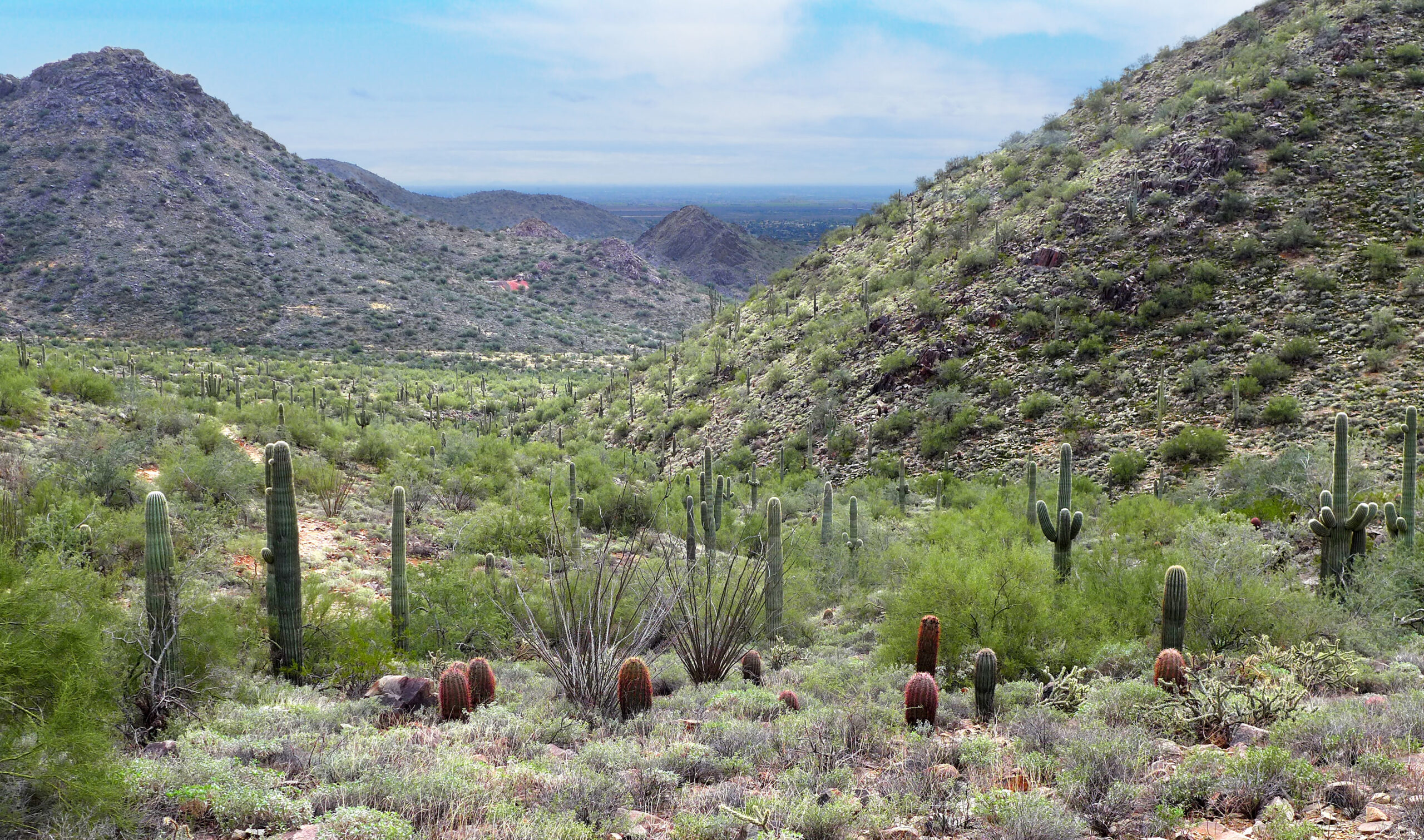
The western district, often called Saguaro West, places a high concentration of saguaros close to scenic roads and short trails. Its principal route is the approximately 6 mile Bajada Loop Drive, a graded dirt road that winds beneath low volcanic ridges. Passenger cars can usually manage it in dry conditions, though washboarding and loose corners require slow speeds.
Choose this district for Signal Hill’s petroglyphs, the Valley View Overlook Trail, and late light across Avra Valley. The desert here is comparatively low and hot, with little natural shade. It also connects conveniently with the Arizona Sonora Desert Museum area, although that attraction lies outside the national park.
Rincon Mountain District rewards longer walks
Saguaro East surrounds the western slopes of the Rincon Mountains. Its paved, one way Cactus Forest Loop Drive covers about 8 miles and provides access to washes, picnic areas, trailheads, and cactus covered foothills. Cyclists also use the loop, whose sharp curves and sustained climbs demand patient driving.
This district is the stronger choice for hiking beyond roadside overlooks. Mica View, Cactus Forest, Freeman Homestead, and Tanque Verde Ridge trails reveal progressively wilder terrain. Backpacking routes continue into the high Rincon backcountry, where pine forest and seasonal snow bear little resemblance to the desert at the entrance.
| District | Best suited to | Defining route | Typical elevation |
|---|---|---|---|
| Tucson Mountain District | Short walks, petroglyphs, sunset | Bajada Loop Drive | About 2,180 to 4,687 feet |
| Rincon Mountain District | Longer hikes, cycling, mountain backcountry | Cactus Forest Loop Drive | About 2,670 to 8,666 feet |
Read the cactus forest before rushing through it
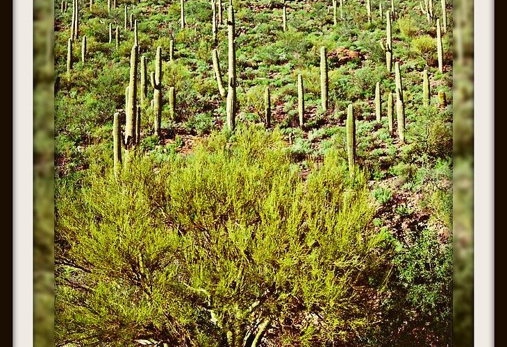
Saguaros grow naturally only in the Sonoran Desert. A mature plant can exceed 40 feet and weigh several tons after absorbing water. Growth is extremely slow during the vulnerable seedling stage, and the first arm commonly appears only after many decades. Palo verde trees, mesquites, and ironwoods often shelter young saguaros from frost and intense sun, functioning as nurse plants.
Look for age, damage, and wildlife use
Height alone does not reveal a saguaro’s exact age because soil, slope exposure, and rainfall affect growth. Instead, compare straight young columns with older plants carrying multiple arms, scars, and woody ribs. Gila woodpeckers and gilded flickers excavate nest cavities in the soft tissue. After the birds leave, elf owls, purple martins, and other animals may occupy the hardened cavity lining known as a saguaro boot.
White flowers appear near the tops of stems in late spring, followed by red fruit in early summer. Lesser long nosed bats, white winged doves, and native bees pollinate the flowers. Fallen fruit feeds desert wildlife and helps distribute thousands of tiny black seeds, although very few seedlings survive drought, frost, and predation.
Time your visit around heat and seasonal light
November through March generally brings the most comfortable hiking temperatures, with cool mornings and mild afternoons. Freezing nights can occur, particularly at higher elevations. April and early May often combine warm days with blooming cacti. By June, exposed low elevation trails can become dangerous by late morning.
The summer monsoon typically brings greater humidity, sudden thunderstorms, lightning, and flash flooding in washes. Storm clouds can lower temperatures briefly, but they also create rapidly changing conditions. September and October remain warm while gradually becoming more suitable for longer walks.
- Start desert hikes near sunrise during warm months.
- Carry more water than the route length appears to require.
- Avoid entering washes when thunderstorms are developing nearby.
- Use sun protective clothing, a brimmed hat, and closed shoes.
- Leave fallen cactus wood, flowers, fruit, and saguaro boots in place.
Follow the essential route through Saguaro West
For a first visit to the Tucson Mountain District, combine Bajada Loop Drive with two short walks rather than stopping at every roadside pullout. The loop’s dirt surface forces a slower pace, which helps reveal changes between rocky bajadas, sandy drainages, and densely vegetated slopes. Begin early for cooler walking or arrive in late afternoon for low angled light on the cactus spines.
Walk to Valley View Overlook
The Valley View Overlook Trail is approximately 0.8 mile round trip. It crosses several shallow washes before climbing gently to a ridge overlooking Avra Valley and the distant mountains west of Tucson. The route is short but fully exposed, and loose stone makes sturdy footwear preferable to sandals.
At the ridge, pale gravel shifts underfoot and the trail narrows between cholla and barrel cactus. Wind moves through the spines with a dry rustle, while saguaros stand at different heights across the slope below. The openness makes distances deceptive. Mountains that appear close sit beyond miles of cactus flats, and the lack of shade becomes immediately apparent when the sun clears the ridge.
See the Signal Hill petroglyphs
Signal Hill Trail is about 0.3 mile round trip, climbing a rocky mound above the surrounding desert. Petroglyphs pecked into dark desert varnish cover boulders near the summit. Many are associated with the Hohokam cultural tradition and are several centuries old, though assigning exact meanings to individual spirals, animals, and geometric forms would be speculative.
Stay on the established path and view the designs without touching the rock. Oils from hands and repeated contact damage the weathered surfaces. The hill also provides a useful elevated view of the Bajada Loop corridor, where alluvial fans spread from the Tucson Mountains into the flatter valley.
Use Cactus Forest Loop as the backbone of Saguaro East
The Rincon Mountain District’s scenic loop passes through rolling foothills rather than flat desert. Plan frequent stops because the narrow, curving road shares space with bicycles and wildlife. Entrance procedures, road access, fees, and facility availability can change, so confirm current details on the official park site before arriving.
Start with the Desert Ecology Trail
The Desert Ecology Trail is a short paved interpretive loop near the beginning of the scenic drive. Signs explain how saguaros, mesquite, palo verde, kangaroo rats, and other species cope with limited water and extreme surface temperatures. Its compact layout makes it useful for families and anyone wanting ecological context before exploring longer trails.
Early morning is especially productive for wildlife observation. Gambel’s quail move between shrubs, cactus wrens call from cholla, and black tailed jackrabbits use open ground before temperatures rise. Rattlesnakes may cross paths or roads during warm weather, so watch where hands and feet are placed rather than stepping blindly around rocks or vegetation.
Take the Mica View and Cactus Forest trails
The paved Mica View Trail runs approximately 0.7 mile between the Mica View area and the Broadway trailhead. It passes through an unusually dense stand of saguaros with clear views toward the Rincon Mountains. Returning by the parallel Cactus Forest Trail creates a loop of roughly 2 miles, adding unpaved terrain and a quieter stretch away from the road.
This combination works well for first-time visitors because it shows both the accessible edge of the cactus forest and its rougher interior. Expect sandy washes, exposed rock, and almost no dependable shade. The mountain wall to the east also demonstrates the park’s vertical scale, rising through grassland and oak woodland toward conifer covered Mica Mountain.
Go farther when cooler weather allows
Short nature trails reveal the structure of the cactus forest, but longer routes show how quickly the terrain changes once you leave the scenic drives. Winter is the most practical season for these hikes. Carry a paper or downloaded map because intersecting trails and sandy washes can make the return route less obvious than expected.
Climb Wasson Peak from King Canyon
At 4,687 feet, Wasson Peak is the highest point in the Tucson Mountains. Routes from the King Canyon trailhead generally cover 7 to 8 miles round trip and gain roughly 2,000 feet, depending on the trail combination. The former mining road through King Canyon provides a relatively direct ascent, while the Hugh Norris Trail adds stone steps and a longer ridge approach.
The summit overlooks Avra Valley, Tucson, and the distant Santa Catalina and Rincon mountains. Start early because the upper ridges remain exposed for several hours. King Canyon also preserves evidence of historic mining, but shafts and unstable workings should be viewed from established trails.
Test the lower Tanque Verde Ridge
Tanque Verde Ridge Trail begins near the east district entrance and climbs continuously toward the Rincon high country. A useful first objective is the broad ridge approximately 1.5 to 2 miles from the trailhead. Reaching it requires several hundred feet of ascent through open desert, with almost no shade or level ground.
Strong backpackers can continue toward Juniper Basin and Tanque Verde Peak, but those destinations require substantially more distance, water, and preparation. Overnight camping in the mountain backcountry requires a permit. Weather can also differ sharply from conditions near Tucson, particularly during winter storms.
Look for seasonal water at Bridal Wreath Falls
The Douglas Spring Trail reaches Bridal Wreath Falls after approximately 2.8 miles and about 1,000 feet of climbing. Water flow depends on recent rain or snowmelt, so the falls may shrink to a damp wall during dry periods. The trail still provides close views of ocotillo slopes, rocky drainages, and the transition toward desert grassland.
| Hike | Approximate distance | Effort | Primary reason to go |
|---|---|---|---|
| Wasson Peak from King Canyon | 7 to 8 miles round trip | Strenuous | Highest Tucson Mountains summit |
| Lower Tanque Verde Ridge | 3 to 4 miles round trip | Moderate to strenuous | Elevated views over the Rincon foothills |
| Bridal Wreath Falls | About 5.6 miles round trip | Moderate | Seasonal waterfall and changing plant communities |
Notice the quieter details most visitors pass
Some of the Best Things to Do in Saguaro National Park involve slowing down rather than adding mileage. Saguaros often grow unevenly across slopes because cold air drainage, soil depth, and water availability influence survival. South facing slopes receive stronger sun, while protected drainages can support denser vegetation and larger mesquites.
Follow the Freeman Homestead Trail
This approximately 1 mile loop in the Rincon Mountain District visits the site of an early twentieth century homestead. Interpretive signs explain how residents attempted to live in a landscape with unreliable rainfall and limited groundwater. The surrounding wash also supports mature mesquite trees, which provide nesting and hunting habitat for birds.
Study animal signs around sandy washes
Tracks are easiest to identify shortly after sunrise, before wind and foot traffic disturb the sand. Javelina leave paired hoofprints, coyotes produce narrow canine tracks, and kangaroo rats make tiny prints accompanied by tail marks. Avoid following animals into vegetation or approaching resting wildlife.
- Scan flowering agaves for hummingbirds and nectar feeding bats.
- Listen for cactus wrens calling from cholla and thorny shrubs.
- Watch road edges around dawn and dusk for snakes and jackrabbits.
- Use binoculars rather than leaving trails to approach nests.
Frequently Asked Questions
First visits are easiest when expectations match the desert environment. Water sources are limited, shade is scarce, and cellular service can be inconsistent away from Tucson. Download maps before entering either district and leave your route with someone if you plan a longer hike.
Entrance stations and visitor centers can provide current trail information, but hikers remain responsible for judging heat, water needs, and storm exposure. Turn around early if water consumption is faster than planned or thunder begins building over the mountains.
How much time do you need in Saguaro National Park?
Allow at least half a day for one district. A full day can include both districts with short walks, while two days allow one district per day and enough time for a longer hike.
Can you visit both districts in one day?
Yes, but Tucson traffic makes the transfer time significant. Pair a morning on Cactus Forest Loop with a late afternoon on Bajada Loop, keeping midday flexible for the cross town drive.
Are dogs allowed on the trails?
Pets are limited to designated roads, picnic areas, and certain paved trails. Most backcountry and unpaved hiking trails prohibit dogs, partly because cactus spines, heat, and wildlife create serious hazards.
Is Saguaro National Park suitable for children?
Short routes such as the Desert Ecology Trail, Mica View Trail, Signal Hill, and Valley View Overlook work well for families. Keep children away from cholla segments, which detach easily and can penetrate shoes and skin.
Do you need a reservation to enter?
Standard day visits generally do not require timed entry, while overnight backcountry camping requires a permit. Entrance fees and administrative requirements can change, so use the park’s official website when finalizing the trip.
Build a first visit around contrast
A practical first itinerary combines the dense cactus stands and cultural sites of Saguaro West with the foothills and longer trail network of Saguaro East. Choose one scenic drive, one interpretive walk, and one elevated viewpoint in each district rather than attempting every marked stop.
Match the route to temperature and daylight. Short walks belong in the warmer part of a winter day, while longer desert hikes should begin early in spring or autumn. With thoughtful timing, the park reveals its defining contrast: giant saguaros on the valley floor below mountain forests rising more than a vertical mile above them.
Want to keep exploring? Browse all our Saguaro guides and articles for more trip-planning tips and ideas.
Gear & Essentials
Tell us about your trip and we will add what else you will want:
The basics
Worth having in the car whatever the park.
For this trip
As an Amazon Associate we earn from qualifying purchases, at no extra cost to you.