Great Smoky Mountains National Park in Winter: What to Expect and What to Do
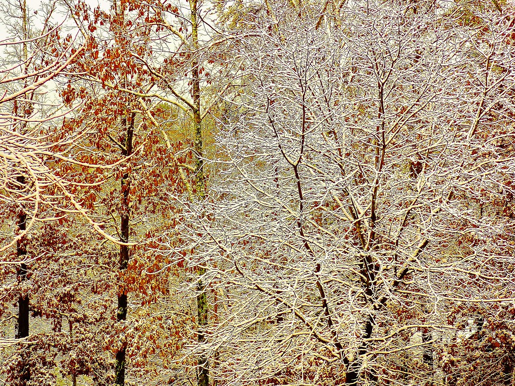
Photo: Olin Gilbert via Flickr (CC BY 2.0)
Great Smoky Mountains National Park is rewarding in winter if you arrive prepared for rapidly changing weather, partial road access, and large differences between valley and ridge conditions. Lower elevations may be damp and snow free while Newfound Gap, Mount Le Conte, and Kuwohi carry snow or ice. Crowds shrink sharply after the holidays, making winter one of the quietest times to explore Cades Cove, Little River Road, and lower elevation trails.
The main planning challenge is uncertainty. A cold front can close mountain roads within hours, and ice may linger on shaded trails long after valley pavement clears. Build flexibility into each day, carry traction for higher trails, and choose lodging with access to more than one park entrance. Winter visitors who plan around elevation rather than the forecast for Gatlinburg or Cherokee make better decisions.
Great Smoky Mountains National Park in Winter: What to Expect
Elevation creates several climates in one park
Great Smoky Mountains National Park rises from roughly 875 feet near the mouth of Abrams Creek to 6,643 feet on Kuwohi, the park’s highest summit. Air temperature commonly drops about 3 to 5 degrees Fahrenheit for every 1,000 feet of elevation gained. A 48 degree afternoon in Townsend can therefore coincide with subfreezing temperatures, rime ice, and strong wind along the Appalachian Trail near Newfound Gap.
Snowfall is concentrated on the high ridges
Valley snow often melts within a day or two, although cold air can preserve ice on bridges, shaded curves, and north facing slopes. Newfound Gap, at 5,046 feet, receives roughly 5 to 6 feet of snow during an average year. Higher summits can receive more. Winter precipitation frequently begins as rain below 3,000 feet and falls as wet snow or sleet above it, complicating both driving and clothing choices.
Forest conditions change with elevation
Leafless hardwoods open long views from trails that feel enclosed from May through October. Along lower ridges, bare oak, hickory, and tulip poplar forests expose old stone walls, roadbeds, and homesite remains. Above about 5,000 feet, Fraser fir and red spruce retain their needles and intercept fog, freezing drizzle, and snow. Ice coated branches can break without warning after storms, so avoid lingering beneath visibly loaded trees.
Great Smoky Mountains National Park Winter Conditions by Month
December through March at a glance
Winter develops in stages rather than arriving on a fixed date. December often combines cool hiking weather with holiday traffic near gateway towns. January and February bring the greatest likelihood of snow, road closures, and sustained ridge ice. March introduces warmer valley afternoons and early wildflowers, but higher trails can remain frozen. The following comparison is a planning guide, not a substitute for the morning road and weather report.
| Period | Typical crowd pattern | Weather character | Access | Best suited to |
|---|---|---|---|---|
| Early December | Quiet on weekdays, busier around holiday events | Cool rain in valleys, intermittent ridge snow | Major through roads generally available between storms | Waterfalls, historic districts, lower trails |
| Late December | Heavy gateway traffic during the holiday week | Frequent freeze and thaw cycles | Temporary high road closures become more likely | Scenic drives with flexible backup plans |
| January and February | Lowest visitation of the year outside holiday weekends | Coldest period, with persistent high elevation ice | Seasonal roads closed and storm closures possible | Solitude, photography, experienced winter hiking |
| March | Increasing on mild weekends | Variable, with spring in valleys and winter on summits | Some seasonal roads remain closed | Lower elevation hiking and early wildflowers |
What low crowds change on the ground
Winter solitude is most noticeable away from overlooks accessible by car. Parking is usually easier at trailheads such as Little River, Middle Prong, and Abrams Falls, but reduced visitation also means fewer people available to assist during an injury or navigation problem. Cellular service remains unreliable across much of the park. Leave a route and return time with someone outside your group, particularly when hiking beyond busy corridors.
How the high country feels after a front
At Newfound Gap after a cold front, the pavement may crunch under a thin crust while wind pushes through the gap and carries fine ice across the overlook. The temperature feels markedly lower than it did beside the river in Gatlinburg. Clouds can erase the North Carolina ridges, then separate within minutes to reveal layered blue slopes. Gloves become necessary quickly because the exposed overlook offers little protection from wind.
Roads, Trails, and Reservations in Great Smoky Mountains National Park in Winter
Roads that shape a winter itinerary
Newfound Gap Road, Little River Road, Laurel Creek Road, and Cades Cove Loop Road form the core winter driving network, although storms can close any of them temporarily. Kuwohi Road normally closes seasonally beyond Newfound Gap, removing vehicle access to the summit area. Roaring Fork Motor Nature Trail and several secondary roads also close for winter. Never drive around a gate, since ice, fallen trees, and unplowed pavement may lie beyond it.
Trail access does not guarantee easy travel
Most hiking trails remain open unless a hazard prompts a specific closure, but their difficulty changes substantially. Alum Cave Trail climbs 1,125 feet in 2.3 miles to Alum Cave Bluffs, where seepage can create broad sheets of ice. The full route to Mount Le Conte gains roughly 2,700 feet over 5.5 miles one way. Rainbow Falls Trail, 5.4 miles round trip, also develops ice near the falls and on shaded upper sections.
Permits, parking, and seasonal facilities
Overnight backcountry travel requires reservations and permits for designated sites and shelters. Frontcountry campgrounds operate on seasonal schedules, and winter availability is limited compared with summer. The park has no general entrance fee, but vehicles parked within park boundaries generally need a parking tag. Sales methods, campground availability, closures, and permit procedures can change, so confirm current details on the official park site before departure.
- Check the park’s road status shortly before entering, not only the previous evening.
- Download maps for offline use because coverage disappears in valleys and behind ridges.
- Carry microspikes when hiking above roughly 3,500 feet after snow or freezing rain.
- Keep food, water, warm layers, and a flashlight in the vehicle in case a closure lengthens the return drive.
- Choose a lower elevation backup trail for every planned ridge hike.
What to Do in Great Smoky Mountains National Park in Winter
For quiet roads and uncrowded trails
Midweek dates in January and February generally provide the deepest quiet, especially along Tremont Road, the Middle Prong Trail, and the western side of the park near Abrams Creek. Choose lower elevation routes after a storm rather than waiting for Newfound Gap Road to reopen. Middle Prong Trail follows a former logging railroad grade beside cascades, providing straightforward navigation and several reasonable turnaround points.
For snow scenery without a major summit hike
Watch for a clearing forecast immediately after a cold front, then target accessible overlooks along Newfound Gap Road once crews reopen it. Snow depth often increases dramatically above Chimneys Picnic Area. Visitors uncomfortable with icy mountain driving should remain at lower elevations and photograph snow covered ridges from Cades Cove or open sections of Foothills Parkway, where distant views can still show the high country’s winter conditions.
For hiking, waterfalls, and early signs of spring
December and March usually provide the broadest selection of manageable lower trails. Laurel Falls Trail covers 2.6 miles round trip, while Abrams Falls requires a 5 mile round trip with rolling climbs and slick rock near the waterfall. By March, hepaticas, spring beauties, and bloodroot may emerge at low elevations even while Mount Le Conte remains icy. Start early because short daylight and shaded terrain make late finishes colder than expected.
How winter compares with the rest of the year
Seasonal tradeoffs at a glance
Winter exchanges broad road access and predictable footing for open forest views, easier parking, and quieter historic areas. Spring brings wildflowers and strong stream flow, summer provides the fullest access to high elevations, and autumn delivers clear air with intense traffic. The best season therefore depends on which limitations affect your trip most. Use this comparison to judge winter against the conditions you would encounter later in the year.
| Season | Crowds | Weather | Road and trail access | Strongest activities |
|---|---|---|---|---|
| Winter | Low outside holidays | Cold rain below, snow and ice above | Seasonal closures and temporary storm closures | Quiet hiking, historic sites, long-range views |
| Spring | Moderate, rising through April | Frequent rain and rapid temperature changes | Roads reopen gradually, streams run high | Wildflowers, waterfalls, birding |
| Summer | Heavy at major trailheads and overlooks | Warm, humid valleys with afternoon storms | Broadest road access, busy parking areas | High-country hiking, camping, family trips |
| Autumn | Very heavy during foliage periods | Cooler, often drier, with early ridge frost | Generally broad access until winter closures begin | Foliage drives, photography, ridge walks |
When another season may suit you better
Choose summer if reaching Kuwohi by road or exploring seasonal routes is central to the trip. Spring better serves visitors interested in trilliums, lady slipper orchids, and high-volume waterfalls. Autumn favors foliage, although congestion can add hours to drives through Cades Cove and Newfound Gap. Winter remains the strongest choice for travelers able to change plans each morning and comfortable carrying traction, insulation, and emergency supplies.
Reservation timing across the year
Winter lodging is generally easier to secure after the holiday period, while autumn weekends and summer vacation dates require earlier planning. Backcountry shelters along the Appalachian Trail and popular sites near Mount Le Conte can still fill on favorable winter weekends. Specialized events use separate application systems. Readers considering a later spring trip can review the 2026 synchronous firefly viewing event dates before comparing seasonal plans.
Build a day that can survive a road closure
Start with a valley objective
A reliable winter itinerary begins below 3,000 feet. The Little River Trail runs through the former Elkmont community beside a broad river, while the Oconaluftee River Trail offers a gentler option near Cherokee. Both allow flexible turnaround points when rain, fading daylight, or rising water changes the day. Historic buildings at Cades Cove and the Mountain Farm Museum add useful alternatives when upper trails are icy.
Add high elevation plans only when conditions support them
Treat Newfound Gap, Alum Cave, and Appalachian Trail outings as conditional additions. Before leaving the valley, compare summit temperatures, wind, recent precipitation, and road status. A reopening means crews have addressed the roadway, but it does not indicate dry trail surfaces. When the upper route becomes impractical, redirect to Schoolhouse Gap Trail or the lower portion of Deep Creek, where three named waterfalls can be reached through a network of comparatively low trails.
Protect the final hour of daylight
Winter sunset arrives early behind steep ridges, and valleys darken before published sunset times. Set a turnaround time rather than relying only on mileage. A practical day plan should include:
- A primary route matched to the morning road report.
- A lower trail near the same entrance to limit extra driving.
- A turnaround time that leaves at least an hour of usable light.
- Dry clothing reserved for the return to the vehicle.
- Enough fuel to reach another gateway if a mountain crossing closes.
Great Smoky Mountains National Park Winter Hazards to Know
Cold rain can be more dangerous than snow
Temperatures between 35 and 45 degrees Fahrenheit create serious hypothermia risk when clothing becomes wet. Wear a waterproof shell over insulating layers, and avoid cotton for longer hikes. Microspikes help on packed ice but provide little grip in deep mud or loose snow. Trekking poles improve balance at frozen stream crossings. Carry a headlamp rather than depending on a phone flashlight, which drains the same battery needed for maps and emergency communication.
Wildlife remains active
Black bears reduce activity during cold periods but may leave dens during warm spells. Store food and scented items securely, keep dogs leashed where permitted, and never approach wildlife beside roads. Trail restrictions can follow bear activity at any time. Our bear incident and trail closure guidance explains why immediate compliance matters. Elk are also common near Oconaluftee and Cataloochee, where icy shoulders make roadside stopping especially hazardous.
Do not assume familiar trails are unchanged
Freeze and thaw cycles loosen rock, undermine tread, and turn drainage channels into ice. Inspect bridges and stepping stones before committing to a crossing, especially after heavy rain. Construction can also alter access on established routes. Hikers considering Mount Le Conte should review the ongoing Bullhead Trail rehabilitation and choose a route based on current work, recent weather, and daylight rather than summer experience.
Planning a Successful Great Smoky Mountains National Park Winter Trip
Winter rewards travelers who organize each day around elevation and maintain two workable plans. Reserve demanding ridge hikes for stable weather, use river valleys and historic districts when ice reaches lower slopes, and keep enough daylight for a cautious return. January and February provide the greatest solitude, while December and March usually offer a wider range of lower-elevation hiking conditions.
Pack for the coldest point on the route rather than the temperature at your lodging. Check roads before entering, respect every closure, and be ready to shorten the day when wind, water, or ice increases. With that flexibility, Great Smoky Mountains National Park provides quiet trails, exposed winter views, and access to landscapes that feel markedly different from their summer form.
Want to keep exploring? Browse all our Great Smoky Mountains guides and articles for more trip-planning tips and ideas.
Gear & Essentials
Tell us about your trip and we will add what else you will want:
The basics
Worth having in the car whatever the park.
For this trip
Traveling with kids
Bringing a pet
RVing
Backcountry
Winter conditions
On the water
Photography
Accessibility
As an Amazon Associate we earn from qualifying purchases, at no extra cost to you.