How to Get to Olympic National Park: Airports, Roads and Getting Around
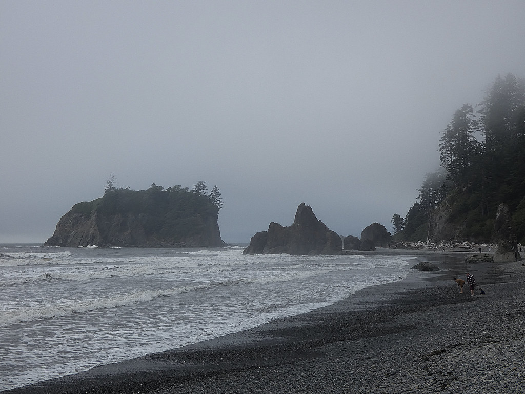
Photo: concrete&fells via Flickr (CC BY 2.0)
Travelers searching How Get Olympic National Park usually need one essential fact first: the park has no central entrance, and no road crosses its mountainous interior. Most visitors fly into the Seattle area, rent a car, and use U.S. Route 101 to reach separate access roads around the Olympic Peninsula.
Your best route depends on which region comes first. Port Angeles is the gateway for Hurricane Ridge, Lake Crescent, and Elwha Valley. Forks works for the Hoh Rain Forest and Pacific beaches. Lake Quinault and Kalaloch are easier to approach from Olympia or Portland. Driving between these areas consumes several hours, so airport choice and itinerary order belong in the same decision.
Start With the Peninsula’s Geography
Olympic National Park surrounds the glacier-carved Olympic Mountains and protects disconnected lowland destinations around them. Mount Olympus reaches 7,980 feet, but roads remain near the perimeter or climb short valleys and ridges. U.S. 101 forms the primary highway around the peninsula, while park roads branch toward Hurricane Ridge, Sol Duc, the Hoh Rain Forest, Rialto Beach, Staircase, and Quinault.
Why a How Get Olympic National Search Can Produce the Wrong Route
Navigation apps may identify the park boundary rather than the correct trailhead or visitor area. Enter the named destination, such as Hoh Rain Forest Visitor Center, Hurricane Ridge, Rialto Beach, or Staircase, instead of “Olympic National Park.” The difference matters because some destinations sit on opposite sides of roadless mountains. Hurricane Ridge and the Hoh Rain Forest appear relatively close on a map, yet the drive between their access points generally takes about three hours.
Choose Your First Region Before Booking a Flight
Divide the peninsula into north, west, and south or east approaches. Port Angeles serves the north. Forks anchors the west side. Lake Quinault connects naturally with the southwestern corridor, while Hoodsport provides access toward Staircase on the southeastern side. A clockwise or counterclockwise circuit prevents backtracking, especially on itineraries that include both temperate rainforest and Pacific coast stops.
How to Get to Olympic National Park: Choose the Right Airport
Seattle-Tacoma International Airport, identified by the code SEA, offers the widest selection of flights and rental cars. It is the default choice for a complete peninsula circuit. Paine Field near Everett can work for limited itineraries beginning north of Seattle, while Portland International Airport is useful when Lake Quinault or Kalaloch comes first. Victoria, British Columbia, provides an international ferry approach directly to Port Angeles.
How to Get to Olympic National Park: Airports Serving Washington
Seattle-Tacoma International Airport
From SEA, drivers can reach Port Angeles by traveling south through Tacoma, crossing the Tacoma Narrows Bridge, and continuing north via State Routes 16 and 3. An alternative uses a Puget Sound ferry, followed by roads across the Kitsap Peninsula. The all-road route avoids ferry queues and missed sailings, while the ferry route can reduce city driving and provide a calmer start after a flight.
Paine Field and Portland International Airport
Paine Field, code PAE, pairs most naturally with the Edmonds to Kingston ferry, although its flight and rental-car selection is smaller than SEA’s. Portland, code PDX, is practical for travelers approaching through Olympia, Aberdeen, and Lake Quinault. It is considerably less convenient for a short trip focused on Port Angeles or Hurricane Ridge because the route covers much of the peninsula’s southern and western perimeter first.
Typical Airport Approaches
| Starting point | Useful first destination | Approximate distance | Typical travel time |
|---|---|---|---|
| SEA via Tacoma | Port Angeles | 140 miles | About 3 hours without major congestion |
| SEA via Olympia | Lake Quinault | 150 miles | About 3 hours |
| PAE via Edmonds and Kingston | Port Angeles | About 95 road miles | 3 to 4 hours including a ferry |
| PDX via Aberdeen | Lake Quinault | About 185 miles | 3.5 to 4 hours |
| Downtown Victoria | Port Angeles | International ferry crossing | About 90 minutes aboard, plus processing |
These estimates exclude Seattle rush hour, ferry lines, customs, meal stops, and road work. Victoria requires passports or other acceptable border documents, and vehicle space may be limited. Before departure, confirm current park road conditions on the official park site and check ferry schedules, vehicle reservations, and international documentation with the appropriate operators.
How to Get to Olympic National Park by Ferry or Road
Seattle’s ferries are part of the state highway system, but they should be treated as scheduled connections rather than continuously available bridges. Common options include Seattle to Bainbridge Island and Edmonds to Kingston. Both lead toward the Hood Canal Bridge and Port Angeles. The ferry itself is straightforward; the variable is the vehicle queue, particularly on summer Fridays, holiday weekends, and Sunday afternoons.
How Get Olympic National Plans Should Account for Waiting Time
A ferry works best when the first night is in Port Angeles or near Lake Crescent and the schedule has slack. Travelers landing late, collecting luggage, and renting a car risk missing a planned sailing. In that situation, the Tacoma route provides more control. It remains vulnerable to urban traffic, but it removes the possibility of waiting through multiple ferry departures.
A Simple Route Decision
- Use the Tacoma Narrows route when arrival time is uncertain or the vehicle carries roof-mounted equipment that complicates ferry loading.
- Use Seattle to Bainbridge when beginning near downtown Seattle and continuing toward Port Angeles.
- Use Edmonds to Kingston when starting north of Seattle or flying through Paine Field.
- Approach through Olympia when the first stops are Quinault, Kalaloch, or the southern coast.
Do not plan a ferry crossing and a long park excursion on the same tight schedule. From Port Angeles, Hurricane Ridge Road climbs roughly 5,000 vertical feet in 17 miles. From the U.S. 101 junction, the Hoh Rain Forest access road continues about 18 miles inland. Either destination deserves enough daylight for slower mountain driving, wildlife on the road, and crowded trailhead approaches.
Getting Around Olympic National Park via U.S. 101 and Spur Roads
U.S. 101 is the peninsula’s transportation spine, but it does not function like a high-speed interstate. Sections curve beside Hood Canal and Lake Crescent, pass through small communities, and narrow through forested terrain. Expect variable speeds, limited passing opportunities, and longer travel times than mileage alone suggests. Fuel, food, and mobile coverage become less dependable west of Port Angeles and around the remote coast.
How to Get to Olympic National Park: Roads Leading Into Each Region
Hurricane Ridge Road begins in Port Angeles and climbs to the high country. Sol Duc Road branches south from U.S. 101 west of Lake Crescent. Upper Hoh Road follows the Hoh River east from the highway, passing working forest before entering old-growth Sitka spruce and western hemlock. Mora Road reaches Rialto Beach, while the Kalaloch beaches and Ruby Beach lie close to U.S. 101 itself. Staircase requires a separate approach from Hoodsport along Lake Cushman.
What the Final Miles Feel Like
On the climb to Hurricane Ridge, dense Douglas fir forest gradually gives way to shorter subalpine trees and open slopes. The air cools as the road gains elevation, and bends reveal brief views into deep river valleys. Near the ridge, the Olympic peaks suddenly fill the southern horizon, with sharp summits, snowfields, and glacier-cut basins stacked behind one another. Wind can be strong even when Port Angeles feels mild, and lingering snow may border the pavement well into the warmer season.
Prepare the Car Before Leaving the Main Highway
- Download offline maps for the entire peninsula rather than relying on mobile service.
- Fill the fuel tank in larger communities before entering long coastal or rainforest corridors.
- Carry drinking water, food, rain layers, and a warm layer for higher elevations.
- Keep a paper map available for identifying the correct spur road and alternate route.
- Allow extra time around Lake Crescent, where U.S. 101 is winding and roadside stopping space is limited.
A conventional passenger car reaches the principal developed areas in normal conditions. Forest roads near park boundaries and routes within Olympic National Forest may be gravel, potholed, or unsuitable for low-clearance vehicles. Rental agreements can also restrict unpaved-road use, so distinguish official park access roads from optional backroad shortcuts suggested by navigation software.
How to Get to Olympic National Park Without Renting a Car
Car-free travel is possible between the peninsula’s principal communities, but reaching individual park valleys and beaches requires more planning. Regional buses connect Seattle and Tacoma transportation hubs with Port Angeles, while county transit routes link Port Angeles, Forks, La Push, and communities along U.S. 101. These services can support a point-to-point backpacking trip or a visit based in one town. They are less effective for touring several park regions in a single day because most trailheads sit miles from the highway.
Match Public Transportation to Reachable Places
Port Angeles is the strongest base without a vehicle because it has lodging, groceries, regional transportation, and access to guided excursions. Forks provides a practical western base, with Rialto Beach and the La Push area roughly 15 miles away. The Hoh Rain Forest is about 18 miles from U.S. 101 after the turnoff, so a bus along the highway does not complete the trip. Sol Duc, Staircase, and many Lake Quinault trailheads present similar last-mile problems.
Use Guided Transport for Isolated Trailheads
Guided day tours and prearranged shuttles can bridge the gap between towns and remote park roads. Confirm that transportation includes the exact trailhead rather than a nearby highway junction. Taxi and rideshare coverage becomes sparse outside Port Angeles, and return pickups can fail where phones have no signal. Backpackers using separate entry and exit points should arrange both transfers before departure and leave the route, vehicle information, and expected return time with a reliable contact.
Getting Around Olympic National Park Without Backtracking
A practical first visit usually moves in one direction around U.S. 101. From Port Angeles, travel west through Lake Crescent, base in Forks for the Hoh and coast, then continue south through Kalaloch and Lake Quinault toward Olympia. Reverse that order when arriving from Portland or beginning at Quinault. This sequence avoids repeatedly crossing the Lake Crescent corridor, where winding pavement, construction, and summer traffic can turn a short-looking transfer into a slow drive.
Use Towns as Resupply Points
Buy groceries and fuel in Port Angeles, Forks, Aberdeen, or Olympia rather than expecting full services near every park road. Forks is especially useful before visiting the Hoh, Rialto Beach, or Kalaloch. Travelers interpreting How Get Olympic National as a single navigation problem often underestimate these supply stops. Pack lunch before entering a valley so a closed café or long restaurant wait does not consume the daylight reserved for a trail.
Budget Time by Road Segment
| Road segment | Approximate distance | Planning allowance | Main concern |
|---|---|---|---|
| Port Angeles to Lake Crescent | 20 miles | 30 to 40 minutes | Curves and limited passing |
| Forks to Hoh Rain Forest | About 31 miles | 50 to 60 minutes | Slow final approach and wildlife |
| Forks to Rialto Beach | About 15 miles | 25 to 30 minutes | Congestion near beach access |
| Forks to Kalaloch | About 35 miles | 45 to 55 minutes | Coastal weather and roadside stops |
These allowances cover ordinary driving rather than parking searches or trail time. Separate major objectives instead of combining Hurricane Ridge, the Hoh, and a sunset beach visit in one day. A better rhythm places one long road excursion in the morning, followed by a nearby beach or short forest walk. That structure leaves enough flexibility for fog, queues, fallen trees, and the slower pace required on unfamiliar roads after dark.
Prepare for Closures and Delays
Olympic’s roads encounter several distinct hazards. Snow and ice affect Hurricane Ridge and other elevated routes. Heavy rain can bring branches, standing water, and slides to forest corridors. Coastal storms produce windblown debris, while wildfire smoke may reduce visibility during dry late-summer periods. Because no road crosses the Olympic Mountains, a closure on U.S. 101 can require a substantial detour around the peninsula rather than a quick alternate route through the interior.
Keep a Backup Destination in the Same Region
If Hurricane Ridge is inaccessible, remain on the north side and consider Lake Crescent, the Elwha area, or low-elevation trails near Port Angeles. If the Hoh approach is delayed, shift to Rialto Beach, Second Beach access, or forest walks closer to Forks. When coastal wind or dangerous surf limits beach time, use the Quinault or Hoh rainforests. Regional backups preserve the itinerary without forcing a multi-hour drive to the opposite side of the park.
Complete a Departure Check
- Save road directions, lodging addresses, and trailhead coordinates offline.
- Check tire pressure, fuel level, headlights, and windshield wipers.
- Carry a flashlight, battery pack, basic first-aid kit, food, and water.
- Pack traction devices or chains when seasonal mountain conditions require them.
- Leave room in the schedule for ferry queues, road work, and early darkness.
- Avoid navigation shortcuts onto unsigned logging or forest roads.
Turn around when water covers an unfamiliar road, snow exceeds the vehicle’s capability, or a closure blocks the planned route. Parking on road shoulders can damage vegetation and obstruct emergency vehicles. If a lot is full, use the designated turnaround and return later rather than creating an improvised space. Early starts help, but the strongest contingency is a second nearby destination that does not depend on the same access road.
Make the Peninsula Work as One Connected Trip
The central planning principle is simple: choose the first park region before choosing the airport, then travel around the mountains rather than trying to cross them. Match Seattle, Paine Field, Portland, or Victoria with the correct side of the peninsula. Treat ferries as timed connections, U.S. 101 as a scenic two-lane highway, and park spur roads as separate excursions requiring fuel, daylight, and offline directions.
A successful route also leaves space for conditions to change. Group Hurricane Ridge with Port Angeles, the Hoh and Pacific beaches with Forks, and Quinault with the southwestern approach. Reserve car-free travel for itineraries built around reachable towns or arranged shuttles. With realistic transfer times and regional backup plans, Olympic’s disconnected entrances become manageable parts of a coherent circuit.
Want to keep exploring? Browse all our Olympic guides and articles for more trip-planning tips and ideas.
Gear & Essentials
Tell us about your trip and we will add what else you will want:
The basics
Worth having in the car whatever the park.
For this trip
Traveling with kids
Bringing a pet
RVing
Backcountry
Winter conditions
On the water
Photography
Accessibility
As an Amazon Associate we earn from qualifying purchases, at no extra cost to you.