Visiting Mount Rainier National Park with Limited Mobility: Accessible Views and Trails
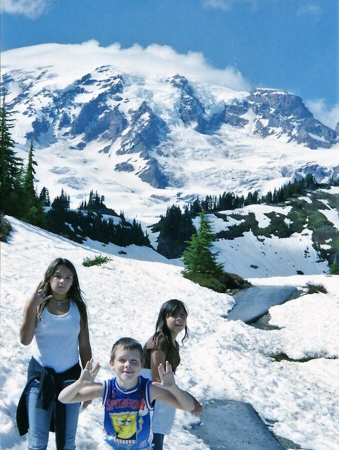
Photo: Stabbur's Master via Flickr (CC BY-SA 2.0)
Visiting Mount Rainier National Park with limited mobility can begin at Sunrise Point just after dawn, where cold air spills through an open car door and the 14,410-foot volcano rises above the White River valley. Glaciers fill the mountain’s upper flanks, while Mount Adams appears beyond the dark Cascade ridges. The viewpoint requires only a short movement from the parking area, yet it reveals the immense vertical scale that defines the park.
Our team recommends planning around roadside overlooks, visitor areas, and short paths rather than treating accessibility as a single standard. A paved trail can still have a demanding grade, and an unpaved path may work well for someone using trekking poles. This guide distinguishes between views available from a vehicle, generally accessible developed areas, and trails suited to visitors who can manage brief slopes or uneven surfaces.
Visiting Mount Rainier National Park with limited mobility begins with choosing the right corridor
The park’s roads do not form one convenient loop
Mount Rainier’s deep river valleys divide the park into separate driving corridors. Longmire and Paradise are approached from the southwest through the Nisqually Entrance. Sunrise is reached from the northeast through the White River corridor, while Tipsoo Lake lies beside State Route 410 near Chinook Pass. Driving between Paradise and Sunrise generally requires leaving the park and circling around the mountain, a journey that can consume several hours before stops.
For limited-mobility travelers, Paradise offers the strongest concentration of developed viewpoints and indoor facilities. Sunrise provides the highest paved-road access in the park, reaching approximately 6,400 feet. Longmire sits much lower, around 2,760 feet, with forest scenery and historic buildings. The Carbon River and Mowich Lake areas involve rougher roads, fewer developed stops, and trail-focused exploration, so they are usually weaker choices for a first accessible visit.
Compare accessible views when visiting Mount Rainier National Park
| Area | Approximate elevation | Primary experience | Mobility considerations |
|---|---|---|---|
| Longmire | 2,760 feet | Old-growth forest, historic district, mineral springs | Level developed area, with rougher nearby paths |
| Paradise | 5,400 feet | Glacier views and subalpine meadows | Paved visitor core, but many trails climb steeply |
| Sunrise | 6,400 feet | Emmons Glacier and northeast mountain views | High-elevation views close to parking |
| Tipsoo Lake | 5,298 feet | Lake, meadow, and Mount Rainier compositions | Roadside views plus an uneven short loop |
Build flexibility into the day
Snow controls access at higher elevations well into summer, and fog can erase the mountain while lower valleys remain clear. Paradise is reached year-round when road and weather conditions permit, but Sunrise and Chinook Pass are seasonal. Timed-entry systems, road openings, accessible parking arrangements, and facility availability can change, so confirm current details on the official park site before departure.
- Carry a mobility device suitable for both pavement and compacted gravel if possible.
- Bring warm layers even when surrounding lowlands are hot.
- Allow extra time for slow traffic, wildlife, and limited parking.
- Keep an alternate low-elevation plan for days when clouds cover the mountain.
Paradise concentrates the most accessible scenery
Visiting Mount Rainier National Park from the Paradise visitor area
The Henry M. Jackson Memorial Visitor Center occupies the center of Paradise, with broad views toward the Nisqually Glacier and the mountain’s south face. Accessible parking is closest to the upper developed area. The lower parking lots require an uphill approach, which can be tiring before a trail begins. Snowbanks may linger around paths into early summer, while peak wildflower color commonly arrives from late July into August.
Accessible trails require careful grade assessment
Nisqually Vista Trail
The Nisqually Vista Trail forms a paved loop of about 1.2 miles through subalpine meadow, gaining roughly 200 feet. Pavement makes the surface predictable, but sustained inclines mean many wheelchair users will need assistance. Visitors who cannot complete the loop can follow its opening section and turn around when the grade becomes uncomfortable. The principal overlooks face the Nisqually Glacier, which has carved a broad trough down the volcano’s southwest side.
Skyline Trail and Myrtle Falls
The lower Skyline Trail is paved from the visitor area, but it climbs immediately. Myrtle Falls lies about 0.5 mile from the trailhead, with roughly 100 feet of elevation gain. The waterfall viewpoint involves additional slope and uneven approaches, so it suits ambulatory visitors comfortable with a short uphill walk rather than travelers seeking a level wheelchair route. Benches and meadow views make an early turnaround worthwhile.
Sunrise delivers high-alpine views with minimal walking
Roadside overlooks do much of the work
Sunrise Point, reached before the main Sunrise complex, provides one of the park’s most useful limited-mobility panoramas. The pullout overlooks the White River valley, the Cascade crest, and several volcanoes on clear days. Farther along, the Sunrise visitor area places Mount Rainier’s northeast face directly above the parking zone. Emmons Glacier, the largest glacier in the contiguous United States by surface area, fills the immense valley below Little Tahoma Peak.
Visiting Mount Rainier National trails near Sunrise
The first portion of the Silver Forest Trail leads toward Emmons Vista, with increasingly open glacier views. Surfaces and grades do not consistently meet modern accessibility standards, so this is best treated as an out-and-back walk whose length can be adjusted. The full Silver Forest route is about 2.4 miles round trip. Sunrise Nature Trail is approximately 1.5 miles, but steeper grades, exposed roots, and elevation make it less suitable for mobility devices.
Tipsoo Lake offers a gentler alternative
Tipsoo Lake sits beside Chinook Pass, roughly 1,100 feet below Sunrise. Mount Rainier can be seen from parking areas and nearby pullouts without completing a trail. The loop around the lake is about 0.5 mile, but compacted soil, stones, roots, and seasonal mud create obstacles. Visitors who can manage a short uneven walk gain reflections of the mountain in calm water, especially during early morning before wind reaches the lake.
Longmire provides lower-elevation options when snow lingers
The historic district is the easiest place to explore slowly
Longmire occupies a forested bench above the Nisqually River and served as the park’s early administrative center. The developed district contains rustic buildings from the park’s formative years, including structures associated with the National Park Service’s early planning era. Compared with Paradise, its walking areas are lower, warmer, and less exposed. Massive Douglas fir, western hemlock, and western red cedar replace the open subalpine meadows found higher on the mountain.
Trail of the Shadows and Kautz Creek
Trail of the Shadows is a 0.7-mile loop across the road from the Longmire developed area. It passes mineral springs, wet meadow, forest, and the cabin site connected with early settler James Longmire. Boardwalk and packed-earth sections can become slippery, while roots and uneven transitions limit wheelchair use. Nearby Kautz Creek has a short interpretive boardwalk leading toward views of the broad flood channel created by volcanic mudflows and repeated glacial flooding.
Waterfalls and glacial rivers reward careful roadside touring
The road between Longmire and Paradise follows the Nisqually River before climbing past several stops that require little walking. These features reveal how snow, ice, and volcanic rock shape the mountain. Water draining from glaciers carries fine gray sediment called glacial flour, giving rivers an opaque appearance. Channels can shift after floods and debris flows, so bridges are positioned above broad, unstable riverbeds rather than directly beside a single permanent stream.
Christine Falls and Narada Falls have different access challenges
Christine Falls drops 69 feet beneath the road’s stone bridge, with the lower tier visible from a small roadside viewing area. Parking is limited, and getting out of a vehicle may be harder than viewing the falls itself. Narada Falls descends 188 feet over andesite cliffs farther uphill. The upper area provides access to the river near the brink, while the familiar lower viewpoint requires a steep, wet trail that is unsuitable for most wheelchairs.
Reflection Lakes and Stevens Canyon extend the scenic drive
Reflection Lakes lies along the seasonal Stevens Canyon Road east of Paradise. Several pullouts provide meadow, lake, and mountain views close to the vehicle, although roadside shoulders can be narrow. Early in the morning, cool air settles above the water and the pavement remains damp beneath the trees. At the lake’s edge, frogs and birds break the silence while Mount Rainier appears between silver fir branches. Even a few steps from the car reveal a quieter landscape than the Paradise visitor core.
Match the itinerary to stamina, weather, and elevation
When visiting Mount Rainier National Park with limited mobility, one primary corridor usually produces a better day than attempting to circle the mountain. Repeated vehicle transfers can be tiring, especially when parking spaces have sloped pavement or limited room for deploying a ramp. A focused route also creates time to wait for shifting clouds. The summit may emerge for ten minutes after remaining hidden throughout the morning.
Choose accessible views and trails with realistic movement demands
The following plans prioritize scenery available from developed areas and short, adjustable walks. Distances between individual stops can feel longer than a map suggests because park roads are winding, narrow, and shared with wildlife. Start with the stop that matters most, then treat later locations as optional. Visitors sensitive to altitude may find Longmire easier than Sunrise, where the thin air at 6,400 feet can intensify fatigue or shortness of breath.
| Plan | Suggested sequence | Typical mobility demand |
|---|---|---|
| Lower-elevation day | Longmire, Trail of the Shadows entrance, Kautz Creek | Short transfers with optional boardwalk and packed-earth sections |
| Southwest highlights | Christine Falls, Narada Falls upper area, Paradise | Roadside viewing plus optional paved slopes |
| Northeast panorama | Sunrise Point, Sunrise visitor area, Tipsoo Lake | Views near parking with optional uneven lakeside walking |
Prepare for rapid changes in temperature and footing
Subalpine weather can change during a single stop. Wind at Sunrise may lower the apparent temperature, while direct sun at Paradise reflects from lingering snow and increases glare. Wet pavement, gravel at path edges, and slush around curb cuts create additional concerns for wheels, canes, and unsteady walkers. Black-tailed deer sometimes cross developed areas, and marmots may sit beside meadow paths. Keep at least 25 yards from most wildlife and 100 yards from bears.
A practical vehicle and mobility checklist
- Pack a lap blanket and waterproof outer layer within reach of the passenger seat.
- Carry traction tips for canes or trekking poles when snow remains beside paved paths.
- Bring wheel chocks or confirm that wheelchair brakes hold securely on sustained grades.
- Use binoculars to examine glaciers, waterfalls, and wildlife without leaving developed viewpoints.
- Store water and medication in the vehicle because high elevation and dry air can increase dehydration.
Plan for the views you can reach comfortably
Mount Rainier’s accessible experience depends on selecting the right elevation and accepting that trail surfaces vary sharply within a small area. Paradise provides the broadest developed visitor zone, Sunrise brings glacier scenery close to the road, and Longmire supplies a lower, forested alternative. Christine Falls, Narada Falls, Reflection Lakes, and Tipsoo Lake add worthwhile stops without requiring a full trail commitment.
A successful day may include one paved path, two roadside overlooks, and enough time to watch clouds move across the summit. Prioritize safe transfers, manageable grades, and flexible turnaround points. That approach preserves energy for the places that matter most and allows travelers with limited mobility to experience the volcano’s glaciers, subalpine meadows, old-growth forest, and glacial rivers on practical terms.
Want to keep exploring? Browse all our Mount Rainier guides and articles for more trip-planning tips and ideas.
Gear & Essentials
Tell us about your trip and we will add what else you will want:
The basics
Worth having in the car whatever the park.
For this trip
Traveling with kids
Bringing a pet
RVing
Backcountry
Winter conditions
On the water
Photography
Accessibility
As an Amazon Associate we earn from qualifying purchases, at no extra cost to you.