Crater Lake National Park in Summer: What to Expect and What to Do
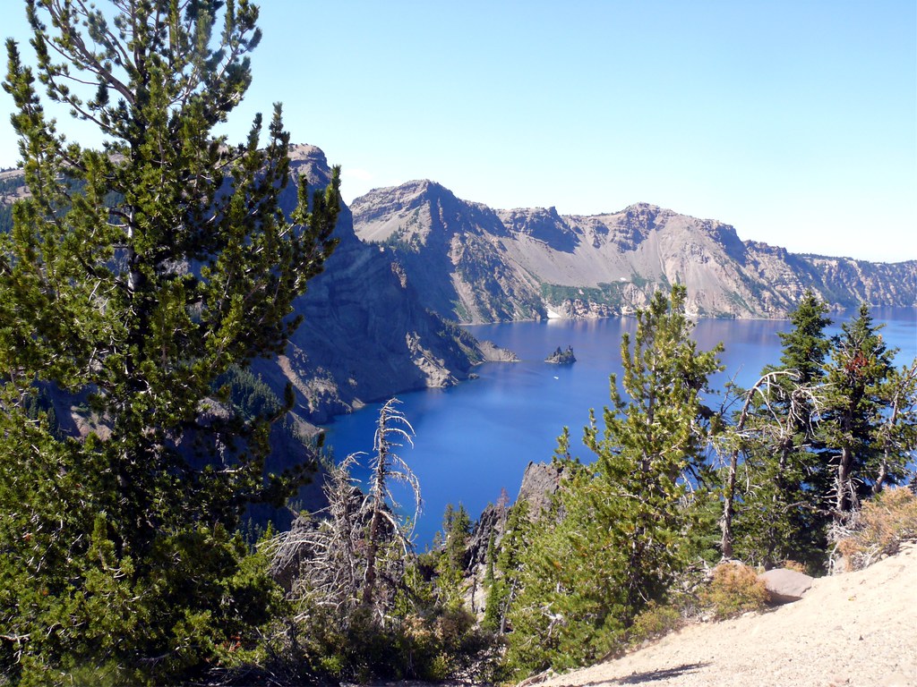
Photo: davidwilson1949 via Flickr (CC BY 2.0)
At Crater Lake National Park, sunrise at Sinnott Memorial Overlook begins with cold air against your face and the soft scrape of shoes on volcanic stone. Far below, the lake appears almost black before direct light reaches the caldera walls. As the sun rises, the water turns an intense blue, Wizard Island takes shape, and the cliffs reveal bands of lava and ash stacked above the lake’s 1,943 foot depth.
Summer provides the broadest access to the park’s roads, trails, overlooks, and lake activities, but “summer” means several different things here. Snowbanks can line Rim Drive into July, afternoon smoke can obscure August views, and early autumn storms sometimes arrive in September. This guide explains those differences, how crowds affect a visit, and what to prioritize once the high country opens.
What to Expect at Crater Lake National Park in Summer
A snowbound caldera becomes accessible
Crater Lake lies in southern Oregon’s Cascade Range, with Rim Village at approximately 7,100 feet and several overlooks above 7,500 feet. The park receives enormous winter snowfall, and deep drifts linger after lower elevations have entered spring. The southern approach through Mazama Village and the road to Rim Village generally provide the most dependable early access. The North Entrance Road and portions of the 33 mile Rim Drive open only after plowing, repairs, and hazard removal.
Once the full loop opens, summer visitors can reach Watchman Overlook, Cloudcap Overlook, Phantom Ship Overlook, and the Cleetwood Cove Trailhead by road. Before that point, a map may show a complete circuit that cannot yet be driven. Construction, rockfall, lingering snow, and wildfire response can also alter access, so confirm current road status, fees, boat operations, reservations, and permit requirements on the official park site before departure.
Why the lake looks so blue
The lake occupies the caldera left by the collapse of Mount Mazama roughly 7,700 years ago. A major eruption emptied enough magma from beneath the volcano that its summit collapsed inward. Rain and snowmelt gradually filled the basin. Crater Lake has no major river flowing into or out of it, which limits sediment and helps produce exceptionally clear water. Blue wavelengths penetrate and scatter through that clear water, creating the saturated color visible from the rim.
Summer weather still behaves like mountain weather
July and August usually bring the driest conditions, with cool mornings, strong midday sun, and substantial temperature changes between exposed overlooks and sheltered forest. Thunderstorms can develop quickly. By late summer, regional wildfire smoke may reduce visibility even when no fire is burning inside the park. A clear morning is often the best window for seeing the entire six mile wide caldera.
Crater Lake National Park in Summer Compared With Other Seasons
How the main visiting periods compare
The calendar alone does not determine access. Snowpack, spring temperatures, fire activity, and the first autumn storms can shift the practical season by weeks. Visitors focused on driving the entire rim should favor the core of summer. Travelers who value quieter overlooks may accept partial road access in June or cooler, less predictable conditions in September.
| Period | Typical conditions | Road and trail access | Crowds | Best suited to |
|---|---|---|---|---|
| May through June | Deep snow remains around the rim, with cold nights and possible storms | South access is usually most reliable; North Entrance and Rim Drive may remain closed or partial | Low away from holiday periods | Snow scenery, short rim visits, and flexible travelers |
| Early July | Long days, melting snowbanks, and cool mornings | Access expands, but some roads and trails may still be opening | Moderate to high | Snow lined viewpoints and early summer hiking |
| Mid July through August | Warmest, driest weather, with possible thunderstorms and smoke | The best chance of full Rim Drive, lake access, and open high trails | Highest | First visits, scenic driving, boat trips, and a broad trail selection |
| September | Cooler nights, shorter days, possible smoke or early snow | Often extensive, but storms can cause rapid changes | Moderate, then lower after major travel weekends | Quieter hiking and crisp morning views |
| October through April | Frequent snow and a long winter season | Most rim roads close to vehicles; winter travel requires specialized planning | Low | Cross country skiing, snowshoeing, and winter conditions |
Choosing When to Visit Crater Lake National Park in Summer
- For the fullest road access: Aim for mid July through August, while retaining flexibility for construction, smoke, and temporary closures.
- For snowbanks beside blue water: Visit in late June or early July, understanding that the North Entrance and full rim loop may not be available.
- For fewer people: Choose a weekday in September and arrive early, while preparing for near freezing mornings or an early storm.
- For boat access: Build the trip around Cleetwood Cove and verify operating dates before committing to lodging or a long drive.
- For hiking: Late July through September usually provides the largest selection of trails free from lingering snow.
What Summer Crowds Change
Rim Village and the busiest overlooks
Most visitors first encounter the lake at Rim Village, where parking, viewpoints, and nearby facilities concentrate activity into a small area. Between late morning and midafternoon, vehicles may circulate while waiting for spaces, and groups cluster near the first open view. Arriving early improves both parking and visibility. It also creates time to continue around the rim before afternoon clouds or smoke soften the distant outline of Mount Scott.
The western side of Rim Drive receives heavy traffic because Watchman Overlook and several pullouts are close to Rim Village. Traffic becomes more dispersed farther around the loop, although parking can tighten at trailheads. Never stop in a travel lane for a photograph. Use established pullouts, and keep wheels off dry vegetation because hot exhaust components can ignite roadside grasses.
Cleetwood Cove is a special case
Cleetwood Cove provides the park’s only maintained trail to the lakeshore. The trail descends about 700 vertical feet in 1.1 miles, then requires the same climb back to the rim. Its sustained grade, loose volcanic surface, elevation, and exposed afternoon heat make the return more demanding than its mileage suggests. Parking demand rises when boat departures and peak hiking hours overlap.
Plan the climb before walking downhill
Carry enough water for the ascent, wear shoes with reliable traction, and leave energy for the return. Swimming is permitted only in designated areas reached from the trail, and the water remains cold even during warm weather. Visitors with heart, breathing, balance, or mobility limitations should evaluate the climb carefully before descending.
Planning Your First Summer Visit to Crater Lake National Park
Entrances, roads, and realistic driving time
The South Entrance is reached from Oregon Route 62 and connects with Mazama Village before climbing toward the rim. The North Entrance links the park with the approach from the north when seasonal snow removal is complete. Although Rim Drive measures about 33 miles, a full circuit occupies several hours once overlooks, short walks, traffic, and photography stops are included. Plan it as a primary activity rather than a quick scenic detour.
Rim Drive is narrow and winding in places, with steep drop offs and frequent bicycle traffic. Towed trailers and large recreational vehicles require extra care at crowded pullouts. Fuel is limited within the broader park area and services vary seasonally, so fill the tank before climbing to the rim and carry food and water rather than depending on a particular concession stop.
Build the day around light and elevation
Start with an east facing or open rim viewpoint early, then hike before the strongest afternoon sun. Discovery Point Trail offers a comparatively approachable rim walk, while the Watchman Peak Trail climbs to a historic fire lookout with broad views over Wizard Island. Strong hikers can consider Mount Scott, the park’s highest point at 8,929 feet, for a higher perspective across the caldera and surrounding Cascades.
A practical first day sequence
- Reach Rim Village early enough to see the lake before midday congestion develops.
- Walk part of the rim near Discovery Point to adjust to the elevation.
- Drive the western rim toward Watchman Overlook, stopping only at designated pullouts.
- Continue around the caldera if the entire road is open, allowing time for short viewpoint walks.
- Save Cleetwood Cove or Mount Scott for a separate block of time rather than compressing either into the scenic drive.
Choose Trails That Fit the Day’s Conditions
Summer hiking ranges from short forest walks to exposed climbs above 8,000 feet. Snowmelt determines when higher routes become practical, while heat and smoke influence the best time of day. Check the trail surface at the trailhead, since shaded sections can retain snow after nearby overlooks are dry. Trekking poles help on loose pumice, and traction devices may be useful during the transition from snow cover to bare ground.
Garfield Peak and Sun Notch
Garfield Peak rises to 8,054 feet directly above Rim Village. The roughly 3.6 mile round trip gains about 1,000 feet through open slopes where mountain hemlock, whitebark pine, and wildflowers give way to broad caldera views. Begin early because much of the route is exposed. For a shorter option, the approximately 0.8 mile Sun Notch loop reaches a clear view of Phantom Ship, a jagged remnant of erosion resistant lava rising from the lake.
Plaikni Falls and the Pinnacles
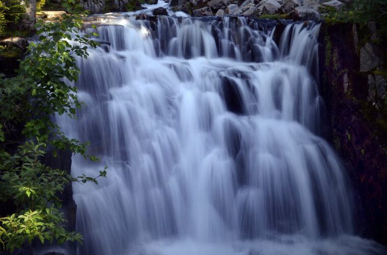
Plaikni Falls Trail covers about two miles round trip through old growth forest on the park’s eastern side. Snowmelt feeds the cascade and supports summer wildflowers near the water. Farther south, the Pinnacles Trail follows Wheeler Creek past pale volcanic spires created when hot gases cemented ash around fumaroles. Later erosion removed the softer surrounding material, leaving narrow towers that expose the internal plumbing of Mount Mazama’s eruption.
Reservations, Permits, and Advance Planning
Entrance access and overnight arrangements require separate planning. A general park visit may not involve the same reservation system as lodging, camping, boat tours, or wilderness travel. Demand concentrates from mid July through August, especially on weekends. Build the trip around the hardest item to secure, then keep scenic driving and most day hikes flexible enough to move between mornings or afternoons.
What to book first
| Trip element | Planning approach | Useful fallback |
|---|---|---|
| In-park lodging | Reserve as soon as summer inventory becomes available | Stay in a gateway community and drive in early |
| Developed camping | Target weekdays and avoid relying on same-day availability | Research legal camping outside park boundaries |
| Boat tour | Coordinate the ticket with Cleetwood Cove access and climbing ability | Use rim overlooks for views of Wizard Island and the caldera walls |
| Backcountry camping | Obtain the required wilderness authorization before beginning the route | Choose a long day hike without an overnight stay |
Allow for arrival delays
A reservation does not shorten the drive around the caldera or eliminate congestion near Rim Village. Leave a generous buffer before any timed activity, particularly if approaching from the opposite side of Rim Drive. Visitors arriving from lower elevations should also avoid scheduling their hardest hike immediately after reaching the rim. A slower first hour helps reveal headaches, nausea, or unusual fatigue associated with elevation.
Prepare for Exposure, Smoke, and Wildlife
Conditions can differ sharply across the park. Calm air at Mazama Village may become a cold crosswind at Watchman Overlook, while direct sun on open pumice can make an afternoon climb feel much warmer than the measured temperature. Mobile service is unreliable in portions of the park, so download maps before arrival and tell someone your route if hiking beyond heavily visited viewpoints.
Carry a high elevation day kit
- Water: Carry enough for exposed climbs and the return from Cleetwood Cove rather than depending on trail availability.
- Sun protection: Use sunglasses, sunscreen, and a brimmed hat because snow, pale pumice, and lake water reflect intense ultraviolet light.
- Layers: Pack a wind resistant outer layer even on warm afternoons.
- Navigation: Bring an offline map, especially when snow obscures trail edges.
- Respiratory needs: Travelers sensitive to smoke should carry their usual medication and plan lower effort alternatives.
Recognize wildlife and fire hazards
Clark’s nutcrackers, Steller’s jays, marmots, deer, and black bears inhabit the park. Store food securely, keep animals at a distance, and never leave packs unattended at picnic areas or trailheads. By late summer, cured vegetation and dry forest litter increase ignition risk. Park only on durable surfaces and follow posted restrictions involving flames, stoves, and smoking. Smoke from regional fires can also reduce visibility long before flames threaten park roads.
What to Do at Crater Lake National Park in Summer
Crater Lake National Park rewards plans built around access rather than a fixed calendar date. Mid July through August usually provides the broadest combination of roads, trails, and lake activities. Early July adds lingering snow, while September offers lighter traffic with colder mornings and a growing chance of storms. Your best window depends on which compromise feels easiest to manage.
Reserve limited overnight or boat-related experiences first, begin each day early, and separate major hikes from the full Rim Drive circuit. Carry layers, water, and offline navigation even during stable weather. With those decisions made before arrival, you can spend less time solving logistics and more time examining Mount Mazama’s caldera from the viewpoints and trails that suit the day.
Want to keep exploring? Browse all our Crater Lake guides and articles for more trip-planning tips and ideas.
Gear & Essentials
Tell us about your trip and we will add what else you will want:
The basics
Worth having in the car whatever the park.
For this trip
Traveling with kids
Bringing a pet
RVing
Backcountry
On the water
Photography
Accessibility
As an Amazon Associate we earn from qualifying purchases, at no extra cost to you.