5 Best Fall Hikes in Crater Lake National Park
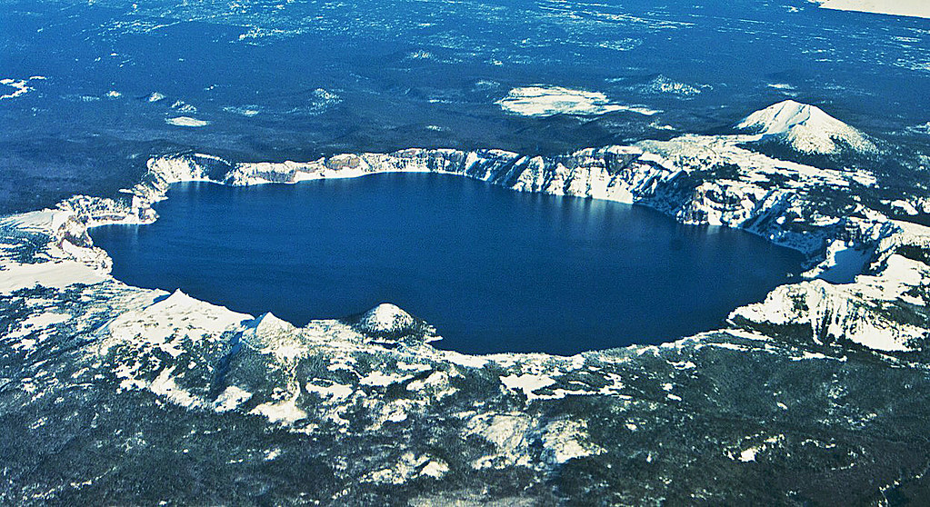
Photo: kla4067 via Flickr (CC BY 2.0)
The Best Fall Hikes Crater Lake visitors can take often have a shorter season than the calendar suggests. At 7,100 feet above sea level near Rim Village, autumn can shift from clear, mild afternoons to accumulating snow within days. September frequently provides the most reliable trail access, while October rewards flexible hikers who arrive prepared for ice, closed roads, and rapidly changing visibility.
Crater Lake fills a caldera formed when Mount Mazama collapsed about 7,700 years ago. The lake sits at 6,178 feet, while surrounding summits rise above 8,000 feet. That elevation creates cooler temperatures, stronger winds, and earlier snowfall than travelers encounter in nearby communities such as Klamath Falls or Medford. Fall also brings quieter overlooks, clearer air after cold fronts, and patches of color from mountain ash, huckleberry, and vine maple.
Why the Fall Hiking Window Is So Short
The practical hiking season usually contracts quickly after the September equinox. Crater Lake receives roughly 40 feet of snow during an average year, and the first meaningful storms can arrive well before winter. A sunny forecast in southern Oregon therefore says little about conditions along the caldera rim. Check the park forecast and road status for the rim itself, then carry traction if overnight temperatures may freeze wet trail surfaces.
September Offers the Broadest Trail Access
Early and middle September generally provide the strongest combination of open roads, dry tread, and moderate daylight. Rim Drive is more likely to remain fully accessible, placing trailheads such as Mount Scott, Plaikni Falls, and the Watchman within reach. Afternoon temperatures can still feel warm in direct sun, but shaded forest and exposed summits cool rapidly. Wildfire smoke is also possible, particularly before sustained autumn rain reaches the southern Cascades.
October Rewards Flexible Plans
October brings fewer people and a sharper seasonal character, but access becomes less predictable. Thin snow can conceal loose volcanic rock, while freeze and thaw cycles create ice near viewpoints and on north facing slopes. East Rim Drive is especially vulnerable to weather closures because it crosses high, exposed terrain. Trails reached from Rim Village or the park’s southern approach are often better contingency choices when the full scenic drive is unavailable.
How the Best Fall Hikes in Crater Lake National Park Change by Season
Fall makes the most sense when viewed against Crater Lake’s entire hiking calendar. Summer provides the widest access but concentrates visitors at Rim Village, Cleetwood Cove, and popular summit trailheads. Winter transforms the rim into a snow travel destination. Spring arrives late at this elevation, leaving many roads and trails buried long after lower elevation wildflowers have opened elsewhere in Oregon.
A Four Season Comparison
| Season | Crowds | Typical conditions | Road and trail access | Best suited activities |
|---|---|---|---|---|
| Spring | Low | Deep snowpack, storms, and soft afternoon snow | Rim Drive and many trailheads remain inaccessible | Snowshoeing, skiing, and limited rim viewpoints |
| Summer | Highest | Mostly dry trails, strong sun, occasional smoke or thunderstorms | Broadest access to Rim Drive and high elevation trails | Summit hikes, lake access, scenic driving, and boat activities |
| Fall | Moderate in September, low by late October | Cool mornings, clearer intervals, frost, and possible early snow | Usually broad early, increasingly weather dependent later | Day hiking, photography, geology, and quiet overlooks |
| Winter | Low | Heavy snow, wind, limited visibility, and avalanche terrain | North Entrance and Rim Drive are generally closed to vehicles | Snowshoeing, cross country skiing, and winter photography |
Early Fall Versus Late Fall
Choose September for Mount Scott, Plaikni Falls, and other routes requiring East Rim Drive. Choose October for shorter hikes near Rim Village, provided the approach roads and trail surfaces remain safe. Late fall visitors should build a plan around accessible trailheads rather than a fixed list. Snow can close a road for the season, reopen after plowing, or leave a shaded trail icy even when nearby pavement appears dry.
Access, Crowds, and Fall Logistics
Crater Lake National Park has no road circling the lake at water level. Rim Drive follows the upper caldera, so nearly every hike begins high and exposed. The main southern approach connects with Oregon Route 62, while the seasonal North Entrance provides faster access from the north. Rim Village serves as the most useful orientation point because several trails, overlooks, and fallback walks begin nearby.
Road Closures Shape the Day
A complete Rim Drive circuit covers about 33 miles, but its winding alignment and frequent overlooks make it a slow drive even in dry weather. East Rim Drive reaches the Mount Scott and Plaikni Falls trailheads, while West Rim Drive connects Rim Village with Discovery Point and the Watchman area. Once snow restricts the circuit, apparent distances on a map become irrelevant because reaching the opposite side may require turning around rather than completing the loop.
What Lower Crowds Actually Change
September weekends can still fill small summit trailheads by late morning. On quieter weekdays, hikers gain easier parking and more time at narrow overlooks, but reduced traffic also means fewer nearby people if an injury or sudden storm occurs. By October, some seasonal visitor services, lodging, food outlets, and campgrounds may be closed. Entrance fees, road status, permit procedures, and operating dates can change, so confirm current details on the official park site before departure.
Permits, Reservations, and Essential Gear
Ordinary day hikes generally do not require a trail permit or trailhead reservation. Overnight backcountry travel follows separate permit rules, and seasonal lodging or camping may require advance booking. Boat tour reservations do not determine access to the rim trails covered here. Every fall day pack should support an unplanned temperature drop and several hours without services.
- Carry at least two liters of water per person because exposed rim routes are dry and potable water may be unavailable seasonally.
- Pack insulating layers, a waterproof shell, gloves, and a warm hat even when the trailhead feels mild.
- Bring a paper map or downloaded offline map because mobile reception is unreliable around the caldera.
- Add compact traction after frost or snow, particularly for shaded slopes and stone viewpoint areas.
- Use sun protection. High elevation ultraviolet exposure remains strong in cool weather.
Comparing the 5 Best Fall Hikes in Crater Lake National Park by Difficulty
Our team favors routes that show different parts of the caldera rather than repeating the same rim perspective. The five selections below include two summit viewpoints, a relatively gentle rim walk, a waterfall reached through old growth forest, and a canyon route below the main lake rim. Distances are approximate round trips, and elevation gains vary slightly among mapping sources.
5 Best Fall Hikes in Crater Lake National Park: Trail Overview
| Trail | Distance | Approximate gain | Primary reason to hike | Best fall window |
|---|---|---|---|---|
| Garfield Peak | 3.6 miles | 1,000 feet | Expansive lake and Phantom Ship views | September to early October |
| Watchman Peak | 1.6 miles | 420 feet | Short summit route and historic fire lookout | September |
| Discovery Point | 2.4 miles | About 300 feet | Accessible rim scenery from Rim Village | September through accessible October days |
| Plaikni Falls | 2 miles | About 100 feet | Old growth forest and a spring fed waterfall | Early to middle September |
| Annie Creek Canyon | About 1.7 miles | About 300 feet | Autumn foliage and volcanic canyon geology | September through October |
Choosing the Best Fall Hikes in Crater Lake for Views, Effort, or Weather
Garfield Peak provides the strongest combination of elevation, lake views, and trailhead convenience. From its 8,054 foot summit, the caldera’s scale becomes clear, with Wizard Island below and Mount Scott rising across the water. Near the upper ridge, loose pumice shifts underfoot, wind moves freely across the crest, and the lake suddenly fills the view beyond a steep inner wall. The final climb feels colder and more exposed than the sheltered start beside Rim Village.
Watchman Peak suits hikers with limited time, while Discovery Point is the more forgiving choice when clouds obscure higher summits. Plaikni Falls works well on a windy day because much of the route passes through forest, although reaching it depends on East Rim Drive access. Annie Creek Canyon lies below the main rim and provides the best chance of fall color, but hikers must account for a steep climb back from the canyon floor.
Trail Details That Matter After Summer
When readers compare Best Fall Hikes Crater Lake routes, mileage alone can be misleading. A short climb above the rim may involve cold wind, loose pumice, and an icy descent, while a longer forest route can remain comfortable during the same weather. Trail orientation also matters. South facing slopes often dry first after light snow, while shaded sections can preserve ice through the afternoon.
Summit Routes Above the Caldera
Garfield Peak and Watchman Peak place hikers above the rim, where wind and cloud cover can change conditions within minutes. Both have substantial exposure near their upper viewpoints. Start early enough to descend before fading light, but allow frost to soften if the trail froze overnight. Trekking poles are particularly useful on loose volcanic gravel.
Garfield Peak
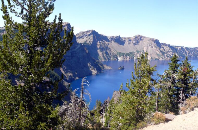
The trail begins near the eastern end of Rim Village and climbs through whitebark pine habitat toward Dutton Cliff. Several openings reveal Phantom Ship, a resistant volcanic formation rising from the lake near the southeast shore. Mountain hemlock provides partial shelter lower down, but the upper ridge receives little protection from wind. Turn around if clouds begin obscuring nearby landmarks because visibility can disappear quickly along the crest.
Watchman Peak
The Watchman route climbs from the west side of Rim Drive to an 8,013 foot summit and a historic fire lookout completed in the early 1930s. Its western position produces a close view of Wizard Island, the cinder cone that formed after Mount Mazama collapsed. The compact summit platform can feel crowded even when the parking area looks quiet, so a weekday morning provides more room for photography.
Lower Trails and Sheltered Alternatives
Discovery Point, Plaikni Falls, and Annie Creek Canyon sacrifice some summit scale for greater protection from wind. They also provide useful alternatives when high clouds flatten the lake view. Their hazards differ from those on the peaks: unguarded rim edges at Discovery Point, damp rock near Plaikni Falls, and a sustained return climb from Annie Creek Canyon.
Discovery Point
This section of the Rim Trail leaves Rim Village and follows the caldera edge toward the place associated with John Wesley Hillman’s 1853 sighting of the lake. The walking is comparatively moderate, but several viewpoints stand beside steep, exposed slopes. Remain on established tread when snow covers the edge. Cornices can form beyond solid ground later in the season.
Plaikni Falls
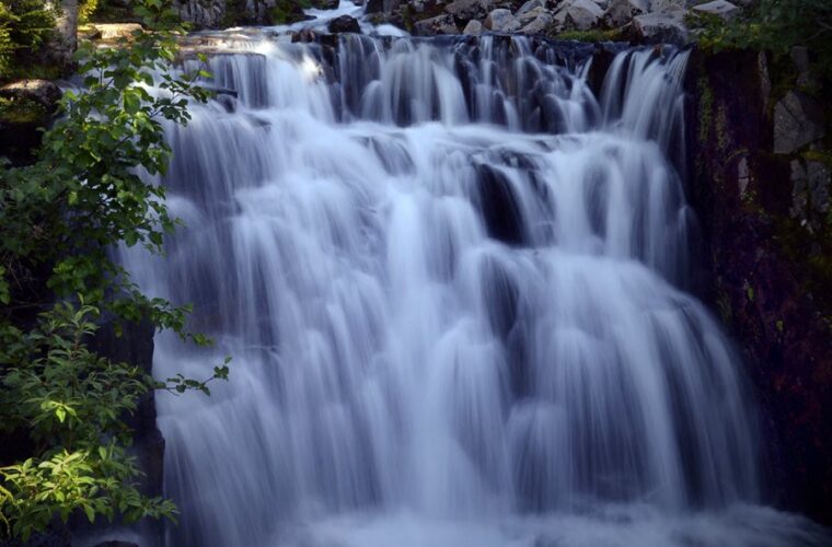
Plaikni Falls drops over a mossy volcanic ledge along Sand Creek. The forest approach passes mountain hemlock and Shasta red fir before opening near wet meadows below the falls. Spray makes the final rocks slick during freezing weather. This route also offers a better chance of hearing Clark’s nutcrackers and red breasted nuthatches than exposed rim trails where wind masks bird calls.
Annie Creek Canyon
Annie Creek has cut through thick deposits of pumice and ash left by Mount Mazama’s climactic eruption. The trail descends from the Mazama Village area into a narrow corridor where shrubs and deciduous plants provide stronger autumn color than the caldera rim. Save energy for the exit. Much of the elevation gain occurs after hikers have completed the canyon floor portion.
Match the Hike to the Day You Actually Have
A rigid itinerary performs poorly during Crater Lake’s fall transition. Select a primary route and one lower, more protected backup before leaving your lodging. Wind at Rim Village, visible snow on surrounding slopes, and cloud height over the lake provide useful clues, but trail surfaces can differ sharply across the park.
Use Conditions as the Deciding Factor
| Observed condition | Better choice | Route to reconsider |
|---|---|---|
| Clear sky and light wind | Garfield Peak or Watchman Peak | None, if surfaces are dry |
| Strong rim wind | Plaikni Falls or Annie Creek Canyon | Garfield Peak |
| Low cloud obscuring the lake | Annie Creek Canyon | Watchman Peak |
| Overnight frost | Discovery Point after surfaces thaw | Shaded summit sections |
| East Rim Drive inaccessible | Discovery Point or Garfield Peak | Plaikni Falls |
Adjust for Time, Ability, and Crowds
Use the following order when plans need to change quickly. It prevents a scenic preference from overriding access, daylight, or the abilities of the group.
- Eliminate every trail whose access road is closed or whose surface exceeds the group’s traction and navigation skills.
- Compare the remaining hiking time with available daylight, including a margin for slower descents.
- Choose Plaikni Falls for forest ecology, Annie Creek for geology and color, or a rim trail for lake views.
- Move to the backup route if parking congestion would force walking along Rim Drive.
Families and mixed ability groups will generally find Discovery Point or Plaikni Falls easier to manage than the summit routes. Strong hikers seeking the broadest perspective should prioritize Garfield Peak. Watchman Peak fits a shorter schedule, while Annie Creek Canyon suits visitors willing to trade lake views for a quieter landscape below the rim.
Planning Your Crater Lake Fall Hiking Day
September gives hikers the greatest likelihood of reaching all five trailheads, making it the practical choice for a first visit or a summit focused itinerary. October works best for travelers who can change routes after checking morning road and weather conditions. Build the day around one main hike rather than attempting several distant trailheads around Rim Drive.
Garfield Peak delivers the most complete caldera panorama, Watchman Peak provides a shorter summit, and Discovery Point offers the strongest fallback near Rim Village. Plaikni Falls adds old growth forest and water, while Annie Creek Canyon reveals the volcanic deposits beneath Mount Mazama’s slopes. Matching those landscapes to access, wind, ice, and daylight turns a fragile fall plan into a workable one.
Want to keep exploring? Browse all our Crater Lake guides and articles for more trip-planning tips and ideas.
Gear & Essentials
Tell us about your trip and we will add what else you will want:
The basics
Worth having in the car whatever the park.
For this trip
Traveling with kids
Bringing a pet
RVing
Backcountry
Winter conditions
On the water
Photography
Accessibility
As an Amazon Associate we earn from qualifying purchases, at no extra cost to you.