Yosemite National Park in Winter: What to Expect and What to Do
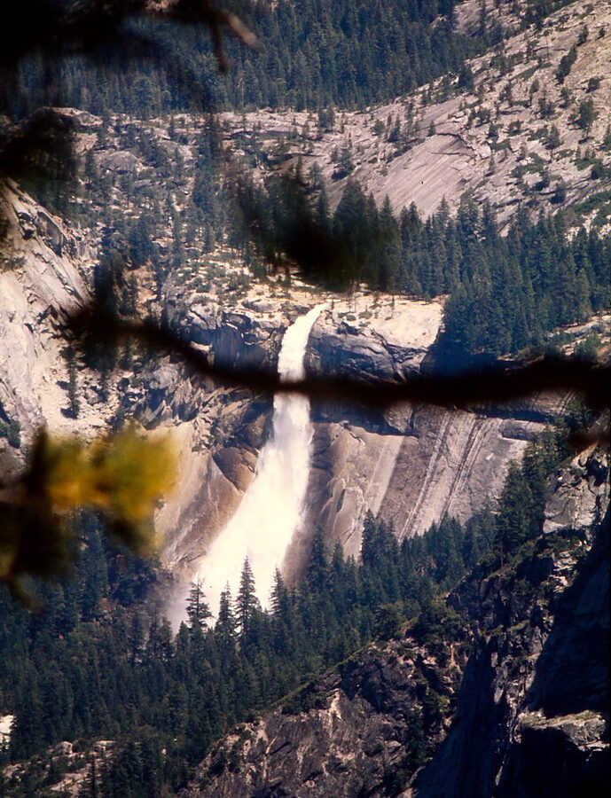
Photo: Ladycliff via Flickr (CC BY 2.0)
The Yosemite National Park winter season transforms the 4,000-foot Yosemite Valley while closing most high-elevation roads above it. Snow outlines the granite walls around El Capitan and Half Dome, seasonal waterfalls begin responding to rain and snowmelt, and visitor numbers fall sharply outside holidays and special February events.
Winter also requires more planning than a summer visit. Tioga Road generally closes between November and late May or June, Glacier Point Road becomes a snow route beyond the Badger Pass area, and tire-chain controls can begin with little notice. Our guide explains how conditions change through the season, which areas remain reachable, and how to choose dates based on snow, crowds, and preferred activities.
How Winter Changes Yosemite National Park
Yosemite covers an enormous elevation range, from roughly 2,000 feet in the western foothills to 13,114 feet on Mount Lyell. As a result, “winter conditions” can mean rain near the lowest entrances, wet snow in Yosemite Valley, and a deep, persistent snowpack around Badger Pass and the Sierra crest. Forecasts for one part of the park rarely describe another accurately.
Yosemite Valley Remains the Main Base
Yosemite Valley is about 7 miles long and contains many of the park’s best-known winter viewpoints. El Capitan, Bridalveil Fall, Yosemite Falls, Cathedral Rocks, and Half Dome can all be seen from roads or relatively level paths. Lower Yosemite Fall Trail is an approximately 1-mile loop, while the full Valley Loop Trail covers about 11.5 miles. Snow accumulation on the valley floor varies considerably because storms often arrive near the freezing point.
Stand in Cook’s Meadow after fresh snow and the scale becomes easier to read. Packed snow squeaks or turns to slush underfoot, depending on the sun, while the shaded base of Yosemite Falls remains noticeably colder. Traffic noise fades away from the road. The upper fall drops from a cliff more than 1,400 feet above the valley floor, occasionally sending ice and windblown spray into the amphitheater below.
Most High Country Becomes Inaccessible by Car
Tioga Road crosses the Sierra through Tuolumne Meadows and reaches 9,945 feet at Tioga Pass. It is not plowed for routine winter travel, so visitors cannot drive to Tenaya Lake, Tuolumne Meadows, or the eastern park entrance during the seasonal closure. These areas become remote ski-touring objectives requiring winter navigation, avalanche awareness, and the ability to travel far beyond maintained services.
Glacier Point Road Changes Function
Glacier Point Road usually closes to vehicles beyond the Badger Pass area once snow accumulates. The unplowed road then provides access for cross-country skiing and snowshoeing, including the demanding journey toward Glacier Point. The distance, changing weather, and limited daylight make that route a serious backcountry undertaking rather than a casual extension of a valley visit.
Yosemite National Park in Winter: A Month-by-Month Guide
Winter in Yosemite is better understood as three distinct phases. December brings short days and highly variable snow coverage. January and February usually provide the strongest chance of established snow at higher elevations. March can still produce major storms, but longer days, warmer valley temperatures, and increasing runoff begin shifting the park toward spring.
Comparing Early, Mid, and Late Winter
The table below describes typical patterns rather than a forecast. Pacific storms can drop substantial snow in a single event, while extended dry periods can leave the valley floor bare even when Badger Pass remains snow covered.
| Period | Typical conditions | Crowd pattern | Road access | Best suited to |
|---|---|---|---|---|
| Late November through December | Rain or snow in the valley, developing mountain snowpack, very short daylight | Quiet weekdays, heavier Thanksgiving and holiday traffic | Valley roads generally open, Tioga Road usually closed, chain controls possible | Scenic drives, short walks, waterfalls after storms |
| January through February | Coldest temperatures, best likelihood of snow recreation at higher elevations | Generally light, with spikes on holiday weekends and during February’s Horsetail Fall viewing period | High-country routes closed, temporary storm restrictions possible | Snowshoeing, skiing, photography, quieter valley trails |
| March into early April | Longer days, mixed rain and snow, rising waterfall flow | Increasing weekend visitation and spring-break traffic | Winter closures usually remain in place despite warmer valley weather | Waterfalls, hiking at lower elevations, mixed-season scenery |
December Rewards Flexible Travelers
Early winter provides the greatest uncertainty. A cold storm may cover Yosemite Valley overnight, followed by sunshine that melts exposed roads and meadows within a day. Bridalveil Fall and Yosemite Falls can revive after autumn rain, but their flow depends on recent precipitation. Visitors seeking guaranteed snow should plan around higher terrain rather than assuming the valley will be white.
January and February Offer the Most Winterlike Experience
Midwinter generally delivers the most reliable conditions for snowshoeing and cross-country skiing around Badger Pass. Yosemite Valley stays quieter on ordinary weekdays, but Presidents Day weekend and the Horsetail Fall viewing period can produce traffic controls, crowded pullouts, and temporary access rules. Horsetail Fall’s orange sunset illumination requires flowing water, a clear western horizon, and a narrow February sun angle, so the effect never comes with a guarantee.
March Mixes Snow with Stronger Waterfall Flow
March often combines winter access limitations with the first signs of spring. Snow remains deep at higher elevations, while lower trails may alternate among ice, mud, standing water, and dry pavement. Warmer storms and early snowmelt increase runoff, making waterfalls more dependable than they are in early winter. Overnight freezing can turn the previous afternoon’s meltwater into hard ice by morning.
Road Access, Chains, and Winter Reservations
Most winter trips concentrate on Yosemite Valley, Wawona, and lower-elevation western approaches. The Arch Rock Entrance on Highway 140 follows the Merced River and reaches the park without the higher passes encountered on other approaches, although rockfall, flooding, snow, and chain controls can still affect travel. Big Oak Flat Road and Wawona Road climb above 6,000 feet before descending into the valley, so conditions can change markedly along either route.
Yosemite National Park Winter Driving Requirements
California chain-control rules apply inside the park. Drivers may be required to carry chains or cables even when operating an all-wheel-drive or four-wheel-drive vehicle, and rental-car agreements do not always permit their installation. Practice fitting the correct traction devices before departure, fill the fuel tank outside the park, and avoid relying on mobile service for directions or weather updates.
- Carry tire chains or approved traction devices sized for the vehicle.
- Pack an ice scraper, gloves, flashlight, water, food, and a warm layer accessible from the cabin.
- Download maps before entering the Merced River or mountain corridors.
- Allow extra braking distance and avoid abrupt steering on shaded roads.
- Clear snow from the roof, lights, and windows before driving.
Reservations, Fees, and Planning Windows
Entrance fees apply throughout winter, and some lodging, campground, day-use, or event-specific reservation rules may change by year. February crowd-management measures are especially important for visitors hoping to see Horsetail Fall. Check the official park site for current reservations, fees, road status, chain controls, campground availability, and shuttle operations before committing to the drive.
Book valley lodging as soon as firm dates become available if traveling during Christmas week, New Year’s, holiday weekends, or the Horsetail Fall viewing window. Travelers with flexible schedules gain a practical advantage by choosing Sunday through Thursday nights and keeping an alternate arrival day available when a major Sierra storm appears in the forecast.
Choose Winter Activities by Elevation
A productive itinerary pairs valley walks with one higher snow day. Yosemite Valley often supports ordinary hiking boots between storms, while terrain near Badger Pass may require snowshoes or skis. Starting with valley viewpoints also gives road crews time to clear overnight accumulation before you climb toward higher elevations.
Walk the Valley’s Shorter Winter Routes
Mirror Lake is roughly 2 miles round trip from the nearest trail access, while the full loop covers about 5 miles beneath Half Dome and North Dome. Winter reflections are best when water is present and wind is light. Cook’s Meadow, Sentinel Bridge, and Valley View provide shorter options when packed snow or ice makes longer walks impractical. Microspikes improve traction on hardened paths, but they do not make steep, snow-covered trails safe.
Move onto Reliable Snow Near Badger Pass
The forest and meadows around Badger Pass sit near 7,200 feet, high enough to retain snow after the valley floor has melted. Marked winter routes support cross-country skiing and snowshoeing, although distance and navigation demands vary. Dewey Point is approximately 7.5 miles round trip by a common winter route and ends above a steep overlook into Yosemite Valley.
Approach Dewey Point Conservatively
The final viewpoint has exposed cliff edges that snow can obscure. Stay well back from cornices, track turnaround time, and carry a map because fresh snowfall can cover previous ski and snowshoe tracks. The return crosses rolling terrain, so visitors who reach the overlook tired still face several miles of travel before dark.
Trail Conditions Require a Different Safety Plan
Yosemite National Park Winter hiking often involves several surfaces within one mile. A paved path may begin wet, become packed snow beneath trees, and finish as clear ice near waterfall spray. Waterproof footwear, gaiters, trekking poles, and removable traction devices handle this variation better than heavy insulated boots alone. Carry spare socks because shallow puddles often hide beneath slush.
Recognize Ice and Falling-Snow Hazards
Freeze-thaw cycles create especially slick conditions near Lower Yosemite Fall, Bridalveil Fall, and shaded sections of the Valley Loop Trail. Ice can also detach from cliffs as temperatures rise, producing loud cracks and dangerous debris near wall bases. Obey closure signs and avoid stopping beneath active icefall zones, even when other visitors gather there.
Prepare for Short Daylight and Limited Signals
Sunset arrives early, and cliffs place many valley trails in shadow well before the published sunset time. Each person should carry a headlamp rather than relying on a phone light. Keep insulating layers, food, and navigation tools in a daypack. Mobile reception remains inconsistent, particularly along Wawona Road, Big Oak Flat Road, and trails away from developed valley areas.
- Tell someone your route and expected return time.
- Turn around if snowfall begins covering tracks or trail markers.
- Keep away from partially frozen rivers, ponds, and snow-covered creek channels.
- Store food properly because black bears may remain active during mild periods.
Match Your Dates to Your Priorities
Crowd levels affect more than parking. Quiet weekdays make roadside photography and valley walking easier, while holiday periods can slow entrance approaches and fill convenient lodging. Storm days reduce visibility but may produce fresh snow. Clear days immediately afterward deliver sharper views, colder morning roads, and heavier competition at familiar viewpoints.
A Practical Winter Decision Table
| Priority | Best timing | Main tradeoff |
|---|---|---|
| Fresh valley snow | Immediately after a cold storm | Chain controls and delayed road clearing |
| Snowshoeing or skiing | January through early March | High-country roads remain closed |
| Waterfalls | After rain or during warmer March weather | Slush, mud, and morning ice |
| Lowest crowds | Nonholiday midweek dates | Fewer open visitor services |
| Horsetail Fall photography | The appropriate February sunset window | Special access measures and concentrated crowds |
Build Flexibility into a Two-Day Visit
Use the clearer day for Tunnel View, Valley View, and outdoor walks, then reserve the stormier day for shorter valley routes and indoor exhibits where available. Travelers focused on snow recreation should schedule their Badger Pass day after checking overnight accumulation and road controls. Avoid building a fixed itinerary around one sunset, waterfall, or viewpoint because cloud cover can erase the intended experience.
Planning a Yosemite National Park Winter Visit with Confidence
Winter concentrates Yosemite into a smaller, more changeable park. Yosemite Valley supplies accessible scenery and lower trails, while Badger Pass provides the most dependable recreational snow. Tioga Road and the Glacier Point corridor beyond the winter access area require a completely different level of backcountry preparation, so ordinary visits should remain within maintained road and marked-route networks.
Select December for changeable scenery and holiday atmosphere, January or February for stronger snow prospects, and March for longer days with improving waterfall flow. Keep traction equipment in the vehicle, carry foot traction in your pack, and leave enough schedule flexibility to respond to storms. Those choices turn uncertain winter conditions into a manageable plan rather than an avoidable disruption.
Want to keep exploring? Browse all our Yosemite guides and articles for more trip-planning tips and ideas.
Gear & Essentials
Tell us about your trip and we will add what else you will want:
The basics
Worth having in the car whatever the park.
For this trip
Traveling with kids
Bringing a pet
RVing
Backcountry
Winter conditions
On the water
Photography
Accessibility
As an Amazon Associate we earn from qualifying purchases, at no extra cost to you.