Arches National Park in Spring: What to Expect and What to Do
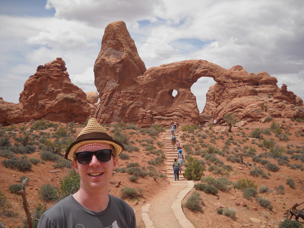
Photo: rococohobo via Flickr (CC BY-SA 2.0)
Arches National Park spring travel pairs comfortable hiking temperatures with longer daylight and clear views across Utah’s Colorado Plateau. The park protects more than 2,000 documented natural stone arches within 76,519 acres, including Landscape Arch, whose opening spans more than 290 feet, and Delicate Arch, a 52 foot freestanding landmark reached by a moderately strenuous trail.
Spring also brings sharp changes from week to week. Snow can dust the fins in March, April often delivers the most balanced hiking weather, and late May can feel like summer by midday. Our guide explains those differences, compares spring with the rest of the year, and covers the crowd, access, and reservation issues that shape a successful visit.
Why Arches National Park in spring works so well
Most developed areas lie between roughly 4,000 and 5,200 feet above sea level. That elevation produces colder mornings than many visitors expect from southern Utah, while the open slickrock warms quickly in direct sun. Spring’s moderate daytime temperatures make exposed routes such as Delicate Arch and Devils Garden more manageable than they are during the hottest part of summer.
Arches National Park spring landscapes and geology
The arches formed in Entrada Sandstone above an unstable foundation of ancient salt deposits. As buried salt shifted, overlying rock fractured into parallel fins. Water entered those joints, froze, expanded, and gradually removed weaker material. Visitors can read that process particularly well in the Windows Section, where fins, alcoves, balanced rocks, and mature arches occur within a compact area.
Moisture also changes the desert’s appearance. Depending on winter precipitation and spring temperatures, blooming plants may include yellow beeplant, evening primrose, Indian paintbrush, prickly pear cactus, and the cream colored flowers of yucca. Biological soil crusts between the plants contain cyanobacteria, lichens, and mosses. Stay on established trails or bare rock because a single footprint can damage crust that took decades to develop.
What the desert feels like before summer
At the Windows, the trail crosses gritty sand before climbing onto pale slickrock beneath North Window. Morning shade holds the previous night’s cold, while sunlit sandstone already feels warm through a resting hand. Ravens call above the fins, wind passes audibly through the opening, and the ground falls away toward the La Sal Mountains. The scale becomes clearest under the arch, where people on the opposite side look small against the Entrada Sandstone.
Arches National Park spring weather by month
Conditions at the park can change rapidly because dry air loses heat after sunset and exposed rock offers little shelter from wind. Moab’s typical daily highs rise from the low to middle 60s Fahrenheit in March to the low 80s by May, while average lows move from the mid 30s into the low 50s. Individual days can depart substantially from those averages.
March brings cold mornings and quieter trails
March is the most variable spring month. Freezing nights remain possible, and late storms can leave snow or ice on shaded sandstone. The slickrock slope on the Delicate Arch Trail deserves particular caution after precipitation because the route traverses open rock above a drop. Pack a warm layer, gloves, and a shell even when Moab’s afternoon forecast looks mild.
Visitor levels usually rise around school breaks, but early March tends to feel less congested than April. Shorter daylight and cold starts reward a compact plan: Park Avenue, Balanced Rock, the Windows, and Double Arch can be combined without committing to a long backcountry route.
April offers the broadest hiking window
April commonly provides cool mornings, mild afternoons, and enough daylight for longer routes. These conditions suit the 3 mile round trip to Delicate Arch, which gains about 480 feet, or the Devils Garden Primitive Loop, approximately 7.8 miles when completed with its major spurs. Strong winds can funnel between fins and make exposed sections uncomfortable, especially near Landscape Arch and Double O Arch.
April is also one of the busiest periods. Trailhead parking can fill during the morning, and entrance traffic may back up toward the highway. Starting near sunrise improves parking odds and places strenuous hiking before the warmest part of the day. Avoid roadside parking unless signs expressly permit it, since narrow shoulders damage vegetation and obstruct traffic.
May begins comfortably but heats up quickly
Early May often retains spring conditions at dawn, yet exposed trails can become hot by late morning. Shade is scarce on the Delicate Arch approach, the Devils Garden fin crossings, and the Park Avenue corridor. Carry water from Moab or another reliable source rather than expecting to refill beside every trailhead. A broad sun hat and high protection sunscreen matter because sandstone reflects sunlight upward.
Later in May, arrange the day around temperature. Hike a longer trail early, use midday for the scenic drive and brief overlooks, then return outside for evening light. Delicate Arch faces broadly east and receives warm late day illumination, but its viewpoint and parking area are correspondingly busy before sunset.
How spring compares with the rest of the year
Spring and fall generally provide the widest choice of trails without summer’s sustained heat or winter’s greater chance of ice. That advantage draws heavier visitation, so weather comfort comes with competition for parking and quieter viewpoints. The best season depends on how a traveler values temperature, solitude, daylight, and access.
| Season | Typical conditions | Crowd pattern | Road and trail access | Best suited to |
|---|---|---|---|---|
| Spring | Cold to mild mornings, increasingly warm afternoons, occasional rain or late snow | Moderate in early March, heavy around school breaks and many April weekends | Main paved road usually accessible, with temporary storm or maintenance closures possible | Long hikes, wildflowers, photography, broad itinerary choice |
| Summer | Very hot afternoons, intense sun, localized thunderstorms later in the season | Busy at major viewpoints, with some midday turnover as heat increases | Most routes accessible, but heat can make exposed trails unsafe | Sunrise outings, scenic driving, short walks |
| Fall | Warm September days followed by cooler, shorter days | Often heavy in September and October | Generally broad access until winter weather arrives | Full day hiking and comfortable camping |
| Winter | Cold nights, mild or cold days, occasional snow and ice | Lowest overall, except around holidays | Paved areas often remain reachable, but shaded trails may be icy | Solitude, snow photography, flexible itineraries |
Choosing dates by your priorities
- For cooler hiking: Choose March, accept the possibility of ice, and carry traction when recent weather warrants it.
- For the widest trail choice: Target April or early May and begin demanding hikes shortly after sunrise.
- For wildflowers: Look from late March into May, recognizing that bloom timing depends heavily on winter moisture and elevation.
- For lower crowd pressure: Visit on weekdays, avoid major school break periods, and enter early or later in the afternoon.
- For night skies: Select dates near a new moon and bring warm clothing because temperatures fall quickly after sunset.
Arches National Park spring crowds, roads, and entry planning
Arches has one primary paved park road extending approximately 18 miles from the entrance area to Devils Garden. Side roads lead to the Windows Section and Delicate Arch. This simple layout makes navigation straightforward, but it also concentrates vehicles at the same junctions and trailheads. There is no alternate through route when congestion or an incident affects the main road.
Where congestion affects the experience
The busiest parking areas serve Delicate Arch, the Windows, Double Arch, and Devils Garden. A full lot can force visitors to revise the entire sequence of their day because circling repeatedly adds traffic without guaranteeing a space. Our team recommends placing one priority hike first, then treating roadside overlooks and shorter trails as flexible additions.
Allow time between distant trailheads
Moab lies about 5 miles south of the park entrance, but reaching Devils Garden requires driving the length of the park road after passing the entrance station. Scenic stops, wildlife, construction, and parking searches can make this considerably slower than the mileage suggests. Build generous buffers around tours or permit times.
Reservations, permits, and regulated activities
Entry systems have varied between recent seasons, and Fiery Furnace access is regulated because its maze of narrow passages is difficult to navigate and environmentally sensitive. Backcountry camping also requires authorization. Before committing to flights or lodging, check the current entry reservation dates, release schedule, Fiery Furnace options, fees, and road status on the official park site.
What to verify before departure
- Whether a timed vehicle entry reservation applies to your spring dates and arrival hour.
- When advance reservations are released and whether any later release period is offered.
- Whether the Fiery Furnace is available through a ranger led hike, an individual permit, or both.
- Current closures affecting roads, trails, campgrounds, or climbing areas.
- The latest weather forecast, with particular attention to wind, freezing temperatures, and thunderstorms.
Match the trail to recent conditions
Spring precipitation can change trail difficulty within minutes. Entrada Sandstone becomes slick when wet, while clay rich sections hold mud that clings to footwear and encourages hikers to widen the path. After rain or snow, begin with developed routes such as Balanced Rock, the Windows, or Double Arch. Save exposed slickrock and primitive trails until surfaces have dried and visibility has improved.
Use extra caution beyond Landscape Arch
The maintained Devils Garden Trail reaches Landscape Arch after approximately 1.9 miles round trip. Beyond that point, the route toward Double O Arch climbs narrow sandstone fins and crosses uneven rock with exposed edges. Cairns mark portions of the route, but they can be difficult to follow during rain, blowing dust, or fading light. The full Primitive Loop adds sandy washes, scrambling, and route finding, so allow several hours and carry a map that works without cellular service.
Consider quieter routes beyond the main corridor
Tower Arch provides a less concentrated experience in the Klondike Bluffs area. The roughly 2.6 mile round trip crosses sand, slickrock, and rolling terrain before reaching a broad arch backed by sandstone walls. Access involves unpaved roads that may become muddy, rutted, or unsuitable for some vehicles after storms. Salt Valley Road and other backcountry roads also respond quickly to precipitation, unlike the main paved park road.
Keep a short alternative ready
Sand Dune Arch, Double Arch, and Balanced Rock require less time than the park’s longer hikes, making them useful when wind, wet rock, or crowded parking disrupts the original plan. Park Avenue offers a different option: the trail descends into a sandstone corridor for about 1.8 miles one way. Without a vehicle shuttle, remember that the return climb turns it into a longer and more strenuous outing.
Build a spring itinerary around one priority
An Arches National Park Spring itinerary works best when each day has one fixed objective and several flexible stops. Trailhead availability, temperature, and wind often matter more than the order shown on a map. Pair destinations located on the same branch of the park road, which reduces unnecessary driving and leaves enough time to wait for a parking space without sacrificing a reserved activity.
A focused one day visit
Begin with Delicate Arch if completing the full trail is the main goal. Afterward, move to the Windows Section for North Window, South Window, Turret Arch, and Double Arch. These formations are close geographically, although each deserves separate walking time. Finish with Balanced Rock and the roadside overlooks along the return drive. If Delicate Arch is reserved for evening, reverse the sequence and avoid committing to Devils Garden on the same day.
A two day plan for longer hikes
Use the first day for Delicate Arch and the Windows Section. Reserve the second for Devils Garden, where hikers can turn around at Landscape Arch, continue to Double O Arch, or complete the Primitive Loop according to conditions and ability. This arrangement keeps the park’s two most demanding developed trail areas on separate days and creates room for Skyline Arch, Sand Dune Arch, or Broken Arch when energy and daylight permit.
- Cold or icy morning: Start with overlooks and sun exposed short walks, then reassess the rock surface.
- Warm May afternoon: Complete the longest hike early and schedule scenic driving during peak heat.
- Strong wind: Avoid exposed fin crossings and choose lower, shorter routes.
- Full priority trailhead: Continue to a planned alternative rather than repeatedly circling the lot.
Prepare for spring hazards on open sandstone
Arches has little natural shade, and wind can disguise dehydration by evaporating sweat quickly. For a long spring hike, many adults need roughly three to four liters of water, with additional capacity during hot May conditions. Bring salty food, sun protection, and an insulating layer. A comfortable morning can become hot by noon, while sunset may produce a rapid temperature drop.
Respond early to storms and lightning
Thunderstorms create hazards beyond wet footing. Washes can carry fast moving water from rainfall that occurred outside the immediate area, and exposed fins offer poor protection from lightning. Leave high sandstone ridges when thunder develops, avoid entering narrow drainages during threatening weather, and never cross flowing water of uncertain depth. Desert rain may be brief, but runoff can continue after the sky overhead begins clearing.
Protect navigation and turnaround time
Rock cairns indicate routes in places where no dirt tread exists. Follow established markers without building new piles, which can misdirect later hikers. Carry an offline map, note major junctions, and set a turnaround time before leaving the trailhead. Spring daylight is generous by April, yet route finding through Devils Garden or the Fiery Furnace takes longer than mileage alone suggests.
Plan your Arches National Park spring visit with flexibility
March favors travelers prepared for freezing mornings and occasional ice. April delivers the most broadly comfortable hiking conditions along with the strongest pressure on entrances and parking. Early May still supports full day exploration when longer routes begin near sunrise, while late May increasingly requires a summer style schedule built around heat and limited shade.
Choose dates according to your main objective, secure any required entry or Fiery Furnace reservation when its release window opens, and build each day around one priority trail. A second choice nearby will protect the itinerary when weather or parking intervenes. With adequate water, realistic drive times, and respect for wet sandstone, spring provides access to the park’s signature arches under some of the year’s most workable conditions.
Want to keep exploring? Browse all our Arches guides and articles for more trip-planning tips and ideas.
Gear & Essentials
Tell us about your trip and we will add what else you will want:
The basics
Worth having in the car whatever the park.
For this trip
Traveling with kids
Bringing a pet
RVing
Backcountry
Winter conditions
On the water
Photography
Accessibility
As an Amazon Associate we earn from qualifying purchases, at no extra cost to you.