7 Best Hikes in Arches National Park
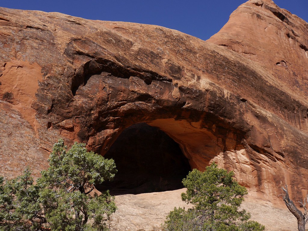
Photo: usareisetipps via Flickr (CC BY-SA 2.0)
The Best Hikes Arches National Park visitors can choose are often shorter than expected, but mileage alone badly understates their difficulty. Slickrock ledges, deep sand, exposed fins, intense sun, and route finding can turn a two mile walk into a demanding outing. Conversely, several of the park’s most impressive arches stand less than a mile from a trailhead.
Arches protects more than 2,000 documented natural stone arches above the Colorado River near Moab, Utah. Most trails branch from one paved road that climbs from the entrance through Park Avenue, the Windows area, Delicate Arch, and Devils Garden. Our seven selections follow that geographic progression, balancing signature formations with quieter terrain and hikes suited to different experience levels.
How We Chose the 7 Best Hikes in Arches National Park
Seven routes that reveal different sides of the park
A useful list should cover more than arch size. We selected routes that explain how the landscape fits together: Park Avenue introduces the Entrada Sandstone cliffs, the Windows area concentrates several enormous openings, Delicate Arch provides the park’s defining viewpoint, and Devils Garden leads into a maze of narrow fins. Landscape Arch earns a separate place because it offers an easier alternative to the complete Devils Garden circuit.
The final seven include Park Avenue Trail, the Windows Loop, Double Arch Trail, Delicate Arch Trail, Landscape Arch Trail, the Devils Garden Primitive Loop, and the Sand Dune Arch to Broken Arch loop. The list deliberately spans walks of less than a mile through a strenuous backcountry style circuit, although every route remains within the park’s developed trail network.
At a Glance: Distances and Difficulty for the Best Hikes in Arches National Park
| Hike | Distance | Typical difficulty | Defining feature |
|---|---|---|---|
| Park Avenue Trail | 1.8 miles one way | Moderate | Courthouse Towers canyon |
| Windows Loop | About 1 mile | Easy to moderate | North and South Windows |
| Double Arch Trail | 0.6 mile round trip | Easy | Two joined arch spans |
| Delicate Arch Trail | 3 miles round trip | Moderate | Freestanding Delicate Arch |
| Landscape Arch Trail | 1.9 miles round trip | Easy to moderate | Long, exceptionally thin arch |
| Devils Garden Primitive Loop | 7.9 miles | Strenuous | Fins, arches, and exposed slickrock |
| Sand Dune Arch and Broken Arch Loop | About 2.3 miles | Moderate | Shaded slot and open grassland |
Distances can vary slightly with viewpoint spurs and parking locations. Trail difficulty also changes with temperature and wind. A route rated moderate in cool April weather may feel strenuous during a June afternoon, when sandstone surfaces radiate heat and exposed sections provide almost no shade.
Reading the Landscape Before You Start Hiking
Why arches form in long, parallel fins
Most arches here developed in Entrada Sandstone, a Jurassic formation deposited roughly 150 million years ago. Deep underground salt beds shifted and buckled the overlying rock, creating fractures. Water entered those joints, freezing temperatures widened them, and erosion removed weaker material. Narrow sandstone walls called fins remained, and openings gradually formed where softer layers failed within them.
This process explains why hikers repeatedly pass through corridors of parallel rock rather than encountering isolated arches on open plains. Devils Garden displays the pattern especially clearly. Delicate Arch represents a later erosional stage, standing apart after much of its original fin disappeared. Rockfall continues today, so climbing directly on named arches is prohibited and lingering beneath visibly fractured rock deserves caution.
Heat, elevation, and desert surfaces
The park entrance lies near 4,000 feet above sea level, while the road rises several hundred feet toward Devils Garden. That elevation brings freezing winter nights, occasional snow, and rapid weather changes. Summer daytime temperatures frequently exceed 100°F, yet spring and autumn mornings can require insulating layers. Biological soil crust, the dark, knobby ground beside many trails, contains cyanobacteria that stabilize soil and retain moisture. One footprint can damage decades of growth.
- Carry water from Moab or another reliable source rather than expecting it at every trailhead.
- Use shoes with dependable traction for sandstone slopes and loose sand.
- Bring sun protection even in winter because most routes have little overhead cover.
- Stay on rock, established paths, or sandy washes to protect biological soil crust.
- Check the forecast for thunderstorms, high wind, extreme heat, and winter ice.
Starting Along the Courthouse Towers Corridor
Park Avenue Trail
Park Avenue begins shortly after the entrance road completes its steep climb. The trail drops into a broad wash between sheer walls and monoliths, including formations associated with Courthouse Towers. Its name comes from the canyon’s resemblance to a street lined by tall buildings. The full route runs 1.8 miles one way to the Courthouse Towers viewpoint, making a 3.6 mile out and back unless a companion relocates the vehicle.
The descent from the upper viewpoint includes stone steps and uneven surfaces, followed by sandy walking through the wash. Most of the elevation change occurs near the upper trailhead. Starting at Courthouse Towers reverses that pattern and saves the climb for the end. Late afternoon brings stronger texture to the west facing walls, while morning generally provides cooler hiking conditions.
Why this archless trail belongs among the seven
Park Avenue gives hikers the clearest ground level introduction to the vertical scale that roadside pullouts flatten. It also reveals joints, alcoves, fallen blocks, and drainage channels that help explain the park’s geology before the first major arches appear. Traffic noise fades in the wash, although both trailheads remain close to the park road. Families should account for the return distance, since no park shuttle routinely links the endpoints.
Two of the Best Hikes in Arches National Park at the Windows
Windows Loop
The Windows section occupies a side road roughly 12 miles from the park entrance. A compact trail system reaches North Window, South Window, and Turret Arch, three large openings carved into the same cluster of fins. The standard loop is about one mile, with stone steps, sloping rock, and limited shade. North Window provides the easiest close view, while South Window sits slightly farther along the formation.
A longer primitive return path curves behind the Windows and provides wider views toward the La Sal Mountains. This segment crosses uneven sandstone and sandy ground, making it less suitable for visitors who want the simplest route. Arrive early when possible because the Windows and nearby Double Arch share one of the park’s busiest developed areas. Parking controls, fees, and entry reservation rules can change, so confirm current details on the official park site.
Double Arch Trail
Across the parking area, a 0.6 mile round trip path leads to Double Arch, where two openings share the same sandstone mass. Unlike many arches formed mainly by erosion from the side, Double Arch developed through downward water erosion from above. Its tallest opening rises more than 100 feet, and the broad alcove beneath it creates one of the park’s strongest demonstrations of scale.
Inside the opening, sand shifts underfoot before giving way to slanted slickrock. Voices rebound from the curved walls overhead, and the air can feel noticeably cooler where the sandstone blocks direct sun. Looking upward compresses both arches into intersecting bands of orange rock. The final scrambling surfaces become polished and steep, so the best stopping point depends on traction, balance, and crowding.
Delicate Arch From Wolfe Ranch
The trail to Delicate Arch begins near Wolfe Ranch, a one room cabin associated with settler John Wesley Wolfe and his family, who ran cattle here around the turn of the twentieth century. A short spur near the start reaches a panel of Ute petroglyphs depicting horses and riders. Those images postdate the arrival of horses in the region and should be viewed from the established path without touching the rock.
The slickrock climb and final ledge
Beyond the historic area, the route crosses Salt Wash and climbs roughly 480 feet, much of it on a broad sandstone slab marked by cairns. The grade is steady and almost entirely exposed to the sun. Near the arch, the trail follows a rock ledge around a sandstone corner. The ledge is wide enough for careful walking, but the drop beside it can trouble hikers with a strong fear of heights. Winter ice makes this section considerably more difficult.
Choosing a time for the basin
Delicate Arch stands on the rim of a natural sandstone bowl, with the La Sal Mountains visible through the opening on clear days. Sunset produces the familiar warm light, but it also concentrates hikers on the ledge and around the viewing basin. Morning offers cooler temperatures, easier parking, and fewer people crossing the route. Carry a headlamp if there is any possibility that the return will continue after dusk.
Two Different Devils Garden Experiences
Devils Garden sits near the end of the park road, where long fins create narrow corridors and isolated openings. Its trail network supports both an approachable walk to Landscape Arch and the park’s most demanding maintained route. Junctions beyond Landscape Arch lead toward Partition Arch, Navajo Arch, Double O Arch, and the Primitive Trail, so photographing the trail map before leaving the trailhead helps prevent wrong turns.
Landscape Arch for an easier outing
The path to Landscape Arch crosses packed ground and rolling sandy sections with side trails to Tunnel Arch and Pine Tree Arch. Landscape Arch stretches approximately 290 feet yet narrows to an exceptionally thin band near its center. A large slab fell from the arch in 1991, and visitors now view it from designated areas rather than walking underneath. This route delivers one of the park’s most unusual formations without the exposed fin crossings found farther ahead.
The Primitive Loop and Double O Arch
Past Landscape Arch, the route climbs steep slickrock and follows the crest of sandstone fins. The complete circuit requires route finding, scrambling, and comfort with exposure. Double O Arch consists of two stacked openings, while side trips reach Navajo and Partition arches. The Primitive Trail adds deep sand, narrow passages, and poorly defined stretches where cairns matter. Retreat toward Landscape Arch if wind, wet sandstone, fatigue, or uncertain navigation makes the fin crossings unsafe.
- Save an offline map because cellular coverage is unreliable among the fins.
- Carry more water than the mileage would suggest, especially from May through September.
- Avoid exposed sandstone when lightning is nearby or rain has reduced traction.
- Allow extra time for the optional arch spurs and careful route finding.
A Quieter Loop Through Broken Arch Country
Sand Dune Arch and Broken Arch occupy a transition between tightly spaced fins and open desert grassland. Sand Dune Arch sits inside a shaded sandstone passage where deep, cool sand accumulates beneath the opening. The connecting route then crosses open ground toward Broken Arch, whose name comes from a pronounced crack across the span. The arch remains intact, and the trail passes directly beneath it.
Combining shade, grassland, and open views
Continuing around the loop reveals a landscape that many roadside stops conceal. Pinyon pine, Utah juniper, blackbrush, and Indian ricegrass survive on thin soils between exposed rock. Ravens commonly patrol the open ground, while mule deer may appear near vegetated washes around dawn or dusk. The sandy tread increases effort, but the terrain is less exposed than the Devils Garden fin crossings and provides a useful middle option between short walks and strenuous routes.
Matching each hike to the day’s conditions
The Best Hikes Arches National Park itinerary should respond to weather rather than a fixed ranking. Exposed climbs belong in the coolest part of the day, while protected formations can fill warmer hours. Wind also matters because gusts feel stronger on Delicate Arch’s approach and the Devils Garden fins.
| Conditions | Best route choice | Main reason |
|---|---|---|
| Cool, calm morning | Delicate Arch | Exposed climb with limited shade |
| Several hours of stable weather | Devils Garden Primitive Loop | Long route with exposed navigation |
| Warm afternoon | Sand Dune Arch and Broken Arch | Brief shade followed by flexible turnaround options |
| Limited time or energy | Landscape Arch or Double Arch | Major formations reached on shorter trails |
Choosing the Right Trail Among the 7 Best Hikes in Arches National Park
First time visitors can build a balanced day by pairing one demanding hike with one compact area. Delicate Arch in the morning followed by the Windows and Double Arch covers the park’s signature formations without committing to the Primitive Loop. Strong hikers with stable weather can devote most of a day to Devils Garden, while Park Avenue or Broken Arch adds a different geological setting on another morning.
Distance should remain only one part of the decision. Heat, sandstone traction, exposure, sand, and navigation determine how difficult these routes feel. Start with honest limits, carry enough water, and protect the biological soil crust by staying on durable surfaces. With that preparation, the seven hikes provide a coherent journey from Courthouse Towers to the remote fins at the end of the park road.
Want to keep exploring? Browse all our Arches guides and articles for more trip-planning tips and ideas.
Gear & Essentials
Tell us about your trip and we will add what else you will want:
The basics
Worth having in the car whatever the park.
For this trip
Traveling with kids
Bringing a pet
RVing
Backcountry
Winter conditions
On the water
Photography
Accessibility
As an Amazon Associate we earn from qualifying purchases, at no extra cost to you.