Visiting Arches National Park with Limited Mobility: Accessible Views and Trails
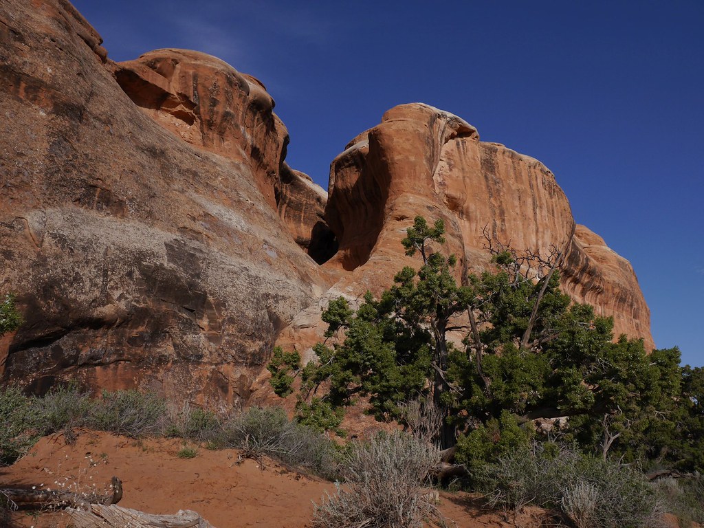
Photo: usareisetipps via Flickr (CC BY-SA 2.0)
Visiting Arches National Park with limited mobility can reveal dozens of arches and immense sandstone formations without requiring long hikes. The park’s paved scenic road reaches overlooks throughout the landscape, while short, firm-surface paths provide views of Balanced Rock, the Windows, Double Arch, and Delicate Arch. Several formations are visible from a vehicle or within a few hundred feet of parking.
Arches occupies a high-desert plateau north of Moab, Utah. Elevations range from roughly 4,000 to more than 5,600 feet, so heat, thin air, intense sunlight, and rapid weather changes affect even brief outings. Our team recommends treating each stop as a separate excursion, using the vehicle for cooling, rest, and recovery between viewpoints.
Visiting Arches National Park with Limited Mobility Starts with the Scenic Road
The paved park road climbs sharply from the entrance and visitor center before continuing approximately 18 miles to Devils Garden. Most major overlooks and trailheads branch directly from this corridor. There is no through-road, so a complete visit involves retracing the route, and driving time increases substantially when parking areas are busy.
Understand the Scale Before Choosing Stops
The landscape appears compact on maps because many formations sit close to the road, but the distances between major zones add up. Park Avenue is near the beginning of the drive, Balanced Rock is farther north, and the Windows section requires a side trip. Delicate Arch viewpoints occupy another spur, while Devils Garden sits at the road’s northern end. Choosing two or three priority zones usually produces a more comfortable day than attempting every named stop.
Accessible Views and Trails Vary Across Arches National Park
Conditions range from paved overlooks to compacted aggregate paths with slopes, lips, and uneven patches. Some visitors using powered wheelchairs may find a route manageable that is difficult with a manual chair. People using walkers or canes should also account for limited shade and the energy required to return from a viewpoint. Recent storms can deposit sand on otherwise firm surfaces.
Before departure, check current entrance procedures, temporary closures, restroom availability, and any timed-entry requirements on the official park site. Once inside, use this sequence to reduce unnecessary walking:
- Study each viewpoint from the parking area before unloading mobility equipment.
- Stop near the entrance first, then follow the road geographically rather than backtracking.
- Save exposed paths for cooler morning hours.
- Carry water in the vehicle and on every excursion, including stops under a quarter mile.
- Allow extra transfer time because accessible parking spaces may be occupied during peak periods.
Accessible Views Along the First Sandstone Cliffs
The opening climb passes through Moab fault geology, where rock layers were displaced millions of years ago. The road then reaches walls and monoliths carved from Entrada Sandstone, the principal arch-forming layer in the park. Vertical fractures, winter ice, and erosion gradually widen openings, while harder caprock can temporarily protect the fins beneath it.
Visiting Arches National Park at Park Avenue Viewpoint
Park Avenue Viewpoint provides one of the park’s strongest low-effort introductions. A short paved approach leads from the parking area to a broad overlook above a sandstone canyon. Courthouse Towers, the Organ, and the Three Gossips rise along this opening corridor. Visitors can appreciate the full scene from the overlook without descending the roughly 1-mile trail into the wash.
At the railing, the pavement ends against a sudden sweep of red stone. Sheer fins stand overhead like narrow building fronts, while the canyon floor lies below in patches of pale sand and blackbrush. Wind funnels between the walls, and traffic noise fades when gusts move through the gap. The scale becomes clearest here because people on the lower trail appear as small moving points beneath the cliffs.
Courthouse Towers and the La Sal Mountains Viewpoint
Roadside pullouts around Courthouse Towers reveal formations from different angles with little walking. The Three Gossips are especially recognizable from the road, while Sheep Rock and the Tower of Babel dominate nearby walls. Farther along, the La Sal Mountains Viewpoint contrasts red sandstone with peaks exceeding 12,000 feet. Spring snow often remains visible on the mountains after lower desert temperatures have become hot.
Balanced Rock from the Paved Viewing Area
Balanced Rock stands beside the main road near the turnoff for the Windows. The formation reaches approximately 128 feet from base to top, with a resistant block of Entrada Sandstone resting above softer Dewey Bridge mudstone. A paved section offers a close view suitable for many mobility devices. The longer loop becomes rougher, so the paved perspective is the practical turnaround point for visitors avoiding steps or irregular rock.
The Windows District and Delicate Arch Viewpoints
The Windows and Delicate Arch roads lead to separate concentrations of features. Both are worthwhile, but they provide different experiences. The Windows area places multiple arches close together, while the Delicate Arch viewpoint road offers a distant look at Utah’s best-known freestanding arch without the strenuous climb to its base.
| Stop | Approximate route | Surface and effort | Primary view |
|---|---|---|---|
| Balanced Rock viewing area | Short approach | Paved section with limited grade | Balanced Rock and surrounding plateau |
| Windows parking area | Views begin near parking | Paved or firm areas, with rougher trail beyond | North Window, South Window, and Turret Arch |
| Double Arch | About 0.6 mile round trip | Generally firm trail with sand and uneven sections | Two joined arch openings |
| Lower Delicate Arch Viewpoint | About 100 yards | Short, relatively level approach | Distant view of Delicate Arch |
Windows Views Without Completing the Loop
North Window and South Window occupy the same sandstone fin and can be seen from around the parking area and approach. The full Windows loop includes rock steps and uneven terrain, so visitors with limited mobility can turn around when the surface stops matching their needs. Turret Arch is also visible from this zone, allowing three major formations to be studied without completing the approximately 1-mile loop.
Double Arch and the Limits of a Firm-Surface Trail
Double Arch formed largely through downward water erosion rather than the side-to-side erosion that shapes many other arches. Its short trail is broad and generally firm, but loose sand, shallow ledges, and seasonal surface changes can create obstacles for wheelchairs or walkers. Even from partway along the route, both openings are visible above the parking basin.
Visiting Arches National Park for a Delicate Arch View
The Lower Delicate Arch Viewpoint is the appropriate choice for travelers who cannot manage the 3-mile round-trip Delicate Arch Trail. That longer route climbs about 480 feet across open slickrock and traverses an exposed ledge near the arch. The lower viewpoint instead uses a short approach and frames the 52-foot-tall opening across a broad sandstone basin.
Delicate Arch appears smaller from this distance, so binoculars improve the view and reveal people standing near its base. Late afternoon brings warmer light to the Entrada Sandstone, but it also produces heavier parking demand. Morning offers cooler temperatures and a quieter viewing experience, particularly during late spring and early autumn.
Low Effort Stops on the Northern Park Road
Beyond the Delicate Arch turnoff, the road crosses open pinyon and juniper country before reaching several viewpoints that require little time outside the vehicle. Salt Valley Overlook faces a broad depression created when underground salt shifted and dissolved, allowing overlying rock to collapse. The Fiery Furnace Viewpoint looks across a dense maze of vertical sandstone fins, although entering that maze demands substantially more mobility and route-finding ability than viewing it from the paved road.
Skyline Arch from the Road and Trail
Skyline Arch sits high in a sandstone wall near Devils Garden and remains visible from the road. A roughly 0.4-mile round-trip path provides a closer perspective, but visitors should expect uneven rock, gravel, and little shade. The opening expanded dramatically when a large block fell from the arch in 1940. Anyone who finds the trail unsuitable can still see the enlarged opening clearly from near the parking area.
Devils Garden Without the Primitive Loop
Devils Garden contains the park’s greatest concentration of arches, but its backcountry loop crosses narrow fins, deep sand, and exposed slickrock. The initial Landscape Arch Trail is considerably easier. It follows a broad, compacted route for approximately 1.9 miles round trip, although slopes, sandy patches, and heat may still limit manual wheelchair users or people with reduced stamina.
Landscape Arch as a Turnaround Point
Landscape Arch spans approximately 306 feet while measuring only about 11 feet thick at its narrowest section. Its long ribbon of Entrada Sandstone is visible from the designated viewing area. The route beyond this point climbs steep sandstone and should serve as a clear turnaround for visitors seeking a moderate, predictable surface.
Match the Visit to Desert Conditions
Season influences accessibility because short paths provide almost no shelter. Summer afternoons regularly exceed 100 degrees Fahrenheit, while winter mornings can leave shaded pavement and sandstone coated with ice. Spring and autumn usually provide the most comfortable temperatures, but strong winds can lift sand across parking areas and trails.
| Period | Typical challenge | Practical approach |
|---|---|---|
| March through May | Cool mornings, wind, crowded midday parking | Use layers and begin with exposed overlooks |
| June through August | Extreme heat and afternoon thunderstorms | Plan brief morning stops and remain near the vehicle |
| September through October | Warm days with rapidly cooling evenings | Carry a light layer and pace longer paths carefully |
| November through February | Ice, occasional snow, and short daylight | Check paved approaches before unloading equipment |
Heat Changes the Meaning of a Short Trail
A quarter-mile route can become demanding when sandstone radiates heat and the return requires a gradual climb. Mobility devices also absorb heat when left in direct sun. Bring more water than the walking distance appears to justify, cover exposed skin, and avoid relying on benches or shade structures at individual viewpoints.
Protect the Living Soil Beside the Path
Dark, knobby biological soil crust contains cyanobacteria, lichens, mosses, and fungi that stabilize loose desert soil. A wheelchair, cane, or single footstep can crush growth that took decades to develop. Stay on pavement, rock, or established trail surfaces when repositioning for photographs, particularly around pullouts where informal tracks appear inviting.
Build a Comfortable Half Day
Visiting Arches National Park with limited mobility works best when the route alternates short outings with seated recovery. A practical half day begins at Park Avenue, continues to Balanced Rock and the Windows, then reaches Lower Delicate Arch Viewpoint. Travelers with remaining energy can continue north to Skyline Arch or Devils Garden rather than committing to every stop.
Carry Equipment for Surfaces, Sun, and Transfers
- A mobility device suited to gravel and shallow sand
- Gloves for manual wheelchair braking on sloped approaches
- Binoculars for Delicate Arch and distant formations
- A wide-brimmed hat, sunscreen, and several water containers
- A firm seat cushion for repeated vehicle transfers
- A lightweight layer for wind and rapid temperature changes
Leave Room for Parking Delays
The Windows, Delicate Arch viewpoints, and Devils Garden can fill while quieter roadside overlooks remain available. If a priority parking area is full, continue to the next planned stop and try again while returning toward the entrance. This approach reduces circling, preserves energy, and takes advantage of the park road’s out-and-back layout.
Plan Your Arches National Park Visit Around Accessible Views
Arches rewards careful selection. Park Avenue provides monumental canyon scenery, the Windows district groups several major arches together, and Lower Delicate Arch Viewpoint removes the need for a strenuous slickrock climb. Northern stops add geology and quieter roadside perspectives when time and stamina permit.
Choose firm surfaces, inspect each approach before transferring, and treat heat as part of the distance calculation. With a paced route and realistic turnaround points, travelers with limited mobility can experience the park’s defining sandstone fins, balanced formations, and natural openings while conserving energy for the views that matter most.
Want to keep exploring? Browse all our Arches guides and articles for more trip-planning tips and ideas.
Gear & Essentials
Tell us about your trip and we will add what else you will want:
The basics
Worth having in the car whatever the park.
For this trip
Traveling with kids
Bringing a pet
RVing
Backcountry
Winter conditions
On the water
Photography
Accessibility
As an Amazon Associate we earn from qualifying purchases, at no extra cost to you.