How to Get to Arches National Park: Airports, Roads and Getting Around
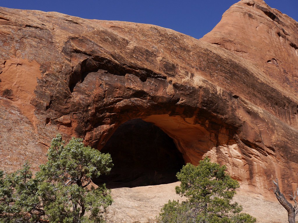
Photo: usareisetipps via Flickr (CC BY-SA 2.0)
The question behind a How Get Arches National search has a counterintuitive answer: the closest airport does not always produce the easiest trip. Arches National Park sits beside Moab, Utah, but its small regional airport has limited service, while larger airports require several hours of driving. Flight schedules, rental car availability, winter weather, and the direction of a longer Utah road trip should guide the decision.
The park entrance is on U.S. Route 191, about 5 miles north of central Moab. From there, one paved road climbs into a landscape of Entrada Sandstone fins, balanced rocks, and more than 2,000 documented natural arches. There is no road connection through Arches to Interstate 70, and reaching most viewpoints requires a private vehicle, bicycle, commercial tour, or considerable walking.
How to Get to Arches National Park: Airports, Roads and Getting Around by Air
Most visitors choose among Canyonlands Regional Airport, Grand Junction Regional Airport, and Salt Lake City International Airport. Canyonlands Regional is nearest, but limited routes and vehicle inventory can outweigh the short drive. Grand Junction often provides the best balance of road time and flight options, while Salt Lake City works well for trips combining Arches with other Utah parks.
Airport distances and approximate driving times
These estimates lead to the Arches entrance rather than a hotel in Moab. They assume normal traffic and dry pavement, with no meal, fuel, or sightseeing stops. Construction, storms, and congestion around the entrance can add time.
| Airport | Approximate distance | Typical drive | Best use |
|---|---|---|---|
| Canyonlands Regional Airport | About 14 miles | 20 minutes | Shortest transfer when schedules and rental cars align |
| Grand Junction Regional Airport | About 110 miles | 1 hour 45 minutes | Convenient regional access from the east |
| Salt Lake City International Airport | About 230 miles | 4 hours | Broader flight selection and Utah road trips |
| Denver International Airport | About 355 miles | 5 hours 30 minutes | Colorado and eastern Utah itineraries |
| Harry Reid International Airport in Las Vegas | About 460 miles | 7 hours | Long trips linking several Southwest parks |
How to Get to Arches National Park from Canyonlands Regional Airport
Canyonlands Regional Airport lies north of the park along U.S. 191. The drive is direct: leave the airport area, turn south toward Moab, and watch for the signed park entrance on the left before reaching town. Confirm current flight schedules, rental car availability, entrance procedures, fees, and any seasonal reservation system on the official park site and with the relevant transport provider.
When the closest airport makes sense
This option works best for a short Arches focused visit when a suitable flight and rental vehicle are available. Arrange the car before purchasing a restrictive airfare because walking from the airport is impractical. The highway has fast traffic, exposed shoulders, and no continuous pedestrian route into the park. Rideshare availability is also too inconsistent to form the backbone of a park itinerary.
Choosing between Grand Junction and Salt Lake City
Grand Junction provides a straightforward approach along Interstate 70 and U.S. 191. Salt Lake City involves a longer drive via Interstate 15, U.S. Route 6, Interstate 70, and U.S. 191, but it generally gives travelers more flexibility when comparing flights and vehicles. Visitors adding Capitol Reef, Bryce Canyon, or Zion can also use Salt Lake City to build an efficient one way or circular Utah itinerary.
How to Get to Arches National Park by Road
Every conventional paved approach eventually reaches U.S. 191. From Interstate 70, drivers take Exit 182 and travel south toward Moab. Travelers arriving from Monument Valley, Monticello, or the Needles district of Canyonlands follow U.S. 191 north through Moab. The entrance road is suitable for ordinary passenger vehicles under normal conditions.
The northern approach from Interstate 70
The northern route crosses open desert between Crescent Junction and the park. Services are sparse, and summer temperatures regularly exceed 100°F in exposed low elevations. Begin this segment with enough fuel and drinking water, especially when arriving late. Drivers coming from Denver must also account for high mountain weather along Interstate 70, including snow and ice around the Continental Divide and Vail Pass.
From Grand Junction or Denver
Follow Interstate 70 west into Utah, then turn south at Exit 182. Scenic Utah Route 128 also reaches Moab from Interstate 70 by following the Colorado River, but it is slower, narrower, and more winding. Use Route 128 when daylight and sightseeing time permit. U.S. 191 is the clearer choice after dark or when reaching a timed activity matters.
The southern approach through Moab
Northbound visitors pass directly through Moab before reaching Arches. Traffic lights, pedestrians, cyclists, and turning vehicles make this section slower than its mileage suggests. Stock up in town because most park destinations lie beyond the entrance with limited opportunities for supplies. Groceries, fuel, ice, meals, and outdoor equipment are easier to obtain in Moab than inside the park.
Road conditions that can change the plan
Paved highways remain the standard approach in every season, but weather creates different hazards. Summer heat strains tires and cooling systems. Autumn brings shorter daylight. Winter storms can leave shaded pavement icy, particularly at higher points inside the park. Intense thunderstorms may send water and debris across low roads, so drivers should never enter flowing water or move around a closure barrier.
- Download offline maps before leaving an airport or Interstate 70.
- Refuel before entering the park, even when the gauge appears adequate.
- Carry at least one gallon of drinking water per person on hot days.
- Check the spare tire and rental vehicle roadside assistance information.
- Avoid unpaved shortcuts suggested by navigation apps.
How to Get to Arches National Park’s Entrance and Navigate the First Miles
Arches has one principal public entrance, reached from U.S. 191. Navigation apps sometimes confuse it with roads near the Colorado River, the Moab Brands trail system, or unpaved routes along the park boundary. Set the destination to the Arches National Park entrance or visitor center, then verify that the final approach remains on U.S. 191.
How to Get to Arches National Park: Airports, Roads and Getting Around after the gate
The paved park road gains elevation quickly from the visitor center area, climbing switchbacks onto the sandstone plateau. Arches ranges from roughly 4,085 to 5,653 feet in elevation, so conditions can be cooler and windier above the entrance. The main road continues toward Devils Garden, with branches serving The Windows, Wolfe Ranch, and the Delicate Arch trailhead.
Follow the park in geographic order
First time visitors can reduce backtracking by grouping stops along the road rather than jumping between famous landmarks. A practical outward sequence is Park Avenue, Courthouse Towers, Balanced Rock, The Windows and Double Arch, Wolfe Ranch for Delicate Arch, and Devils Garden. Delicate Arch requires a separate side road, while Landscape Arch is reached from the Devils Garden trailhead near the road’s far end.
- Stop at the visitor center area before beginning the steep climb.
- Use Park Avenue and Courthouse Towers as early roadside stops.
- Turn toward The Windows for several short trails in one compact area.
- Continue to Wolfe Ranch for the 3 mile round trip Delicate Arch hike.
- Finish at Devils Garden, where the Landscape Arch route begins.
The climb above Moab
Beyond the entrance, the road curls upward beneath tall red walls. The engine works harder, the town drops out of sight, and traffic noise gives way to wind moving across exposed stone. Near Park Avenue, the pavement meets a broad canyon framed by monoliths that resemble a city skyline. Summer heat radiates from the asphalt and sandstone, while winter shade can preserve ice long after sunny sections have dried.
Choose the Right Way to Move Through the Park
Arches Scenic Drive runs approximately 18 miles from the entrance area to Devils Garden. A complete out and back drive therefore covers about 36 miles before adding side roads to The Windows or Delicate Arch. A private vehicle gives hikers the most control over departure times, water, and gear, but commercial tours can solve the driving problem for visitors arriving in Moab without a rental car.
Match each road stop to its walking commitment
Roadside overlooks require little time, while the major arches involve distinct trail distances and exposure levels. The table below helps prevent a common planning error: treating every named stop as a quick viewpoint. Distances are approximate, measured from the entrance, and walking figures are round trip unless noted otherwise.
| Destination | Approximate road distance | Typical walking commitment |
|---|---|---|
| Park Avenue | 2 miles | Overlook or 1 mile one way trail |
| Balanced Rock | 9 miles | 0.3 mile loop |
| The Windows | 12 miles | About 1 mile for the main loop |
| Delicate Arch | 13 miles | 3 miles with roughly 480 feet of ascent |
| Devils Garden | 18 miles | About 1.9 miles to Landscape Arch |
Understand the alternatives to driving
Arches has no internal public bus connecting its trailheads. Bicycles can cover paved roads, but riders face sustained climbing, narrow shoulders, fast vehicles, wind, and long exposed sections without shade. A commercial sightseeing or hiking tour is usually the practical car free option because it includes transportation from Moab. Airport transfers or taxis only solve the trip to town unless a driver specifically agrees to remain available for park travel.
Plan Around Parking Rather Than Mileage
A map can make the park look compact, yet parking determines how quickly visitors move between its major sites. The Windows, Delicate Arch trailhead, and Devils Garden concentrate many vehicles into finite lots. Circling repeatedly wastes fuel and can obstruct traffic. Build flexibility into the order of stops so a full lot becomes a reason to continue to another destination rather than wait in the roadway.
Protect the hikes that matter most
Schedule the longest or highest priority hike first, then fit roadside overlooks around it. Delicate Arch crosses open slickrock with minimal shade, making heat and sun exposure more consequential than the mileage suggests. Devils Garden offers several turnaround points, so visitors can shorten the outing after Landscape Arch if temperatures rise or time runs short. Carry a headlamp when beginning before sunrise or finishing near dusk.
Use a simple parking fallback sequence
Drivers should know what they will do before encountering a full lot. Safe alternatives depend on available legal parking, not proximity to the trail. Road shoulders can damage desert vegetation and may block emergency access.
- Pass the full lot without stopping in the travel lane.
- Continue to the next planned overlook or trailhead.
- Revisit the original stop later if the itinerary and entry conditions allow.
- Never create a parking space on biological soil crust or unsigned ground.
Prepare the Vehicle and a Backup Plan
An ordinary passenger car can reach the principal developed destinations on pavement. Four wheel drive does not improve access to Delicate Arch, The Windows, or Devils Garden because each uses the main paved road system. Vehicle size matters more than drivetrain. Long recreational vehicles require additional turning room, and crowded lots may offer fewer workable spaces than drivers expect.
Avoid navigation and fuel mistakes
The most useful answer to a How Get Arches National query includes what to carry after arrival. Cellular coverage can weaken among sandstone walls, so save the park map offline and photograph the posted map near the entrance. Arches has no through road, meaning every driver returns toward U.S. 191. Begin with sufficient fuel for the scenic drive, side roads, idling, and a return to Moab.
- Pack charging cables and a vehicle power adapter.
- Keep drinking water inside the passenger compartment during freezing weather.
- Carry a windshield shade during summer because parked interiors heat rapidly.
- Bring traction devices for footwear when winter ice affects shaded trails.
- Store the rental company’s roadside assistance number offline.
Respond safely to weather and road interruptions
If rain produces flowing water or debris across pavement, stop at a safe location and follow ranger or law enforcement direction. Sandstone channels can collect runoff from storms occurring beyond the visible horizon. During winter, delay steep interior driving until icy sections improve rather than assuming sunlight has cleared every curve. When access is interrupted, return to Moab instead of testing boundary roads or navigation app shortcuts.
Build an Arches Arrival Plan That Holds Up
Choose the airport by total travel time, rental vehicle certainty, and the direction of the wider itinerary. Approach the entrance on U.S. 191, arrive with fuel and water, then account for the 36 mile scenic road round trip plus side roads. Inside the park, prioritize one major hike, treat parking as a variable, and keep shorter stops available as flexible alternatives.
A reliable plan also recognizes the park’s physical limits. There is one principal entrance, no internal transit network, and no paved shortcut back to Interstate 70. Offline directions, realistic walking estimates, and a clear parking fallback turn those constraints into manageable decisions. With those pieces settled before departure, the journey from airport gate to sandstone trailhead becomes far easier to execute.
Want to keep exploring? Browse all our Arches guides and articles for more trip-planning tips and ideas.
Gear & Essentials
Tell us about your trip and we will add what else you will want:
The basics
Worth having in the car whatever the park.
For this trip
Traveling with kids
Bringing a pet
RVing
Backcountry
Winter conditions
On the water
Photography
Accessibility
As an Amazon Associate we earn from qualifying purchases, at no extra cost to you.