Arches National Park and Canyonlands National Park: How to Visit Both on One Trip
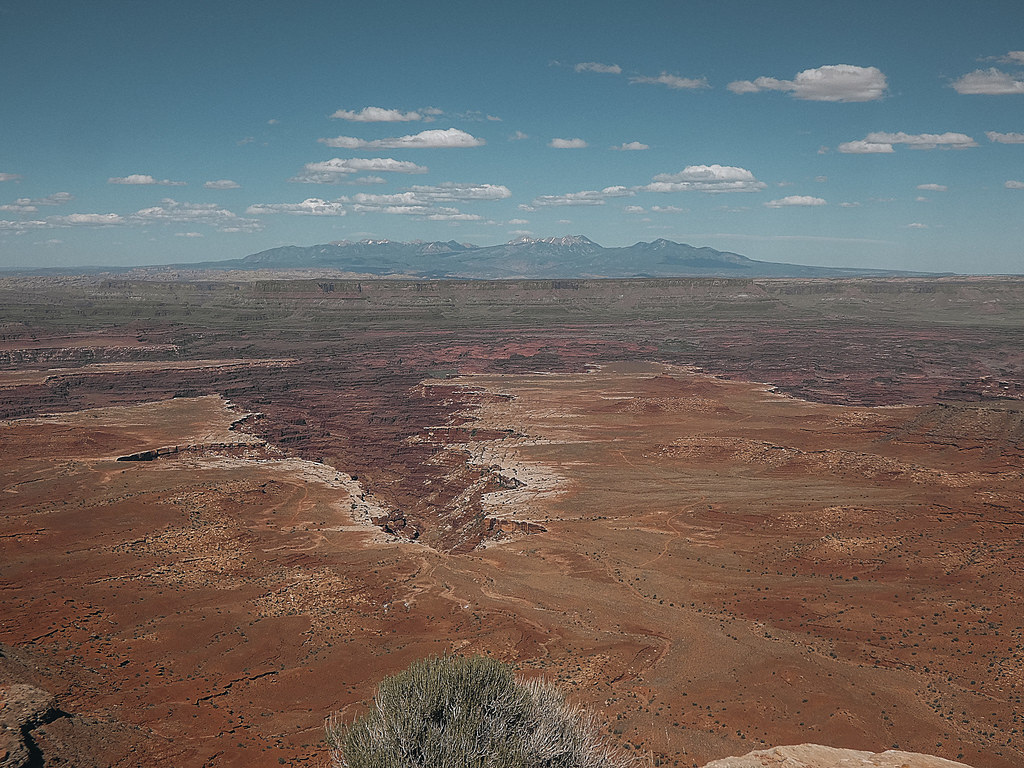
Photo: concrete&fells via Flickr (CC BY 2.0)
An Arches National Park Canyonlands trip fits comfortably into one itinerary when you allow at least two full sightseeing days and use Moab as your base. Spend one day along the 18-mile Arches Scenic Drive, then devote the next to Canyonlands’ Island in the Sky district. Three or four days provide enough time for longer hikes, sunrise or sunset outings, and delays caused by heat, wind, or crowded parking areas. The two parks protect different expressions of southeastern Utah’s sandstone landscape. Arches contains more than 2,000 documented natural arches among Entrada Sandstone fins, while Canyonlands surrounds immense plateaus and canyons.
The two parks protect different expressions of southeastern Utah’s sandstone landscape. Arches contains more than 2,000 documented natural arches among Entrada Sandstone fins, while Canyonlands surrounds immense plateaus and canyons carved by the Colorado and Green rivers. Their entrances look close on a regional map, but Canyonlands has four districts with no direct roads between them. Choosing the correct district is the first important planning decision.
How the Arches National Park and Canyonlands National Park layout works
Moab is the practical hub for this trip. The town sits on U.S. Route 191, approximately 5 miles south of the Arches entrance and 32 miles from the Island in the Sky Visitor Center. Fuel, groceries, restaurants, lodging, campgrounds, and outdoor equipment are concentrated here. Staying in town also avoids changing accommodations between park days, which saves valuable early-morning driving time.
Arches is one connected scenic-drive park
Most Arches visits follow the paved Arches Scenic Drive from the entrance area to Devils Garden. Side roads reach The Windows, Delicate Arch, and Wolfe Ranch. The elevation rises from roughly 4,085 feet near the visitor center to more than 5,600 feet near Devils Garden, so temperatures and wind can differ noticeably across the park. Key short walks include The Windows loop, about 1 mile, and the 1.9-mile round trip to Landscape Arch.
Canyonlands requires a district choice
Island in the Sky is the correct Canyonlands district for most combined trips. Its paved roads reach Mesa Arch, Green River Overlook, Grand View Point, and views into the Shafer and White Rim canyons. The Needles district lies roughly 75 road miles from Moab and deserves a separate full day. The remote Maze requires considerably more time, specialized route planning, and usually a high-clearance four-wheel-drive vehicle. The rivers form a fourth district accessed primarily by boat.
Arches National Park and Canyonlands drive-time comparison
| Route | Approximate distance | Typical drive | Planning implication |
|---|---|---|---|
| Moab to Arches entrance | 5 miles | 10 minutes | Easy to reach before sunrise |
| Moab to Island in the Sky Visitor Center | 32 miles | 40 to 45 minutes | Allow extra time for overlooks along Utah Route 313 |
| Arches entrance to Island in the Sky Visitor Center | About 26 miles | 35 to 40 minutes | Possible on one long day, but rushed |
| Moab to The Needles | About 75 miles | Approximately 1.5 hours | Plan a dedicated day rather than combining it with Arches |
How many days to spend in Arches National Park and Canyonlands
Two days is the functional minimum for seeing the principal paved-road sights without reducing both parks to windshield views. We recommend three days for first-time visitors. That schedule creates room for Delicate Arch, Devils Garden, Mesa Arch, and Grand View Point while preserving flexibility around midday heat and parking congestion.
A two-day trip covers the major landmarks
Use the first day for Arches because its trailheads and viewpoints are arranged along a single road. A focused itinerary can include Park Avenue, Balanced Rock, The Windows, Delicate Arch Viewpoint or the full Delicate Arch hike, and Devils Garden. Reserve the second day for Island in the Sky, pairing the 0.6-mile Mesa Arch loop with Green River Overlook and the approximately 1.8-mile Grand View Point trail.
Three days allow better hiking and timing
With a third day, split Arches into northern and southern sections or add a second Canyonlands outing. Strong hikers can complete more of the Devils Garden Primitive Loop, approximately 7.8 miles, while avoiding the hottest afternoon hours. In Canyonlands, the 1.4-mile Aztec Butte route introduces ancestral Puebloan granaries and exposed slickrock travel. A spare evening can also be used for sunset without forcing a dark drive immediately after a full hiking day.
Four days make The Needles practical
Add The Needles only when the trip includes at least four full days. The district’s sandstone spires, grassland benches, and Cedar Mesa Sandstone formations differ substantially from Island in the Sky. Chesler Park and the Joint Trail form the area’s signature backcountry experience, but common route combinations exceed 10 miles. Shorter options include the 2.4-mile Slickrock Trail and the roughly 2.6-mile Cave Spring loop, where ladders and slickrock ledges require steady footing.
A realistic itinerary for Arches National Park and Canyonlands National Park
Assign each full day to one park rather than crossing between them at midday. Parking turnover can be slow at Delicate Arch, The Windows, and Mesa Arch, and the transfer consumes the part of the day when trailheads are busiest. Keeping the days separate also makes it easier to carry the correct water, food, and layers without returning to Moab.
Day one follows the Arches Scenic Drive
- Begin with Park Avenue or the Courthouse Towers viewpoints while low-angle light defines the sandstone walls.
- Continue to Balanced Rock and The Windows before their compact parking areas fill.
- Hike Delicate Arch early or late. The trail is 3 miles round trip with about 480 feet of climbing and prolonged sun exposure.
- Finish near Devils Garden, where Landscape Arch provides a relatively moderate walk and longer routes continue across fins and exposed slickrock.
Delicate Arch has almost no shade, and the final approach crosses a sloping sandstone bench before following a narrow ledge. The arch appears suddenly around the last rock corner, standing above a broad slickrock bowl with the La Sal Mountains beyond. Boots grip coarse sandstone underfoot, wind funnels across the opening, and the exposed basin makes the final few hundred yards feel larger than the map suggests.
Day two concentrates on Island in the Sky
Start near Mesa Arch, then drive south toward Grand View Point, stopping at Buck Canyon Overlook and Orange Cliffs Overlook when visibility is clear. At Grand View Point, the mesa edge stands roughly 1,000 feet above the surrounding canyon country. The Colorado River remains mostly hidden inside deeper canyons, but the branching drainage patterns and distant Needles formations reveal the scale of erosion far better than a roadside photograph can.
Arches National Park and Canyonlands reservations, roads, and trip preparation
Arches may use timed-entry reservations during busy periods, while entrance fees, campground procedures, road work, and ranger-service schedules can change. Check both parks on the official National Park Service site before finalizing the sequence of your days. A reservation for Arches does not cover Canyonlands, and a lodging reservation in Moab does not guarantee park entry under any active access system.
Match the vehicle to the roads you intend to drive
Standard passenger cars can reach the primary attractions along Arches Scenic Drive and the paved Island in the Sky roads. Unpaved routes require a separate assessment. Shafer Trail, White Rim Road, Potash Road, and backcountry roads in The Needles can include steep grades, ledges, deep sand, washouts, or clay that becomes impassable when wet. A rental vehicle’s ground clearance does not automatically make it suitable, and many rental agreements prohibit off-pavement travel.
Carry supplies for exposed desert terrain
- Water: Carry enough for the drive and the hike. Do not plan around finding drinking water at every trailhead.
- Sun protection: Use a wide-brimmed hat, sunglasses, sunscreen, and clothing that covers exposed skin.
- Navigation: Download park maps before leaving Moab because mobile coverage is unreliable inside both parks.
- Food: Pack lunch and salty snacks so a return to town does not divide the sightseeing day.
- Layers: Bring a wind-resistant outer layer. High mesas can feel cold at sunrise even after a warm afternoon.
- Footwear: Choose shoes with dependable traction for sand-covered slickrock, ledges, and uneven stone steps.
Choose dates around heat, storms, and daylight
Spring and autumn offer the broadest hiking windows, but elevation creates meaningful differences between the parks. Island in the Sky sits near 6,000 feet, roughly 2,000 feet above Moab, and can be cold or windy while lower trails feel comfortable. From March through May, expect freezing mornings, mild afternoons, and occasional late snow on shaded slickrock. September through October usually brings cooler hiking weather and shorter daylight, making early starts important for longer Devils Garden or Needles routes.
Summer requires a split-day schedule
June through August temperatures around Moab commonly exceed 100 degrees Fahrenheit, and exposed sandstone radiates heat after the air begins cooling. Finish strenuous hiking by late morning, rest in Moab during the hottest hours, and return for overlooks or short walks near evening. One gallon of water per person is a sensible starting point for a full summer day, with additional water needed during sustained exercise. Electrolytes and salty food help replace what heavy sweating removes.
Storms affect each park differently
Thunderstorms are especially important from July into September. Avoid exposed rims, isolated arches, and broad slickrock when thunder is audible. In Arches, water can race through washes and low trail sections even when rain falls upstream. At Island in the Sky, lightning exposure is the greater concern along Grand View Point and other open mesa edges. Winter visitors should expect ice on north-facing slopes, including the final approach to Delicate Arch and shaded sections of Devils Garden.
| Period | Typical challenge | Best adjustment |
|---|---|---|
| March to May | Cold mornings and variable wind | Carry warm layers and begin with lower-elevation stops |
| June to August | Extreme heat and afternoon storms | Hike near dawn, rest midday, and monitor clouds |
| September to October | Shortening daylight | Set a turnaround time before starting longer trails |
| November to February | Snow, ice, and limited daylight | Use traction when needed and select sun-exposed walks |
Avoid the mistakes that consume a park day
The most damaging planning error is measuring the trip by entrance-to-entrance drive time. Reaching the Arches entrance does not place you near Devils Garden, and arriving at Island in the Sky still leaves substantial driving between Mesa Arch and Grand View Point. Build the itinerary around trailhead arrival times rather than departure from Moab. Leave room for photography stops, slower vehicles, wildlife, and the walk from an overflow parking position.
Do not treat every slickrock route as an ordinary path
Cairns often mark routes across bare sandstone where no dirt tread exists. Watch for the next marker before leaving the current one, particularly on Devils Garden’s primitive sections and the Aztec Butte route. Do not construct, move, or dismantle cairns. Steep fins, drop-offs, and sand over rock can slow a group substantially. If the route becomes unclear, return to the last confirmed marker instead of following footprints, which may lead toward viewpoints rather than the trail.
Protect biological soil and archaeological places
Dark, knobby biological soil crust contains cyanobacteria, lichens, mosses, and fungi that stabilize desert soil and retain moisture. A single footprint can damage growth that took decades to develop. Remain on established trails, bare rock, or sandy washes. At Aztec Butte and sites in The Needles, observe granaries, rock imagery, and artifacts without touching or entering structures. Oils from hands, climbing pressure, and displaced stones accelerate deterioration at places that have endured for centuries.
Build backup plans before leaving Moab
A flexible Arches National Park Canyonlands trip needs alternatives for full parking areas, high wind, poor visibility, and tired legs. Decide on substitutes while you still have mobile service. This prevents an hour of roadside discussion and keeps the day moving. Pair each demanding hike with a shorter nearby option, and set a firm turnaround time based on daylight, temperature, and the slowest member of the group.
Use nearby alternatives when a trailhead is full
Inside Arches
If The Windows area is congested, continue toward Delicate Arch Viewpoint or Devils Garden and return later rather than waiting in a travel lane. Sand Dune Arch provides a short, sandy walk between fins, while the Broken Arch route can be expanded into a longer loop when conditions are comfortable. If strong wind makes exposed fins unpleasant, choose lower, sheltered terrain and avoid standing beneath visibly fractured rock edges.
At Island in the Sky
If Mesa Arch is crowded, continue to Green River Overlook, where the view extends across Stillwater Canyon toward the distant Orange Cliffs. White Rim Overlook offers a roughly 1.8-mile round trip with expansive views east toward the Colorado River canyons. When haze obscures distant scenery, focus on closer geological features at Upheaval Dome, a deeply eroded structure about 3 miles wide whose origin has been linked to a meteorite impact.
Know when to shorten the day
Turn back when thunder begins, water supplies reach the halfway point, route markers become difficult to follow, or a hiker shows heat illness symptoms. Headache, nausea, dizziness, confusion, and loss of coordination require immediate attention. Move the person into shade, cool the skin, and seek emergency help for confusion or worsening symptoms. Mobile service is unreliable, so tell someone your route and return time before entering a longer trail.
Putting your Arches National Park and Canyonlands trip plan together
The strongest itinerary gives Arches and Island in the Sky separate days, places exposed hikes in the coolest hours, and keeps one shorter alternative ready for every major trail. Add The Needles only when the schedule supports its longer drive and trail network. This structure preserves time for the geological differences that make the pairing worthwhile, from Entrada Sandstone arches to the layered canyons cut around the Colorado and Green rivers.
Use Moab for resupply, download maps before departure, and make each morning’s plan the night before. Check the forecast, identify the first trailhead, calculate the return before dark, and pack water and food for the entire outing. With those decisions settled, Arches National Park and Canyonlands National Park can share one trip without either park feeling rushed or reduced to a quick roadside stop.
Want to keep exploring? Browse all our Canyonlands guides and articles for more trip-planning tips and ideas.
Gear & Essentials
Tell us about your trip and we will add what else you will want:
The basics
Worth having in the car whatever the park.
For this trip
Traveling with kids
Bringing a pet
RVing
Backcountry
Winter conditions
On the water
Photography
Accessibility
As an Amazon Associate we earn from qualifying purchases, at no extra cost to you.