5 Best Hikes in Acadia National Park
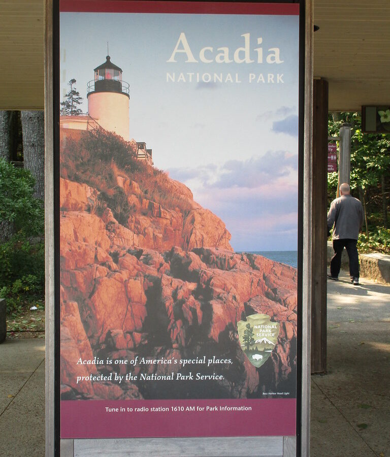
Photo: jaygannett via Flickr (CC BY-SA 2.0)
The Best Hikes Acadia National Park offers combine exposed granite summits, wave-cut shoreline, glacial lakes, and quieter western mountains. Our five picks are the Beehive Loop, Ocean Path, Jordan Pond Path, Cadillac Mountain South Ridge Trail, and Beech Mountain Loop. Together, they cover Acadia’s defining landscapes while providing choices for hikers who prefer iron rungs, sustained climbing, level paths, or short family outings.
All five are on Mount Desert Island, the park’s largest and most visited section. Bar Harbor provides the most convenient base for the eastern trails, while Southwest Harbor and other western island communities shorten the drive to Beech Mountain. Trailheads that appear close on a map can be separated by slow park roads, limited parking, and summer congestion, so organize each day around one area rather than crossing the island repeatedly.
How Acadia’s landscape shapes the hiking
Glaciers carved the routes hikers follow today
Acadia’s mountains are compact, but their steep sides create more effort than their elevations suggest. Cadillac Mountain reaches 1,530 feet, the highest point on Mount Desert Island, while the Beehive rises only 520 feet. Both involve abrupt granite slopes. During the last Ice Age, glaciers widened valleys, rounded summits, and excavated basins such as Jordan Pond. The result is a trail system where hikers can move quickly from sea level to open rock, often without the long forest approaches found in larger mountain ranges.
Pink granite, spruce forest, and exposed coastline
Much of eastern Mount Desert Island is underlain by coarse Cadillac Mountain granite, recognizable by its pink feldspar crystals. Tree roots find shallow purchase in cracks, leaving summits exposed to wind and weather. At lower elevations, red spruce, balsam fir, white pine, birch, and maple form dense forests. Ocean Path adds another environment entirely, following a shore shaped by frost, waves, and repeated storm action. These transitions are a central reason short Acadia hikes feel unusually varied.
The 5 Best Hikes in Acadia National Park at a Glance
This selection balances scenery, physical challenge, and geographic variety. Distances and elevation gains are approximate because connecting trails can change the final total. The difficulty ratings account for exposure and footing as well as mileage. A short iron-rung climb can demand more confidence than a longer, steadily graded mountain trail.
| Hike | Approximate distance | Elevation gain | Difficulty | Defining experience |
|---|---|---|---|---|
| Beehive Loop | 1.4 miles | 450 feet | Strenuous | Iron rungs and exposed ledges |
| Ocean Path | 4.4 miles round trip | About 200 feet | Easy to moderate | Granite headlands and surf |
| Jordan Pond Path | 3.3 miles | About 100 feet | Moderate | Glacial lake and mountain views |
| Cadillac South Ridge Trail | 7.1 miles round trip | About 1,350 feet | Strenuous | Long granite ascent to Acadia’s highest summit |
| Beech Mountain Loop | 1.2 miles | About 350 feet | Moderate | Western island forest and fire tower |
Choosing Among the Best Hikes Acadia National Park Offers
Choose Ocean Path for coastal scenery with flexible turnaround points, or Jordan Pond Path for a complete lake circuit with minimal climbing. Cadillac South Ridge suits hikers who want a sustained half-day ascent. Beech Mountain delivers a summit quickly and usually feels calmer than the eastern park corridor. The Beehive belongs on an itinerary only when everyone in the group is comfortable climbing steep rock beside open drops.
Understanding Acadia’s difficulty ratings
Rock slabs become slick during rain, and polished granite can remain wet after surrounding soil begins drying. Roots, uneven stone steps, and bog bridges add complexity to otherwise gentle routes. Acadia also has several historic ladder trails built with iron rungs, including the Beehive and Precipice Trail. Dogs, small children, and hikers with a strong fear of heights should avoid those routes. Elevation gain alone does not capture their exposure.
Planning Your 5 Best Hikes in Acadia National Park
Group the Best Hikes in Acadia National Park by Corridor
Pair the Beehive with Ocean Path because both begin along Park Loop Road near Sand Beach. Jordan Pond lies farther west on the same general loop and works well as a separate morning or late-afternoon outing. Cadillac South Ridge begins near Route 3, south of the mountain’s summit road. Beech Mountain is in the quieter western half of Mount Desert Island, roughly a 30 to 35 minute drive from Bar Harbor before summer traffic develops.
Parking, buses, and current access rules
Sand Beach, Jordan Pond, and Cadillac Mountain become congested early on summer and fall weekends. Acadia’s seasonal bus network can reduce parking problems, although routes do not serve every trailhead equally. Summit-road vehicle reservations do not replace the park entrance pass and generally do not apply to hikers approaching Cadillac on foot. Entrance fees, road arrangements, bus schedules, and temporary trail closures can change, so confirm current details on the official park site.
What to carry on Acadia’s granite trails
- Footwear with dependable traction: Smooth soles perform poorly on damp granite, wooden bridges, and root-covered descents.
- Water: Exposed summits offer little shade, and reliable natural water sources are limited along these routes.
- Wind layer: Conditions on Cadillac or Beech Mountain can feel markedly colder than sheltered trailheads.
- Printed or downloaded map: Intersecting paths and carriage roads make accidental detours easy.
- Sun protection: The Beehive and Cadillac South Ridge include long stretches without forest cover.
Late spring often brings mud, wet rock, and black flies. July and August deliver the warmest conditions and heaviest visitation. September commonly combines cooler hiking temperatures with stable footing, while October foliage draws another surge of visitors. Snow and ice can persist on shaded steps outside the main season. Our spring and summer Acadia overview provides additional seasonal context.
Beehive Loop: Acadia’s signature iron-rung climb
Route from Sand Beach to the summit
The Beehive Trail begins near the Sand Beach parking area and climbs the south face of the mountain using stone steps, narrow ledges, and fixed iron rungs. Hikers should ascend this section rather than descend it. From the 520-foot summit, continue toward The Bowl, a small glacial pond, then return through forest to complete the loop. Starting early reduces encounters on narrow passages where passing can be awkward.
What the exposed section feels like
The forest drops away quickly, and rough granite replaces the soft needle-covered approach. Iron bars feel cool under your hands, while boots search for shallow footholds cut into the rock. Below, Sand Beach forms a pale crescent between Great Head and the cliffs of Ocean Drive. Wind reaches the open face without obstruction, and the sound of surf rises from far below. The climb is brief, but the combination of height and restricted movement makes it mentally demanding.
When to choose another trail
Skip the Beehive during rain, ice, strong wind, or poor visibility. The route is also unsuitable for dogs because several rung sequences require human reach and controlled climbing. Families uncertain about exposure can hike toward The Bowl from the rear and approach the summit by less exposed connecting trails. Nearby Gorham Mountain provides another rocky summit experience without the Beehive’s vertical rung sections.
Ocean Path and Jordan Pond reveal Acadia at water level
These two routes trade exposed summits for close views of the forces that shaped Mount Desert Island. Ocean Path follows the Atlantic edge through spruce forest and open granite, while Jordan Pond Path circles a glacial basin between Penobscot Mountain and Pemetic Mountain. Both can become crowded near their main access points, yet hikers who complete the full routes encounter quieter stretches beyond the first viewpoints.
Reading the coastline along Ocean Path
Ocean Path runs about 2.2 miles one way from Sand Beach to Otter Point. Thunder Hole lies roughly one third of the way along the route, where waves compress air inside a narrow rock inlet. Its characteristic boom depends on swell direction, wave size, and tide, so high tide alone does not guarantee dramatic action. Continue past Monument Cove to Otter Cliff, where the vertical granite face rises approximately 110 feet above the water.
Stay on the marked path and established overlooks. Storm waves can sweep across apparently dry ledges, particularly around Thunder Hole and Otter Point. Walking south from Sand Beach keeps the ocean on the left and places the broadest views ahead. Return on foot for the complete shoreline experience, or use the seasonal bus when its route and schedule fit your plan.
Handling the varied footing around Jordan Pond
The western shore of Jordan Pond follows a relatively smooth gravel path beneath Penobscot Mountain. At the northern end, narrow bog bridges cross wet ground near the outlet streams. The eastern shore is slower, with angular boulders and uneven stone steps below Pemetic Mountain. Traveling clockwise places the easier walking first and saves the roughest footing for the second half. Swimming is prohibited because the pond serves as a public water supply.
Cadillac South Ridge rewards steady pacing
Cadillac South Ridge begins near Route 3 and reaches the summit without using the mountain road. The climb passes Eagle’s Crag, the shallow pond called the Featherbed, and extensive granite ridges marked by cairns and blue trail blazes. Forest cover becomes intermittent higher on the mountain, exposing hikers to sun and wind well before they reach the developed summit area.
Divide the ascent into natural stages
The lower trail rises gradually through conifers before emerging onto ledges near Eagle’s Crag. The Featherbed provides a useful rest point, although its water should never be treated as potable without filtration or purification. Above the pond, navigation requires attention because granite surfaces can make the tread less obvious. Follow constructed cairns rather than building new stacks, which can misdirect hikers and disturb fragile summit vegetation.
Match the hike to daylight and weather
Allow roughly four to five hours for a comfortable round trip, adding time for summit views and breaks. Fog can erase visual landmarks, while wind across the upper ridge makes cool days feel significantly colder. Seasonal conditions affect the route in different ways:
| Period | Likely trail conditions | Planning priority |
|---|---|---|
| Late spring | Wet roots, mud, lingering ice in shaded areas | Carry traction when freezing nights persist |
| Summer | Warm exposed rock and limited shade | Start early and carry sufficient water |
| Early fall | Cooler temperatures and shorter daylight | Pack a headlamp and wind layer |
| Late fall | Ice, strong wind, and rapid weather changes | Use conservative turnaround times |
Beech Mountain provides a quieter western summit
Beech Mountain stands west of Echo Lake in the section of Mount Desert Island commonly called the quiet side. Its summit reaches 839 feet and supports a historic fire tower. The upper platform may be inaccessible depending on conditions, but the surrounding ledges still provide clear views toward Long Pond, Mansell Mountain, Bernard Mountain, and the Cranberry Isles.
Choose the loop direction for your preferred climb
The loop’s branches differ noticeably. One side climbs steep stone steps and exposed granite, while the other follows a more gradual forested grade. Hikers who prefer ascending the steepest terrain should take the shorter, rockier branch uphill and use the gentler branch for the descent. Watch carefully at junctions because Beech Mountain Trail, Valley Trail, and Beech Cliff connections create longer alternatives.
Build a western island hiking day
Beech Mountain combines well with stops around Echo Lake and Long Pond, reducing time spent driving back through the busy eastern corridor. A practical day can include:
- Climb Beech Mountain in the morning, before exposed ledges warm in direct sun.
- Descend carefully through the mixed spruce and hardwood forest.
- Eat lunch at an established picnic area rather than on fragile summit vegetation.
- Choose a short waterside walk near Echo Lake instead of returning immediately to Park Loop Road.
This side of the island supports red spruce, northern white cedar, paper birch, and low blueberry shrubs. Peregrine falcons and ravens may pass over the open ridges, while white-tailed deer are more likely near forest edges. Give all wildlife room and keep food secured, particularly at trailheads where animals can associate parked vehicles with meals.
Choosing Among the 5 Best Hikes in Acadia National Park
Readers comparing the Best Hikes Acadia National Park has to offer should match the route to exposure tolerance, footing, and available time. The Beehive demands comfort with heights. Cadillac South Ridge requires endurance and weather awareness. Ocean Path emphasizes coastal geology, Jordan Pond rewards careful movement over mixed surfaces, and Beech Mountain supplies a compact summit outing away from the busiest corridor.
Organize each day geographically, begin earlier than the main visitor rush, and keep an alternative ready for wet granite or poor visibility. Acadia’s modest elevations can disguise serious exposure, abrupt weather changes, and technical footing. A realistic route choice leaves enough time to study the shoreline, forests, glacial basins, and granite ridges that make these five hikes distinct.
Want to keep exploring? Browse all our Acadia guides and articles for more trip-planning tips and ideas.
Gear & Essentials
Tell us about your trip and we will add what else you will want:
The basics
Worth having in the car whatever the park.
For this trip
Traveling with kids
Bringing a pet
RVing
Backcountry
Winter conditions
On the water
Photography
Accessibility
As an Amazon Associate we earn from qualifying purchases, at no extra cost to you.