Visiting Acadia National Park with Limited Mobility: Accessible Views and Trails
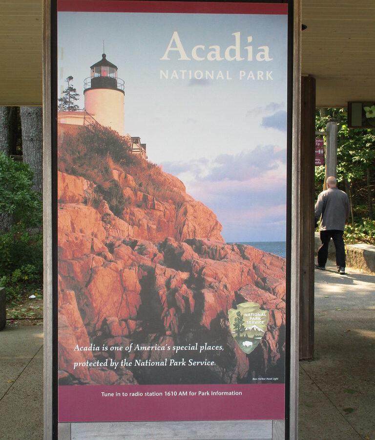
Photo: jaygannett via Flickr (CC BY-SA 2.0)
Visiting Acadia National Park can begin beside Otter Point just after sunrise, where cool salt air moves through spruce trees and waves strike the pink granite below with a low, repeating thud. The paved roadside overlooks let you experience this meeting of mountain and ocean without descending a rocky trail. From the upper viewpoints, the horizon appears first, then the scale of the cliffs becomes clear as the light reaches Great Head and the Cranberry Isles.
Acadia rewards careful route planning because its accessible experiences are distributed among mountain summits, carriage roads, shoreline pullouts, ponds, and historic garden paths. This first half explains the park’s geography, the most practical travel sequence, and the principal accessible stops along Park Loop Road. Trail surfaces and slopes can affect wheelchair users, people with balance concerns, and visitors who cannot walk far in different ways, so we describe the physical setting rather than relying on broad difficulty labels.
Understanding Acadia’s Island Geography
Most first visits concentrate on Mount Desert Island, which contains Cadillac Mountain, Jordan Pond, Sand Beach, and the ocean section of Park Loop Road. The island’s eastern side has the greatest concentration of short paths and roadside viewpoints. A separate mainland district occupies the Schoodic Peninsula, while Isle au Haut requires boat transportation and presents a less practical choice for travelers seeking developed accessible routes.
Visiting Acadia National Park by Geographic Zone
Mount Desert Island is divided by Somes Sound, a deep glacial embayment extending north from the ocean. Bar Harbor provides the most direct approach to the eastern park roads, while Southwest Harbor and Bass Harbor serve the quieter western side. Schoodic Peninsula is reached by road from the mainland and requires roughly an hour and a half of driving from Bar Harbor under ordinary conditions, despite lying only a few miles away across Frenchman Bay.
| Area | Defining experiences | Limited mobility considerations |
|---|---|---|
| Eastern Mount Desert Island | Ocean Drive, Jordan Pond, Cadillac Mountain | Highest concentration of paved overlooks, short paths, and developed stops |
| Western Mount Desert Island | Seawall, Bass Harbor, Echo Lake | Scenic driving is practical, but several famous viewpoints involve stairs or rough granite |
| Schoodic Peninsula | Open granite coast, Schoodic Point, Mount Desert Island views | Roadside scenery and broad paved areas reduce the need for long walks |
| Isle au Haut | Remote shoreline and forest trails | Boat access and rugged trails make planning substantially more complicated |
Why the Terrain Changes So Quickly
Acadia’s rounded mountains and exposed ledges were shaped by glaciers moving across resistant granite. Cadillac Mountain rises to 1,530 feet within a short distance of the sea, while valleys such as the Jordan Pond basin follow weaker rock and glacial channels. The resulting landscape creates frequent slopes, stone steps, roots, and polished bedrock. Even paths described as short may demand careful foot placement or sustained braking in a wheelchair.
Planning a Manageable Day When Visiting Acadia National Park
Park Loop Road provides the backbone of an accessible visit. The full scenic road is approximately 27 miles, although traffic patterns and one way sections affect how stops are approached. A useful plan groups nearby overlooks together, limits repeated vehicle transfers, and reserves longer rest periods for Jordan Pond or the summit of Cadillac Mountain.
A Practical Itinerary for Visiting Acadia National Park With Limited Mobility
Begin with the Ocean Drive section while parking areas are quieter, then continue toward Otter Point and Jordan Pond. Cadillac Mountain can be scheduled separately because its access road branches away from the coastal corridor. Vehicle reservations are commonly required for Cadillac Summit Road during the main visitor season, and entrance fees, reservation dates, parking arrangements, and seasonal road openings can change. Confirm current details on the official park site before finalizing the day.
- Choose three priority stops and identify nearby alternatives in case parking is unavailable.
- Place the shortest outdoor route first, when energy and balance are strongest.
- Allow extra time for unloading mobility equipment and crossing busy parking areas.
- Carry water and a warm layer in the vehicle, even when Bar Harbor feels mild.
- Use scenic pullouts between walking stops to reduce cumulative fatigue.
Weather, Crowds, and Surface Conditions
Late spring often brings cool fog, wet granite, muddy path edges, and temperatures lower than inland Maine. July and August generally provide the warmest conditions, along with the heaviest traffic. September and early October can bring clearer air and cooler walking weather. Fallen leaves may conceal roots or path edges in autumn, while ice can persist on shaded paths well after roads and sunny overlooks appear dry. Our spring and summer Acadia overview provides additional seasonal context.
Accessible Views and Trails Along Acadia’s Ocean Corridor
The eastern shoreline contains Acadia’s most efficient sequence of high impact scenery. Park Loop Road passes Sand Beach, Thunder Hole, Monument Cove, Otter Cliff, and Otter Point within a compact corridor. Many views can be seen from paved pullouts or reached by short approaches, although cross slopes, curbs, traffic, and uneven granite remain important at individual stops.
Ocean Path and Its Most Usable Sections
Ocean Path follows the coast for roughly 2.2 miles between Sand Beach and Otter Point. Walking the entire route requires about 4.4 miles round trip unless transportation is arranged at the far end. The path is generally wide and surfaced with compacted gravel, but grades, exposed roots, drainage channels, and short rough sections vary. Visitors with limited stamina can sample individual segments from roadside parking rather than committing to the complete trail.
Thunder Hole’s Upper Viewing Area
Thunder Hole is a narrow rock inlet where incoming waves compress air and water, sometimes producing a booming sound. The effect depends on swell, tide, and wind, so calm days may be quiet. A developed approach reaches the upper viewing area, while the lower platform involves a steeper descent and can become wet from spray. The upper level still provides a clear look into the inlet and along the granite coast.
Otter Cliff and Otter Point
Otter Cliff rises about 110 feet above the Atlantic and is one of the highest coastal headlands north of Rio de Janeiro along the western Atlantic coastline. Roadside viewpoints near the cliff reveal the vertical face and offshore ledges without requiring a long hike. Farther south, Otter Point has open water views and relatively direct access from nearby parking, though exposed granite beyond developed surfaces can be irregular and slippery.
Sand Beach Without the Stair Descent
Sand Beach lies between Great Head and rocky cliffs at the end of a sheltered inlet. The beach consists largely of shell fragments produced by marine organisms, mixed with eroded rock. Reaching the sand traditionally involves stairs, which can rule out a beach-level visit for some travelers. Views from the developed area above the beach still show the cove, Great Head, and Beehive cliffs, making this a worthwhile scenic stop without attempting the descent.
Cadillac Mountain and Jordan Pond
Cadillac Mountain and Jordan Pond present two different expressions of Acadia’s glacial landscape. The summit provides an elevated view across Frenchman Bay, the Porcupine Islands, and inland lakes. Jordan Pond sits in a steep-sided basin beneath the rounded granite summits known as the Bubbles. Both can be experienced without completing the rugged trails that climb into the surrounding mountains.
Visiting Acadia National Park from Cadillac Summit
Cadillac Summit Road climbs from the interior of Mount Desert Island to a developed parking area near the 1,530-foot summit. Short paved sections provide expansive views, while the complete summit loop includes uneven granite and slopes that may exceed some visitors’ comfort or equipment limits. Conditions can be colder and windier than at sea level, and fog may erase the view even when the shoreline below remains clear.
From the developed summit area, focus on the eastern viewpoints toward Bar Harbor and Frenchman Bay rather than treating the entire loop as necessary. Sunrise receives the most attention, but later morning often provides warmer temperatures and better visibility after fog begins to lift. Sunset introduces its own challenges because cooling granite, fading light, and concentrated traffic can complicate transfers and footing.
Jordan Pond’s Shoreline and Carriage Road Options
Jordan Pond is approximately 150 feet deep and was carved by glacial ice between Penobscot Mountain and Pemetic Mountain. The full Jordan Pond Path circles the water for roughly 3.3 miles, but its western shore includes narrow bog bridging, rocks, and root-filled sections. Visitors seeking a shorter outing can use the developed southern end for views toward North Bubble and South Bubble, then turn around before the trail becomes rougher.
Nearby carriage roads offer broad broken-stone surfaces built as part of John D. Rockefeller Jr.’s 45-mile network. Their width and lack of motor traffic can be helpful, but the roads were engineered through hilly terrain and include sustained grades. A short out-and-back excursion allows visitors to assess surface resistance and slope without becoming committed to a long circuit.
Choosing a Carriage Road Segment
Acadia’s carriage roads use compacted crushed stone over engineered foundations, a surface that drains well but creates more rolling resistance than pavement. Granite coping stones border many exposed edges, and historic stone bridges carry the roads across streams and motor routes. Gradients vary considerably, so distance alone cannot predict effort. Manual wheelchair users may need assistance on climbs that appear gradual from the starting point.
Witch Hole Pond and Eagle Lake
Witch Hole Pond is reached through the northern carriage road network and offers wetland, forest, and water views. The complete loop is about 3.3 miles, but connecting approaches can add distance and climbing. Eagle Lake has a roughly 6 mile circuit with several sustained grades. At either location, an out and back trip of 20 to 30 minutes provides a useful test of traction, vibration, and braking effort before continuing farther.
How to Evaluate the Surface
Rain can soften loose aggregate at road margins, while dry weather may leave shallow ruts and scattered gravel. Power wheelchair range also declines on sloping, unpaved surfaces. Before starting, check tire pressure, battery charge, and the location of the nearest road crossing or parking area. Visitors using walkers or canes should watch for rounded stones collecting near bridge approaches.
- Select a turnaround time before beginning.
- Stay near the firm center of the road when traffic permits.
- Yield to horses and move only after the driver gives instructions.
- Carry repair supplies appropriate for pneumatic tires.
The Quieter Western Side of Mount Desert Island
The western side lacks the continuous sequence of developed overlooks found along Ocean Drive, but it supports an effective scenic drive for visitors limiting walking. Maine Route 102A passes through coastal forest toward Seawall and Bass Harbor. Distances between stops are greater, traffic is generally less concentrated, and the landscape shifts from sheltered coves to low granite shelves exposed to the open Gulf of Maine.
Seawall and the Natural Seawall
Seawall’s shoreline ridge was assembled by storm waves that pushed rounded granite cobbles above the normal high tide line. Roadside openings reveal the Cranberry Isles and offshore ledges without requiring a trail. The cobbles themselves roll underfoot and are unsuitable for most mobility devices, so remain on firm roadside surfaces. Salt spray can make adjacent rock slick even when the pavement appears dry.
Bass Harbor and Nearby Trail Decisions
Bass Harbor Head Light stands on a granite promontory at the entrance to Bass Harbor. The lighthouse can be approached by a short paved route, but the familiar seaward composition requires descending steep wooden and stone steps onto rough shoreline rock. Wonderland and Ship Harbor provide attractive coastal walks nearby, although roots, exposed stone, and uneven tread make them poor substitutes for an accessible promenade.
| Western stop | Best limited mobility experience | Primary obstacle |
|---|---|---|
| Seawall | Ocean views from firm roadside areas | Loose, rounded shoreline cobbles |
| Bass Harbor Head Light | Upper lighthouse approach | Stairs to the classic coastal viewpoint |
| Echo Lake | Lake and mountain scenery from developed areas | Changing grades near the shore |
Schoodic Peninsula as a Lower Effort Alternative
Schoodic Peninsula preserves the same granite coast, spruce forest, and offshore island views found on Mount Desert Island, but its road corridor feels more spacious. The one way Schoodic Loop Road passes Frazer Point, Schoodic Point, and several small pullouts. Visiting Acadia National Park here works particularly well when a group wants dramatic shoreline scenery with fewer complicated transfers between closely spaced attractions.
Schoodic Point from the Developed Edge
At Schoodic Point, broad pavement reaches close to wave washed granite. From the developed edge, visitors can watch swells break across dark basalt dikes cutting through pale granite. The flat rock beyond may look easy, yet fractures, puddles, seaweed, and abrupt ledges create serious hazards. Remaining near the pavement preserves wide views toward Mount Desert Island while avoiding the most irregular ground.
Frazer Point and Blueberry Hill
Frazer Point looks across Winter Harbor and the islands near the peninsula’s western shore. Blueberry Hill faces open water from the opposite side and provides another useful roadside pause. Fog can erase the distant mountains while leaving nearby fishing boats and ledges visible. Because the loop road controls the direction of travel, mark desired stops in advance and enter each parking area when it first appears.
Visiting Acadia National Park With Limited Mobility and Changing Energy Levels
A successful limited mobility itinerary combines one major viewpoint, one short surface test, and several vehicle based coastal stops. Cadillac Mountain, the southern end of Jordan Pond, and Schoodic Point each provide a complete sense of Acadia’s scale without requiring a rugged summit trail. Treat additional stops as optional, since repeated transfers and sloping parking areas often consume more energy than their map distances suggest.
Use the park’s geography to reduce unnecessary driving: devote one period to Ocean Drive and Jordan Pond, another to Cadillac Mountain, and a separate half day to western Mount Desert Island or Schoodic Peninsula. This approach preserves flexibility for fog, fatigue, and wet granite. With realistic turnaround points and careful surface choices, Acadia’s mountain, lake, and Atlantic landscapes remain available across a broad range of mobility needs.
Want to keep exploring? Browse all our Acadia guides and articles for more trip-planning tips and ideas.
Gear & Essentials
Tell us about your trip and we will add what else you will want:
The basics
Worth having in the car whatever the park.
For this trip
Traveling with kids
Bringing a pet
RVing
Backcountry
Winter conditions
On the water
Photography
Accessibility
As an Amazon Associate we earn from qualifying purchases, at no extra cost to you.