How to Get to Acadia National Park: Airports, Roads and Getting Around
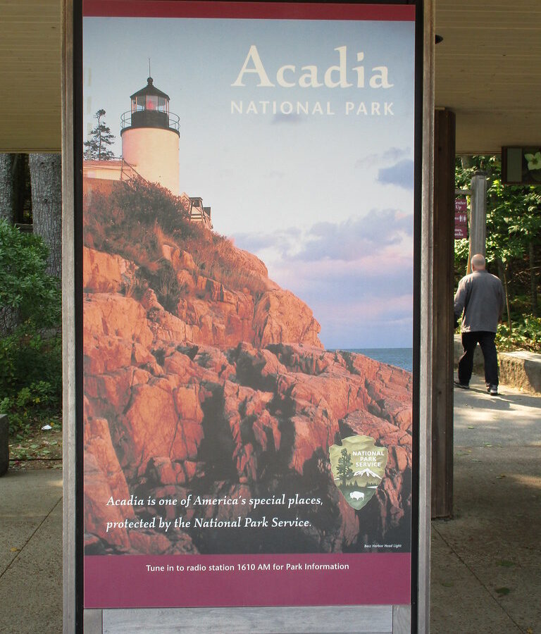
Photo: jaygannett via Flickr (CC BY-SA 2.0)
Knowing How Get Acadia National Park matters when dawn breaks over Frenchman Bay and the granite face of Cadillac Mountain turns pink above Bar Harbor. Near the summit, the air can feel sharply colder than it did at sea level, while wind moves through red spruce and lowbush blueberry. Below, Mount Desert Island’s coves, lakes, and rounded granite ridges reveal why choosing the correct airport and road can save hours. Acadia is divided among Mount Desert Island, the Schoodic Peninsula, and Isle au Haut. Most first visits focus on Mount Desert Island, home to Cadillac Mountain and Jordan Pond.
Acadia is divided among Mount Desert Island, the Schoodic Peninsula, and Isle au Haut. Most first visits focus on Mount Desert Island, home to Cadillac Mountain, Jordan Pond, Sand Beach, and most of Park Loop Road. The sections are separated by water and cannot be treated as adjacent entrances, so transportation planning begins with deciding which part of the park you intend to visit.
How to Get to Acadia National Park: Start With the Right Destination
Bar Harbor is the principal gateway for Mount Desert Island, but it is not a formal park entrance in the way travelers may expect from larger western parks. Roads enter the island through Thompson Island and split toward Bar Harbor, Northeast Harbor, Southwest Harbor, and other communities. From Bar Harbor, Park Loop Road reaches many signature locations, including Sand Beach, Thunder Hole, Otter Point, Jordan Pond, and the Cadillac Mountain summit road.
Match your navigation pin to your plans
Entering “Acadia National Park” into a mapping application can produce an administrative office, visitor center, trailhead, or point in a different park district. Use a specific first stop instead. Hulls Cove is useful for general orientation, Sand Beach for the Ocean Path corridor, and Jordan Pond for the island’s central glacial landscape. Drivers staying on the western side should navigate toward Southwest Harbor or Bass Harbor rather than routing through congested Bar Harbor.
Understand Acadia’s three geographic sections
| Park area | Best gateway | What visitors find there |
|---|---|---|
| Mount Desert Island | Bar Harbor, Northeast Harbor, or Southwest Harbor | Park Loop Road, Cadillac Mountain at 1,530 feet, Jordan Pond, carriage roads, and the largest trail network |
| Schoodic Peninsula | Winter Harbor | Schoodic Loop Road, exposed granite shoreline, Schoodic Head, and fewer crowds |
| Isle au Haut | Passenger ferry from Stonington | Remote hiking, rocky coast, and limited ground transportation |
Schoodic Peninsula lies east of Mount Desert Island across Frenchman Bay. Driving between Bar Harbor and Winter Harbor generally takes about 75 to 90 minutes because the road circles the bay through Ellsworth. Isle au Haut requires a passenger boat from Stonington, and private vehicles are not part of a typical day visit. Travelers combining districts should assign each one a separate day.
How to Get to Acadia National Park: Choosing the Best Airport
No large commercial airport sits beside the park. The most practical choices are Hancock County-Bar Harbor Airport in Trenton, Bangor International Airport, Portland International Jetport, and Boston Logan International Airport. Flight schedules, rental-car availability, and total travel time matter more than airfare alone, especially outside summer when service to smaller Maine airports becomes less frequent.
How to Get to Acadia National Park From Nearby Airports
Hancock County-Bar Harbor Airport
Hancock County-Bar Harbor Airport, commonly identified by the code BHB, is in Trenton on the mainland. It is roughly 12 miles from Bar Harbor and close to the bridge onto Mount Desert Island. The drive commonly takes 20 to 30 minutes before summer traffic. Commercial service is limited and often seasonal, but this is the most convenient airport when the available flights and rental-car arrangements fit the trip.
Bangor International Airport
Bangor, airport code BGR, is about 50 miles from Bar Harbor. Most drivers need approximately 75 minutes via US Route 1A through Holden and Ellsworth, though congestion in Ellsworth can add time. Bangor generally offers more year-round flight and rental-car options than Trenton. It provides the strongest balance of airport convenience, driving distance, and schedule flexibility for many visitors.
Portland and Boston
Portland is approximately 175 road miles from Bar Harbor, with a typical drive of about three hours when traffic is light. Boston is roughly 280 miles away and usually requires at least five hours, with longer travel common around metropolitan Boston and on summer weekends. These airports offer broader flight networks, but travelers should compare the entire journey rather than assuming a cheaper ticket produces an easier arrival.
Choose flights around Maine driving conditions
- For the shortest transfer: Check BHB first, then verify that the flight and rental-car hours align.
- For reliable year-round access: Compare Bangor schedules and rental inventory.
- For international or nonstop connections: Portland or Boston may reduce airfare or eliminate a connection.
- For a late arrival: Avoid committing to a long nighttime drive after a tiring flight, particularly during fog, rain, or winter weather.
Rental vehicles can become scarce during peak foliage and summer periods, so reserve the car alongside the flight rather than waiting until lodging is booked. Public transportation can work for selected summer itineraries, but it requires coordinating airport connections, lodging, and park transit. Confirm current transportation schedules, vehicle reservations, entrance fees, and seasonal road status on the official park site before finalizing the itinerary.
How to Get to Acadia National Park by Road From Portland, Boston, and Bangor
Maine’s fastest inland roads and its scenic coastal roads serve different purposes. Interstate and major state routes are preferable on an arrival day, while US Route 1 suits a slower trip with planned stops. Navigation estimates often understate summer delays around Wiscasset, Belfast, Ellsworth, and the approaches to Mount Desert Island.
The efficient inland approaches
From Bangor, follow US Route 1A southeast to Ellsworth, then continue on Maine Route 3 toward Mount Desert Island and Bar Harbor. From Portland, a common fast route uses Interstate 295 and Interstate 95 toward Augusta, followed by Maine Route 3 east through Belfast and Ellsworth. From Boston, Interstate 95 leads north through New Hampshire and southern Maine before connecting with the Portland route.
How Get Acadia National planning changes on the coastal route
US Route 1 passes through communities such as Rockland, Camden, Belfast, and Bucksport, but it is not an efficient shortcut. The road includes town centers, lower speed limits, traffic signals, and seasonal queues. Use it when coastal scenery and stops are part of the trip, preferably with a night along the route. For a same-day flight arrival and park check-in, the inland route usually provides more predictable timing.
Fuel, food, and the final approach
Ellsworth is the last major service center before Mount Desert Island and the Schoodic turnoffs. It is a practical place to buy groceries, refuel, and obtain supplies that may cost more or require extra driving in park communities. After Ellsworth, Route 3 crosses onto Mount Desert Island at Thompson Island, where traffic divides toward Bar Harbor and the quieter western and southern villages.
How to Get to Acadia National Park via Mount Desert Island
The final approach is where otherwise sound itineraries often fail. A short distance on the map can take considerably longer during midsummer, fall foliage weekends, or road construction. Bar Harbor’s compact street pattern, pedestrian crossings, and limited central parking slow traffic further. Build time for unloading luggage and reaching lodging before attempting a scenic drive or trail.
A simple arrival sequence
- Stop in Ellsworth for fuel, food, and any forgotten outdoor supplies.
- Cross to Mount Desert Island and proceed directly to lodging rather than sightseeing with luggage in the vehicle.
- Identify the nearest park transit stop or practical parking area.
- Save Park Loop Road and Cadillac Mountain for a planned outing with enough daylight.
Avoid the wrong side of the island
Route 3 toward Bar Harbor serves the island’s eastern side, while Routes 102 and 102A reach Somesville, Southwest Harbor, Bass Harbor, and the western side. Somes Sound, a deep glacially carved inlet, divides much of the island and limits east-west road connections. A lodging choice near Bass Harbor can place you about 30 miles by road from Sand Beach, despite both locations being within the same island park landscape.
Getting Around Acadia National Park: Choose the Right Transportation
Driving gives you the greatest flexibility before sunrise, after sunset, and on the western side of Mount Desert Island. It also creates parking problems at Sand Beach, Jordan Pond, Cadillac Mountain, and popular trailheads. The seasonal Island Explorer bus network connects many villages, campgrounds, and park destinations, making a mixed strategy practical: leave the vehicle at lodging or an established transit hub, then use the bus for congested corridors.
Use Park Loop Road efficiently
Park Loop Road covers roughly 27 miles and includes a one way section along the eastern shoreline. Drivers can reach Sand Beach, Thunder Hole, Otter Point, Jordan Pond, and several trailheads from this corridor. One way traffic means a missed turnout may require a lengthy circuit rather than a quick reversal. Download an offline map before entering the park because tree cover, granite ridges, and coastal terrain can interrupt mobile service.
Combine buses, bicycles, and walking
The Island Explorer is most useful for point to point hikes, especially when the starting and finishing trailheads differ. Acadia’s 45 miles of historic carriage roads provide a separate network for walking, cycling, and horse drawn travel. Motor vehicles are prohibited on these broken stone roads. Bicycle riders should expect sustained climbing around Eagle Lake, Bubble Pond, and Day Mountain, plus narrow passages and limited sightlines near the park’s distinctive granite faced bridges.
Compare transportation choices
| Method | Best use | Primary limitation |
|---|---|---|
| Private vehicle | Early departures, western Mount Desert Island, carrying equipment | Parking fills quickly at major sights |
| Seasonal bus | Bar Harbor connections and point to point hikes | Routes and operating periods vary |
| Bicycle | Carriage roads and village travel | Steep grades, traffic, and changing weather |
| Walking | Bar Harbor waterfront and linked trail corridors | Distances between park districts are substantial |
Prevent parking and navigation mistakes
Parking pressure follows a predictable pattern. Ocean Path access, Jordan Pond, Cadillac Mountain, and compact Bar Harbor lots become busiest from late morning through the afternoon. Arriving early helps, but illegally parking along narrow roads damages vegetation and can obstruct emergency vehicles. If a designated area is full, continue to another planned stop or use transit rather than waiting in an active travel lane.
Build outings around geographic clusters
Group Sand Beach, Great Head, Thunder Hole, and Otter Point into one eastern shoreline outing. Combine Jordan Pond with the Bubbles or nearby carriage roads. On the western side, pair Bass Harbor Head Light Station with Ship Harbor or Wonderland. This approach reduces repeated crossings of Somes Sound and prevents a day from dissolving into slow drives between unrelated trailheads.
Carry a navigation backup
If your search began with “How Get Acadia National,” the most important practical answer is to save exact destinations before departure. Carry a paper park map and record lodging directions, trailhead names, and return bus stops. A phone charger or battery pack is useful because navigation, photography, and cold coastal air can drain batteries quickly. Tell another person your planned route when visiting quieter western trails or Schoodic paths.
Prepare for delays and changing conditions
Coastal fog can reduce visibility within minutes, particularly near Otter Point, Schoodic Point, and exposed summit roads. Heavy rain makes granite steps slick, while autumn darkness arrives earlier than many visitors expect. Winter introduces ice, snow, and seasonal road closures. Keep rain layers, water, food, a headlamp, and warmer clothing in the vehicle even when Bar Harbor feels mild.
Use a disruption checklist
- Allow extra time for Ellsworth traffic and bridge approaches.
- Keep at least half a tank of fuel before exploring remote sections.
- Save two alternative stops in the same part of the island.
- Carry payment options for private transportation or unexpected lodging needs.
- Avoid scheduling a long hike immediately before a departing flight.
Protect the departure day
Return rental vehicles and reach the airport with more margin than an urban trip might require. A collision, construction zone, dense fog, or seasonal traffic queue can affect the limited roads leading off Mount Desert Island. Travelers flying from Portland or Boston should consider staying closer to the airport on the final night when departure is early. This removes a long, weather dependent drive from the morning flight plan.
Complete Your Plan for Airports, Roads, and Getting Around Acadia National Park
The strongest itinerary matches the airport, lodging location, and park district before reservations are made. Bangor usually balances access and flight choice, while Trenton minimizes the final transfer when suitable service is available. Portland and Boston work best when broader flight options justify the longer drive. On Mount Desert Island, organize each day by area and use transit where parking demand is highest.
Save precise map pins, download offline directions, carry basic weather gear, and leave room for traffic or fog. Those steps turn Acadia’s fragmented geography into a manageable plan. With the arrival route settled and local transportation chosen in advance, your time can go toward granite summits, carriage roads, spruce forest, and the Atlantic shoreline rather than repeated drives across the island.
Want to keep exploring? Browse all our Acadia guides and articles for more trip-planning tips and ideas.
Gear & Essentials
Tell us about your trip and we will add what else you will want:
The basics
Worth having in the car whatever the park.
For this trip
Traveling with kids
Bringing a pet
RVing
Backcountry
Winter conditions
On the water
Photography
Accessibility
As an Amazon Associate we earn from qualifying purchases, at no extra cost to you.