Kings Canyon National Park Itinerary: A Perfect 3-Day Mountain Escape
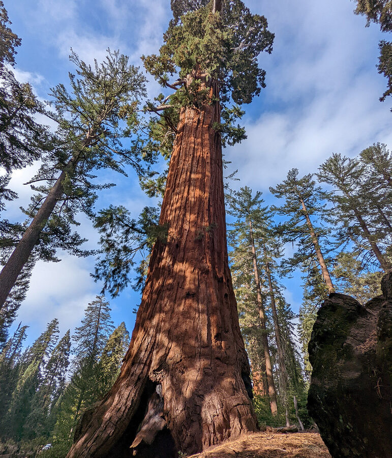
Photo: RuggyBearLA via Flickr (CC BY 2.0)
A Kings Canyon National Park Itinerary begins especially well at Grant Grove just after sunrise, when cool air settles among the sequoias and your footsteps land softly on cinnamon-colored bark. On the General Grant Tree Trail, the forest canopy blocks much of the early light, while Steller’s jays and white-headed woodpeckers call overhead. The immense trunk of the General Grant Tree gradually appears between younger conifers, giving the grove a scale that photographs rarely communicate.
This three-day route links Grant Grove with the glacially carved canyon of the South Fork Kings River, finishing with a substantial hike from Roads End. It works best when Highway 180 into Cedar Grove is open, generally from late spring into fall. The order minimizes backtracking, places the longest drive on a sightseeing day, and allows you to sleep near the trailhead before the most demanding hike.
Understanding the park before planning the route
Kings Canyon National Park has two road-accessible districts separated by roughly 30 winding miles of mountain highway. Grant Grove occupies the western high country near the Big Stump Entrance, while Cedar Grove lies thousands of feet below, deep in Kings Canyon. Highway 180 connects them through Sequoia National Forest before ending at Roads End. There is no road across the Sierra Nevada from Roads End, despite the apparent proximity of destinations east of the crest.
Grant Grove provides the year-round base
Grant Grove sits at approximately 6,500 feet and contains the park’s most accessible giant sequoia walks, visitor services, campgrounds, and winter recreation. The grove is close to the Highway 180 entrance, so it makes a logical first-night base after arriving from Fresno or California’s Central Valley. Snow can cover the area from late autumn into spring, and tire-chain controls are possible during storms.
Cedar Grove reaches the canyon floor
The Cedar Grove section follows the South Fork Kings River beneath walls formed by glaciers and the river cutting through Sierra Nevada granite. Elevations along the canyon floor are generally around 4,600 to 5,000 feet, producing warmer afternoons and an earlier spring than Grant Grove. Roads End marks the pavement’s eastern terminus and the departure point for trails entering the wilderness toward Mist Falls, Paradise Valley, and the Pacific Crest.
How the three-day route fits together
Day one stays around Grant Grove, allowing time to adjust to elevation and walk beneath giant sequoias without committing to a long hike. Day two follows the Kings Canyon Scenic Byway into Cedar Grove, using overlooks and short waterfall walks to break up the descent. After sleeping in or near Cedar Grove, day three begins early at Roads End for the approximately 8-mile round trip to Mist Falls.
The itinerary at a glance
| Day | Primary stop | Main highlight | Approximate driving |
|---|---|---|---|
| 1 | Grant Grove | General Grant Tree and North Grove | 10 to 25 minutes between local stops |
| 2 | Kings Canyon Scenic Byway and Cedar Grove | Junction View, Grizzly Falls, and the South Fork Kings River | About 1 hour 15 minutes from Grant Grove to Roads End without stops |
| 3 | Roads End | Mist Falls hike, followed by the drive west | About 1 hour 15 minutes back to Grant Grove, plus the onward journey |
Where to spend each night
Spend the first night in the Grant Grove area, choosing between park lodging, a developed campground, or accommodation farther west along Highway 180. For the second night, staying in Cedar Grove removes an early morning mountain drive before Mist Falls. Seasonal lodging and campgrounds are limited there, so travelers without a Cedar Grove reservation should return to Grant Grove and accept the additional driving on day three.
Food, fuel, road conditions, and seasonal access
The route enters a long corridor with limited services. Mobile reception becomes unreliable around Grant Grove and generally disappears in the canyon, so download maps, reservation details, and trail information before leaving the foothills. Fill the fuel tank before climbing Highway 180. Carry enough water and food for the full Cedar Grove portion, even when seasonal markets or food counters are operating.
What to pack in the vehicle
- Water: Carry at least two liters per person for short sightseeing days, and more for the Mist Falls hike during hot weather.
- Layers: Grant Grove mornings can be cool while Cedar Grove becomes hot on the same afternoon.
- Sun protection: Exposed granite, open river corridors, and higher elevations increase ultraviolet exposure.
- Offline navigation: Save the park map and hiking route before entering the canyon.
- Food storage plan: Black bears are active throughout both districts. Use provided bear-resistant storage where required and never leave food visible in an unattended vehicle.
When this exact plan works
The complete route depends on Highway 180 being open between Grant Grove and Cedar Grove. Winter visitors can still build three days around Grant Grove, snowshoeing, sequoia walks, and nearby sections of Sequoia National Park, but they cannot drive into the canyon. Spring opening dates vary with snowpack, storm damage, and road repairs. Check current road status, entrance fees, campground availability, and food services on the official park site before departure.
Day one: giant sequoias and Grant Grove overlooks
Enter through the Big Stump Entrance and continue to Grant Grove Village before starting the main walks. Arriving by midmorning leaves enough time for the General Grant Tree Trail, the quieter North Grove Loop, and an afternoon viewpoint. Keep the first day moderate because even visitors accustomed to hiking can feel the difference at 6,500 feet.
Walk the General Grant Tree Trail
The paved loop is approximately half a mile and passes several notable sequoias, including the General Grant Tree, named in 1867 for Ulysses S. Grant. Congress designated it the Nation’s Christmas Tree in 1926. Nearby, the fallen Gamlin Cabin and interpretive exhibits explain how timber claims, tourism, and early conservation shaped the grove before Kings Canyon National Park was established in 1940.
Add the North Grove Loop for a quieter forest walk
The North Grove Loop covers roughly 1.5 miles through mixed conifer forest containing sequoias, white fir, sugar pine, and incense cedar. It receives fewer visitors than the General Grant loop and provides a clearer sense of how sequoias grow within a broader Sierra ecosystem. Look for fire scars on mature trunks. Giant sequoias depend on periodic low-intensity fire to open cones, expose mineral soil, and create sunny gaps where seedlings can survive.
Finish above the grove at Panoramic Point
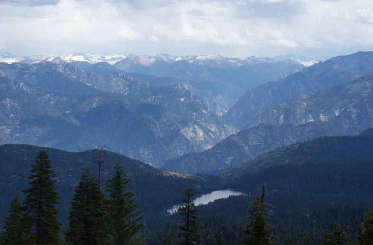
When the narrow seasonal access road is open, Panoramic Point provides a useful geographic overview of the next two days. From roughly 7,500 feet, the view extends across Hume Lake toward the high Sierra and the drainage of the Kings River. The short approach is easier than the park’s backcountry overlooks, but the road has tight turns and vehicle restrictions. If access is closed, use the remaining afternoon for the Big Stump Trail near the park entrance.
Day two: descend the Kings Canyon Scenic Byway
Leave Grant Grove early enough to give the canyon road a full day. Highway 180 drops through conifer forest and exposed slopes before reaching the South Fork Kings River, losing roughly 2,000 feet in elevation. The road is paved but narrow and curving, with limited passing opportunities. Use designated pullouts rather than stopping along the shoulder, and expect the return trip to take longer after an active day.
Make the essential roadside stops
Junction View reveals the meeting of the Middle and South Fork canyons, with steep metamorphic slopes contrasting against the granite farther east. Continue to Grizzly Falls, where a short walk reaches an approximately 80-foot cascade fed by snowmelt. Roaring River Falls is another priority. Its brief paved approach ends beside a narrow granite chute where the river compresses into a turbulent pool.
Choose optional stops according to daylight
- Hume Lake: Add this forest road detour for a lakeside picnic or easy shoreline walk, allowing roughly one additional hour.
- Canyon View: Stop here to examine the broad U-shaped valley created by repeated glaciation.
- Zumwalt Meadow: Explore open portions of the trail for river access, meadow habitat, and views toward North Dome.
Slow down at Zumwalt Meadow
Near Zumwalt Meadow, the canyon walls fill nearly the entire view. Coarse sand and granite gravel shift beneath your shoes, afternoon heat reflects from exposed rock, and the South Fork Kings River carries a constant low roar through the trees. North Dome rises more than 3,000 feet above the canyon floor, making distances difficult to judge. This is the day’s best place to stop moving, watch the light cross the granite, and understand the canyon’s scale.
Day three: hike from Roads End to Mist Falls
Begin at Roads End before direct sun reaches the open canyon floor. The Mist Falls route covers approximately 8 miles round trip with about 800 feet of elevation gain. Early miles pass sandy flats and woodland beside the river, while the final approach climbs polished granite near powerful cascades. Most hikers need four to six hours, depending on heat, rest stops, and time spent at the falls.
Manage the exposed approach
The lower trail can become hot by late morning because sections have limited shade. Carry more water than the distance alone suggests, and keep food within reach so you can eat before the steeper final miles. Trail junctions near Bubbs Creek and Paradise Valley lead toward longer wilderness routes, so read signs carefully. Mist from the falls makes nearby granite slick, and swift water eliminates safe swimming opportunities during peak runoff.
Set a firm turnaround time
Paradise Valley begins beyond Mist Falls, but adding it turns the day into a substantially longer backcountry outing. For a three-day Kings Canyon National Park Itinerary, Mist Falls is the sensible turnaround point. Return to Roads End, eat before driving, and allow daylight for the winding climb toward Grant Grove. Fatigue matters on Highway 180, where blind bends and wildlife require sustained attention.
Adjusting the route for Sierra seasons
Late spring and summer priorities
Late spring produces the strongest waterfalls, cold river temperatures, wet trail edges, and lingering snow at higher elevations. Mosquito activity increases around meadows as standing water develops. Summer brings reliable trail access but also hot canyon afternoons, occasional thunderstorms, and possible smoke from regional wildfires. Start hikes near sunrise, avoid exposed granite when thunder is audible, and carry a filter only as backup because untreated Sierra water can contain pathogens.
Autumn and winter alternatives
Early autumn often brings cooler hiking temperatures, lower river flow, and shorter daylight. Freezing nights can arrive well before snow closes the canyon road. Once Cedar Grove becomes inaccessible, base the trip at Grant Grove and replace days two and three with the Big Stump Trail, snow travel through the sequoia groves, and accessible portions of nearby Sequoia National Park. Carry tire chains when controls are possible, even if pavement is clear at lower elevations.
Frequently Asked Questions
These practical answers cover the decisions that most often change a three-day plan. Day hiking rules are relatively stable, while road access remains the major seasonal limitation.
Can you see Kings Canyon National Park in three days?
Three days provide enough time for Grant Grove, the major Scenic Byway stops, Cedar Grove, and one substantial hike from Roads End. Exploring the high-country wilderness or combining numerous long hikes requires additional days.
Do I need a permit for Mist Falls?
A wilderness permit is not required for a day hike to Mist Falls. Overnight travel beyond Roads End into Paradise Valley or other wilderness destinations requires a wilderness permit.
Are dogs allowed on the trails?
Pets are prohibited on national park trails, including the routes to Mist Falls and through the sequoia groves. They may be allowed in certain developed areas, but owners should plan hikes without them.
Is this itinerary suitable for children?
The General Grant Tree Trail, roadside waterfalls, and short canyon walks suit many families. Mist Falls is better for older children accustomed to eight-mile hikes, summer heat, uneven surfaces, and sustained elevation gain.
Can I drive through Kings Canyon to the eastern Sierra?
No road crosses the Sierra Nevada from Roads End. Drivers must return west on Highway 180, then use a distant mountain pass or travel around the range to reach communities along US 395.
A practical route through two very different districts
This plan uses elevation and geography to its advantage. Grant Grove provides a moderate first day among giant sequoias, the Scenic Byway turns the transfer to Cedar Grove into a full sightseeing day, and sleeping near the canyon positions you for an early Mist Falls departure. The sequence reduces unnecessary driving while preserving time at the park’s most consequential landscapes.
Download navigation, arrive with fuel and food, and treat Highway 180 access as the key planning constraint. With those details settled, three days are enough to experience ancient sequoia forest, a glacier-cut river canyon, roadside waterfalls, and a demanding Sierra trail without compressing every stop into a rushed drive.
Want to keep exploring? Browse all our Kings Canyon guides and articles for more trip-planning tips and ideas.
Gear & Essentials
Tell us about your trip and we will add what else you will want:
The basics
Worth having in the car whatever the park.
For this trip
As an Amazon Associate we earn from qualifying purchases, at no extra cost to you.