Utah National Parks Road Trip: A 10-Day Itinerary
Our Utah National Parks Road itinerary covers five parks in 10 days, yet the route between them demands almost as much planning as the hikes. Utah’s Mighty Five form a rough arc rather than a tidy loop. Starting in Salt Lake City and finishing in Las Vegas removes several hours of backtracking while placing the longest transfer at the beginning, when energy is highest.
This east to west plan visits Arches, Canyonlands, Capitol Reef, Bryce Canyon, and Zion in that order. It allows two nights or more near most major stops and uses Utah Scenic Byway 12 between Capitol Reef and Bryce Canyon. The park sequence also creates a useful progression from Moab’s low desert, through Bryce Canyon’s rim above 8,000 feet, and down into Zion Canyon.
Why the Route Runs East to West
An open jaw itinerary saves a day of backtracking
Fly into Salt Lake City, collect a rental car, and drive approximately 235 miles to Moab. At the other end, Zion’s south entrance is about 170 miles from Las Vegas, making that city the practical departure point. The park to park backbone covers roughly 760 miles before local drives, overlooks, trailheads, and food stops are added. A Salt Lake City loop requires retracing a substantial section of Interstate 15 after Zion.
The reverse direction works if airfare or vehicle rental prices favor Las Vegas, but it puts Zion first. Zion often has the most complicated transportation and parking logistics, while Moab provides an easier place to organize supplies and settle into the trip. Beginning in Moab also reserves the higher Bryce Canyon elevations for the middle of the itinerary, allowing some gradual adjustment before hiking around the rim.
Scenic Byway 12 belongs in the itinerary
The route from Capitol Reef to Bryce Canyon follows Utah Highway 12 through Boulder, Grand Staircase Escalante National Monument, and the upper Escalante River country. It crosses the exposed sandstone ridge known as the Hogback, then climbs through aspen and conifer forest on Boulder Mountain. The direct drive takes roughly three hours, but overlooks and short walks can turn it into most of a day.
Using faster highways around the west side would sacrifice one of the journey’s defining landscapes. Highway 12 reveals how southern Utah’s geology connects: uplifted plateaus, deeply cut canyons, volcanic boulder fields, and eroded sedimentary layers appear in sequence. Drivers uncomfortable with exposed roads should take the Hogback slowly and avoid rushing this section after dark.
The 10 Days at a Glance
The Complete Plan
This schedule prioritizes one substantial hike or sightseeing circuit each day. Drive times are approximate and exclude trailhead searches, entrance queues, fuel stops, and photography. Lodging locations are chosen to reduce morning driving, with Moab serving Arches and Canyonlands, Torrey serving Capitol Reef, and Springdale serving Zion.
| Day | Stop | Primary highlight | Approximate driving |
|---|---|---|---|
| 1 | Salt Lake City to Moab | Colorado River corridor or sunset viewpoint | 4 hours |
| 2 | Arches National Park | Delicate Arch and Windows area | 1 to 2 hours locally |
| 3 | Canyonlands National Park | Island in the Sky overlooks | 2 to 3 hours locally |
| 4 | Moab to Capitol Reef | Highway 24 and Fruita | About 3 hours |
| 5 | Capitol Reef | Hickman Bridge or Cassidy Arch | About 1 hour locally |
| 6 | Torrey to Bryce Canyon | Scenic Byway 12 | About 3 hours without stops |
| 7 | Bryce Canyon | Navajo Loop and Queen’s Garden | Under 1 hour locally |
| 8 | Bryce Canyon to Zion | Mount Carmel Highway | About 2 hours |
| 9 | Zion National Park | Zion Canyon hike | Minimal if using park transportation |
| 10 | Zion to Las Vegas | Morning walk and departure | About 3 hours |
Reservations, fuel, food, and connectivity
Entrance systems, trail permits, shuttle operations, campground reservations, and fees can change, so confirm current details on each official park site before booking flights. Spring and autumn lodging often fills first in Moab and Springdale. Reserve those locations before committing to less constrained nights near Torrey or Bryce Canyon.
- Fuel: Fill in Moab, Torrey, the Bryce Canyon area, and Springdale. Highway 12 has services in small communities, but stations are widely spaced and may keep limited hours.
- Food: Carry breakfast, trail lunches, and at least one backup dinner. Grocery choices narrow considerably after leaving Moab.
- Connectivity: Expect unreliable mobile service inside Canyonlands, Capitol Reef, Grand Staircase Escalante, and parts of Zion. Download offline maps before departure.
- Water: Carry more than a single reusable bottle. Exposed Moab trails can require several liters per person during warm weather.
Days 1 to 3: Moab and Canyon Country
Day 1: Reach Moab and keep the evening flexible
The drive from Salt Lake City follows Interstate 15 and US 6 through Spanish Fork Canyon before joining Interstate 70 near Green River. US 6 includes long grades and regular freight traffic, so daylight driving is preferable. Stop in Green River for fuel before continuing across open desert to Moab. Sleep in Moab for three nights to avoid changing accommodations between Arches and Canyonlands.
If arrival leaves two hours of daylight, follow Utah Highway 128 beside the Colorado River rather than forcing a major hike. Sandstone walls rise directly from the river corridor, providing an immediate introduction to the region’s scale. A sunset visit to Dead Horse Point State Park is another option, although it adds driving and should be reserved for an early arrival.
Day 2: Concentrate on Arches National Park
Delicate Arch and the Windows
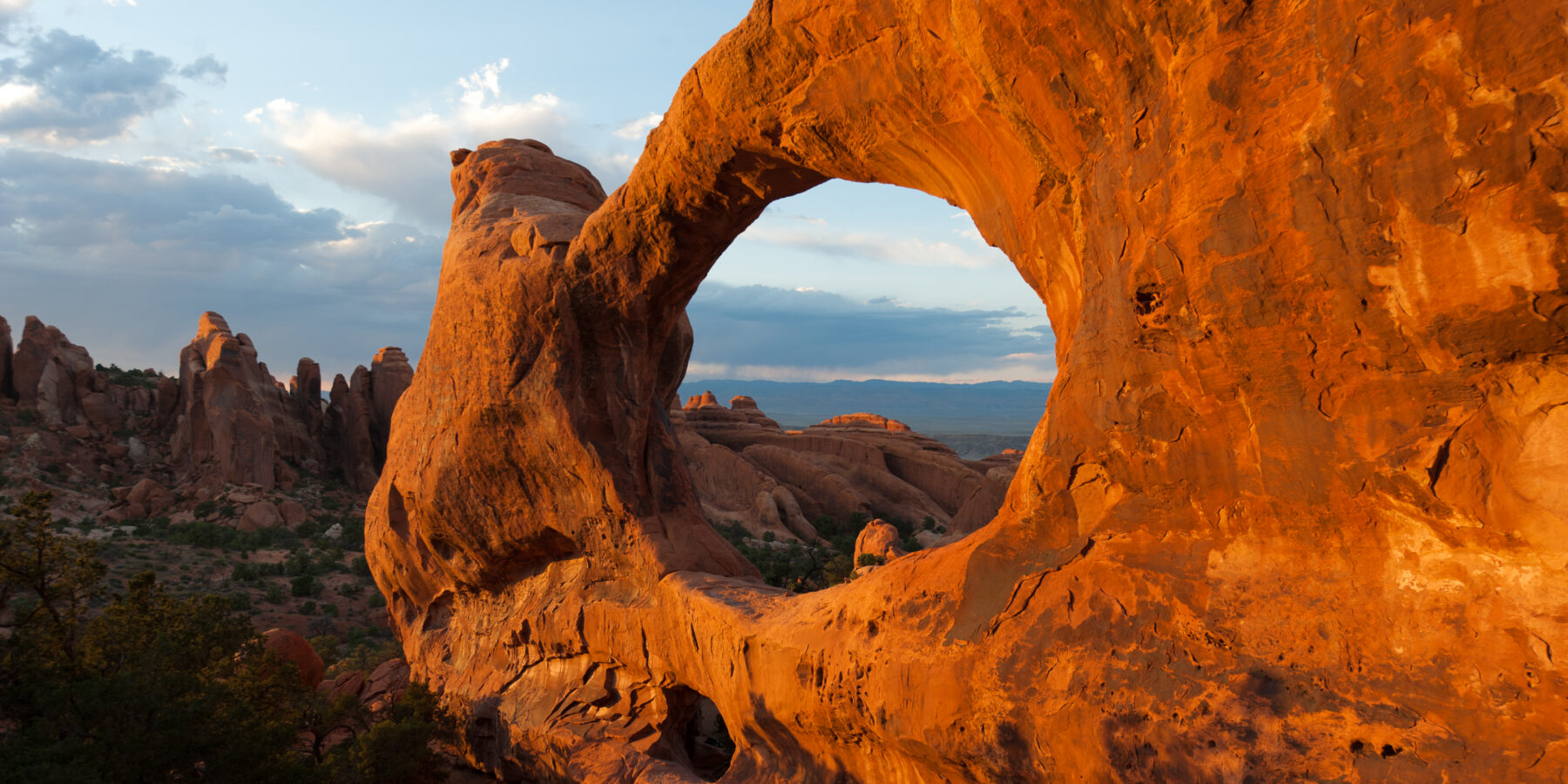
Delicate Arch is reached by a 3 mile round trip with roughly 480 feet of elevation gain. The route crosses open slickrock with little shade, so an early start reduces heat exposure. Later, visit the Windows section for a compact collection of large openings, including North Window, South Window, and Turret Arch. Balanced Rock requires only a short walk and fits naturally between the Windows and the park entrance.
For a longer alternative, hike to Landscape Arch in Devils Garden. The maintained route is about 1.9 miles round trip and leads to an exceptionally thin sandstone span. The trail beyond Landscape Arch becomes rougher, with exposed fins and route finding challenges. Save that extension for experienced hikers carrying adequate water.
Day 3: Explore Canyonlands from Island in the Sky
Island in the Sky is the most practical Canyonlands district for a first visit. It occupies a broad mesa above the Colorado and Green rivers, with paved access to Mesa Arch, Green River Overlook, and Grand View Point. Mesa Arch is reached by a 0.7 mile loop, while the Grand View Point trail extends approximately 1.8 miles along the mesa rim.
At Grand View Point, the trail runs over pale sandstone scattered with black biological soil crust. Wind crosses the rim without obstruction, and the land drops away into benches, fins, and branching canyons. The distant Needles appear small despite rising across an enormous basin. Footsteps sound sharp on the rock, while vehicles and river corridors disappear far below the visible edge.
Days 4 and 5: Crossing to Capitol Reef
Day 4: Follow the desert corridor to Fruita
Leave Moab on Interstate 70, then turn south toward Hanksville and west on Utah Highway 24. The approximately 150 mile drive enters Capitol Reef through the Fremont River canyon. An optional Goblin Valley detour adds time but provides short walks among mushroom shaped Entrada Sandstone formations. Skip it if the goal is to reach Fruita early enough for an afternoon trail.
Capitol Reef protects part of the Waterpocket Fold, a nearly 100 mile wrinkle in Earth’s crust created during the Laramide Orogeny. Highway 24 cuts across tilted rock layers before reaching the historic Fruita district. Cottonwoods, orchards, and the Fremont River create a green corridor beneath red cliffs. Sleep in Torrey or in authorized park accommodations if secured in advance.
Day 5: Choose a bridge, canyon, or high viewpoint
Hickman Bridge is the most efficient morning hike, covering about 1.8 miles round trip with roughly 400 feet of climbing. The trail rises above the Fremont River, passes small alcoves, and reaches a natural bridge spanning 133 feet. Cassidy Arch is more strenuous, with sustained slickrock climbing from Grand Wash and broad views over the Waterpocket Fold.
Grand Wash offers a lower elevation alternative between sheer canyon walls. The full route connects two trailheads, but an out and back walk from Highway 24 reaches the narrowest section without requiring a vehicle shuttle. Avoid washes when thunderstorms threaten upstream. Flash floods can arrive from rainfall that is not visible at the trailhead.
Days 6 and 7: Scenic Byway 12 and Bryce Canyon
Day 6: Treat the transfer as a sightseeing day
Leave Torrey with a full fuel tank and follow Highway 12 south across Boulder Mountain, where the road reaches elevations above 9,000 feet. Pullouts overlook the Waterpocket Fold and Henry Mountains before the route descends toward Boulder. Calf Creek Recreation Area offers a worthwhile detour, but the 6 mile round trip to Lower Calf Creek Falls requires roughly three hours. Choose that hike only if you can still cross the Hogback and reach Bryce Canyon before dark.
Beyond Escalante, the road climbs through sandstone canyons toward the forested Aquarius Plateau. Mossy Cave provides a shorter stop near Bryce Canyon, with a walk of about 0.8 mile beside a seasonally flowing stream. Sleep near Bryce Canyon for two nights. Staying close to the entrance makes an early rim walk practical and reduces the risk of losing time to parking congestion later in the morning.
Day 7: Descend among Bryce Canyon’s hoodoos
Combine the Queen’s Garden and Navajo Loop trails for a circuit of approximately 3 miles with about 600 feet of elevation change. Sunrise Point provides the usual starting point, while the climb through Navajo Loop returns toward Sunset Point. Ice can persist on shaded switchbacks well after exposed sections have dried. If closures affect Navajo Loop, use Queen’s Garden as an out and back route and explore the paved Rim Trail afterward.
Extend the day along the southern rim
Drive the park road to Rainbow Point, which stands above 9,000 feet, then work back through overlooks such as Natural Bridge and Agua Canyon. This direction reduces repeated left turns across traffic. The high plateau supports ponderosa pine, Douglas fir, and bristlecone pine, creating cooler conditions than the desert parks. Pronghorn may appear in open meadows, while Steller’s jays and ravens frequent the developed rim.
Days 8 to 10: Zion Canyon and the Las Vegas Finish
Day 8: Enter Zion through the east side
The drive from Bryce Canyon follows US 89 and Utah Highway 9 through the park’s east entrance. Checkerboard Mesa, the slickrock around Clear Creek, and the switchbacks above Pine Creek make this approach a major part of the day. The Zion Mount Carmel Tunnel was completed in 1930 and cuts through approximately 1.1 miles of sandstone. Large vehicles may face traffic controls or special requirements, so rental vehicle dimensions matter when planning this segment.
Use the Canyon Overlook Trail as the day’s principal walk. The 1 mile round trip crosses ledges above Pine Creek and ends above the switchbacks, with views toward the Towers of the Virgin. The trail includes exposed edges and metal railings, making it unsuitable for some hikers with a strong fear of heights. Continue to Springdale afterward and stay two nights, allowing Day 9 to begin without another accommodation change.
Day 9: Match the Zion hike to conditions
Angels Landing requires steep climbing, narrow exposure, and an applicable permit for the chained section. A less exposed alternative follows the same West Rim Trail to Scout Lookout, gaining roughly 1,000 feet over about 3.6 miles round trip. The Narrows presents different hazards, including cold water, slippery cobbles, flash flooding, and changing river flow. Riverside Walk remains the sensible substitute when water conditions or equipment make upstream travel inappropriate.
Day 10: Use the final morning carefully
For an early flight, drive directly to Las Vegas and allow additional time for the Mountain Time to Pacific Time change at the Nevada border. A later departure permits a short walk on the Pa’rus Trail or a visit to the lower canyon viewpoints before leaving. Interstate 15 passes through the Virgin River Gorge in Arizona, where tight curves and construction can slow traffic. Keep fuel in reserve rather than depending on a single planned stop.
Adjusting the Route for Heat, Snow, and Short Daylight
Seasonal conditions change which hikes deserve priority
Spring and autumn usually provide the broadest range of workable elevations, although Bryce Canyon can still receive snow while Moab approaches hot-weather conditions. Summer favors dawn starts in Arches, Canyonlands, and Capitol Reef, followed by shaded stops or driving during the hottest afternoon hours. Winter brings quiet trails and striking snow on the hoodoos, but storms can complicate Boulder Mountain, Bryce Canyon, and the drive through Zion’s east side.
| Season | Main advantage | Primary adjustment |
|---|---|---|
| March to May | Moderate desert temperatures | Carry traction for icy Bryce trails |
| June to August | Long daylight | Hike exposed terrain near sunrise |
| September to October | Comfortable hiking conditions | Book gateway lodging well ahead |
| November to February | Smaller crowds and snow scenery | Allow extra driving time after storms |
Build one flexible half-day into the plan
Weather, fatigue, and road delays can disrupt a tightly scheduled Utah National Parks Road trip. Protect the core route by identifying optional stops before departure. Goblin Valley, Lower Calf Creek Falls, the Bryce Canyon scenic drive, and a final Zion morning are the easiest elements to shorten or remove. Keep the principal park day at each destination intact whenever possible, since transferring accommodation consumes more time than maps suggest.
- Move strenuous Moab hikes to sunrise during hot weather.
- Carry traction devices when overnight freezing is possible at Bryce Canyon.
- Avoid slot canyons and washes when thunderstorms are forecast anywhere upstream.
- Pack layers for elevation changes exceeding several thousand feet along the route.
Gear & Essentials
Tell us about your trip and we will add what else you will want:
The basics
Worth having in the car whatever the park.
For this trip
As an Amazon Associate we earn from qualifying purchases, at no extra cost to you.
Completing the Mighty Five
This itinerary works because it limits backtracking, groups overnight stays efficiently, and gives every national park at least one focused day. The route also preserves the landscape transition that makes southern Utah understandable: Colorado Plateau mesas around Moab lead into the Waterpocket Fold, the high plateaus around Bryce Canyon, and the deep sandstone walls of Zion.
Reserve the constrained lodging first, download maps, and choose one priority hike plus one weather-safe alternative for each park. Ten days will not cover every district or backcountry route, but it provides enough time for the defining trails, overlooks, and geological features without turning every day into a race. A disciplined plan leaves room for the roadside stops and changing light that make the drive itself worth remembering.