10 Best Hikes in Grand Canyon National Park
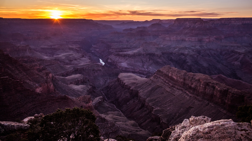
Photo: Giuseppe Milo (www.gmilo.com) via Flickr (CC BY 2.0)
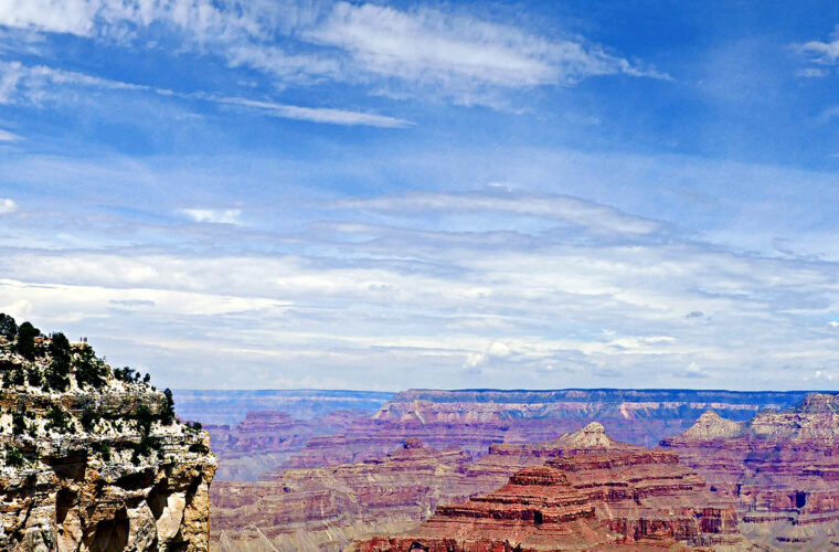
Our guide to the 10 Best Hikes Grand Canyon National Park visitors can tackle ranges from level rim walks to steep descents into rock layers nearly two billion years old. First time visitors should begin with the Rim Trail or a short section of the South Kaibab Trail. Experienced hikers can descend farther, but every uphill return requires sustained climbing at elevations above 6,000 feet.
The South Rim holds the greatest concentration of trailheads and remains the practical base for most trips. The quieter North Rim sits about 1,000 feet higher and is reached by a drive of roughly 210 miles from Grand Canyon Village. Trail distance alone can mislead here: sun exposure, elevation change, dry air, and summer temperatures inside the canyon frequently make a six mile hike feel harder than a much longer walk elsewhere.
How We Chose the 10 Best Hikes in Grand Canyon National Park
Our team selected routes that reveal distinct parts of the canyon rather than repeating ten versions of the same view. The list includes accessible rim scenery, maintained corridor trails, historic routes, forested North Rim paths, and quieter overlooks. Distances below are approximate because exact mileage can vary with the trailhead, turnaround point, and seasonal access arrangements.
Understand the Difference Between Rim and Inner Canyon Miles
The South Rim averages about 7,000 feet above sea level, while the Colorado River near the main corridor crossings lies around 2,400 feet. Descending feels deceptively easy because gravity assists and the temperature rises. The return reverses both advantages. A practical planning rule is to allow about twice as much time for the ascent as the descent, then add time for shade, food, and photographs.
Season and Elevation Shape Every Route
Spring and autumn generally provide the broadest hiking window, although snow and ice can linger near either rim. Summer brings dangerous heat below the rim, especially along exposed stretches of the South Kaibab and Grandview trails. The North Rim, at approximately 8,000 feet, receives heavier snow and has a shorter access season. Winter hikers on the South Rim should expect shaded switchbacks to remain icy after sunny viewpoints have dried.
What to Carry Below the Rim
- Water: Carry enough for the complete route. Never assume a seasonal water source is operating.
- Food: Pack salty snacks and substantial calories, particularly for climbs exceeding 1,000 vertical feet.
- Traction: Lightweight traction devices can be essential on icy upper switchbacks in winter and early spring.
- Sun protection: Use a brimmed hat, sunscreen, and clothing that covers exposed skin.
- Navigation: Download or carry a map even on maintained corridor trails, since mobile service is unreliable.
The 10 Best Hikes in Grand Canyon National Park at a Glance
These routes are ordered by the experience they provide rather than by difficulty. Several use a named turnaround point on a longer trail, allowing hikers to see the strongest section without committing to the Colorado River. Overnight travel below the rim generally requires a backcountry permit, while ordinary day hikes do not.
Distance and Difficulty of the 10 Best Grand Canyon Hikes
| Hike | Approximate distance | Elevation change | Best fit |
|---|---|---|---|
| Rim Trail | 1 to 13 miles | Minimal to moderate | Flexible rim walking |
| South Kaibab to Ooh Aah Point | 1.8 miles round trip | About 600 feet | First descent below the rim |
| Bright Angel to Havasupai Gardens | About 9 miles round trip | About 3,000 feet | Strenuous corridor hike |
| South Kaibab to Skeleton Point | 6 miles round trip | About 2,000 feet | Open inner canyon views |
| Grandview to Coconino Saddle | About 2.2 miles round trip | About 1,000 feet | Steep historic trail |
| Hermit Trail to Santa Maria Spring | About 4.4 miles round trip | About 1,700 feet | Rugged solitude |
| Shoshone Point | About 2.1 miles round trip | Minimal | Quiet forest and overlook |
| North Kaibab to Coconino Overlook | About 1.4 miles round trip | About 800 feet | Short North Rim descent |
| Cape Final Trail | About 4 miles round trip | Moderate | Secluded North Rim viewpoint |
| Widforss Trail | About 9.6 miles round trip | Moderate rolling terrain | Forest and canyon scenery |
Trailhead Logistics and Water Planning
Parking and seasonal transportation affect the South Kaibab, Hermit, and North Rim trailheads, while drinking water availability can change with weather or infrastructure conditions. Confirm current fees, road access, shuttle operations, water status, and permit rules on the official park site. Our report on South Rim services and water conservation also explains why hikers should fill containers before reaching a trailhead.
Best Grand Canyon South Rim Hikes for a First Visit
The central South Rim corridor provides the clearest introduction to Grand Canyon geology. Trails descend through pale Kaibab Limestone, fossil rich Toroweap Formation, cream colored Coconino Sandstone, and red Supai layers. Each formation erodes differently, creating cliffs, benches, slopes, and the prominent switchbacks visible from overlooks.
1. Rim Trail From Mather Point Toward Grand Canyon Village
The Rim Trail extends roughly 13 miles between the South Kaibab Trailhead area and Hermits Rest, with numerous access points for shorter walks. The section from Mather Point toward Yavapai Point provides expansive views into the central canyon and access to displays explaining its geology. Continuing west toward Grand Canyon Village adds historic architecture and changing views of Bright Angel Canyon.
2. South Kaibab Trail to Ooh Aah Point
This 1.8 mile round trip is the strongest short introduction to hiking below the rim. The trail drops about 600 feet from Yaki Point through tight limestone switchbacks before traversing an exposed ridge. There is little shade and generally no water along the route, so an early start matters even when the distance appears modest.
Below the switchbacks, boots scrape over pale limestone chips while the rim rises abruptly behind you. Wind crosses the ridge without warning, carrying raven calls through the open space. At Ooh Aah Point, the trail turns onto a narrow spine and the view suddenly reaches east and west, revealing stacked red buttes that the forested rim concealed only minutes earlier.
3. South Kaibab Trail to Skeleton Point
Skeleton Point extends the South Kaibab experience to a six mile round trip. Beyond Cedar Ridge, the route crosses open slopes to O’Neill Butte and descends through additional Supai layers. From the turnaround, hikers can glimpse the Colorado River far below. The sustained climb back to the rim, complete exposure, and roughly 2,000 feet of elevation gain make this a demanding day hike.
4. Bright Angel Trail to Havasupai Gardens
Bright Angel follows an Indigenous travel corridor later developed as a toll trail. The route descends through two rock tunnels, passes the seasonal resthouse areas, and reaches Havasupai Gardens beside Garden Creek after about 4.5 miles. Cottonwoods provide valuable shade near the gardens, but the return climb gains roughly 3,000 feet through the canyon’s upper rock layers.
Quieter South Rim Routes Beyond the Main Corridor
East and west of Grand Canyon Village, older trails descend through broken rock with fewer engineered switchbacks than Bright Angel or South Kaibab. Grandview and Hermit demand careful footing, while Shoshone Point stays on the rim and suits hikers seeking solitude without a major climb. These routes also lack the frequent patrol presence associated with the main corridor, so conservative turnaround times matter.
5. Grandview Trail to Coconino Saddle
Grandview Trail begins near the historic Grandview Point mining area and drops roughly 1,000 feet in about 1.1 miles to Coconino Saddle. Miners constructed portions of the route from fitted stones during the late nineteenth century, but erosion has left steep steps, loose cobbles, and narrow turns. The saddle provides views toward Horseshoe Mesa without requiring the longer descent to the mesa itself. Carry all needed water because the route has no dependable source.
6. Hermit Trail to Santa Maria Spring
Hermit Trail follows a route improved by the Santa Fe Railway in the early twentieth century. The descent crosses fractured limestone and reaches the shaded Santa Maria Spring area after passing through the upper canyon walls. Treat or filter any natural water encountered. Rockfall, washed-out steps, and uneven slabs make this hike slower than its mileage suggests, particularly during the climb back toward Hermits Rest.
7. Shoshone Point
Shoshone Point is reached by an approximately one-mile walk through ponderosa pine and pinyon-juniper woodland. The mostly level approach ends at a narrow limestone promontory overlooking Vishnu Temple and the eastern canyon. Because the viewpoint has abrupt, unguarded edges, children require close supervision. Wildlife is another reason to slow down: mule deer, Abert’s squirrels, elk, and wild turkeys frequently use the surrounding forest.
Best Grand Canyon North Rim Hikes Through Forest and Side Canyons
The North Rim’s higher elevation supports white fir, Douglas fir, aspen, and ponderosa pine before trails reach exposed canyon walls. Temperatures are commonly cooler than on the South Rim, yet thunderstorms, hail, and strong winds can develop quickly during summer afternoons. Road access is seasonal, making these three hikes practical only when the North Rim approach roads are open.
8. North Kaibab Trail to Coconino Overlook
The North Kaibab Trail begins near 8,200 feet and descends through dense forest before entering pale Coconino Sandstone. Coconino Overlook sits about 0.7 mile from the trailhead, with an elevation loss near 800 feet. Its shaded upper switchbacks can retain ice well into spring. Hikers continuing beyond the overlook should remember that the trail eventually drops more than 5,700 feet to the Colorado River, far beyond a reasonable casual day hike.
9. Cape Final Trail
Cape Final follows an old fire road for roughly two miles each way through open ponderosa forest. The route ends on the Walhalla Plateau above a broad view of Vishnu Temple, Jupiter Temple, and the eastern canyon. Elevation changes are relatively gentle compared with inner-canyon trails, although the exposed point offers little shelter from lightning. Start early when summer thunderstorms are forecast and leave the overlook before clouds build overhead.
10. Widforss Trail
Widforss Trail combines forest ecology with sustained rim views over approximately 9.6 miles round trip. The first section traces the edge of Transept Canyon, where openings reveal layered cliffs below. Farther west, the path enters deeper forest before reaching Widforss Point. Rolling terrain and an elevation near 8,000 feet make the hike tiring despite the absence of a major canyon descent. Allow most of a day and carry water for the entire distance.
Choosing a Route and Setting a Safe Turnaround
The 10 Best Hikes Grand Canyon visitors consider should be matched to elevation gain, heat exposure, and available daylight rather than mileage alone. Ooh Aah Point and Coconino Overlook deliver below-rim geology on shorter outings. Cape Final and Shoshone Point favor scenery with limited climbing, while Skeleton Point, Havasupai Gardens, and Widforss require sustained effort and stronger preparation.
Use Conditions to Adjust the Plan
Begin exposed descents near sunrise during warm months and set a turnaround time before leaving the trailhead. If water consumption exceeds half the carried supply before reaching the planned destination, turn around immediately. During winter, shaded upper switchbacks often remain icy even when temperatures at the rim feel mild. Thunderstorms create a different hazard on projecting viewpoints, where lightning can arrive before rain reaches the trail.
Share Corridor Trails Safely
Pack trains use Bright Angel, South Kaibab, and North Kaibab trails. When mules approach, step to the inside edge away from the drop, follow the wrangler’s instructions, and remain quiet until the final animal passes. Do not shelter beneath overhangs where rockfall debris has accumulated. Rest in wider areas that leave room for uphill hikers and emergency personnel.
Final Trailhead Check
- Record the route, destination, and expected return time with someone outside the hiking group.
- Carry a paper map, headlamp, first-aid supplies, electrolyte replacement, and insulating clothing.
- Inspect footwear for secure tread, especially before Grandview or Hermit Trail.
- Eat regularly during the descent instead of waiting until fatigue begins on the climb.
- Turn back for dizziness, confusion, vomiting, chills in hot weather, or an inability to maintain steady progress.
Plan Your Trip Around the 10 Best Hikes in Grand Canyon National Park
First-time visitors gain the clearest progression by walking part of the Rim Trail, descending to Ooh Aah Point, and reserving a longer day for one carefully chosen route. Experienced hikers can add Havasupai Gardens, Skeleton Point, Grandview, or Hermit Trail after accounting for elevation and seasonal temperatures. North Rim visitors should prioritize Widforss or Cape Final, then use Coconino Overlook for a short look into the canyon’s upper rock layers.
Choose one primary hike and one easier alternative for each day. Wind, ice, heat, smoke, or approaching storms can make the original plan unsuitable within hours. A flexible itinerary protects both the hiking party and the canyon’s limited rescue resources. With realistic turnaround points, sufficient water, and an early start, these ten trails reveal the park’s forests, historic pathways, exposed ridges, and immense vertical geology at a responsible pace.
Want to keep exploring? Browse all our Grand Canyon guides and articles for more trip-planning tips and ideas.
Gear & Essentials
Tell us about your trip and we will add what else you will want:
The basics
Worth having in the car whatever the park.
For this trip
Traveling with kids
Bringing a pet
RVing
Backcountry
Winter conditions
On the water
Photography
Accessibility
As an Amazon Associate we earn from qualifying purchases, at no extra cost to you.