How to Avoid the Crowds at Rocky Mountain National Park
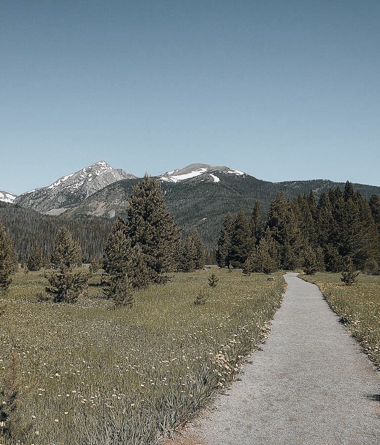
Photo: concrete&fells via Flickr (CC BY 2.0)
If your search was “How Avoid Crowds Rocky,” the practical answer is to choose a quieter park corridor, enter before peak arrival, and avoid building the entire day around Bear Lake. Rocky Mountain National Park covers 415 square miles, yet visitation concentrates along Bear Lake Road, Trail Ridge Road, Alberta Falls, and the alpine visitor facilities. Moving even one drainage away from those magnets can change the experience substantially.
Our team recommends planning in this order: select a park district, identify its parking constraint, choose a primary trail and backup, then set an arrival time. This approach is more reliable than arriving at an entrance and asking what looks quiet. Elevations range from about 7,600 feet to 14,259 feet on Longs Peak, so weather, snowpack, and hiking difficulty vary considerably across the park.
How to Avoid the Crowds at Rocky Mountain National Park by Mapping Busy Areas
Most congestion forms around a small number of famous destinations. Bear Lake, Nymph Lake, Dream Lake, Emerald Lake, Alberta Falls, Sprague Lake, and the upper Trail Ridge Road overlooks receive disproportionate attention. Estes Park also funnels several major highways toward the eastern entrances. On summer mornings, traffic and full trailhead parking can become limiting factors before visitors have chosen a trail.
Understand the Bear Lake Road bottleneck
Bear Lake sits at 9,475 feet and provides short access to several subalpine lakes. The trail to Emerald Lake is about 3.6 miles round trip, passing Nymph and Dream lakes, while Alberta Falls is approximately 1.6 miles round trip from the Glacier Gorge trailhead. Those modest distances attract families, first-time visitors, and hikers beginning longer routes toward Mills Lake, The Loch, and Sky Pond.
Parking farther down the road and using park transportation can solve the parking problem, but it does not make the lake trails quiet. For relative solitude, walk beyond the first landmark or choose another drainage. Trail construction can also redirect hikers. Our report on the temporary closure above Nymph Lake illustrates how one closure can affect several linked destinations.
Recognize when Trail Ridge Road becomes the main draw
Trail Ridge Road crosses the Continental Divide and reaches 12,183 feet, placing drivers directly in alpine tundra above treeline. Pullouts around Forest Canyon, Rock Cut, and the high alpine zone become busiest from late morning through afternoon. Wind, lightning, fog, and rapid temperature changes can close or complicate this corridor even during summer, while winter snow generally prevents through travel between Estes Park and Grand Lake.
| Park area | Typical crowd pattern | Useful alternative |
|---|---|---|
| Bear Lake Road | Heavy from morning through afternoon | Begin very early or select Wild Basin |
| Trail Ridge Road | Pullouts fill around midday | Cross early and stop on the return |
| Fall River entrance | Queues build on summer mornings | Enter outside the main arrival window |
| Grand Lake side | Generally quieter, with localized trailhead pressure | Use East Inlet, Green Mountain, or Coyote Valley |
How Timing Helps You Avoid Crowds in Rocky Mountain National Park
Timing matters most at parking-limited trailheads. A dawn arrival can provide a quieter trail and a safer weather window, particularly for routes above treeline where thunderstorms commonly develop during summer afternoons. Late-day visits can also work for roadside lakes and short walks, although hikers must leave enough daylight for the return and carry lighting in case the outing takes longer than expected.
Use the first and final hours of daylight
At Bear Lake near sunrise, packed dirt and granite feel firm underfoot, cold air settles over the water, and voices carry clearly through the spruce and fir. As the sun reaches Hallett Peak, the shoreline brightens before the shaded trail warms. Within an hour, shuttle arrivals and groups can replace the quiet. That transition explains why a modest change in arrival time matters more here than choosing a weekday at midday.
Evening is better suited to Sprague Lake, Sheep Lakes, Moraine Park, and roadside wildlife viewing than to exposed summit objectives. Elk frequently use open meadows, especially around dawn and dusk, but stopping in travel lanes creates both hazards and traffic. Use established pullouts, remain well away from wildlife, and expect sudden backups wherever animals become visible from the road.
Choose seasons and weekdays strategically
Midweek travel reduces some pressure, especially outside school holidays, but it does not empty the principal lake trails. September brings cooler mornings and elk activity in the montane valleys. Late September and early October can add golden aspen, occasional snow, and shorter daylight. Spring offers lower visitation, although deep snow and ice often remain above 9,000 feet long after lower elevations have dried.
- Summer: Start early, expect afternoon storms, and reserve exposed alpine hiking for the morning.
- Autumn: Avoid meadow bottlenecks during peak elk viewing hours and carry traction after early snow.
- Winter: Focus on the east side, where many roads remain accessible even though Trail Ridge Road does not cross the park.
- Spring: Plan for mud at lower elevations and consolidated snow in shaded subalpine forest.
Build an Itinerary Away from the Famous Lakes
A quieter itinerary pairs one less concentrated trail with one scenic drive or wildlife area. This keeps the day flexible if a parking area fills. It also prevents unnecessary driving between distant districts. Wild Basin and the Longs Peak area lie south of the Bear Lake corridor, while the East Inlet and North Inlet trailheads are reached from the Grand Lake side across the Continental Divide.
Use the southeastern trailheads
Lily Lake and the Twin Sisters area
Lily Lake, at approximately 8,930 feet, has a loop of about 0.8 mile with views toward Longs Peak and the Twin Sisters. It is a practical acclimatization walk for visitors arriving from lower elevations. Parking capacity is limited, so have another nearby plan rather than waiting along the highway. The Twin Sisters route is considerably steeper and climbs toward a summit above 11,000 feet.
Wild Basin beyond the first waterfall
Wild Basin receives fewer visitors than Bear Lake Road, although Copeland Falls and Calypso Cascades remain popular. Continuing toward Ouzel Falls creates a hike of roughly 5.4 miles round trip. The trail follows North St. Vrain Creek through lodgepole pine, aspen, and spruce forest. Hikers prepared for a longer day can continue toward Ouzel Lake, where distance naturally spreads parties farther apart.
Consider the west side from Grand Lake
The west side has a broader, wetter valley landscape shaped by the Colorado River headwaters. The East Inlet Trail reaches Adams Falls in approximately 0.6 mile round trip, so the waterfall itself can be busy. Continue into the meadow and forest beyond the falls to leave many short-stay visitors behind. Green Mountain Trail provides access to Big Meadows, about 1.8 miles from the trailhead, through forest affected by historic wildfire.
Coyote Valley offers a roughly one-mile, mostly level walk beside the Colorado River. It suits families, photographers, and visitors adjusting to elevation, though wildlife sightings can draw groups. Moose inhabit the wetter west-side valleys and willow stands. Give them extensive space, particularly cows with calves, and never rely on a boardwalk or narrow trail as a safe barrier.
How Better Logistics Help You Avoid Crowds at Rocky Mountain National Park
Rocky Mountain National Park has used seasonal timed-entry systems, including controls affecting the Bear Lake Road corridor. Requirements, reservation windows, transportation schedules, fees, road status, and construction access can change, so confirm current details on the official park site before choosing an entrance time. A reservation controls entry access rather than guaranteeing parking at a specific trailhead.
Prepare a primary route and a same-district backup
A useful backup should share the same entrance and require no cross-park drive. If Bear Lake parking is unavailable, consider a shuttle-accessible trail rather than driving toward Grand Lake. If Wild Basin is full, Lily Lake or a lower-elevation walk near the southeastern boundary may preserve the day. Crossing Trail Ridge Road simply to reach a backup can consume several hours when traffic and overlook stops are included.
- Download or carry a park map because cellular coverage is unreliable in mountain valleys.
- Save the correct entrance, trailhead, and backup trail before leaving lodging.
- Carry water, food, sun protection, a warm layer, and rain protection even on short hikes.
- Pack a headlamp for dawn starts and unexpected delays.
- Check elevation gain as carefully as mileage because thin air increases effort.
- Keep wildlife-viewing plans flexible and use designated pullouts rather than road shoulders.
Common Mistakes That Put You Back in the Crowd
Several crowd-avoidance tactics fail because they move visitors from one congested place to another. Leaving Bear Lake at noon for Alberta Falls rarely improves the experience, and circling a full parking area adds traffic without creating a space. A better response is to change the length or character of the outing. Deer Mountain, with a 10,013-foot summit and a route of roughly 6 miles round trip, spreads hikers across a longer trail while providing broad views over the eastern valleys.
Do not wait indefinitely for trailhead parking
Set a firm turnaround rule before entering a small lot. If no legal space appears after one pass, proceed to the backup selected during planning. Parking on vegetation, blocking emergency access, or squeezing beyond marked spaces can damage roadside habitat and lead to enforcement action. At Lumpy Ridge, the Gem Lake Trail offers a roughly 3.4-mile round trip through granite formations, but its lot can also fill. A backup must account for parking capacity, not simply trail popularity.
Do not trade crowds for avoidable risk
Starting in darkness requires a headlamp, route familiarity, and the ability to recognize trail junctions. Quiet afternoon routes above treeline can expose hikers to lightning, particularly on open terrain such as Flattop Mountain or the Ute Trail. Solitude also increases the consequences of a navigation error or injury. Leave an itinerary with someone outside the hiking party, carry an offline map, and turn around when thunder, worsening visibility, or altitude symptoms appear.
Pack for a Flexible Day Rather Than One Trail
A crowd-resistant plan may shift from a shaded forest route to an exposed overlook, so clothing and supplies must cover both settings. Temperatures can differ sharply between Estes Park, Bear Lake, and the alpine tundra. Sun intensity also increases with elevation. Carry enough equipment to accept a sensible alternative without returning to town, while keeping the pack light enough for the longest route under consideration.
Match equipment to the backup terrain
| Plan type | Useful equipment | Problem it prevents |
|---|---|---|
| Predawn trail start | Headlamp, spare power, warm gloves | Navigation errors and cold hands at junctions |
| Subalpine lake hike | Rain shell, insulation, offline map | Exposure during storms or route changes |
| Alpine tundra walk | Sun protection, wind layer, extra water | Rapid dehydration and wind chill |
| Snow or shoulder season | Traction, gaiters, trekking poles | Falls on packed ice and wet feet in soft snow |
Carry food and water beyond the planned mileage
Allow for a longer alternative, traffic delays, and slower movement at altitude. Headache, nausea, unusual fatigue, and dizziness can indicate altitude illness, particularly for visitors arriving directly from low elevations. Descending is the appropriate response when symptoms worsen. Keep food secured and within reach rather than leaving an open pack unattended. Ravens, ground squirrels, and chipmunks quickly investigate food at overlooks and lakeshores, and feeding them changes their behavior.
- Bring water for the full outing rather than depending on untreated streams.
- Choose compact snacks that can be eaten during an unplanned delay.
- Carry every wrapper and food scrap back out.
- Keep a warm layer accessible instead of burying it beneath other gear.
Use a Clear Contingency Plan When Conditions Change
The best How Avoid Crowds Rocky strategy includes a decision point for weather, parking, and physical condition. Decide in advance which factor will trigger a shorter walk. This prevents a group from debating options beside a congested road. Cub Lake, reached from the Moraine Park area on a route of roughly 4.6 miles round trip, can serve as a moderate forest and wetland alternative when higher objectives become unsuitable.
Pivot downward when storms build
If clouds begin growing vertically over the Continental Divide, move away from summits, exposed ridges, and isolated trees. Lower routes through ponderosa pine and montane meadow usually provide better options than waiting near treeline. Thunder means lightning is already close enough to matter. Separate group members slightly, return toward enclosed vehicles when practical, and avoid open water, metal railings, and shallow caves that offer poor lightning protection.
Replace a full trailhead with a different activity
A filled lot does not require another long search for parking. Combine a short legal stop with scenic driving, wildlife observation from established pullouts, or a picnic outside the busiest corridor. The Beaver Ponds area, Upper Beaver Meadows, and west-side Colorado River viewpoints create useful lower-commitment choices. Save the original hike for another morning rather than forcing it into a shrinking weather and daylight window.
How to Avoid the Crowds at Rocky Mountain National Park for a Better Day
Successful planning begins with geography rather than a list of famous sights. Choose one district, understand its parking limits, start within a safe weather window, and carry a nearby alternative suited to the same entrance. Longer trails beyond the first waterfall or lake often disperse visitors naturally, while Wild Basin, Lumpy Ridge, and the Grand Lake side provide practical choices outside the Bear Lake concentration.
Keep the plan flexible without compromising safety or resource protection. Legal parking, adequate equipment, realistic altitude expectations, and a firm weather turnaround matter more than reaching a particular landmark. With those decisions made before arrival, you can spend less time circling lots and more time walking through the park at a pace that suits both the landscape and your group.
Want to keep exploring? Browse all our Rocky Mountain guides and articles for more trip-planning tips and ideas.
Gear & Essentials
Tell us about your trip and we will add what else you will want:
The basics
Worth having in the car whatever the park.
For this trip
Traveling with kids
Bringing a pet
RVing
Backcountry
Winter conditions
On the water
Photography
Accessibility
As an Amazon Associate we earn from qualifying purchases, at no extra cost to you.