How to Get to Grand Canyon National Park: Airports, Roads and Getting Around
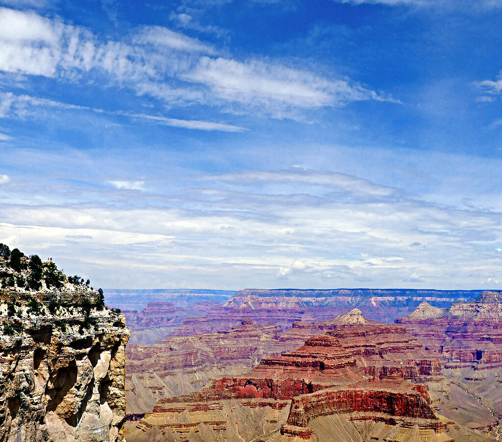
Photo: pom'. via Flickr (CC BY-SA 2.0)
A “How Get Grand Canyon” search can lead to the wrong destination unless you choose a rim before choosing an airport. Grand Canyon Village on the South Rim and the North Rim visitor area lie roughly 10 miles apart across the canyon, yet driving between them requires about 212 miles and at least 4.5 hours in favorable conditions.
Most first-time visitors use the South Rim, the park’s year-round hub at approximately 7,000 feet. The quieter North Rim sits above 8,000 feet and is reached from northern Arizona and southern Utah, but its access road closes seasonally because of snow. Grand Canyon West, home of the Skywalk, is on Hualapai land outside Grand Canyon National Park and should be planned as a separate destination.
How to Get to Grand Canyon National Park: Airports, Roads and Getting Around Starts With the Rim
Choose the South Rim for the broadest selection of viewpoints, lodging, food services, paved paths and transportation connections. Grand Canyon Village provides access to Mather Point, Yavapai Point, the Trail of Time, Bright Angel Trail and the South Kaibab Trail corridor. Desert View, 23 road miles east of the village, has a separate park entrance reached from Cameron and US 89.
How Get Grand Canyon Plans Change by Destination
The North Rim suits travelers approaching from Zion, Bryce Canyon, Kanab or Page, provided the access season matches the trip. Its higher elevation supports forests of ponderosa pine, white fir and quaking aspen, and temperatures commonly run cooler than on the South Rim. Cape Royal and Point Imperial are reached by slow, winding roads that add considerable driving beyond the entrance station.
| Destination | Best approach | Key planning issue |
|---|---|---|
| South Rim | Williams, Flagstaff or Cameron | Open year-round, with winter snow possible |
| North Rim | Jacob Lake via AZ 67 | Seasonal road closure |
| Grand Canyon West | Las Vegas or Kingman | Outside the national park |
| Inner canyon | South Rim or North Rim trailheads | No road crosses the canyon inside the park |
A Simple Decision Sequence
Lock down the rim before reserving flights, rental cars or lodging. A map search for “Grand Canyon” can prioritize whichever attraction is geographically closest, including locations outside the national park. Use the following order to prevent expensive rerouting:
- Choose the South Rim, North Rim or Grand Canyon West.
- Check seasonal road access for the chosen entrance.
- Select an airport based on total driving time and rental-car availability.
- Reserve lodging before finalizing a tightly timed itinerary.
- Download maps because cellular coverage is inconsistent near the canyon.
How to Get to Grand Canyon National Park: Choosing an Airport for the South Rim
Flagstaff Pulliam Airport is the closest airport with scheduled commercial service, about 90 road miles from Grand Canyon Village. Its limited route network can require a connection, but the shorter drive is valuable after a late arrival. Phoenix Sky Harbor has far more flights and rental cars. The drive from Phoenix is approximately 230 miles and usually takes 3.5 to 4 hours without substantial traffic or weather delays.
How to Get to Grand Canyon National Park: Airports Compared
Las Vegas Harry Reid International Airport is roughly 280 miles from the South Rim, commonly a 4.5-hour drive before stops. It works well for itineraries incorporating Hoover Dam, Route 66 or southern Utah. Page Municipal Airport is much closer to the East Entrance, but scheduled service is limited. Grand Canyon National Park Airport near Tusayan primarily supports scenic and charter flying rather than functioning as a major commercial gateway.
| Airport | Approximate distance to South Rim | Typical use |
|---|---|---|
| Flagstaff | 90 miles | Shortest practical commercial-airport drive |
| Phoenix | 230 miles | Widest flight and rental-car selection |
| Las Vegas | 280 miles | Road trips through Nevada or Route 66 |
| Page | 135 miles to the East Entrance area | Northern Arizona combinations |
Connections Without a Rental Car
Scheduled ground transportation sometimes links Phoenix or Flagstaff with Williams, Tusayan and the South Rim, while the Grand Canyon Railway carries passengers from Williams to the historic depot in Grand Canyon Village. The train is a sightseeing-oriented journey rather than a flexible local transit system. Service days, baggage rules and onward connections require advance coordination. Confirm current transportation schedules, entrance fees and reservation requirements on the official park site before booking nonrefundable travel.
How to Get to Grand Canyon National Park by Road to the South Rim
The South Entrance near Tusayan handles most traffic arriving from Williams, Flagstaff and Phoenix. From Interstate 40, drivers commonly use AZ 64 north from Williams. An alternative from Flagstaff follows US 180 northwest to AZ 64, though US 180 is a two-lane high-country road where snow, wildlife and slow vehicles can extend the trip.
Approaching Through the South Entrance
Tusayan sits immediately south of the park boundary, approximately 7 miles from Grand Canyon Village. Entrance backups can develop during busy spring, summer and holiday periods, particularly in late morning. Arriving early reduces queuing and improves parking options. In winter, check conditions for both the highway and park roads, then carry an ice scraper, warm layers and enough fuel to tolerate delays.
Why Elevation Matters on the Final Approach
The road climbs through ponderosa pine forest onto the Coconino Plateau, reaching elevations near 7,000 feet. A dry road in Flagstaff or Williams does not guarantee bare pavement at the rim. From late autumn through early spring, shaded sections can retain packed snow and ice after sunny stretches have melted elsewhere.
How Get Grand Canyon Travelers Can Use the East Entrance
Travelers coming from Page, Monument Valley or northern New Mexico can enter through Desert View by following US 89 to Cameron and turning west onto AZ 64. The road then traces approximately 25 miles of the South Rim before reaching Grand Canyon Village. This approach places Desert View Watchtower, Lipan Point, Moran Point and Grandview Point in a logical sequence without backtracking.
At Lipan Point, the ground changes from level pavement to broken limestone near the railings, and wind rises from the canyon even when the forest behind you feels still. The Colorado River appears as a narrow brown line thousands of feet below, while the tilted layers of the Grand Canyon Supergroup become visible beneath the broad horizontal cliffs. That sudden scale explains why short mileage between overlooks can still consume several hours.
Getting Around Grand Canyon National Park’s South Rim
Grand Canyon Village is spread across several districts rather than organized around one central parking lot. Visitor facilities, the historic district, lodging areas and major trailheads are separated by congested roads and limited parking. The practical strategy is to park once, then combine park shuttle buses with walking along the Rim Trail.
Using Shuttles and the Rim Trail Together
Shuttle routes generally connect major village areas, the South Kaibab Trailhead corridor and viewpoints along Hermit Road, although operating patterns vary by season. Private vehicles are restricted on portions of Hermit Road during much of the year. The mostly paved Rim Trail lets travelers walk selected segments and board a later shuttle, avoiding a full out-and-back route.
Distances That Affect Your Day
The Rim Trail extends for approximately 13 miles between the South Kaibab Trailhead area and Hermits Rest, with many shorter access points. The paved Trail of Time between Yavapai Geology Museum and Grand Canyon Village covers about 2.8 miles and uses markers to interpret nearly two billion years of exposed rock. Bright Angel Trail and South Kaibab Trail descend steeply below the rim and should never be treated as shortcuts between shuttle stops.
The North Rim Requires a Separate Road Strategy
North Rim access funnels through Jacob Lake, where US 89A meets AZ 67. From that junction, AZ 67 runs approximately 44 miles south to the developed rim. The route crosses the Kaibab Plateau, climbing through ponderosa pine, mixed conifer forest and open meadows where deer and bison can enter the roadway. Snow usually closes the highway during the colder months, so a North Rim itinerary must account for the full seasonal closure rather than relying on navigation software.
Allow Time for the Final Plateau Drive
AZ 67 is paved, but its two-lane alignment and wildlife exposure reward conservative speeds. Darkness makes animals difficult to see, particularly around meadow edges. Travelers arriving from Kanab, Page or Zion should fuel before beginning the final approach and avoid scheduling a tight sunset arrival. Mobile service becomes unreliable across the plateau, making downloaded directions or a paper Arizona highway map useful if a closure or missed turn forces a change.
Cape Royal and Point Imperial Add Slow Miles
The scenic roads beyond the visitor area are narrower and more winding than AZ 67. Point Imperial, at 8,803 feet, overlooks the eastern canyon and the distant Painted Desert. Cape Royal provides a broad view across Wotan’s Throne and toward the South Rim. Visiting both can occupy half a day because turnout stops, curves and limited parking slow progress considerably.
Getting Around Without a Village Shuttle Network
The North Rim does not function like the South Rim’s interconnected shuttle system. Visitors generally drive between the lodge area, campground vicinity and scenic-road viewpoints, then explore on foot. The paved Bright Angel Point Trail is short but exposed and steep in places. Longer routes such as the Widforss Trail require dedicated hiking time, while the North Kaibab Trail descends into the canyon and demands careful turnaround planning.
| North Rim objective | Primary access | Planning allowance |
|---|---|---|
| Bright Angel Point | Main visitor area | Walk from central parking areas |
| Point Imperial | Point Imperial Road | Slow mountain driving |
| Cape Royal | Cape Royal Road | Several hours with viewpoint stops |
| North Kaibab Trailhead | AZ 67 corridor | Separate hiking and pickup plan |
Build an Arrival Plan That Can Absorb Delays
A reliable How Get Grand Canyon plan includes time for weather, entrance congestion and navigation errors. Add at least one hour of flexibility before a fixed activity, and avoid placing a flight departure immediately after a rim-to-airport drive. Winter storms can affect Interstate 40, US 180, AZ 64 and local park roads simultaneously. Summer construction, crashes and holiday traffic can create delays even when the weather is clear.
Prepare the Vehicle Before Leaving the Gateway Town
Fuel, food and water are easiest to manage before reaching the park boundary. Electric-vehicle drivers should identify primary and backup charging locations, then consider elevation gain, cold-weather battery loss and extended idling. Water availability can also be affected by infrastructure conditions. Our reporting on South Rim water conservation and services explains why carrying an independent supply remains sensible.
- Download offline road and park maps.
- Carry drinking water, food and required medications.
- Pack an ice scraper and warm clothing outside summer.
- Keep the fuel tank above half full on remote approaches.
- Store lodging details and confirmation numbers offline.
Avoid Navigation Shortcuts on Unpaved Roads
Navigation apps sometimes suggest forest roads as alternatives to established highways. These routes can become muddy, snow-covered or impassable, and rental agreements may prohibit unpaved travel. Stay on signed state highways and paved park roads unless you have verified a route with the responsible land agency. Never assume a thin line on a digital map represents a maintained passenger-car road.
Use a Specific Contingency for Each Common Disruption
Match the response to the problem instead of improvising at the roadside. If the South Entrance is congested, waiting in Tusayan may be safer than attempting an unofficial detour. If snow affects US 180, the Interstate 40 and Williams approach may provide a better-maintained alternative. A closed North Rim access road requires changing destinations entirely because no nearby public road crosses the canyon.
| Problem | Practical response |
|---|---|
| Heavy snow near the South Rim | Use maintained highways, slow down and postpone if traction is inadequate |
| North Rim seasonal closure | Rebook for the South Rim or change the travel dates |
| Weak cellular signal | Follow downloaded maps and written route numbers |
| Late arrival | Skip distant overlooks and proceed directly to lodging |
Do Not Treat a Rim-to-Rim Hike as Transportation
The corridor trails connect the rims on foot, but the route involves thousands of feet of elevation change, desert heat and a major logistical commitment. It does not solve a misplaced rental car or lodging reservation. Travelers hiking rim to rim need separate vehicle repositioning or scheduled transportation planned well ahead, plus a weather-appropriate hiking itinerary.
Choose the Rim First, Then Control the Variables
Successful Grand Canyon transportation planning follows a clear sequence: select the correct rim, choose an airport based on the complete road journey, use established highways and decide how you will move around after arrival. South Rim travelers can combine centralized parking, shuttles and the Rim Trail. North Rim visitors should expect greater dependence on a private vehicle and slower scenic-road travel.
Build flexibility into every transfer, especially during winter weather, peak arrival periods and the North Rim’s limited access season. Offline maps, adequate fuel, independent water and a realistic arrival time prevent the most common problems. With those details settled before departure, the final approach becomes straightforward and your time at the canyon can begin at the overlooks rather than in a roadside scramble.
Want to keep exploring? Browse all our Grand Canyon guides and articles for more trip-planning tips and ideas.
Gear & Essentials
Tell us about your trip and we will add what else you will want:
The basics
Worth having in the car whatever the park.
For this trip
Traveling with kids
Bringing a pet
RVing
Backcountry
Winter conditions
On the water
Photography
Accessibility
As an Amazon Associate we earn from qualifying purchases, at no extra cost to you.