10 Best Spring Hikes in Joshua Tree National Park
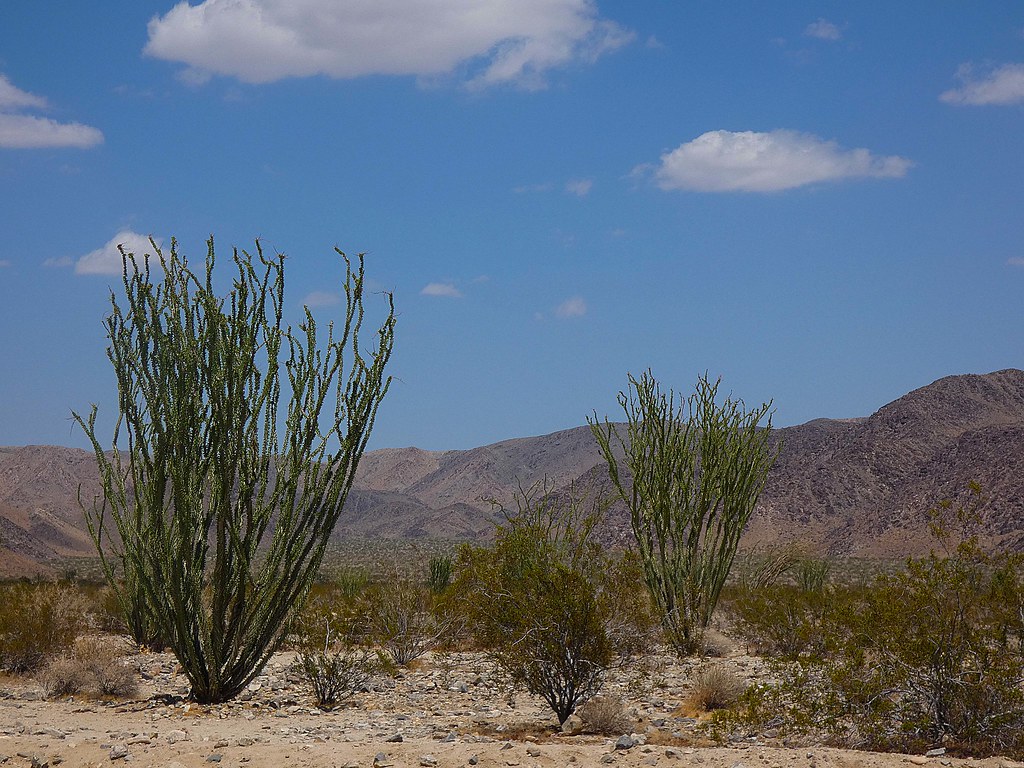
Photo: concrete&fells via Flickr (CC BY 2.0)
The 10 Best Spring Hikes in Joshua Tree National Park combine comfortable hiking temperatures, exposed granite formations, desert oases, mining history, and the possibility of seasonal wildflowers. For most visitors, the strongest hiking window runs from late February through April, although conditions vary sharply with elevation, wind, and the timing of winter rain.
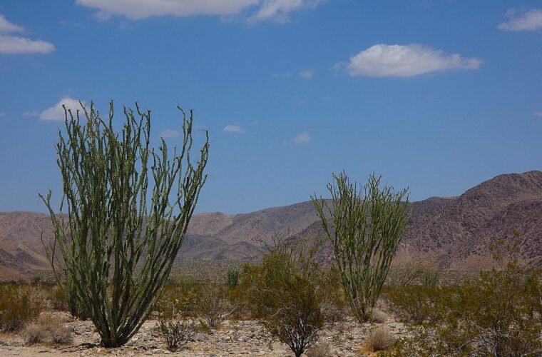
Joshua Tree covers two deserts. The higher Mojave Desert dominates the western half, where Joshua trees and monzogranite boulder piles surround trails such as Hidden Valley and Ryan Mountain. The lower Colorado Desert occupies the east and south, where cholla, ocotillo, and fan palm oases grow in warmer terrain. Spring hikers need to account for that elevation difference when choosing both trails and start times.
Why the 10 Best Spring Hikes in Joshua Tree National Park Shine This Season
Spring provides the broadest range of practical hiking choices. Morning temperatures can be cool enough for exposed climbs, while afternoons are often suitable for short nature loops. Summer heat makes many of the same routes hazardous, especially low elevation trails near Cottonwood Spring. Winter is excellent during calm periods, but cold fronts can bring freezing nights, powerful wind, and occasional snow at higher elevations.
The Core Spring Hiking Window
March and early April generally offer the best balance for full day itineraries. Low elevation routes warm first, so hikes such as Mastodon Peak and Lost Palms Oasis may require an early start even while Ryan Mountain remains cool. By late April, exposed slopes can become hot before midday. February often feels more like winter, particularly above 4,000 feet, but it can be ideal for strenuous climbing when the wind is light.
How Rainfall Changes the Desert
Wildflower displays depend on rainfall timing, temperature, and follow up moisture. Productive years may bring sand verbena, desert dandelion, brittlebush, lupine, and Canterbury bells, but blooms are never guaranteed. Flowers usually appear first in the warmer Colorado Desert and progress toward higher Mojave elevations. Rain also creates short lived hazards: washes can flood, granite becomes slick, and unpaved roads may remain damaged after the sky clears.
Comparing Spring With the Rest of the Joshua Tree Calendar
Each season changes where and when hiking is sensible. The park’s paved routes generally provide broad access throughout the year, but storms, flooding, wildfire response, or maintenance can close individual roads and trailheads. Unpaved routes are more vulnerable to washouts and deep sand. Summer visitors face the greatest limitation because shade is scarce and emergency response can take time in remote areas.
A Season by Season Planning Table
| Season | Typical conditions | Crowd pattern | Trail access and best uses |
|---|---|---|---|
| Spring | Cool mornings, warm afternoons, variable wind, possible flowers | Heaviest on weekends, holidays, and bloom periods | Best overall access for loops, summits, oases, and longer hikes |
| Summer | Extreme daytime heat, warm nights, occasional thunderstorms | Lower visitation away from sunrise and sunset | Short walks near dawn only; low desert hikes become especially hazardous |
| Autumn | Heat lingers in September, then temperatures moderate | Increasing visitation as conditions improve | Good for granite trails and moderate distances later in the season |
| Winter | Cold nights, mild sunny days, strong wind, occasional snow | Busy during holidays and warm weekends | Excellent for exposed climbs when surfaces are dry and wind is manageable |
Choosing Dates Around Your Priorities
Match the trip to the experience rather than relying on a single “best” week. Flower seekers should remain flexible because bloom timing can shift by several weeks. Hikers prioritizing cool temperatures should favor late February or March. Families planning short loops may prefer a calm weekday morning in March or April, while photographers often benefit from the longer spring evenings and lower angled light on granite formations.
- For fewer people: enter early on a Tuesday through Thursday and begin beyond the first cluster of trailheads.
- For strenuous routes: choose a cool, low wind morning and carry all required water from the start.
- For flowers: compare recent observations from both the Colorado and Mojave sections.
- For several short hikes: group nearby trailheads to avoid repeated drives through congested corridors.
Planning the 10 Best Spring Hikes in Joshua Tree National Park
Joshua Tree’s scale surprises first time visitors. The main park roads connect the West Entrance, North Entrance, and Cottonwood area, but trailheads are spread across different ecological zones. A route that pairs Hidden Valley, Barker Dam, and Wall Street Mill minimizes driving. Mastodon Peak and Lost Palms Oasis belong in a separate Cottonwood day because they sit far south of the central granite country.
How Crowds Affect a Hiking Day
Spring crowds create practical delays at entrance stations, junctions, and small trailhead parking areas. Hidden Valley, Barker Dam, Ryan Mountain, and Keys View are especially likely to fill during late morning. Starting at sunrise reduces parking pressure and heat exposure. If a lot is full, continue to a legal parking area rather than damaging roadside vegetation. Biological soil crust and young desert plants can take decades to recover from tires and repeated foot traffic.
Water, Permits, and Road Access
Carry all hiking water before entering the trail. A practical minimum for moderate spring outings is about one liter per person every two hours, with more needed during heat, wind, or sustained climbing. Electrolytes help on longer routes, but they do not replace water. Most ordinary day hikes require no separate trail permit, while entrance fees, campground reservations, backcountry registration, closures, and road conditions can change. Confirm current details on the official park site before departure.
Navigation deserves equal attention. Signed loops such as Hidden Valley are straightforward, but washes and informal tracks can confuse hikers around mines, boulder fields, and oasis routes. Download an offline map, carry a paper backup, and record the trailhead location. Mobile coverage is unreliable, and granite formations can block both sightlines and signals.
Start the 10 Best Spring Hikes in Joshua Tree National Park With These Four Routes
Our team starts the list with four trails that explain the park’s landscape unusually well. Together they cover enclosed granite valleys, human history, panoramic elevation, and the transition into the Colorado Desert. Distances below are approximate because short access paths and parking locations can alter recorded mileage.
Short Walks Through Granite and Desert History
Hidden Valley and Barker Dam are close enough to combine in one morning. Both are short, but they reward slow observation. Look for pinyon pine, juniper, Mojave yucca, cactus wrens, and weathered monzogranite. Stay on durable surfaces around water and vegetation, particularly near Barker Dam, where wildlife may approach the reservoir during dry periods.
1. Hidden Valley Nature Trail
This roughly 1 mile loop passes through a natural opening in a ring of granite formations. The mostly level route crosses sand, stone steps, and compacted trail while interpretive signs explain plant adaptations and the area’s ranching associations. Inside the valley, coarse granite presses close to the path, boots grind over pale sand, and voices echo from climbing walls. The enclosure blocks distant views until the trail rises toward the opening and the wider desert suddenly returns.
2. Barker Dam Loop
The approximately 1.1 mile loop reaches a small historic reservoir constructed by ranchers and later modified by the Barker and Shay cattle operation. Rock art and ranching remnants add context, although some markings were altered during the twentieth century. Water presence varies considerably. Even when the reservoir is dry, the surrounding bedrock, Joshua tree woodland, and broad sandy washes make this a useful introduction to Mojave Desert ecology.
Higher Views and Lower Desert Terrain
The next pair demands more effort and exposes hikers to weather for longer periods. Ryan Mountain climbs directly toward one of the park’s broadest viewpoints. Mastodon Peak is shorter and lower, but its warmer Colorado Desert setting makes an early spring start important. Neither route provides meaningful shade.
3. Ryan Mountain
Ryan Mountain rises to 5,457 feet and requires about 3 miles round trip with roughly 1,050 feet of elevation gain. Stone steps and a sustained grade lead above pinyon and juniper habitat to views of Lost Horse Valley, Queen Valley, Pinto Basin, and surrounding peaks. Wind can be much stronger near the summit than at the trailhead, so carry a light insulating layer even on a sunny morning.
4. Mastodon Peak Loop
This roughly 2.4 mile loop begins near Cottonwood Spring and gains about 375 feet through rolling Colorado Desert terrain. A short scramble reaches the granite summit of Mastodon Peak, while the main loop passes the remains of the Mastodon Mine. Ocotillo, cholla, and fan palms distinguish this landscape from the Joshua tree woodland farther north. Complete the exposed climb early when April temperatures are rising.
Six More Trails to Complete the Spring List
The remaining routes expand the 10 Best Spring Hikes from short granite loops to mining country, palm oases, and a point to point backcountry corridor. Their difficulty varies considerably. Arch Rock requires little time, while Lost Palms Oasis and the Boy Scout Trail demand stronger navigation, more water, and careful transportation planning.
Granite Formations and Mining Remains
These three hikes occupy the Mojave section of the park and work well from the North or West Entrance. They offer modest elevation changes compared with Ryan Mountain, but sandy surfaces can slow the pace. Around abandoned mining structures, avoid shafts, unstable timbers, and contaminated tailings.
5. Arch Rock Trail
The approximately 1.4 mile route from the Twin Tanks area reaches a naturally weathered granite arch. Follow marked paths carefully because numerous climbing tracks cross the boulder field. Morning light emphasizes the arch’s texture, while an evening return requires a headlamp and close attention to trail markers.
6. Split Rock Loop
This roughly 2.5 mile loop circles fractured monzogranite formations, including the enormous split boulder beside the trailhead. The route passes sandy washes, rocky steps, and shaded pockets beneath cliffs. Watch for climbers above the path and avoid lingering where loose rock could fall.
7. Lost Horse Mine
The direct hike to Lost Horse Mine covers about 4 miles round trip, while the longer loop extends the outing to approximately 6.5 miles. The ten stamp mill recalls one of the park’s most productive historic mines. The loop crosses exposed ridges with limited landmarks, making an offline map especially useful.
Oases and Backcountry Distance
Fan palm oases occupy fractures where groundwater reaches the surface. They are sensitive wildlife areas rather than swimming or picnic sites. Keep food packed, give bighorn sheep a wide corridor to water, and remain outside dense palm skirts where falling fronds and bees can create hazards.
8. Fortynine Palms Oasis
This 3 mile round trip climbs roughly 300 feet over a rocky ridge before descending to California fan palms. The return ascent feels hotter than the approach, particularly after midday. Its trailhead lies outside the main entrance stations near Twentynine Palms, so do not leave valuables visible in a parked vehicle.
9. Lost Palms Oasis
Lost Palms Oasis requires approximately 7.5 miles round trip from Cottonwood Spring, with about 500 feet of cumulative climbing. Rolling ridges and open washes provide little shade before the final overlook. Reaching the palms requires a steep descent that must be regained, so many hikers turn around at the overlook.
10. Boy Scout Trail
The Boy Scout Trail runs about 8 miles one way between Keys West and Indian Cove. It crosses Joshua tree woodland, sandy washes, and the edge of the Wonderland of Rocks. Arrange a two vehicle shuttle or a legal turnaround distance in advance. Route finding becomes harder where wash travel obscures footprints.
Match the Route to Time, Heat, and Experience
Distance alone does not predict effort in Joshua Tree. Deep sand, exposed climbing, wind, and a warm return can make a moderate trail unexpectedly tiring. Use the following comparison to identify routes that fit the day’s forecast and your group’s pace.
| Trail | Approximate distance | Primary challenge | Best spring timing |
|---|---|---|---|
| Arch Rock | 1.4 miles | Confusing side paths | Morning or late afternoon |
| Split Rock | 2.5 miles | Sand and rocky steps | Cool morning |
| Lost Horse Mine | 4 or 6.5 miles | Exposure and navigation | Early morning |
| Fortynine Palms Oasis | 3 miles | Hot return climb | Early morning |
| Lost Palms Oasis | 7.5 miles | Distance and scarce shade | Sunrise start |
| Boy Scout Trail | 8 miles one way | Transport and route finding | Cool, calm weekday |
A Simple Decision Framework
Choose Hidden Valley, Barker Dam, or Arch Rock when time is limited. Split Rock and Mastodon Peak suit hikers seeking a half day outing with varied terrain. Ryan Mountain provides the strongest summit workout, while Lost Palms Oasis offers the most demanding oasis hike. Experienced groups with transportation arranged can reserve a full day for the Boy Scout Trail.
- Forecast above your comfort range: shorten the route or start at sunrise.
- Strong wind: avoid exposed summits and ridgelines.
- Recent rain: skip flooded washes and slick granite scrambles.
- Mixed abilities: select a loop with a clear turnaround and regrouping points.
Build a Spring Hiking Plan That Leaves Room to Adapt
A practical two day plan groups Hidden Valley, Barker Dam, and Lost Horse Mine on one day, then uses the second for Ryan Mountain or a Cottonwood route. Three days allow a dedicated oasis hike and enough flexibility to respond to wind, heat, or parking congestion. Avoid pairing two long exposed trails unless every hiker has desert experience and sufficient water capacity.
Spring provides the widest selection, but conditions still determine the safest choice. Begin with elevation, forecast temperature, and wind, then consider distance and crowds. With those factors settled, the 10 Best Spring Hikes provide a balanced introduction to Joshua Tree’s granite basins, historic mines, Joshua tree woodland, Colorado Desert vegetation, and groundwater fed palm oases.
Want to keep exploring? Browse all our Joshua Tree guides and articles for more trip-planning tips and ideas.
Gear & Essentials
Tell us about your trip and we will add what else you will want:
The basics
Worth having in the car whatever the park.
For this trip
Traveling with kids
Bringing a pet
RVing
Backcountry
Winter conditions
On the water
Photography
Accessibility
As an Amazon Associate we earn from qualifying purchases, at no extra cost to you.