10 Best Winter Hikes in Joshua Tree National Park
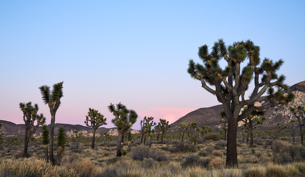
Photo: szeke via Flickr (CC BY-SA 2.0)
The 10 Best Winter Hikes begin to make sense at sunrise in Hidden Valley, when frost stiffens the bunchgrasses, granite walls hold the night’s cold, and ravens call across the empty basin. The coarse sand underfoot softens each step until the first light reaches the monzogranite, turning pale rock warm orange while shaded gullies remain close to freezing.
Winter gives hikers the most comfortable conditions for exploring Joshua Tree National Park’s exposed valleys, rocky summits, historic mine sites, and fan palm oases. This guide compares the seasons, explains winter access and crowd patterns, and starts our ranked selection of trails with reliable distances, elevation changes, and route characteristics.
Why the 10 Best Winter Hikes Belong in the Cool Season
Daytime temperatures favor longer routes
From December through February, typical daytime temperatures at lower elevations often reach the upper 50s or 60s Fahrenheit, while nights can fall near or below freezing. Higher locations such as Keys View, Ryan Mountain, and the park’s western uplands are colder and more exposed to wind. These conditions favor sustained climbs and open desert routes that become punishing during warmer months.
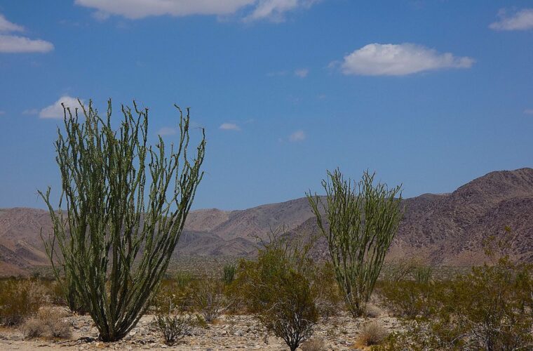
The park spans two deserts. Mojave Desert terrain dominates the higher western section, where Joshua trees grow among rounded monzogranite formations. Lower elevations in the east transition into the Colorado Desert, marked by creosote scrub, ocotillo, cholla, and broader alluvial plains. A winter itinerary can cross both ecosystems without the severe heat that limits summer hiking.
Cold weather still requires desert precautions
Low temperatures reduce heat stress, but they do not eliminate dehydration or sun exposure. The air is dry, shade is scarce, and reflected light from pale granite increases ultraviolet exposure. Carry water rather than expecting to find it at trailheads or oases. Natural water sources are ecologically sensitive and unreliable for human use.
- Carry at least two liters of water per person for shorter hikes, with more for long or steep routes.
- Pack insulating layers, gloves, and a wind-resistant shell for exposed ridges.
- Use a paper map or downloaded offline map because mobile service is inconsistent.
- Bring a headlamp during short winter days, even for an early afternoon start.
- Wear shoes with reliable traction for granite slabs, loose gravel, and sandy washes.
How Winter Compares With Joshua Tree’s Other Seasons
A season-by-season planning table
Joshua Tree remains accessible throughout the year, but hiking quality changes sharply with temperature, daylight, storms, and visitor volume. The following comparison reflects normal seasonal patterns rather than a forecast for a specific trip.
| Season | Typical conditions | Crowds | Access considerations | Best activities |
|---|---|---|---|---|
| Winter | Cool days, freezing nights possible, occasional rain or snow | High on holidays and weekends | Ice can affect high roads and shaded trails | Summits, long loops, mine routes, backpacking |
| Spring | Mild early, increasingly hot by late season, possible wildflowers | Very high during blooms and school breaks | Parking fills early at major trailheads | Wildflower walks, climbing, shorter hikes |
| Summer | Extreme daytime heat, warm nights, monsoon storms possible | Low during the day | Flash floods can close roads and washes | Brief sunrise walks and stargazing |
| Fall | Hot in early fall, comfortable later, cooler nights | Moderate, rising around holidays | Generally broad access after summer storm repairs | Climbing, camping, moderate hikes |
What winter crowds change on the ground
Cool weather attracts hikers, climbers, campers, and day visitors from Southern California. Hidden Valley, Barker Dam, Keys View, and Skull Rock experience the greatest parking pressure. Congestion also develops near the West Entrance, especially on holiday mornings. Entering through the North Entrance near Twentynine Palms can reduce time spent in an entrance queue when arriving from that direction.
Crowds affect route selection as much as scenery. Ryan Mountain may feel busy because its narrow trail concentrates hikers, while the longer Lost Horse Mine Loop disperses visitors across more miles. Starting near sunrise improves parking availability and provides extra daylight if loose footing or route-finding slows the group.
Roads, reservations, and permits
Main park roads are paved, but winter storms can leave snow or ice around Keys View Road, Ryan Mountain, and other higher western areas. Heavy rain may damage unpaved roads or make washes impassable. Day hiking generally requires no trail permit, while overnight backcountry travel uses a separate registration system. Campground reservations, entrance fees, closures, and registration procedures can change, so confirm current details on the official park site before departure.
Choosing Among the 10 Best Winter Hikes
Match the route to temperature and wind
Use elevation and exposure to refine the day’s plan. Ryan Mountain rises to 5,457 feet and can be cold or windy even when lower trails feel pleasant. Fortynine Palms Oasis descends into a sheltered canyon, but the return climb is exposed to afternoon sun. Lost Palms Oasis lies in the warmer Colorado Desert and often suits colder winter days better than high western routes.
After rain, avoid entering narrow washes if additional storms are forecast. Water can move quickly through drainages even when precipitation falls several miles away. Snow creates a different problem: shaded granite steps and north-facing slopes may stay icy after open ground has melted.
A practical decision framework
- Choose Hidden Valley or Barker Dam for a short introduction with minimal climbing.
- Choose Ryan Mountain for a strenuous summit and broad park views.
- Choose Lost Horse Mine Loop for mining history and a half-day outing.
- Choose Fortynine Palms or Lost Palms Oasis for native California fan palms.
- Choose Split Rock or Skull Rock for granite formations and family-friendly scrambling.
- Choose the Boy Scout Trail or Panorama Loop when mileage matters more than famous landmarks.
Families should consider footing as well as mileage. Several short trails include rock steps, sandy sections, and tempting scrambling areas beside the formal route. Hikers with limited mobility may find firm nature trails easier than washes, where deep sand increases effort despite modest elevation gain.
The First Four of the 10 Best Winter Hikes in Joshua Tree National Park
Short routes through classic Joshua Tree terrain
1. Hidden Valley Nature Trail
The 1-mile loop enters an enclosed basin through a narrow opening in the rocks. Its modest elevation change makes it an effective first walk after a long drive, while interpretive signs identify pinyon pine, juniper, desert scrub, and the human history of the valley. Monzogranite walls surround the route, creating colder shaded pockets on winter mornings.
2. Barker Dam Loop
This approximately 1.1-mile loop combines granite formations, Joshua tree woodland, Indigenous cultural features, and a small historic reservoir built by cattle ranchers. Water levels vary with rainfall, but the basin can attract birds and bighorn sheep. Stay well back from wildlife and avoid approaching the water’s edge when animals are present.
Routes for views and desert history
3. Ryan Mountain Trail
Ryan Mountain is a 3-mile round trip with roughly 1,000 feet of climbing. Stone steps and exposed switchbacks lead to the 5,457-foot summit, where views extend toward Queen Valley, Lost Horse Valley, Pinto Basin, and the surrounding ranges. Winter wind can make the summit considerably colder than the trailhead, so carry a shell even under clear skies.
4. Lost Horse Mine Loop
The roughly 6.5-mile loop visits one of the park’s best-preserved historic mining areas and gains about 850 feet. Lost Horse Mine produced gold and silver during the late nineteenth and early twentieth centuries. The route crosses open slopes with little shade, passes Joshua tree woodland, and requires attention at junctions where old roads and informal tracks can cause confusion.
Completing the 10 Best Winter Hikes in Joshua Tree National Park
Oases in two different desert zones
5. Fortynine Palms Oasis Trail
This 3-mile round trip climbs over a rocky ridge before descending to a stand of native California fan palms. Expect roughly 600 feet of total elevation change and little shade before the oasis. The return ascent is the harder half, particularly once the south-facing slopes warm. Avoid touching or entering the water, which supports bighorn sheep and other wildlife.
6. Lost Palms Oasis Trail
Beginning near Cottonwood Spring, this approximately 7.5-mile round trip crosses rolling Colorado Desert terrain to an overlook above a secluded palm-filled canyon. The trail gains and loses elevation repeatedly rather than making one continuous climb. Allow four to five hours, and resist descending into the steep oasis canyon unless prepared for loose rock, scrambling, and a demanding climb back out.
Granite formations and longer backcountry miles
7. Split Rock Loop
This 2.5-mile loop winds among monzogranite domes, narrow passages, and large freestanding boulders. Elevation change is moderate, but sandy washes and uneven rock slow the pace. The quieter setting provides a useful alternative when Hidden Valley and Skull Rock are congested. Watch carefully for trail markers where the route crosses open granite and branching washes.
8. Skull Rock Nature Trail
The approximately 1.7-mile loop explores Jumbo Rocks, where weathering has enlarged two hollows in a granite boulder into the feature that gives the trail its name. Parking beside Park Boulevard fills quickly because drivers can see Skull Rock from the road. Walking the complete loop reveals additional washes, sculpted boulders, and desert vegetation missed by roadside stops.
9. Boy Scout Trail
The Boy Scout Trail runs about 8 miles one way between Keys West and Indian Cove, crossing Joshua tree woodland before descending toward the Mojave Desert’s lower edge. A vehicle shuttle creates the cleanest point-to-point itinerary. An out-and-back can be shortened at any chosen turnaround, but hikers must reserve enough water and daylight for the return across exposed terrain.
10. Panorama Loop
Starting at Black Rock, the roughly 6.6-mile Panorama Loop climbs through dense Joshua tree woodland into the Little San Bernardino Mountains. About 1,100 feet of elevation gain makes it one of the stronger conditioning hikes on this list. Junctions connect with the Warren Peak and Burnt Hill trails, so carry a map and verify each turn rather than following the busiest track.
| Trail | Distance | Primary challenge | Best fit |
|---|---|---|---|
| Fortynine Palms Oasis | 3 miles round trip | Exposed return climb | Half-day oasis walk |
| Lost Palms Oasis | 7.5 miles round trip | Repeated climbs | Cool, clear winter day |
| Split Rock Loop | 2.5-mile loop | Sandy, uneven footing | Quieter granite scenery |
| Skull Rock Nature Trail | 1.7-mile loop | Parking congestion | Families and short visits |
| Boy Scout Trail | 8 miles one way | Shuttle logistics | Distance hikers |
| Panorama Loop | 6.6-mile loop | About 1,100 feet of gain | Strong hikers seeking views |
Build the Day Around Light, Traffic, and Recovery Time
Use trailheads in geographic clusters
Joshua Tree’s internal drives consume substantial daylight. Group Hidden Valley, Barker Dam, Ryan Mountain, Lost Horse Mine, and Skull Rock into western or central park days. Pair Cottonwood Spring with Lost Palms Oasis in the southern Colorado Desert. Fortynine Palms has a separate road approach from Twentynine Palms, while Black Rock is reached from Yucca Valley without connecting to the main park road inside the boundary.
Plan for winter’s short hiking window
December provides fewer than ten hours between sunrise and sunset. Begin Lost Palms, Boy Scout, Panorama, or Lost Horse early enough to absorb navigation delays, rest stops, and slower travel over sand. Short routes work well late in the day, but granite formations block direct sunlight before official sunset and make shaded trail sections difficult to read.
- Use weekday mornings for Ryan Mountain and Barker Dam.
- Reserve holiday periods for less concentrated routes such as Split Rock or Panorama Loop.
- Keep a short backup hike ready if a trailhead lot is full.
- Set a turnaround time before beginning any out-and-back route.
Adjust the List When Winter Weather Arrives
After rain, snow, or strong wind
Rain can leave potholes on dirt access roads and send runoff through sandy washes. Snow is uncommon at lower elevations but can accumulate around Keys View and the western highlands. After a cold storm, favor lower routes near Cottonwood or Fortynine Palms while ice persists on shaded stone steps. During strong wind, replace Ryan Mountain with a lower loop protected by granite walls.
Choose according to the day’s priority
For geology, combine Hidden Valley, Split Rock, and Skull Rock. For cultural history, Barker Dam and Lost Horse Mine provide the strongest pairing. Oasis hikers should choose Fortynine Palms for a shorter commitment and Lost Palms for a longer backcountry day. Ryan Mountain and Panorama Loop suit visitors prioritizing elevation gain, while Boy Scout Trail rewards efficient point-to-point planning.
Putting the 10 Best Winter Hikes Into One Plan
A first visit works best with one demanding route and one short loop per day. Pair Ryan Mountain with Hidden Valley, Lost Horse Mine with Barker Dam, or Lost Palms Oasis with the brief paths around Cottonwood Spring. This structure leaves enough time for winter road delays and prevents fatigue from accumulating across consecutive exposed hikes.
The 10 Best Winter Hikes cover both desert ecosystems, several levels of difficulty, and landscapes ranging from historic mine country to palm oases and high ridges. Choose according to wind, temperature, daylight, and trailhead congestion rather than following the ranking rigidly. That flexible approach produces safer days and makes better use of Joshua Tree’s limited winter light.
Want to keep exploring? Browse all our Joshua Tree guides and articles for more trip-planning tips and ideas.
Gear & Essentials
Tell us about your trip and we will add what else you will want:
The basics
Worth having in the car whatever the park.
For this trip
Traveling with kids
Bringing a pet
RVing
Backcountry
Winter conditions
On the water
Photography
Accessibility
As an Amazon Associate we earn from qualifying purchases, at no extra cost to you.