Sequoia National Park in Fall: What to Expect and What to Do
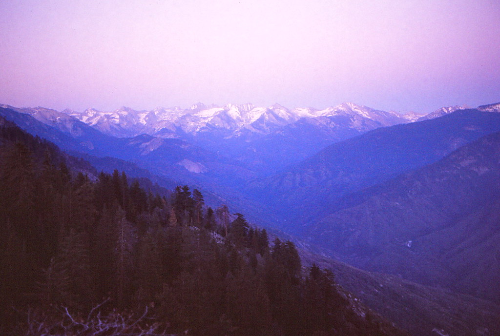
Photo: Ladycliff via Flickr (CC BY 2.0)
Sequoia National Park fall travel brings cooler hiking weather, thinner crowds, changing oak and dogwood leaves, and the possibility of an early Sierra Nevada snowstorm. Elevation controls the experience: the park rises from roughly 1,370 feet in the foothills to 14,494 feet on Mount Whitney, so visitors can encounter summerlike heat and freezing temperatures during the same trip.
September usually provides the broadest trail and road access, October brings stronger fall color and colder nights, and November shifts toward winter conditions in the giant sequoia groves. This guide explains those differences, compares fall with the other seasons, and covers the access decisions that can determine which parts of the park you can realistically visit.
Why Sequoia National Park Fall Conditions Vary by Elevation
Most first-time visits center on Giant Forest, Lodgepole, Moro Rock, and Crescent Meadow, all located around 6,400 to 7,000 feet. These areas cool quickly after sunset and may receive snow while the lower foothills remain dry. The elevation difference also explains why fall color unfolds gradually rather than appearing everywhere at once.
Three elevation zones shape every itinerary
The foothills near the Ash Mountain Entrance contain chaparral, blue oak woodland, and the marble-carved drainage of the Kaweah River. Giant Forest occupies a cooler middle elevation where massive sequoias grow among white fir, sugar pine, incense cedar, and black oak. Higher routes reach granite basins and exposed alpine terrain, where overnight freezes begin early and snow lingers after comparatively small storms.
- Foothills below about 4,000 feet: Expect warm afternoons, dry slopes, and better hiking temperatures later in fall.
- Sequoia groves around 5,000 to 7,500 feet: Prepare for cold mornings, shaded ice, and occasional snowfall by October.
- High country above 8,000 feet: Expect freezing nights, rapidly changing weather, and diminishing backcountry access as fall progresses.
Why the giant sequoias stay green
Giant sequoias are evergreen conifers, so the famous groves do not turn gold as a whole. Seasonal color comes from California black oak, Pacific dogwood, bigleaf maple, willow, and shrubs along streams and meadow margins. Look around Crescent Meadow, the edges of Giant Forest, and lower sections of the Generals Highway. Color timing depends on elevation, moisture, wind, and the arrival of hard freezes.
Sequoia National Park in Fall: What to Expect Each Month
Fall behaves as a progression rather than a single dependable weather window. September often resembles a quieter extension of summer, while November can require winter driving equipment and flexible plans. Sunrise also arrives later behind the high ridges, leaving shaded groves noticeably colder than exposed overlooks.
September favors high country access
September generally offers the best chance of reaching higher trailheads before snow affects roads and passes. Days are often dry, thunderstorms become less frequent than in midsummer, and destinations such as Alta Peak, Pear Lake, and Mineral King may remain accessible. Smoke from regional wildfires can still reduce visibility, however, and waterfalls including Tokopah Falls usually carry far less water than during spring snowmelt.
October balances color with uncertainty
October is often the strongest compromise between comfortable daytime hiking and visible autumn color. Black oaks develop yellow and bronze leaves, dogwoods can turn pink or red, and morning frost becomes common in meadows. Storms may temporarily close roads or create icy sections on shaded trails. Daylight contracts quickly, so longer hikes require earlier starts than visitors often expect.
November begins the winter transition
By November, snow and ice become realistic planning factors around Giant Forest and Lodgepole. The park remains rewarding for short grove walks and lower-elevation hikes, but high-country routes may require traction devices, snow travel skills, or a change of plan. Seasonal facilities and lodging options also become more limited, while the foothills usually provide comparatively mild alternatives.
How Sequoia National Park in Fall Compares With Other Seasons
Fall trades peak waterfall flow and maximum service availability for lower traffic and cooler walking temperatures. Its main disadvantage is uncertainty: an early storm can change road conditions overnight, while a prolonged dry spell can leave September feeling much like late summer. The comparison below shows how those tradeoffs affect common trip priorities.
| Season | Crowds | Typical conditions | Road and trail access | Best suited to |
|---|---|---|---|---|
| Spring | Moderate, increasing near summer | Snow at higher elevations, strong runoff, mild foothills | High routes remain snowbound; some seasonal roads stay closed | Waterfalls, foothill wildflowers, river scenery |
| Summer | Heaviest near major groves and overlooks | Hot foothills, mild grove temperatures, afternoon thunderstorms | Broadest access to high-country trails and seasonal roads | Backpacking, alpine hiking, family trips with maximum services |
| Fall | Moderate in September, lighter later | Dry early, colder nights, increasing snow risk | Usually broad early, progressively reduced by storms and closures | Grove walks, fall foliage, photography, quieter hiking |
| Winter | Lowest outside holiday periods | Snow in the groves, rain or mild weather in the foothills | Chain controls and seasonal closures limit flexibility | Snowshoeing, snowy sequoias, lower-elevation hiking |
What lower crowds change on the ground
Reduced traffic matters most at confined locations such as the General Sherman Tree parking area, Moro Rock, Tunnel Log, and narrow sections of the Generals Highway. In summer, parking delays can shape an entire day. During much of fall, visitors gain more freedom to stop at overlooks and walk the popular trails without moving in a continuous line of people.
Choosing fall according to your priorities
Choose September for alpine trails and the widest likely access. Choose October for a stronger combination of foliage, comfortable midday temperatures, and manageable crowds. Choose November for quiet groves and potential snow scenes, provided the itinerary can shift toward lower elevations. Travelers focused on waterfalls should favor spring, while those planning demanding backcountry routes generally gain more predictable access in summer.
Road Access, Reservations, and Arrival Strategy
Sequoia’s mountain roads are steep, winding, and slower than their mileage suggests. The Generals Highway connects the foothills with Giant Forest, then continues toward Grant Grove in neighboring Kings Canyon National Park. Curves, construction, wildlife, ice, and fallen branches can all increase driving time, especially after a storm.
Sequoia National Park Fall entrance choices
The Ash Mountain Entrance on Highway 198 approaches from Three Rivers and climbs sharply toward Giant Forest. The Big Stump Entrance on Highway 180 reaches Grant Grove first, followed by a longer drive south to Sequoia’s principal grove area. Large vehicles face length advisories on the narrow switchbacks above the foothills, making the Highway 180 approach preferable for some drivers.
Seasonal roads and storm closures
Mineral King Road is a narrow, winding seasonal route into a high glacial valley and typically closes as winter approaches. Roads to Moro Rock and Crescent Meadow may also shift to seasonal access patterns, while snow can trigger temporary chain controls elsewhere. Check current road status, entrance requirements, fees, facility availability, and reservation rules on the official park site before departure.
Permits and reservations to plan ahead
Day hiking on standard front-country trails generally does not require a wilderness permit. Overnight backcountry travel does, and quota systems commonly cover the main hiking season before transitioning to different fall procedures. Lodging and developed campgrounds may require advance reservations, although some campgrounds and services close seasonally. Fall visitors should secure accommodation first, then build daily plans around the elevations and roads that remain accessible.
First Experiences to Prioritize in the Giant Forest
Giant Forest contains five of the world’s ten largest trees by volume, including the General Sherman Tree. Its trail network supports anything from a brief roadside stop to several hours of walking among sequoias, meadows, and mixed-conifer forest. Fall’s cooler temperatures make the longer interconnected loops more comfortable than they are during hot summer afternoons.
Sequoia National Park Fall walks among the largest trees
The main General Sherman Tree route is about 1 mile round trip and descends roughly 200 feet on the way in, leaving the climb for the return. Congress Trail adds a paved loop of approximately 2 miles through groups of named sequoias. Big Trees Trail makes an easy circuit of about 1.2 miles around Round Meadow, where interpretive signs explain how fire and moisture shape the grove.
Standing beneath the General Sherman Tree
Near the base, the paved path feels small against a trunk more than 36 feet across at ground level. Cool air settles under the canopy, fallen sequoia needles soften the sound of footsteps, and the upper branches disappear behind neighboring firs when viewed from close range. Walking a few minutes onto Congress Trail creates a clearer sense of scale because the crowd noise fades and multiple immense trunks appear between the darker conifers.
Moro Rock and Crescent Meadow
Moro Rock’s staircase climbs roughly 350 steps to an exposed granite summit with views across the Great Western Divide and the Kaweah River canyon. Ice, wind, or lightning can make the route unsafe. Nearby Crescent Meadow offers gentler terrain, sequoia-lined paths, and a roughly 1.8-mile meadow loop, making it a practical alternative when exposed rock is wet or frozen.
Explore Beyond the Main Sequoia Groves
Giant Forest deserves substantial time, but fall also improves several trails at lower and higher elevations. Warm foothill routes become more comfortable as October advances, while September often preserves access to granite lakes and exposed summits. Matching the hike to the day’s freezing level is safer than committing to one trail before seeing conditions.
Follow the Marble Fork to Tokopah Falls
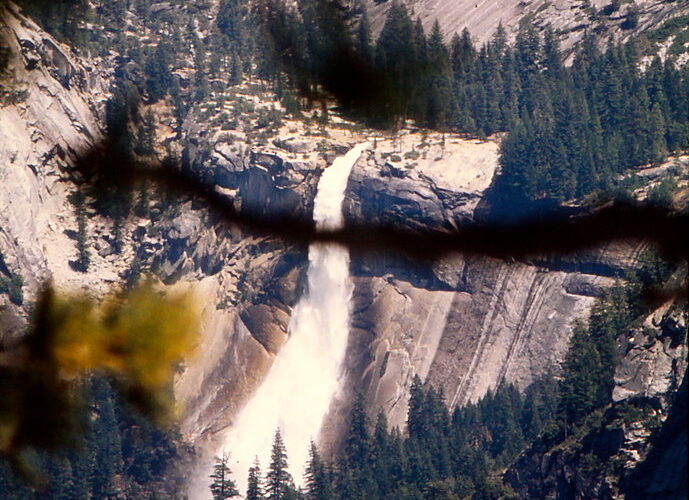
The Tokopah Falls Trail runs about 3.4 miles round trip from Lodgepole and gains roughly 600 feet beside the Marble Fork of the Kaweah River. Autumn water flow is usually modest, but the route still provides close views of glacially carved granite walls. Watch for ice on shaded rocks after cold nights. Far below the groves, the Marble Falls Trail near Potwisha covers about 7.4 miles round trip and gains approximately 2,400 feet, making it a strenuous option for a cool foothill day.
Attempt higher routes only in stable weather
Alta Peak reaches 11,204 feet after a demanding hike of nearly 14 miles round trip with about 4,000 feet of climbing. September offers the best fall window, although wind, freezing temperatures, and early snow can arrive before winter. Turn around when clouds obscure the Great Western Divide or snow conceals the trail. Lower objectives on the Lakes Trail provide useful alternatives when the summit route becomes impractical.
Build a Fall Itinerary That Can Change
A workable Sequoia National Park fall plan pairs one primary objective with a lower or less exposed alternative. Mountain weather can separate nearby destinations into different seasons within a single morning. Keep food, warm layers, and traction equipment in the vehicle so a road closure or icy trail becomes a change of route rather than a lost day.
A focused one day visit
Enter early, walk one of the longer Giant Forest loops, and reserve the afternoon for an overlook or meadow trail. Early arrival protects limited daylight and leaves time for slower driving after sunset. If Moro Rock is icy, replace it with a forest walk instead of waiting for the surface to thaw.
A flexible two day plan
Use the first day for the middle elevations, then choose the second day according to observed conditions:
- Dry and stable: Hike Tokopah Falls or a higher section of the Lakes Trail.
- Fresh snow in the groves: Choose short, level forest paths and avoid exposed granite.
- Persistent ice or poor visibility: Descend toward Hospital Rock, the Kaweah River corridor, or a foothill trail.
- Warm foothill forecast: Start early, carry extra water, and expect sun exposure on chaparral slopes.
Prepare for Cold, Darkness, and Wildlife
Fall hazards often develop during transitions rather than major storms. Meltwater can refreeze after sunset, shaded pavement may remain slick through the morning, and temperatures can drop sharply when the sun leaves a canyon. Cellular coverage is unreliable across much of the park, so download maps and leave the day’s route with someone outside your group.
Match equipment to the forecast
| Condition | Useful preparation | Best adjustment |
|---|---|---|
| Below freezing morning | Insulating layer, gloves, traction devices | Delay steep shaded trails until surfaces soften |
| Wind at exposed overlooks | Wind resistant shell and warm hat | Choose sheltered grove or meadow routes |
| Early snowfall | Waterproof footwear and dry spare clothing | Reduce mileage and avoid concealed trail edges |
| Short daylight window | Headlamp with spare batteries | Set a firm turnaround time before departure |
Store food correctly and respect fire conditions
American black bears remain active during fall as they search for calorie rich food before winter. Use designated storage boxes where provided, keep scented items secured, and never leave food visible in an unattended vehicle. Dry vegetation can also sustain wildfire well into autumn. Smoke may affect air quality far from the source, so check regional conditions before strenuous hiking and avoid any activity that could create sparks.
Choosing the Right Time for a Sequoia National Park Fall Visit
September is the practical choice for long alpine hikes, Mineral King access, and the greatest likelihood of snow free trails. October better suits visitors prioritizing colored oak and dogwood leaves, cooler midday walks, and easier parking near major sights. November rewards flexible travelers who welcome quiet groves and possible snow but can redirect their plans toward the foothills.
The strongest itinerary follows elevation rather than a rigid checklist. Begin with the destinations most vulnerable to storms, keep a lower route ready, and allow extra driving time on the Generals Highway. With that structure, autumn’s changing conditions become manageable, and each day can be shaped around the safest available combination of groves, granite, foliage, and open road.
Want to keep exploring? Browse all our Sequoia guides and articles for more trip-planning tips and ideas.
Gear & Essentials
Tell us about your trip and we will add what else you will want:
The basics
Worth having in the car whatever the park.
For this trip
Traveling with kids
Bringing a pet
RVing
Backcountry
Winter conditions
On the water
Photography
Accessibility
As an Amazon Associate we earn from qualifying purchases, at no extra cost to you.