5 Best Hikes in Sequoia National Park
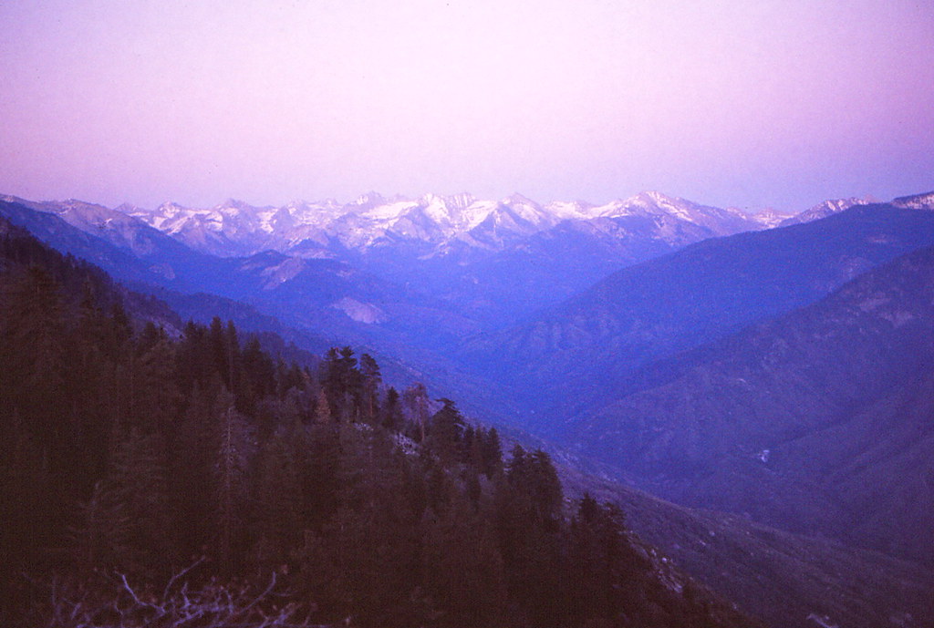
Photo: Ladycliff via Flickr (CC BY 2.0)
The Best Hikes Sequoia National Park visitors can choose reveal themselves early beside the General Sherman Tree, where morning light reaches through cinnamon colored trunks and catches on the forest floor. The paved path feels cool underfoot, even after the surrounding slopes begin to warm. Voices fade beneath the canopy, and the scale becomes clear only when hikers pass behind a giant sequoia and disappear from view.
Sequoia’s strongest day hikes fall into three distinct landscapes: the giant sequoia groves around Giant Forest, the granite domes and waterfalls along the Generals Highway, and the higher alpine country reached from Wolverton. Our five selections cover each zone, ranging from a short stair climb up Moro Rock to a demanding ascent of 11,204 foot Alta Peak.
How the 5 Best Hikes in Sequoia National Park Compare
Sequoia National Park rises from roughly 1,300 feet in the foothills to 14,494 feet on Mount Whitney, creating major differences in temperature, snow cover, and vegetation. Most first time hikers concentrate on the higher Generals Highway corridor between Giant Forest and Lodgepole. That area places giant sequoias, granite viewpoints, and the Marble Fork of the Kaweah River within a relatively compact part of the park.
Three hiking zones along the Generals Highway
Giant Forest contains the General Sherman Tree, Congress Trail, and numerous connecting paths through mature sequoia groves. A few miles south, Moro Rock rises above the canyon of the Middle Fork Kaweah River. North of Giant Forest, Lodgepole provides access to Tokopah Valley, while nearby Wolverton is the starting point for the Lakes Trail and Alta Peak Trail.
Road distances can appear short on a map, but the Generals Highway is narrow and winding. Reaching Giant Forest from the Ash Mountain entrance commonly takes about one hour without heavy traffic. The road climbs more than 5,000 vertical feet through oak woodland, chaparral, mixed conifer forest, and finally the sequoia belt.
Elevation determines trail conditions
Congress Trail and Moro Rock sit near 7,000 feet, Tokopah Falls begins around 6,700 feet, and the Wolverton routes climb well above 9,000 feet. Snow can linger into early summer on shaded high elevation slopes, while the foothills below are already hot and dry. Afternoon thunderstorms become an additional concern on exposed ridges during summer.
Visitors should check road status, trail closures, current entrance requirements, shuttle operations, and weather advisories before driving into the park. Parking patterns and seasonal transportation arrangements change, so confirm current details on the official park site.
Best Hikes in Sequoia National Park: Trail Comparison
These five routes were chosen for variety rather than distance alone. Congress Trail delivers the strongest sequoia grove experience, Moro Rock provides the most accessible panoramic viewpoint, and Tokopah Falls follows a glacial valley beside a mountain river. The Lakes Trail and Alta Peak supply the longer alpine objectives.
| Hike | Approximate distance | Elevation gain | Difficulty | Defining feature |
|---|---|---|---|---|
| Congress Trail | 2 mile loop, plus approach | About 200 feet | Easy to moderate | Dense giant sequoia grove |
| Moro Rock | About 0.5 mile round trip | About 300 feet | Moderate | Exposed granite summit |
| Tokopah Falls | 3.4 miles round trip | About 630 feet | Moderate | River canyon and seasonal waterfall |
| Lakes Trail to Pear Lake | About 12 miles round trip | About 2,700 feet | Strenuous | Subalpine lakes and granite cliffs |
| Alta Peak | About 14 miles round trip | About 4,000 feet | Very strenuous | 11,204 foot summit |
Choosing a route for your available time
Travelers with half a day can combine Congress Trail and Moro Rock because both lie in the Giant Forest area. Tokopah Falls works better as a separate half day outing from Lodgepole. Pear Lake and Alta Peak require early starts, steady pacing, and enough daylight to handle long descents safely.
- Best first hike: Congress Trail, particularly for visitors adjusting to elevation.
- Best short viewpoint: Moro Rock, provided exposed stairs are comfortable.
- Best spring waterfall walk: Tokopah Falls during strong snowmelt.
- Best lake route: Pear Lake via the Lakes Trail.
- Best summit challenge: Alta Peak in stable, snow free conditions.
Congress Trail Through the Heart of Giant Forest
Congress Trail begins near the General Sherman Tree, the world’s largest known living tree by trunk volume. The main loop covers about two miles, although the total outing is longer when the walk from parking or a transit stop is included. The path is paved, but gradual climbs and the park’s elevation can make it feel harder than its mileage suggests.
Why this is one of the 5 Best Hikes in Sequoia National Park
The trail passes named groups including the House and Senate, clusters of mature giant sequoias whose closely spaced trunks resemble assembled columns. It also reaches the President Tree, one of the grove’s largest specimens. These trees depend on Sierra Nevada snow, well drained soils, and periodic fire that clears competing vegetation and exposes mineral soil for seedlings.
Walk the loop clockwise for a quieter finish
From the Sherman Tree area, a clockwise circuit reaches the President Tree and Senate grouping before returning through quieter sections of mixed conifer forest. Sugar pine, white fir, and incense cedar fill spaces between the sequoias. Side paths can complicate navigation, so photographing the trail map at the junction is useful.
Allow time for the climb back
The Sherman Tree sits downhill from the primary parking area. Visitors often underestimate the return because the outbound walk feels easy. Take the uphill section slowly, carry water, and watch for headache or unusual breathlessness if you have arrived directly from low elevation. Snow and ice can remain on shaded pavement after sunny sections have cleared.
Moro Rock and Tokopah Falls: Granite Above, River Below
Moro Rock and Tokopah Falls explain how glaciers, rivers, and erosion shaped the western Sierra Nevada. Moro Rock is a granite dome overlooking deep river canyons, while Tokopah Valley is a broad glacial trough enclosed by cliffs. Together they provide two contrasting moderate hikes without requiring an all day alpine commitment.
Moro Rock’s carved staircase
The Moro Rock route climbs roughly 350 stone and concrete steps to a summit around 6,725 feet. Railings protect much of the staircase, but several passages are narrow and exposed. The summit overlooks the Great Western Divide, the Middle Fork Kaweah canyon, and foothill ridges descending toward California’s Central Valley.
Start early to avoid heat on the exposed granite and congestion on the narrowest stairs. Storm clouds require immediate attention because the summit has little protection from lightning. People with a strong fear of heights may prefer nearby forest trails, since looking down through railings is unavoidable in several places.
Tokopah Falls through a glacial valley
Tokopah Falls Trail starts near Lodgepole and follows the Marble Fork of the Kaweah River for approximately 1.7 miles upstream. The route initially passes through lodgepole pine and fir forest before entering a more open valley beneath the granite walls of the Watchtower and surrounding ridges.
The waterfall drops in a long series of cascades totaling roughly 1,200 feet, but its character depends heavily on snowmelt. Late spring and early summer usually bring the strongest flow. By late summer, the cascade may shrink considerably, while exposed sections of trail become hotter and afternoon storms become more relevant.
The Lakes Trail From Wolverton to Pear Lake
The Lakes Trail begins at Wolverton and climbs through red fir forest toward four glacial basins: Heather, Aster, Emerald, and Pear lakes. Pear Lake is the full day objective, but the intermediate lakes create useful turnaround points. The trail’s sustained ascent, exposed granite, and elevation above 9,000 feet make this route considerably harder than Tokopah Falls.
The Watchtower route reveals the glacial terrain
When snow free and open, the Watchtower branch crosses a granite shoulder with a direct view into Tokopah Valley. The trail is narrow beside steep drop offs, and ice can make this section hazardous. The alternative Hump route stays farther from the cliff but adds climbing. Heather Lake appears first, while Emerald Lake occupies a higher granite basin beneath Alta Peak.
Pear Lake rewards the full climb
Pear Lake sits near 9,500 feet beneath pale granite walls shaped by glacial ice. On the approach, the forest thins and broad slabs replace the shaded lower trail. Afternoon wind can cool the basin quickly, even after a warm climb. Day hikers should establish a firm turnaround time because most of the return follows the same long descent to Wolverton.
Alta Peak Above the Great Western Divide
Alta Peak is the hardest route in this list and should be reserved for hikers comfortable with sustained climbing at altitude. The summit rises to 11,204 feet, high enough for altitude symptoms to affect visitors arriving from sea level. Stable weather, an early departure, and previous acclimatization around Giant Forest or Lodgepole improve the chances of completing it safely.
Panther Gap provides the first major viewpoint
The route climbs from Wolverton through fir forest before reaching Panther Gap, where views open toward the Middle Fork Kaweah canyon. The junction for Alta Meadow appears farther along. That meadow makes a worthwhile alternate destination when the summit is obscured, thunderstorms are developing, or the remaining elevation gain exceeds the group’s pace.
The final ridge is exposed and demanding
Above the meadow junction, switchbacks climb through sparse foxtail pines and increasingly open granite. The final approach can hold snow after lower trails have melted, and route finding becomes harder where footprints cross lingering drifts. From the summit, clear conditions reveal the Great Western Divide and distant Sierra crest. Begin descending well before storm clouds reach the ridge.
Match Each Trail to the Season and Your Gear
The Best Hikes Sequoia National Park visitors attempt in June can look very different from the same routes in September. Snowmelt strengthens Tokopah Falls but can leave the Lakes Trail icy. Late summer usually improves high country access, although waterfalls diminish and smoke from regional fires can reduce visibility. Autumn brings colder mornings and shorter hiking windows.
A practical seasonal comparison
| Period | Likely advantage | Primary concern |
|---|---|---|
| Late spring | Strong waterfall flow and cooler lower trails | Snow, ice, and runoff at higher elevations |
| Early summer | Long daylight and improving trail access | Lingering snowfields and swift water |
| Late summer | Best chance of snow free alpine routes | Heat, thunderstorms, and possible smoke |
| Early autumn | Quieter trails and crisp visibility | Short daylight and freezing temperatures |
Carry equipment for elevation changes
Temperatures can differ sharply between the foothills and Wolverton. Carry layers rather than relying on the forecast for the park entrance. Giant sequoia roots and polished granite also become slick after rain, while exposed routes provide little shelter from sun or lightning.
- Carry enough water for the complete route, plus salty food for longer climbs.
- Pack a paper map or downloaded map because reception is unreliable.
- Bring traction when recent reports describe compacted snow or ice.
- Use sun protection on Moro Rock, the Watchtower, and Alta Peak.
- Store food securely and keep wildlife from accessing packs.
Choosing Among the 5 Best Hikes in Sequoia National Park
Congress Trail and Moro Rock form the strongest pairing for a first day, combining the park’s largest trees with a broad Sierra viewpoint. Tokopah Falls suits hikers seeking a moderate river walk, especially during snowmelt. Pear Lake requires a full day and rewards steady climbers with a sequence of granite basins rather than a single destination.
Alta Peak belongs at the end of an acclimatized itinerary, after weather and personal pace have been tested on lower routes. Choose by elevation, current surface conditions, and available daylight rather than mileage alone. That approach turns these five hikes into a practical progression through Sequoia’s defining landscapes, from giant sequoia forest to exposed alpine granite.
Want to keep exploring? Browse all our Sequoia guides and articles for more trip-planning tips and ideas.
Gear & Essentials
Tell us about your trip and we will add what else you will want:
The basics
Worth having in the car whatever the park.
For this trip
Traveling with kids
Bringing a pet
RVing
Backcountry
Winter conditions
On the water
Photography
Accessibility
As an Amazon Associate we earn from qualifying purchases, at no extra cost to you.