Visiting Sequoia National Park with Limited Mobility: Accessible Views and Trails
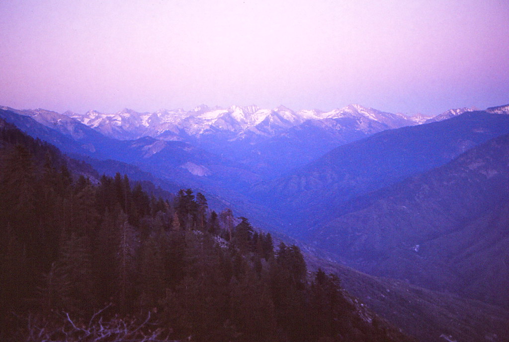
Photo: Ladycliff via Flickr (CC BY 2.0)
Visiting Sequoia National Park with limited mobility is most rewarding in Giant Forest, where paved paths and roadside viewpoints provide access to sequoia groves at roughly 6,400 feet. The park protects more than giant trees, however. Its terrain rises from oak-covered foothills near 1,700 feet to 14,494-foot Mount Whitney, producing steep roads, substantial elevation changes, snowbound high country, and very different conditions within a single day.
Our team recommends planning around three achievable experiences: entering a living sequoia grove, seeing the General Sherman Tree, and following the Generals Highway to overlooks reached with little walking. This guide explains which areas work for wheelchairs, walkers, canes, and limited stamina, along with the slopes, surfaces, driving demands, and seasonal barriers that maps often fail to communicate.
Understanding the Park Before Visiting Sequoia National Park with Limited Mobility
Sequoia’s elevation controls the experience
Sequoia National Park occupies the western slope of California’s Sierra Nevada. The main entrance near Three Rivers leads into the foothills, then the Generals Highway climbs approximately 5,000 vertical feet to Giant Forest. Although the road distance is modest, tight curves and slow traffic make the ascent demanding. Drivers commonly need about 75 minutes to reach Giant Forest from the entrance area, without lengthy stops.
That elevation gain matters for visitors with respiratory conditions, heart conditions, vertigo, or reduced stamina. Giant Forest sits high enough for some people to notice breathlessness, particularly while pushing a manual wheelchair or walking uphill. Move slowly after leaving the vehicle, drink regularly, and schedule the least strenuous stop first. Summer temperatures can exceed 100 degrees Fahrenheit in the foothills while the sequoia groves remain considerably cooler.
Why giant sequoia groves require careful route selection
Giant sequoias grow naturally only in scattered groves on the Sierra Nevada’s western slope, generally between about 5,000 and 7,000 feet. Their fibrous bark can exceed two feet in thickness, and mature trees survive many low-intensity fires. Fire opens the forest canopy, exposes mineral soil, and helps release seeds from cones. This ecology creates uneven ground, fallen branches, exposed roots, and drainage channels beyond developed paths.
Paved routes are therefore especially valuable. They let visitors enter the grove without negotiating the loose duff and root systems found on conventional trails. Paving does not guarantee a level route, however. Mountain drainage requires grades that may challenge manual wheelchair users, while pine needles, ice, and broken twigs can reduce traction.
Visiting Sequoia National Park Through Its Most Accessible Corridors
The Foothills and Generals Highway ascent
The Foothills Visitor Center area lies near the park’s lower entrance and provides a useful acclimation and planning stop before the climb. The surrounding landscape is dominated by blue oak, California buckeye, chaparral, and the Middle Fork of the Kaweah River rather than giant sequoias. Hospital Rock, farther up the highway, preserves Native American pictographs and bedrock mortars, although surfaces and viewing conditions vary around the site.
Above the foothills, the Generals Highway becomes narrow and sharply curved as it passes exposed granite slopes. Several pullouts reveal the Kaweah River canyon and the Great Western Divide. These roadside views demand far less exertion than summit trails, but parking areas may have uneven pavement or gravel shoulders. Passengers prone to motion sickness should sit facing forward, keep cool air circulating, and allow time for brief stops.
Giant Forest is the accessibility center
Giant Forest contains thousands of mature sequoias and offers the park’s strongest concentration of short, developed experiences. Giant Forest Museum is the practical orientation point for the grove. Big Trees Trail begins nearby, while roads branch toward the General Sherman Tree, Moro Rock, and Crescent Meadow. Seasonal traffic controls can affect how visitors reach these sites, so confirm current road access, shuttle operation, parking rules, fees, and facility details on the official park site.
Standing beside Round Meadow on Big Trees Trail, visitors move over firm pavement beneath a canopy that filters the midday sun into narrow shafts. Sequoia bark feels deeply furrowed and dry, while the meadow introduces cooler air and the sound of birds moving through the forest edge. The trees appear broad from a distance, but their scale becomes clearer when the path bends and an entire trunk fills the view overhead.
Lodgepole and the northern approach
Lodgepole lies about two miles north of Giant Forest at approximately 6,700 feet. The developed area can serve as a pause between the Sherman Tree and the drive toward Kings Canyon National Park. Trails leaving Lodgepole quickly become rougher and steeper. The popular route to Tokopah Falls is roughly four miles round trip over rocky terrain, making it unsuitable for most wheelchair users and many visitors with balance or endurance limitations.
North of Lodgepole, the highway continues through conifer forest toward Grant Grove in neighboring Kings Canyon National Park. This connection allows travelers to pair accessible sequoia experiences in both parks, but driving time accumulates quickly. A limited-mobility itinerary usually works better when Giant Forest receives most of the day, with Grant Grove reserved for a separate outing or an overnight trip.
Accessible Views and Trails to Prioritize When Visiting Sequoia National Park
Comparing the principal low-exertion experiences
Accessibility depends on more than mileage. Grade, cross-slope, elevation, rest opportunities, snow, and the distance from parking all influence whether a route is manageable. The following figures provide planning estimates for the principal developed experiences. Individual ability and current surface conditions should guide the final choice.
| Location | Approximate distance | Surface and grade | Best suited for |
|---|---|---|---|
| Big Trees Trail | About 0.7 mile loop | Paved, generally gentle, with some grades | Wheelchairs, walkers, and slow-paced walking |
| General Sherman accessible route | Short approach from designated parking | Paved with a gradual grade | Visitors using mobility devices or disability parking |
| Auto Log | Roadside stop | View primarily from the vehicle or parking area | Very limited walking capacity |
| Tunnel Log | Drive-through or roadside view | Vehicle-based experience | Visitors who need to remain seated |
| Moro Rock area | View from road or parking vicinity | Summit route has roughly 350 stone steps | Roadside scenery rather than the summit climb |
Visiting Sequoia National Park with Limited Mobility via Big Trees Trail
Big Trees Trail circles Round Meadow near Giant Forest Museum. Interpretive panels explain fire ecology, meadow hydrology, and sequoia growth, giving the route more context than a simple tree viewing stop. The loop is paved and approximately 0.7 mile long, but some sections may require assistance for manual wheelchair users. Benches allow visitors to divide the circuit into short segments.
Before starting, assess the path rather than relying solely on its accessible designation. Conditions that can change the experience include:
- Snow or ice lingering beneath shaded trees in spring.
- Pine needles and cones reducing traction after wind.
- Warm afternoon temperatures and thinner air at elevation.
- Temporary detours caused by fire work or damaged pavement.
- Black bears near meadow edges, requiring secure food storage and generous distance.
The General Sherman Tree with reduced walking
The General Sherman Tree is the world’s largest known living tree by trunk volume. It stands about 275 feet tall and measures more than 36 feet across at the base. The standard trail from the main parking area descends roughly 200 feet over about half a mile, creating a strenuous uphill return that can surprise visitors who found the walk down manageable.
Visitors with an appropriate disability parking placard can generally use designated parking closer to the tree and approach by a shorter paved route. Traveling companions should still expect some slope and crowded viewing areas. Early morning reduces both congestion and summer heat, while late-season snow or ice can make even the shorter approach impractical for wheels, canes, and unsteady walkers.
Low-effort stops beyond the Sherman Tree
The Moro Rock and Crescent Meadow corridor adds several vehicle-based sequoia experiences without committing to a long trail. Access along this spur road is seasonal, and traffic controls sometimes change how visitors reach individual stops. Allow at least an hour for slow driving, parking, and photographs. The narrow roadway passes close to massive trunks, so drivers should watch mirrors carefully and use designated pullouts rather than stopping in a travel lane.
Auto Log, Tunnel Log, and Crescent Meadow
Auto Log is a fallen sequoia once used as a novelty driving surface, although vehicles no longer travel onto the trunk. Tunnel Log, another fallen giant, has a vehicle passage cut through it and a bypass for vehicles that cannot fit. Crescent Meadow marks the road’s end. The meadow itself is easiest to appreciate from near the parking area because routes toward Tharp’s Log and Log Meadow include natural surfaces, roots, and longer distances.
Granite views without climbing Moro Rock
Moro Rock rises to 6,725 feet, but its summit requires climbing approximately 350 stone steps with narrow passages and exposed drop-offs. Visitors can still study the granite dome from the parking vicinity and nearby roadway. Beetle Rock, close to Giant Forest Museum, provides a broader west-facing view across the Kaweah drainage after a short paved approach. Its sloping granite surface can be awkward for wheelchairs, walkers, and anyone with uncertain balance.
Choosing a season for stable surfaces
Snow commonly limits access to Giant Forest from late autumn into spring, while summer brings the most dependable pavement conditions. Mountain weather does not follow the foothills forecast. A warm afternoon near Three Rivers can coincide with freezing temperatures around the sequoias. Tire-chain requirements may apply during storms, and shaded paths can retain ice after open roads and parking areas have dried.
How seasonal conditions affect mobility
| Period | Likely conditions | Mobility consideration |
|---|---|---|
| Spring | Melting snow, wet pavement, and cold shade | Expect ice patches and reduced traction near groves |
| Summer | Dry paths, busy parking areas, and hot foothills | Start early and carry water before the long ascent |
| Autumn | Cool mornings and possible early snow | Good pacing weather when roads remain clear |
| Winter | Snow, chain controls, and limited high-elevation access | Vehicle preparation becomes the central concern |
Build recovery time into the day
Visiting Sequoia National Park at a slower pace works best with one primary grove experience and several brief roadside stops. Complete the most important paved route during the morning, then alternate sitting and walking. A practical sequence is:
- Pause in the foothills before beginning the winding climb.
- Use Big Trees Trail or the shorter Sherman approach as the main activity.
- Rest and eat before driving the Moro Rock corridor.
- Finish at Beetle Rock or another roadside viewpoint before descending.
Equipment and safety for a mountain park
Mobility devices must handle elevation, temperature changes, and forest debris. Manual wheelchair users may benefit from a companion on grades, while powered-chair users should begin with a full battery because cold weather and sustained slopes can reduce range. Cell service is unreliable in much of the park. Download maps beforehand and leave the day’s route with someone who is not traveling with the group.
A compact accessibility kit
Small items can prevent a manageable outing from becoming uncomfortable. Carry gloves for wheelchair propulsion, an extra cane tip, medication, water, and a warm layer even in summer. A seat cushion helps during long drives on the Generals Highway. Traction attachments may help on cold-season pavement, but they do not make an icy slope safe. Keep mobility equipment secured inside the vehicle on the winding descent.
Bears, altitude, and emergency decisions
American black bears regularly forage around meadows and developed areas. Keep food, toiletries, and scented items secured according to posted storage rules, and never approach a bear for a photograph. Headache, nausea, unusual fatigue, or worsening breathlessness can indicate difficulty adjusting to elevation. Stop exertion, rest with a companion, and descend if symptoms persist. Drivers should also use lower gears on long descents to reduce brake overheating.
Planning for Visiting Sequoia National Park with Limited Mobility
Giant Forest provides the strongest combination of paved routes, close sequoia views, and short transfers from a vehicle. Prioritize either Big Trees Trail or the designated approach to the General Sherman Tree, then add Auto Log, Tunnel Log, Beetle Rock, or the Moro Rock parking area according to remaining energy. Avoid measuring success by the number of stops. Elevation and grades make a short mountain itinerary physically substantial.
The best plan matches surface conditions to the visitor’s mobility device and reserves enough stamina for the return journey. Check the weather at grove elevation, prepare for the winding Generals Highway, and choose one signature tree experience before adding optional viewpoints. That approach preserves flexibility while giving visitors meaningful access to the immense scale, fire-shaped ecology, and high Sierra setting that define Sequoia National Park.
Want to keep exploring? Browse all our Sequoia guides and articles for more trip-planning tips and ideas.
Gear & Essentials
Tell us about your trip and we will add what else you will want:
The basics
Worth having in the car whatever the park.
For this trip
Traveling with kids
Bringing a pet
RVing
Backcountry
Winter conditions
On the water
Photography
Accessibility
As an Amazon Associate we earn from qualifying purchases, at no extra cost to you.