How to Get to Sequoia National Park: Airports, Roads and Getting Around
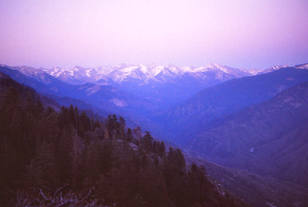
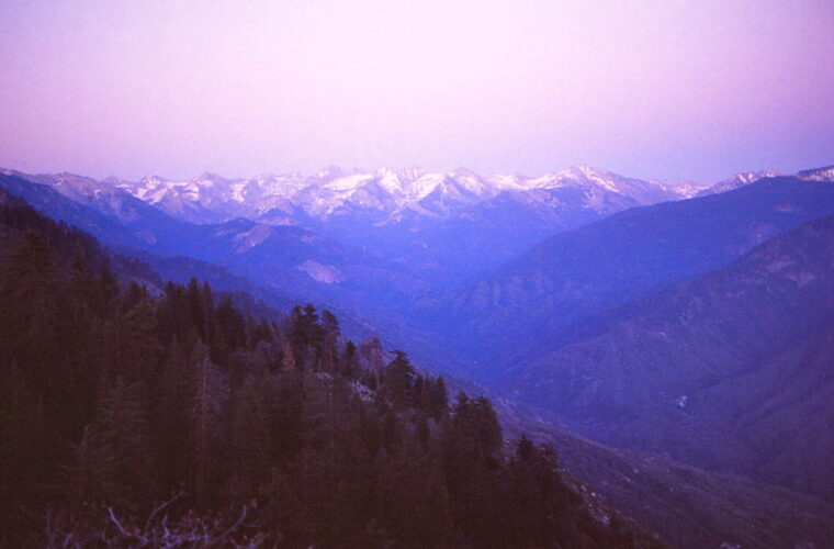
Photo: Ladycliff via Flickr (CC BY 2.0)
If you typed “How Get Sequoia National Park” into a search box, start by choosing the correct entrance: Ash Mountain on California Highway 198 for the Giant Forest and foothills, or Big Stump on Highway 180 for Grant Grove and the northern approach. Most visitors fly into Fresno Yosemite International Airport, rent a car, and enter by Highway 180. Travelers approaching from Los Angeles, Bakersfield, or Visalia often use Highway 198 instead.
Sequoia and neighboring Kings Canyon National Parks share a mountain road system, but the Sierra Nevada creates firm limits. No road enters Sequoia from the east, and no highway crosses the crest within either park. A map may place Lone Pine or Bishop close to the park boundary, yet reaching the giant sequoia groves from those towns requires driving around the Sierra, potentially adding several hours.
How to Get to Sequoia National Park: Turn Your Search into a Route
Match the entrance to your first destination
Ash Mountain Entrance stands near Three Rivers at roughly 1,700 feet. It provides the most direct approach to Hospital Rock, the Foothills Visitor Center area, Giant Forest, Moro Rock, Crescent Meadow, and the General Sherman Tree. From the entrance, Generals Highway climbs more than 5,000 vertical feet through tight switchbacks before reaching Giant Forest. That climb commonly takes about an hour without stops, even though the road distance is comparatively short.
Big Stump Entrance lies on Highway 180 near Grant Grove at approximately 6,300 feet. Use it when arriving from Fresno or when your first stops are the General Grant Tree, Panoramic Point, Grant Grove Village, or the Kings Canyon Scenic Byway. Generals Highway continues south from Grant Grove toward Lodgepole and Giant Forest, creating a useful through route when snow, construction, and wildfire conditions permit.
How to Get to Sequoia National Park: Airports, Roads and Regional Transportation
| Starting region | Usual approach | Best for | Approximate driving commitment |
|---|---|---|---|
| Fresno | Highway 180 to Big Stump | Grant Grove, Lodgepole, Giant Forest | About 1.5 hours to the entrance |
| Visalia or Three Rivers | Highway 198 to Ash Mountain | Foothills, Moro Rock, General Sherman Tree | About 45 minutes from Visalia to Three Rivers, then a short drive to the entrance |
| Bakersfield | Highway 99, then Highway 198 | Southern entrance and Giant Forest | Roughly 2.5 to 3 hours before mountain delays |
| Los Angeles | Interstate 5 or Highway 99, then Highway 198 | Ash Mountain approach | Usually 4.5 to 6 hours with traffic |
| San Francisco Bay Area | Central Valley routes to Highway 180 | Big Stump and a north to south park itinerary | Usually 4.5 to 6 hours |
Drive times increase sharply once the road begins climbing. Curves, wildlife, road work, snow controls, and slow recreational vehicles matter more here than the mileage suggests. Build the itinerary around arrival before dark. Mountain roads have limited lighting, and black bears, mule deer, and smaller animals may enter the roadway around dawn and dusk.
How to Get to Sequoia National Park by Airport and Rental Car
Fresno provides the simplest air connection
Fresno Yosemite International Airport is the most practical commercial airport for most trips. It is roughly 65 to 70 road miles from Big Stump Entrance, depending on the chosen route, and has a broader rental car selection than smaller regional airports. Its location also supports a logical itinerary through Grant Grove, Lodgepole, Giant Forest, and Ash Mountain without retracing the entire drive.
Visalia Municipal Airport is geographically closer to Highway 198, but scheduled passenger options are limited and can change. Bakersfield’s airport can work for travelers combining Sequoia with destinations farther south. Los Angeles, San Francisco, Oakland, San Jose, and Sacramento offer more flights, although traffic and longer Central Valley drives can consume much of an arrival or departure day.
How Get Sequoia National Park travelers should compare vehicles
A standard passenger car is adequate for the principal paved roads in normal summer conditions. Four wheel drive does not compensate for missing tire chains, poor tires, or unsafe speed on ice. Rental agreements may restrict chain installation, so winter travelers should review the contract before leaving the airport. Electric vehicle drivers should identify charging locations outside the park and avoid assuming that chargers will be available near a trailhead or lodging area.
- Choose a compact vehicle if entering through Ash Mountain, where switchbacks are tight.
- Reserve enough luggage space to keep food and scented items out of sight during travel.
- Download offline maps before leaving Fresno, Visalia, or Bakersfield.
- Refuel before climbing into the park, especially when continuing toward Lodgepole or Grant Grove.
- Carry drinking water because heat in the foothills can exceed conditions in the sequoia groves by 20 degrees Fahrenheit or more.
Selecting the Right Entrance Road
Highway 198 and the Ash Mountain climb
Highway 198 passes through Visalia, Lake Kaweah, and Three Rivers before reaching Ash Mountain. Beyond the entrance, Generals Highway climbs through the chaparral covered foothills and into mixed conifer forest. Vehicles longer than 22 feet are generally discouraged on the steep, winding section between Potwisha Campground and Giant Forest Museum. Larger recreational vehicles should approach through Highway 180 and Big Stump when that route is open.
On the upper switchbacks, the pavement presses against exposed granite while the Middle Fork Kaweah River drops out of view below. The air cools as gray pine and oak give way to incense cedar, white fir, and sugar pine. Near Giant Forest, the road suddenly enters the massive reddish columns of mature sequoias. Their scale is difficult to read from inside a vehicle until nearby cars appear small against the trunks.
Highway 180 and Big Stump Entrance
Highway 180 approaches from Fresno through citrus country, foothill oak woodland, and conifer forest. The grade is generally easier for long vehicles than the Ash Mountain ascent. At Grant Grove, travelers can turn south on Generals Highway toward Sequoia or continue east on the Kings Canyon Scenic Byway when its seasonal section is open.
Do not confuse access to Big Stump with access to Cedar Grove. The road to Grant Grove may be operating while the deeper canyon segment beyond Hume Lake junction remains closed by snow or storm damage. Current road openings, tire chain rules, entrance requirements, and shuttle operations are volatile, so confirm them on the official park site before departure.
Building a Reliable Arrival Plan
Check roads before trusting navigation apps
Navigation software may recommend closed roads, unpaved forest routes, or an eastern Sierra approach that cannot cross the mountains. Enter the park entrance or first visitor area as the destination rather than using only “Sequoia National Park.” For Ash Mountain, route toward Three Rivers. For Big Stump, route toward Grant Grove. Mineral King is a separate, narrow mountain road and does not provide access to Giant Forest.
- Choose the first major sight or lodging area.
- Select Ash Mountain or Big Stump based on that destination.
- Review the official road status and weather forecast.
- Download the route and park map for offline use.
- Refuel and buy food before beginning the mountain climb.
- Add at least an hour for overlooks, road delays, and slow traffic.
Prepare for elevation and seasonal changes
Sequoia spans a dramatic elevation range, from warm foothills below 2,000 feet to alpine terrain above 14,000 feet. Giant Forest sits near 6,400 feet, while Lodgepole is around 6,700 feet. A mild afternoon in Three Rivers can coincide with snow, freezing temperatures, or chain controls around the main sequoia groves.
Summer brings the most predictable access, but afternoon thunderstorms, smoke, and heavy weekend traffic remain possible. Autumn usually has cooler driving conditions and shorter daylight. Winter and early spring require flexible routing because storms can temporarily close Generals Highway or restrict travel. Pack layered clothing, gloves, a windshield scraper, water, food, and a flashlight whenever freezing conditions are possible.
Moving Between the Main Sequoia Areas
Use Generals Highway as the central spine
Generals Highway connects Grant Grove, Lodgepole, and Giant Forest, but mountain driving keeps average speeds low. Plan about an hour between Grant Grove and Giant Forest under clear conditions. Lodgepole sits only a few miles north of Giant Forest, making those areas practical to combine. Roads to Moro Rock and Crescent Meadow branch from the Giant Forest area and add extra time because of curves, pedestrian traffic, and possible vehicle controls.
| Park segment | Approximate distance | Typical driving time without stops |
|---|---|---|
| Grant Grove to Giant Forest | About 28 miles | 60 to 75 minutes |
| Giant Forest to Lodgepole | About 4 miles | 10 to 15 minutes |
| Giant Forest Museum area to Moro Rock | About 3 miles | 15 minutes |
| Moro Rock to Crescent Meadow | About 3 miles | 15 minutes |
Park once when destinations are clustered
Repeatedly moving a car can consume the busiest part of the day. When shuttles are operating, they can connect major Giant Forest and Lodgepole stops while reducing parking searches. Walking also works for closely grouped sites, particularly around Giant Forest. Carry the park map because shuttle stops, walking paths, and vehicle roads do not always follow the same alignment.
General Sherman Tree parking requires an uphill return
The main General Sherman parking area connects to the tree by a descending paved trail of roughly half a mile. The return climb reaches about 7,000 feet in elevation and feels harder than the distance suggests. Visitors sensitive to altitude should walk slowly and allow recovery time. Limited mobility parking arrangements use a different approach, so review the park accessibility information while planning.
Build the Day Around Direction and Daylight
Create a through route when both entrances are available
Travelers staying in Fresno can enter at Big Stump, visit Grant Grove, continue south to Giant Forest, and leave through Ash Mountain toward Three Rivers or Visalia. Reversing that sequence works well for arrivals from Southern California. This approach minimizes backtracking, but it requires lodging or onward travel on the opposite side of the park. It also depends on the full Generals Highway connection being open.
Set priorities before adding side roads
A common mistake is combining Grant Grove, General Sherman Tree, Moro Rock, Crescent Meadow, and Cedar Grove in one rushed day. Cedar Grove lies deep along the Kings Canyon Scenic Byway and requires a substantial detour from Grant Grove. For a more reliable schedule, choose one sequoia grove cluster and one nearby viewpoint or meadow. Use this order:
- Reach the primary grove early in the day.
- Complete any longer walk before afternoon heat or thunderstorms develop.
- Add Moro Rock, Crescent Meadow, or Panoramic Point only after the main objective.
- Begin the mountain descent with enough daylight for curves and wildlife.
Handle Closures, Delays, and Driving Problems
Keep an entrance specific backup plan
If the road between Grant Grove and Giant Forest becomes unavailable, the entrances do not provide quick substitutes for each other. Returning to the Central Valley and driving around can take several hours. Big Stump travelers can concentrate on Grant Grove and nearby trails. Ash Mountain travelers can remain around Giant Forest, Lodgepole, and the foothills. A closure near Moro Rock still leaves the General Sherman Tree and other Giant Forest walks as practical alternatives.
Prepare passengers for steep, curved roads
The Ash Mountain climb can trigger motion sickness because its switchbacks continue for miles with few straight sections. Seat sensitive passengers near the front, secure loose objects, and use designated pullouts rather than stopping in the traffic lane. Brake before curves and select a lower gear on long descents to reduce brake overheating. Your vehicle checklist should include:
- A paper map or saved park map in addition to offline navigation
- Water and food sufficient for an unexpected road delay
- Layers suitable for both hot foothills and cool sequoia groves
- A flashlight, phone charging cable, and portable battery
- Tire chains when winter conditions are possible and the vehicle agreement permits them
Complete Your Plan for Getting to and Around Sequoia National Park
The practical answer to “How Get Sequoia National” begins with the first destination, not the nearest point on a map. Choose Big Stump for Grant Grove and the easier northern approach. Choose Ash Mountain for Three Rivers, the foothills, and direct access toward Giant Forest. Then account for slow mountain speeds, elevation changes, limited fuel options, and the absence of an eastern entrance.
A well planned visit also limits unnecessary driving inside the park. Group Lodgepole with Giant Forest, use available shuttles or walking connections, and treat Cedar Grove as a separate time commitment. With an entrance specific route, an offline map, a fueled vehicle, and a realistic daylight margin, you can spend the day among the sequoias instead of correcting navigation mistakes on mountain roads.
Want to keep exploring? Browse all our Sequoia guides and articles for more trip-planning tips and ideas.
Gear & Essentials
Tell us about your trip and we will add what else you will want:
The basics
Worth having in the car whatever the park.
For this trip
Traveling with kids
Bringing a pet
RVing
Backcountry
Winter conditions
On the water
Photography
Accessibility
As an Amazon Associate we earn from qualifying purchases, at no extra cost to you.