Sequoia National Park and Kings Canyon National Park: How to Visit Both on One Trip
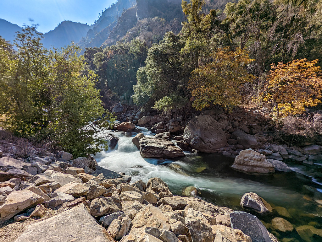
Photo: RuggyBearLA via Flickr (CC BY 2.0)
Planning a Sequoia National Park Kings Canyon trip is easier than the two park names suggest, but the deepest part of Kings Canyon sits well beyond the main route connecting them. Sequoia and Kings Canyon are contiguous, jointly managed parks. Their signature giant sequoia groves are linked by the Generals Highway, while Cedar Grove and the glacial canyon carved by the South Fork of the Kings River require a separate 70 mile round trip from Grant Grove.
Most first-time visitors should enter near one end of the Generals Highway and leave through the other. This approach connects Giant Forest, General Sherman Tree, Grant Grove, and several Sierra Nevada overlooks without retracing the entire mountain road. Allow at least two full sightseeing days, and add a third if Cedar Grove, longer hikes, or a relaxed pace matters.
Understand the Sequoia National Park and Kings Canyon National Park map
See how Sequoia National Park and Kings Canyon function as one destination
Sequoia National Park lies primarily south of Kings Canyon National Park. The Ash Mountain Entrance, reached through Three Rivers on Highway 198, leads uphill toward Giant Forest. Kings Canyon’s Big Stump Entrance is reached from the west on Highway 180 and sits close to Grant Grove. Between Giant Forest and Grant Grove, the Generals Highway crosses sequoia groves, mixed conifer forest, granite ridges, and portions of Sequoia National Forest.
Elevation changes explain why drive times are much longer than the mileage suggests. The foothills near Ash Mountain begin around 1,700 feet, Giant Forest stands near 6,400 feet, and Grant Grove is approximately 6,500 feet. Curves, wildlife, winter ice, roadwork, and scenic stops routinely slow traffic. Navigation apps often underestimate the time required because they cannot account for cautious mountain driving or crowded parking areas.
Separate the parks into four practical zones
We find it helpful to plan around four geographic zones: the Sequoia foothills, Giant Forest and Lodgepole, Grant Grove, and Cedar Grove. Giant Forest contains the General Sherman Tree, the world’s largest living tree by volume, plus Congress Trail and Moro Rock. Grant Grove contains the General Grant Tree and provides the natural transition into Kings Canyon. Cedar Grove lies much farther east, beneath granite walls along the Kings River.
Mineral King forms a fifth zone, but it does not fit efficiently into a first visit covering both parks. Its narrow, steep access road ends in a remote subalpine valley and does not connect with Giant Forest. Treat Mineral King as a separate trip centered on hiking rather than adding it to a two or three-day itinerary.
Choose the most efficient Sequoia National Park Kings Canyon route
Travel south to north or reverse the order
A one-way traverse reduces backtracking. South-to-north travelers enter at Ash Mountain, climb to Giant Forest, continue along the Generals Highway, and leave through Big Stump. This order places the steepest, tightest driving early in the trip. North-to-south travelers begin at Grant Grove and finish among the giant sequoias before descending toward Three Rivers. Either direction works, so lodging availability and the next destination should determine the choice.
Drivers arriving from Los Angeles or the southern Central Valley usually find the Ash Mountain side more direct. Visitors approaching from Fresno, Yosemite, or the Bay Area often begin at Big Stump. Recreational vehicles and trailers need extra planning because the Highway 198 climb contains sharp switchbacks and vehicle-length restrictions. Check current limits, seasonal road status, entrance requirements, and shuttle operations on the official park site before departure.
Use drive times that reflect mountain roads
| Route | Approximate distance | Typical driving time without stops | Planning note |
|---|---|---|---|
| Ash Mountain Entrance to Giant Forest | 17 miles | 45 to 60 minutes | Steep switchbacks and substantial elevation gain |
| Giant Forest to Grant Grove | About 28 miles | 50 to 75 minutes | Core route linking both parks |
| Grant Grove to Cedar Grove | About 35 miles | Roughly 1 hour each way | Dead-end scenic road, generally seasonal |
Decide separately whether to include Cedar Grove
Cedar Grove is where Kings Canyon’s scale becomes clearest. Highway 180 descends past overlooks into a glacier-carved valley with granite walls, river access, Zumwalt Meadow, and trailheads reaching deep into the Sierra wilderness. The road ends near Roads End, so every mile must be retraced. Snow and rockfall usually keep this section closed outside the warmer part of the year.
Add Cedar Grove when you have a third day or when Kings Canyon scenery is a higher priority than additional sequoia walks. Skip it on a rushed two-day visit and concentrate on Grant Grove. The General Grant Tree Trail is approximately one-third of a mile, while the nearby North Grove Loop covers roughly 1.5 miles through a quieter stand of mature sequoias.
Build a realistic Sequoia National Park and Kings Canyon itinerary
Allow two full days for the essential route
Two full days provide enough time for each park’s principal grove without turning the trip into a continuous drive. Spend the first day around Giant Forest. Walk the half-mile General Sherman Tree route, then follow part or all of the paved and forested Congress Trail, a roughly 2-mile loop passing named clusters such as the Senate and House groups. Finish at Moro Rock or the nearby viewpoints if weather and parking permit.
Day one around Giant Forest
Moro Rock’s stairway climbs more than 350 steps over exposed granite to an elevation of 6,725 feet. Underfoot, the stone is rough and uneven, while the metal handrail follows narrow ledges above the forest. Wind replaces the muffled quiet of the sequoia grove, and the Great Western Divide suddenly fills the eastern horizon. The short climb feels strenuous because of the elevation and continuous stairs.
Day two in Grant Grove
Use the second day for the Generals Highway drive and Grant Grove. Stop at accessible overlooks and grove trails rather than trying to visit every signed turnout. At Grant Grove, walk to the General Grant Tree, then continue through the surrounding sequoias if time allows. These trees grow naturally only in scattered groves on the Sierra Nevada’s western slope, generally between about 5,000 and 7,000 feet.
Add a third day for the canyon or a longer hike
A third day creates two strong options. Drive into Cedar Grove and walk the Zumwalt Meadow area, or remain in Sequoia for a longer route such as the Lakes Trail toward Heather, Emerald, and Pear lakes. The complete lake journey is demanding, while shorter turnarounds still reach granite terrain above Lodgepole. Choose one objective rather than combining Cedar Grove with a major hike, since the canyon drive consumes at least two hours before stops.
Prepare for elevation, weather, and limited services
Match the trip to the Sierra season
Summer generally provides the broadest road access, but afternoons can bring thunderstorms, exposed granite becomes hot, and popular groves draw heavy traffic. Autumn brings colder nights and fewer visitors, with early snow possible at grove elevations. Winter transforms Giant Forest and Grant Grove into snow destinations, while tire-chain controls and road closures may affect the connecting highway. Spring conditions vary sharply by elevation, with warm foothills below snow-covered sequoia groves.
Pack for several climate zones
A single traverse can begin in dry oak woodland and finish in cool conifer forest. Temperatures commonly drop as the road gains nearly 5,000 feet, and shade beneath mature sequoias can feel much colder than the foothills. Our team recommends keeping the following items accessible rather than buried beneath luggage:
- Refillable water containers with enough capacity for delays and closed filling stations
- Layered clothing, including a warm outer layer even during summer
- Sun protection for exposed granite trails and overlooks
- Traction devices and approved tire chains when wintry conditions are possible
- Offline maps because mobile coverage is unreliable between developed areas
- Food for the driving day, especially when continuing into Cedar Grove
- A flashlight or headlamp in case mountain driving or hiking extends past sunset
Protect sightseeing time with smart overnight stops
A Sequoia National Park Kings Canyon route works best when the overnight location follows the direction of travel. Staying near Three Rivers before a northbound trip provides an early start for the Ash Mountain climb. For a southbound trip, lodging near Grant Grove or along the Highway 180 approach reduces morning driving. One central base may look simpler, but repeated mountain crossings consume hours that could be spent walking among the sequoias.
Reach popular trailheads before midday
General Sherman Tree, Moro Rock, and Crescent Meadow attract the heaviest parking demand. Visit the Sherman Tree area first, then group Moro Rock and Crescent Meadow together because they branch from the same portion of the Giant Forest road network. Shuttle access and private vehicle restrictions vary, so use the current operating pattern checked during trip planning. At Grant Grove, beginning with the General Grant Tree leaves the quieter North Grove Loop for later.
Pack the vehicle in travel order
Keep hiking shoes, layers, food, and water reachable without unloading overnight bags at every stop. Store scented products correctly whenever the vehicle is unattended. A practical loading sequence is:
- Place luggage and lodging supplies deepest in the cargo area.
- Keep daypacks, trekking poles, and rain shells near the door.
- Carry drinking water where it will remain shaded and accessible.
- Download maps and save lodging directions before entering the mountains.
- Separate wet or snowy footwear from clothing needed the following day.
Avoid the mistakes that disrupt two-park trips
The most common planning error is measuring the trip by mileage alone. Mountain curves, scenic stops, trailhead searches, and slower vehicles make a packed schedule collapse quickly. Limit each half-day to one major grove or hike plus nearby viewpoints. Do not schedule a fixed dinner reservation outside the parks immediately after sunset, since the descent can take considerably longer in darkness.
Manage food around black bears
American black bears live throughout both parks, including animals with brown or cinnamon coats. Remove food, trash, coolers, toiletries, and other scented items from exposed campsites, and use the required storage system at your campground or lodging. Never feed a bear or crowd one for photographs. If an animal appears near a trail, give it ample room and follow ranger directions rather than attempting to pass closely.
Recognize elevation problems early
Headache, nausea, unusual fatigue, and dizziness can develop after a rapid climb from the Central Valley to the sequoia groves. Hydration helps with exertion but does not cure altitude illness. Stop climbing if symptoms worsen, and descend when rest fails to bring improvement. Visitors arriving from sea level should place shorter walks first, saving steep objectives such as Moro Rock or the Lakes Trail for after they have assessed how they feel.
Build a contingency plan before entering the parks
Snow, wildfire smoke, rockfall, thunderstorms, and temporary road closures can change the trip quickly. Decide in advance which stop has priority. If seeing the largest sequoias matters most, protect Giant Forest time and shorten secondary overlooks. If canyon scenery is the goal, preserve the Cedar Grove day and treat grove walks as flexible stops along the connecting route.
Know what to change when conditions shift
| Problem | Best adjustment | What to avoid |
|---|---|---|
| Afternoon thunder near exposed granite | Complete Moro Rock or high lake trails early | Remaining on ridges during lightning |
| Cedar Grove road unavailable | Add North Grove Loop or a longer Giant Forest walk | Driving east without verified access |
| Heavy smoke | Choose short grove walks and reduce exertion | Long climbs when air quality is poor |
| Snow or ice | Stay on maintained routes and carry required traction equipment | Depending on summer travel times |
Keep lower-commitment alternatives ready
Big Trees Trail provides an approximately 1.2-mile loop around Round Meadow near Giant Forest, with minimal route-finding and frequent sequoia views. Grant Grove’s main loop offers another compact option when weather or fatigue rules out a longer hike. In the foothills, lower elevations may remain usable when snow affects the groves, although summer heat can make those trails unsuitable by afternoon.
Visit Sequoia National Park and Kings Canyon without rushing
The strongest itinerary links Giant Forest and Grant Grove in one direction, assigns a full day to each major area, and treats Cedar Grove as a deliberate third-day choice. Matching lodging to the route, starting crowded sites early, and limiting each half-day to one principal objective keeps mountain driving from overtaking the visit.
Build flexibility into the final schedule. Carry supplies for changing temperatures, secure food against bears, monitor elevation symptoms, and identify a shorter substitute for every exposed or remote hike. With those decisions made before arrival, both parks fit naturally into one trip while leaving enough time to experience the groves, granite ridges, and Kings River canyon on foot.
Want to keep exploring? Browse all our Kings Canyon guides and articles for more trip-planning tips and ideas.
Gear & Essentials
Tell us about your trip and we will add what else you will want:
The basics
Worth having in the car whatever the park.
For this trip
Traveling with kids
Bringing a pet
RVing
Backcountry
Winter conditions
On the water
Photography
Accessibility
As an Amazon Associate we earn from qualifying purchases, at no extra cost to you.