Visiting Yosemite National Park with Limited Mobility: Accessible Views and Trails
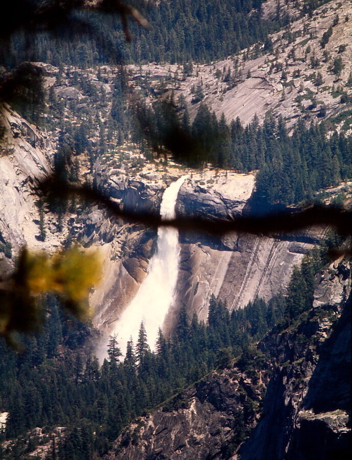
Photo: Ladycliff via Flickr (CC BY 2.0)
Visiting Yosemite National Park with limited mobility is most rewarding in Yosemite Valley, where roadside overlooks and short, largely level paths reveal El Capitan, Half Dome, Yosemite Falls, and the Merced River. The valley floor sits at roughly 4,000 feet, while granite walls rise 3,000 feet or more almost vertically around it. Many defining views require little walking, although traffic patterns, seasonal road closures, and the distance between stops make advance planning important.
Our team recommends organizing a visit around three experiences: the waterfalls and meadows of Yosemite Valley, the elevated panorama from Glacier Point, and the roadside alpine scenery along Tioga Road. This guide explains which viewpoints demand the least walking, which paths have firm surfaces, where elevation creates additional challenges, and how to sequence the park without wasting energy on difficult transfers.
Visiting Yosemite National Park begins with understanding the terrain
Yosemite covers nearly 1,200 square miles, but its famous landmarks are concentrated in several widely separated corridors. Yosemite Valley is about seven miles long and generally between half a mile and one mile wide. Glacier Point stands high above its southern rim, while Tioga Road crosses the Sierra Nevada to the north. Driving between these zones can take hours because the roads climb around cliffs and deep watersheds rather than connecting directly across them.
Why Yosemite Valley is the easiest base when visiting Yosemite National Park
The valley contains the greatest concentration of accessible scenery, lodging, food services, paved paths, and relatively level ground. El Capitan rises about 3,000 feet from the valley floor, Yosemite Falls drops 2,425 feet in three major sections, and Half Dome reaches 8,839 feet in elevation. These features can be seen from roads, parking areas, meadow paths, and shuttle stops, allowing visitors to experience Yosemite’s scale without committing to steep trails.
Most valley roads follow a one-way circulation pattern. Missing a parking entrance can therefore require a substantial loop through traffic. Drivers should group nearby stops and avoid repeatedly crossing the valley. A mobility device is useful even for short viewpoints because distances from parking spaces to viewing areas can increase when the closest spaces are occupied.
Planning a low-exertion day when visiting Yosemite National Park with limited mobility
Build the day around a few high-value stops rather than trying to visit every named viewpoint. Waterfalls are usually strongest in spring, while meadow views and granite formations remain worthwhile after flows diminish. Allow extra time for boarding, unloading mobility equipment, and waiting for traffic near Yosemite Village.
- Carry a valid accessible parking placard or plate if eligible, and display it as required.
- Bring any mobility device needed for several hundred feet of continuous movement, even when a stop is described as roadside.
- Pack water, medication, sun protection, and a warm layer inside the vehicle rather than relying on a distant trailhead facility.
- Download maps before entering the park because cellular service is inconsistent.
- Check road status, entrance requirements, shuttle operations, and accessibility notices before departure, and confirm current details on the official park site.
Accessible views and trails in Yosemite Valley
The strongest low-effort itinerary links Tunnel View, Lower Yosemite Fall, Cook’s Meadow, Sentinel Bridge, and Valley View. Together they show the valley from its western entrance, beneath its tallest waterfall, across open meadow habitat, and beside the Merced River. Surface conditions vary, so visitors using wheelchairs or walkers should distinguish paved approaches from rough riverbanks and unpaved side paths.
Tunnel View and Valley View
Tunnel View
Tunnel View lies immediately east of the Wawona Tunnel on State Route 41. The overlook frames El Capitan on the left, Bridalveil Fall on the right, and Half Dome farther east. The principal panorama is visible close to the parking area, although the viewing terrace can become crowded and transfers must occur near moving vehicles. Morning light reaches deeper into the valley, while late afternoon can illuminate Bridalveil Fall and the western cliffs.
Valley View
Valley View is a roadside stop along Northside Drive near the western end of Yosemite Valley. El Capitan dominates the north wall, Cathedral Rocks rise opposite it, and the Merced River provides the foreground. Much of the composition is visible from the turnout, but the river’s edge may contain sand, stones, roots, or seasonal mud. Remain on the firmest available surface rather than following photographers onto unstable banks.
Lower Yosemite Fall and Cook’s Meadow
The Lower Yosemite Fall loop is approximately one mile, with a shorter out-and-back option on the paved eastern approach. Lower Fall itself drops 320 feet and produces cold spray during peak snowmelt. The generally accessible approach can become wet, icy, or covered by debris depending on the season. Visitors sensitive to noise or moisture should stop before the final bridge, where the waterfall remains visible through the trees.
Cook’s Meadow Loop covers roughly one mile across mostly level terrain, using paved paths and boardwalk sections. It provides broad views of Yosemite Falls, Half Dome, Sentinel Rock, and the surrounding cliffs. Individual segments can be combined with nearby roadside viewpoints, so there is no need to complete the entire loop. Sentinel Bridge is especially useful for seeing Half Dome above the Merced River with minimal elevation change.
Comparing Yosemite’s main scenic corridors
Yosemite Valley deserves the most time, but Glacier Point Road and Tioga Road add perspectives unavailable from below. Both roads climb into higher country where snow can delay opening well beyond the start of spring. The thinner air, colder temperatures, and longer distance from services may matter to visitors with respiratory, cardiac, or fatigue-related limitations.
| Area | Approximate elevation | Best limited-mobility experience | Primary constraint |
|---|---|---|---|
| Yosemite Valley | 4,000 feet | Waterfalls, meadows, granite walls, and river views | Traffic and distances between parking areas |
| Glacier Point | 7,214 feet | Elevated view of Half Dome and the High Sierra | Seasonal road access and high elevation |
| Tioga Pass | 9,945 feet | Roadside alpine lakes, domes, and subalpine forest | Highest elevation and a short operating season |
| Mariposa Grove | About 5,600 to 6,800 feet | Giant sequoias including the Grizzly Giant | Transportation arrangements and sloping trails |
Visiting Yosemite National Park from Glacier Point Road
Glacier Point overlooks Yosemite Valley from approximately 3,200 feet above the valley floor. Half Dome fills the eastern view, with Nevada Fall and Vernal Fall visible in the Merced River canyon. The main viewpoint is reached by a short paved route from the parking area, but elevation can make even modest walking feel harder. Washburn Point, encountered shortly before Glacier Point, offers another broad panorama with less time outside the vehicle.
At Glacier Point, the air often feels markedly cooler than it did on the valley floor. The pavement slopes toward a railing, wind moves across the exposed granite rim, and the ground appears to fall directly toward the tiny roads and trees below. Half Dome stands nearly level with the viewer rather than overhead, changing the sense of scale that defines the valley.
Tioga Road’s roadside alpine scenery
Tioga Road crosses the park for about 46 miles between Crane Flat and Tioga Pass. Olmsted Point looks toward Half Dome across glacially polished granite, while Tenaya Lake sits at about 8,150 feet beneath rounded domes. Scenic pullouts allow worthwhile views without a trail, although some contain uneven granite or gravel beyond the paved edge.
Tuolumne Meadows lies near 8,600 feet and supports subalpine grasses, lodgepole pine, and the winding Tuolumne River. The landscape is gentler than Yosemite Valley, but elevation can increase breathlessness, dizziness, and fatigue. Visitors who are uncertain about altitude should keep the first stop brief, hydrate regularly, and descend if symptoms intensify.
Choosing a season around mobility and comfort
Conditions change sharply with elevation. Spring brings strong waterfalls to Yosemite Valley, but shaded paths can remain icy and the high-country roads are usually still snowbound. Summer provides the widest geographic access, accompanied by heavier traffic, warmer valley temperatures, and crowded parking areas. Autumn offers cooler air and lighter waterfall flow, while winter concentrates practical sightseeing on the valley floor.
Spring and early summer
April through June generally provides the best waterfall viewing because Sierra snowmelt feeds Yosemite Falls, Bridalveil Fall, Vernal Fall, and Nevada Fall. Spray can soak pavement near Lower Yosemite Fall and Bridalveil Fall, creating slippery surfaces. Late spring also brings rapid temperature changes, with warm afternoons in the valley and winter conditions persisting at higher elevations.
Late summer through winter
By late summer, Yosemite Falls may shrink substantially or stop flowing during dry years, but accessible views of El Capitan, Half Dome, and the meadows remain intact. Autumn reduces heat and often improves driving conditions before snow arrives. Winter storms can close high-elevation roads and cover valley paths with snow or ice, yet fresh snow on the granite walls creates exceptional roadside scenery for visitors prepared for cold transfers and slick pavement.
Meeting Yosemite’s giant sequoias with less walking
Mariposa Grove contains more than 500 mature giant sequoias near Yosemite’s South Entrance. For visitors with limited mobility, the practical goal is the Big Trees Loop rather than the longer climb through the upper grove. Transportation from the parking area to the grove changes with road and seasonal conditions, so account for boarding, mobility equipment, and waiting time when deciding whether to add this area to a valley itinerary.
The Big Trees Loop
The Big Trees Loop covers approximately 0.3 mile near the grove arrival area. Its firm trail and boardwalk provide views of the Fallen Monarch and several living sequoias without the sustained elevation gain found farther uphill. Giant sequoia bark can exceed two feet in thickness, helping mature trees survive the low intensity fires that historically cleared competing vegetation and released nutrients into the soil.
Knowing where the steeper ground begins
The Grizzly Giant Loop extends about two miles and gains roughly 300 feet. It reaches the Grizzly Giant and California Tunnel Tree, but the combination of grades, elevation, and uneven sections makes it a different undertaking from the arrival area. Visitors who use manual wheelchairs, become fatigued quickly, or have difficulty descending slopes can gain a fuller experience by spending unhurried time on the lower loop instead.
Short valley stops beyond the headline viewpoints
Several compact stops fill gaps between the valley’s major overlooks. Their approaches range from immediate roadside viewing to a two mile paved outing, so distance alone does not describe the effort required. Incline, cross slope, crowding, and the availability of firm turning space often matter more to wheelchair and walker users.
| Stop | Approximate outing | Surface and effort |
|---|---|---|
| Bridalveil Fall | About 0.5 mile round trip | Paved, with noticeable incline and seasonal spray |
| El Capitan Meadow | Viewable from roadside pullouts | Minimal travel if remaining near the vehicle |
| Mirror Lake | About 2 miles round trip to the lake area | Paved approach with gradual elevation gain |
| Big Trees Loop | About 0.3 mile | Firm trail and boardwalk near the lower grove |
Bridalveil Fall and El Capitan Meadow
Bridalveil Fall descends 620 feet from a hanging valley carved by tributary glaciers. Wind frequently pushes the falling water sideways, and spring spray can leave the paved approach wet. El Capitan Meadow provides a drier alternative nearby. Binoculars reveal climbers on the granite face, while morning and late afternoon light make cracks and ledges easier to distinguish.
Mirror Lake’s seasonal character
Mirror Lake occupies a widening in Tenaya Creek beneath Half Dome and Mount Watkins. The paved approach rises gradually through forest, making it better suited to visitors who can manage a longer continuous outing. Water levels are generally highest during snowmelt. By late summer, much of the shallow lake may become exposed sand and meadow, although the enclosing canyon remains visible.
Visiting Yosemite National Park with limited mobility: Build around energy, not mileage
Visiting Yosemite National Park often involves more exertion than the map suggests. A 200 foot transfer may include unloading equipment, negotiating a curb, waiting for other visitors, and returning uphill to the vehicle. Our preferred strategy places the most important outdoor stop first, followed by viewpoints that can be enjoyed from or immediately beside the vehicle.
A manageable single day
Enter Yosemite Valley early enough to make Lower Yosemite Fall the first extended outing. Continue to Sentinel Bridge or Cook’s Meadow, then use Tunnel View and Valley View as low effort stops later in the day. This sequence protects energy for the paved waterfall approach while preserving two major panoramas if fatigue, heat, or congestion shortens the schedule.
Dividing the park across two days
A second day should focus on one elevated corridor. Choose Glacier Point when the priority is a panoramic view over Yosemite Valley. Choose Tioga Road for Tenaya Lake, Olmsted Point, and subalpine scenery. Mariposa Grove works better as a separate southern excursion because combining it with Tioga Road creates a long driving day with repeated transfers.
- Limit each half day to one longer paved route.
- Schedule seated rest before fatigue affects balance or transfers.
- Keep mobility equipment shaded because metal surfaces and batteries can become hot in summer.
- Carry food and water in the vehicle to avoid an unnecessary trip across a busy parking area.
- Use roadside viewpoints as flexible substitutes when pain, altitude, or weather changes the plan.
Plan for the views that fit your mobility
Yosemite’s defining scenery remains remarkably accessible when the route is chosen carefully. Yosemite Valley supplies the greatest concentration of level paths and close roadside views. Glacier Point adds the elevated perspective, Tioga Road introduces the high Sierra, and Mariposa Grove provides a short route among giant sequoias.
Choose a few priority places, leave time for transfers, and treat paved distance as only one measure of difficulty. A focused plan can include El Capitan, Half Dome, waterfalls, alpine lakes, and ancient trees without relying on steep hiking. That approach leaves enough energy to watch changing light, water, and weather shape the granite landscape throughout the day.
Want to keep exploring? Browse all our Yosemite guides and articles for more trip-planning tips and ideas.
Gear & Essentials
Tell us about your trip and we will add what else you will want:
The basics
Worth having in the car whatever the park.
For this trip
Traveling with kids
Bringing a pet
RVing
Backcountry
Winter conditions
On the water
Photography
Accessibility
As an Amazon Associate we earn from qualifying purchases, at no extra cost to you.