How to Get to Yellowstone National Park: Airports, Roads and Getting Around
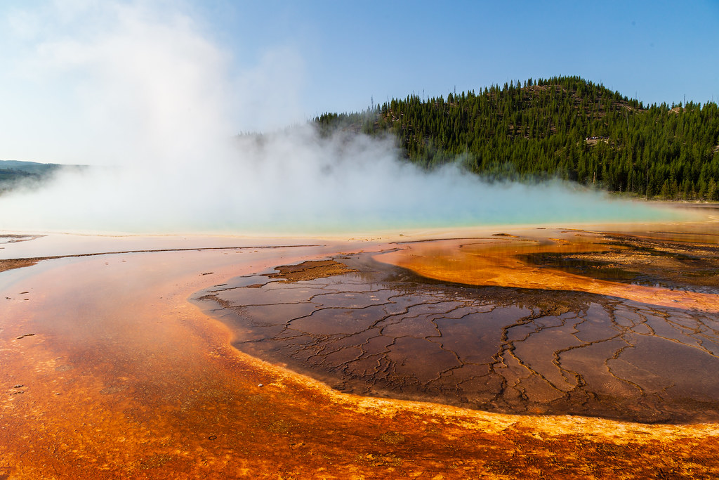
Photo: aparlette via Flickr (CC BY 2.0)
If your planning notes begin with “How Get Yellowstone National Park,” start by choosing the entrance closest to your first overnight stop, then select an airport or driving route that serves that entrance. Yellowstone has five road entrances spread across Wyoming and Montana, and driving from one side of the park to the other can consume several hours.
Most visitors need a rental car because Yellowstone has no comprehensive public transportation system. Bozeman, Jackson, Idaho Falls, Cody, Billings, and Salt Lake City are the principal flight gateways. The best choice depends on season, airfare, rental car availability, and whether your itinerary concentrates on Old Faithful, Mammoth Hot Springs, Yellowstone Lake, or the Lamar Valley.
How to Get to Yellowstone National Park: Airports, Roads and Getting Around by Entrance
Yellowstone covers nearly 3,472 square miles, an area larger than Delaware and Rhode Island combined. Its Grand Loop Road forms a 142 mile figure eight, so the entrance on your reservation matters. A traveler staying near Canyon Village gains little from saving money on a flight if the resulting route adds half a day behind the wheel.
Match each entrance to your first destination
The West Entrance provides the most direct approach to the geyser basins around Old Faithful and the Firehole River. The North Entrance at Gardiner leads to Mammoth Hot Springs, while the Northeast Entrance serves the Lamar Valley. Travelers arriving from Jackson and Grand Teton National Park use the South Entrance. Cody is the natural gateway for the East Entrance and Yellowstone Lake.
| Entrance | Nearest gateway | Best initial destinations | Seasonal consideration |
|---|---|---|---|
| North | Gardiner, Montana | Mammoth Hot Springs, Tower Junction | Primary year round vehicle approach |
| West | West Yellowstone, Montana | Old Faithful, Norris, Madison | Regular road access is seasonal |
| South | Jackson, Wyoming | West Thumb, Grant Village, Old Faithful | Closed to ordinary vehicles in winter |
| East | Cody, Wyoming | Yellowstone Lake, Fishing Bridge | High elevation approach opens seasonally |
| Northeast | Cooke City, Montana | Lamar Valley, Tower Junction | Winter access comes through Gardiner |
Why the closest map pin can mislead you
The Northeast Entrance sits beside Cooke City, but the Beartooth Highway climbs to nearly 11,000 feet and normally closes through winter. Jackson is close to Yellowstone’s southern boundary, yet the route passes through Grand Teton National Park before reaching the entrance. From there, Old Faithful remains about 39 road miles away. Always measure the route to your lodging or first attraction rather than to the park boundary.
How to Get to Yellowstone National Park: Choosing an Airport
Regional airports reduce driving, while larger hubs usually provide more schedules and rental cars. Yellowstone Airport near West Yellowstone is the closest commercial airport to a park entrance, but its airline service is generally seasonal. Bozeman Yellowstone International Airport provides a practical balance of flight choice and access to the North and West entrances.
How Get Yellowstone National Park visitors should compare regional airports
Jackson Hole Airport works especially well for a combined Grand Teton and Yellowstone trip. Yellowstone Regional Airport in Cody places travelers roughly 55 road miles from the East Entrance. Idaho Falls Regional Airport is about 110 miles from West Yellowstone, while Billings Logan International Airport supports routes through Gardiner, Red Lodge, or Cody. Airline schedules, rental car supply, road openings, entrance requirements, and fees can change, so confirm current details on the official park site before booking.
Closest gateways for short trips
For a trip centered on Old Faithful and the geyser basins, West Yellowstone usually minimizes park driving. Bozeman is more flexible for Mammoth, Norris, and the Lamar Valley. Cody suits visitors who want the East Entrance scenery through the Absaroka Range, although Sylvan Pass reaches 8,524 feet and can experience snow well beyond the core winter months.
Major hubs for lower fares and longer itineraries
Salt Lake City International Airport is roughly 320 road miles from West Yellowstone. The drive commonly takes about five hours before meal, fuel, or weather stops. It becomes a reasonable choice when regional fares are high, when rental cars are scarce, or when the trip includes Idaho, Grand Teton National Park, or several nights outside Yellowstone.
Reserve the right rental vehicle
A standard passenger car can travel Yellowstone’s paved public roads during normal conditions. Four wheel drive can help during early spring or autumn snow, but it does not compensate for closed roads or poor tires. Before leaving the airport, check the spare tire, windshield washer fluid, fuel level, and rental agreement restrictions.
- Choose a vehicle with enough luggage space to keep food and scented items concealed.
- Download offline maps because mobile service is unreliable across much of the park.
- Carry warm layers, water, food, and a flashlight for delays between developed areas.
- Refuel before long crossings, particularly when entering through Cody or Cooke City.
How to Get to Yellowstone National Park by Road
The approach roads are part of the planning calculation. Routes from Bozeman and Idaho Falls cross broad river valleys, while the East and Northeast approaches climb through mountainous terrain. Elevation, snow, construction, and wildlife can turn a straightforward mileage estimate into a much longer drive.
Approaches from Montana and Idaho
From Bozeman, US 191 follows the Gallatin River south toward West Yellowstone, passing through Gallatin Canyon. The route to Gardiner instead uses Interstate 90 and US 89 through Paradise Valley. From Idaho Falls, US 20 crosses eastern Idaho toward Island Park and West Yellowstone. These roads are paved, but darkness increases the risk of encounters with elk, deer, and moose.
How to Get to Yellowstone National Park through Wyoming
US 14, US 16, and US 20 converge west of Cody before following the Shoshone River toward the East Entrance. From Jackson, US 89 and US 191 run north through Grand Teton National Park and the John D. Rockefeller, Jr. Memorial Parkway. The Northeast approach uses US 212, including the Beartooth Highway from Red Lodge or the lower route through the Clarks Fork corridor.
Spring opening dates should never be treated as guaranteed travel dates. An April storm can halt plowing and postpone access after a road was scheduled to open, as occurred during the 2026 Yellowstone road opening delay. Build an alternate entrance and refundable lodging into shoulder season itineraries.
Getting Around Yellowstone National Park: Understanding the Road Network
Once inside, the Grand Loop Road connects Mammoth Hot Springs, Norris, Madison, Old Faithful, West Thumb, Lake Village, Canyon Village, and Tower Junction. Distances look modest on a map, but speed limits, bison herds, construction, and crowded parking areas make urban driving estimates useless. Plan by region rather than attempting the entire loop every day.
Upper Loop and Lower Loop planning
The Upper Loop covers Mammoth, Norris, Tower, and the northern approach to Canyon. The Lower Loop connects Madison, Old Faithful, West Thumb, Yellowstone Lake, and Canyon. Staying near the half of the loop you intend to explore reduces backtracking. Norris and Canyon are useful junctions, but congestion can build where wildlife sightings attract vehicles onto road shoulders.
What driving through the park feels like
In Hayden Valley, the road drops beside the Yellowstone River and opens onto miles of sagebrush and wet meadow. Cold air often pools over the valley at dawn, fog hangs above the river, and bison can step onto the pavement with little warning. From a roadside pullout, their hooves sound against packed soil before traffic noise returns. This is why a 16 mile drive between Canyon and Lake Village can take far longer than the mileage suggests.
Build a Daily Driving Plan That Survives Yellowstone Traffic
Organize each day around one major road corridor and begin with the farthest planned stop. Thermal areas have limited parking, while wildlife jams can stop traffic for 30 minutes or longer. A morning based near Old Faithful might combine Upper Geyser Basin, Biscuit Basin, and Firehole Lake Drive when open. Adding Mammoth Hot Springs to that same day creates excessive backtracking and leaves little time for boardwalks.
Use road segments instead of straight line distance
Yellowstone’s junctions make useful decision points. Madison connects the West Entrance with Old Faithful and Norris. Fishing Bridge links Yellowstone Lake with the East Entrance and Hayden Valley. Tower Junction divides routes toward Mammoth, Lamar Valley, and Dunraven Pass. Estimate each segment separately, then add time for construction controls, animal crossings, parking searches, and stops at overlooks.
| Road segment | Approximate distance | Primary delay risk |
|---|---|---|
| Madison to Old Faithful | 16 miles | Geyser basin traffic and bison |
| Norris to Canyon | 12 miles | Construction and limited passing |
| Canyon to Lake Village | 16 miles | Hayden Valley wildlife jams |
| Mammoth to Tower Junction | 18 miles | Wildlife and narrow curves |
Leave before the busiest arrival period
Departing at dawn improves parking prospects at places such as Grand Prismatic Spring, Norris Geyser Basin, and the Grand Canyon of the Yellowstone. Save flexible roadside stops for later, when a full parking area will not disrupt the entire schedule. After sunset, reduce speed well below the posted limit where visibility is limited. Bison, elk, bears, and mule deer can occupy the pavement without reflective warning.
How to Get to Yellowstone National Park in Every Season
Yellowstone’s elevation controls access. Much of the central road system lies between 7,000 and 8,000 feet, and snow can affect travel during spring and autumn. Summer brings the broadest vehicle access but also the greatest congestion. September offers lighter traffic after peak vacation season, although freezing nights and early snow become increasingly possible as the month progresses.
Spring and autumn require backup routes
Carry an ice scraper and clothing suitable for waiting outside if a vehicle problem occurs. Avoid scheduling a flight immediately after a long park crossing because temporary closures can disrupt the route to Bozeman, Jackson, or Cody. When Dunraven Pass or another central segment closes, reaching the opposite side may require a lengthy detour around the Grand Loop or outside the park.
Winter travel uses a different network
During winter, ordinary vehicle travel generally remains possible on the northern road from Gardiner through Mammoth and the Lamar Valley toward Cooke City. Most interior roads shift to managed oversnow travel by authorized snowcoach or snowmobile. Travelers must arrange those trips in advance and leave their rental car at the designated departure community. The South, East, and West entrances should never be assumed usable by conventional car in winter.
Prepare for Delays, Closures, and Navigation Failures
Mobile coverage is intermittent outside developed areas, and navigation applications may continue routing toward a closed seasonal road. Download regional maps before leaving the airport, keep a paper map in the vehicle, and record the address of the night’s lodging. Tell someone which entrance and road corridor you expect to use, particularly when driving after dark or during shoulder season weather.
Avoid the most expensive planning mistakes
- Do not return a rental car with an nearly empty tank after crossing a long section of the park.
- Keep flight departure day free of major sightseeing stops.
- Never follow an unpaved shortcut suggested by a navigation application without verifying that rental vehicles are permitted.
- Store food securely and never leave coolers exposed in an open truck bed.
- Check road status before leaving lodging rather than after reaching a blocked junction.
Know what to do when the route changes
If a closure divides the planned itinerary, protect the lodging reservation first and remove attractions that require backtracking. Travelers headed to an airport should leave by the nearest reliable entrance, even when navigation software suggests a shorter seasonal road. Keep water, food, medication, warm layers, a charging cable, and a flashlight accessible inside the passenger compartment rather than buried beneath luggage.
How to Get to Yellowstone National Park: Plan Your Route Before Booking a Flight
If your original search used the shorthand “How Get Yellowstone National,” the practical answer begins with geography: select the first overnight base, match it to an entrance, and then choose the airport and rental car. Divide sightseeing by Upper Loop and Lower Loop corridors, allow generous margins for wildlife and weather, and avoid using boundary distance as a measure of actual travel time.
A reliable Yellowstone transportation plan also includes alternatives. Save offline maps, monitor road conditions, carry basic delay supplies, and identify a second usable entrance during spring or autumn. With those decisions made before arrival, driving becomes part of the itinerary rather than a daily logistical problem, and more of each day remains available for geyser basins, valleys, lakes, and overlooks.
Want to keep exploring? Browse all our Yellowstone guides and articles for more trip-planning tips and ideas.
Gear & Essentials
Tell us about your trip and we will add what else you will want:
The basics
Worth having in the car whatever the park.
For this trip
Traveling with kids
Bringing a pet
RVing
Backcountry
Winter conditions
On the water
Photography
Accessibility
As an Amazon Associate we earn from qualifying purchases, at no extra cost to you.