How to Get to Rocky Mountain National Park: Airports, Roads and Getting Around
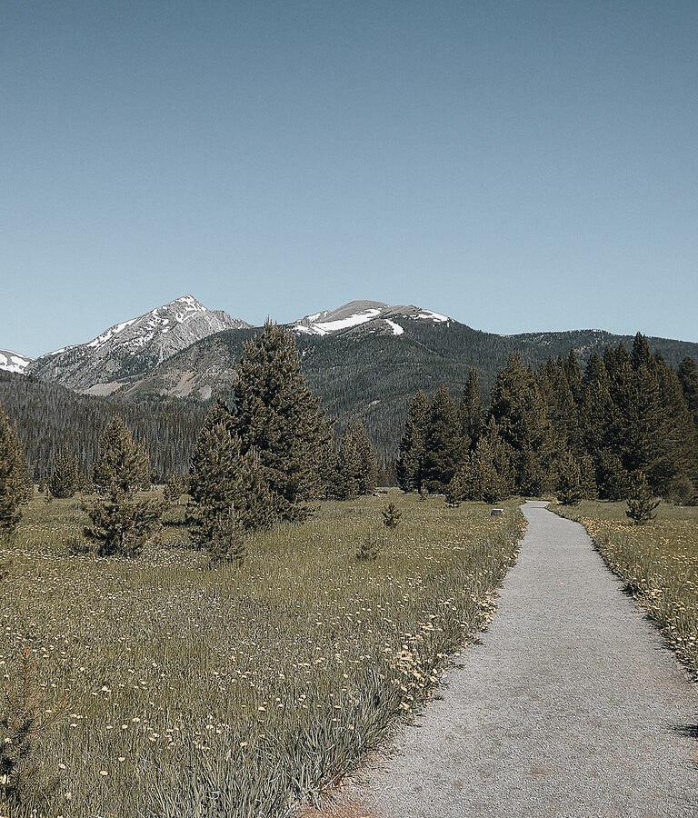
Photo: concrete&fells via Flickr (CC BY 2.0)
Understanding How Get Rocky Mountain National Park begins with one counterintuitive fact: the park has no single all-purpose entrance. Estes Park serves the busy east side, Grand Lake anchors the quieter west side, and Trail Ridge Road connects them only when high-country conditions permit. Choosing an airport or hotel before deciding which side you want to explore can add hours of driving. The park rises from roughly 7,630 feet to the 14,259-foot summit of Longs Peak. Its roads cross montane forests, subalpine terrain, and exposed alpine tundra, so elevation and weather affect transportation as much as mileage.
The park rises from roughly 7,630 feet to the 14,259-foot summit of Longs Peak. Its roads cross montane forests, subalpine terrain, and exposed alpine tundra, so elevation and weather affect transportation as much as mileage. Our team recommends planning in this order: select the sights you most want to reach, choose the correct gateway town, then book flights and ground transportation.
How to Get to Rocky Mountain National Park: Airports, Roads and Getting Around
Most first-time visitors should approach through Estes Park because it provides direct access to Beaver Meadows, Fall River, Bear Lake Road, and the Longs Peak area. Grand Lake is better positioned for the Kawuneeche Valley, where the Colorado River begins, and for west-side wildlife viewing around Harbison Meadow and the Holzwarth Historic Site.
Match the entrance to your priorities
Beaver Meadows Entrance, reached from Estes Park by US 36, is the most practical entry for Moraine Park and Bear Lake Road. Fall River Entrance connects to US 34 and provides another east-side approach to Trail Ridge Road. Wild Basin, south of Estes Park near Allenspark, serves trails to Ouzel Falls, Finch Lake, and Sandbeach Lake but does not connect internally to the main east-side road network.
Do not treat the park as a drive-through shortcut
Trail Ridge Road travels approximately 48 miles between Estes Park and Grand Lake, reaching 12,183 feet near Fall River Pass. The crossing commonly takes two hours without prolonged stops, traffic, wildlife delays, or parking searches. It usually closes to through travel during the snowy season, while plowing and wind can affect reopening in late spring. Current entrance requirements, timed-entry procedures, road status, and shuttle operations should be confirmed on the official park site.
Choosing an Airport: How to Get to Rocky Mountain National Park
Denver International Airport is the default choice because it has the broadest flight selection and the largest rental-car inventory. The airport sits east of Denver, however, so travelers must cross the metropolitan area or use the E-470 toll corridor before reaching the foothills. Allow roughly 1.5 to 2 hours to Estes Park in light traffic and considerably longer during weekday commuting periods or busy summer weekends.
Airport Distances and Tradeoffs for Getting to Rocky Mountain National Park
| Airport | Approximate drive to Estes Park | Approximate drive to Grand Lake | Best use |
|---|---|---|---|
| Denver International Airport | 75 miles | 125 miles | Best flight and rental-car selection |
| Northern Colorado Regional Airport area | 40 miles | About 105 miles | Useful for private aviation or limited scheduled service |
| Colorado Springs Airport | 135 miles | About 185 miles | Alternative when fares or schedules justify a longer drive |
| Eagle County Regional Airport | About 145 miles | About 105 miles | Potential western approach, especially when paired with other mountain destinations |
Distances alone can mislead. Eagle County Regional Airport appears relatively convenient for Grand Lake, but the route crosses mountain terrain and may be affected by winter weather. Colorado Springs requires driving through or around Denver before turning northwest. Northern Colorado Regional Airport is geographically close to Estes Park, although scheduled passenger service and rental availability are much more limited than at Denver.
When a rental car is effectively necessary
A car provides the simplest connection among the airport, lodging, groceries, trailheads, and gateway communities. Airport-to-Estes transportation services may eliminate the first drive, but they do not automatically solve early trailhead access or west-side travel. Visitors relying on shuttles should choose lodging near the applicable pickup network and avoid building an itinerary around distant trailheads such as Wild Basin or Longs Peak.
How to Get to Rocky Mountain National Park by Road
Three highways approach Estes Park from the Front Range. US 36 climbs from the Boulder and Lyons direction, US 34 follows the Big Thompson Canyon from Loveland, and Colorado 7 arrives from the south through the Peak to Peak corridor. Grand Lake is reached primarily by US 34 from Granby and the US 40 corridor.
Driving from Denver to Estes Park
US 36 through Boulder and Lyons
This is the most intuitive route for many Denver arrivals. It passes through Boulder, continues to Lyons, and climbs through foothill valleys to Estes Park. Traffic lights and congestion around Boulder can erase any mileage advantage. The final approach gives drivers broad views toward the Continental Divide before descending toward Lake Estes.
US 34 through Loveland and Big Thompson Canyon
US 34 follows the Big Thompson River through a steep canyon cut into Precambrian granite and metamorphic rock. The road is scenic but curving, with limited passing opportunities and occasional wildlife near the pavement. It works well for travelers approaching from northern Denver, Fort Collins, or Interstate 25 north of the metropolitan core.
Reaching Grand Lake without crossing the park
From Denver, the dependable year-round approach follows Interstate 70 west, US 40 over Berthoud Pass, and US 34 north from Granby. Berthoud Pass reaches 11,307 feet and can experience snow, ice, and poor visibility well outside midwinter. This route also provides access to the west entrance when Trail Ridge Road is closed, although winter driving time depends heavily on pass conditions.
Crossing the Continental Divide on Trail Ridge Road
Trail Ridge Road is both a transportation route and one of the park’s defining experiences. Eleven miles run above treeline, where prolonged exposure to wind and snow prevents upright trees from growing. Drivers pass overlooks into Forest Canyon and across the headwaters of the Cache la Poudre River before descending through subalpine forest toward the Kawuneeche Valley.
What the high road feels like
Near the road’s crest, the pavement crosses open tundra with no trees to soften the scale. Wind presses against the vehicle, temperatures can sit far below those in Estes Park, and patches of old snow remain beside the road in summer. At an overlook, the ground feels springy underfoot where alpine plants form dense mats between stones. Peaks extend across the horizon while glacial valleys drop sharply below the guardrails.
Plan the crossing step by step
- Check whether the road is open for through travel before leaving either gateway town.
- Start with enough fuel for delays, detours, and slow mountain driving.
- Carry water, warm layers, sun protection, and rain gear even on a clear morning.
- Use designated pullouts rather than stopping in the travel lane for wildlife or photographs.
- Expect slower movement near tundra overlooks, where parking fills quickly.
- Descend in a lower gear to reduce prolonged braking on steep grades.
Altitude can cause headache, nausea, or unusual fatigue, particularly for travelers arriving directly from sea level. Keep the first high-elevation stop brief, drink water, and descend if symptoms intensify. Afternoon thunderstorms are another practical concern: exposed overlooks provide little shelter, and lightning can arrive before rain reaches the road.
Getting Around Rocky Mountain National Park: Parking and Shuttle Strategy
Driving through an entrance does not guarantee parking at the trailhead you selected. Bear Lake and Glacier Gorge serve several of the east side’s most popular hikes, and their small lots often fill early. Build each day around a primary parking area and a fallback. Turning repeatedly between full lots wastes time, increases congestion, and can place you far from your intended trail when afternoon weather develops.
Use the Bear Lake corridor shuttle efficiently
When seasonal shuttle service is operating, the Bear Lake Road Park and Ride can replace the search for spaces at Bear Lake, Glacier Gorge, and intermediate stops. Keep food, rain layers, water, and essential medication with you because returning to the vehicle can take considerable time. The shuttle does not serve every trailhead, including Wild Basin and Longs Peak, so verify that your hike begins within the covered corridor.
Choose the correct stop before boarding
| Objective | Useful access point | Planning note |
|---|---|---|
| Bear Lake, Nymph Lake, and Emerald Lake | Bear Lake | Expect concentrated morning demand |
| Alberta Falls, The Loch, and Mills Lake | Glacier Gorge | Limited trailhead parking makes the shuttle practical |
| Moraine Park trails and campground area | Moraine Park corridor | Check the applicable seasonal route before departure |
| Alpine tundra overlooks | Drive Trail Ridge Road | Bear Lake shuttles do not reach the alpine road |
Separate town transportation from park transportation
Estes Park transit can help visitors move between lodging districts, downtown, and park connection points during its operating season. Park shuttles handle specific interior corridors. Treating the two systems as one continuous network creates missed connections, especially at the end of the day. A car-free itinerary works best when lodging, dinner, and the desired trails all sit near established stops. Grand Lake visitors should expect fewer transportation alternatives and plan around a personal vehicle.
Prepare the Vehicle and Avoid Costly Arrival Mistakes
A workable How Get Rocky Mountain plan includes preparation before climbing out of the foothills. Cellular coverage becomes inconsistent in the canyons and across portions of the park, so download maps and save lodging instructions before leaving Boulder, Loveland, Granby, or Interstate 70. Fill the fuel tank in a gateway community. Mountain grades, idling traffic, cabin heating, and unexpected detours can consume more fuel than the mileage suggests.
Pack for road delays as well as hiking
- Download an offline regional map that includes US 34, US 36, Colorado 7, US 40, and Interstate 70.
- Carry drinking water and food that can remain in the vehicle during a prolonged delay.
- Bring a windshield scraper and warm gloves outside midsummer.
- Check the rental agreement before carrying or installing tire chains.
- Keep charging cables accessible rather than packed inside checked luggage.
- Store footwear and insulating layers where passengers can reach them without unloading the vehicle.
Do not schedule a tight departure day
A morning hike followed by an afternoon flight from Denver leaves little margin for trailhead traffic, canyon incidents, roadwork, or rental-car return lines. For a domestic departure, leaving Estes Park about four hours before flight time provides a more realistic baseline than relying on the fastest navigation estimate. Add further time during snow, holiday weekends, or weekday traffic. From Grand Lake, an airport hotel on the final night can remove a mountain-pass crossing from departure morning.
Build a route contingency before starting
If US 34 through Big Thompson Canyon becomes unavailable, US 36 through Lyons or Colorado 7 through Allenspark may preserve access to Estes Park. A closure of Trail Ridge Road requires travelers moving between Estes Park and Grand Lake to circle south through the Interstate 70 and US 40 corridor. That detour changes a park crossing into a substantial regional drive, so keep lodging reservations on the same side as the following morning’s primary activity.
Complete Your Rocky Mountain Transportation Plan
Start by choosing between the east-side trail network around Bear Lake and Moraine Park or the west-side landscapes of the Kawuneeche Valley. Then select the matching gateway, airport, and road approach. Denver International Airport and Estes Park suit the broadest range of first visits, while Grand Lake works better for travelers prioritizing the Colorado River headwaters, west-side wildlife areas, and access from Colorado’s central mountain corridor.
Once the major route is set, solve the final details: offline navigation, fuel, trailhead parking, shuttle compatibility, weather layers, and an alternate road. Keep arrival and departure days flexible enough to absorb mountain conditions. That sequence prevents the most common transportation mistakes and gives you more time for the park itself, rather than correcting avoidable routing decisions after reaching the Continental Divide.
Want to keep exploring? Browse all our Rocky Mountain guides and articles for more trip-planning tips and ideas.
Gear & Essentials
Tell us about your trip and we will add what else you will want:
The basics
Worth having in the car whatever the park.
For this trip
Traveling with kids
Bringing a pet
RVing
Backcountry
Winter conditions
On the water
Photography
Accessibility
As an Amazon Associate we earn from qualifying purchases, at no extra cost to you.