Glacier National Park in Summer: What to Expect and What to Do
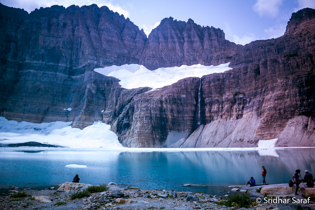
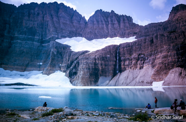
Photo: SridharSaraf via Flickr (CC BY-SA 2.0)
A Glacier National Park summer begins later than many first-time visitors expect. Calendar summer may start in June, yet deep snow can keep the alpine section of Going-to-the-Sun Road and high trails closed into late June or July. The park’s most complete access often lasts only from mid-July through early September, a narrow window shaped by a long Rocky Mountain winter.
Glacier covers more than one million acres along the Continental Divide in northwestern Montana. Elevations rise from roughly 3,100 feet near the western valleys to 10,466 feet on Mount Cleveland. That vertical range creates sharp differences in weather, vegetation, snowpack, and trail access between Lake McDonald, Logan Pass, Many Glacier, Two Medicine, and the North Fork.
What to Expect as the Glacier National Park Summer Season Unfolds
Summer conditions progress uphill. Lower forests and lakeshores open first, followed by mid-elevation trails and finally the alpine country around Logan Pass. Visitors arriving a few weeks apart can encounter completely different versions of the park, from snow-covered passes in June to smoky skies and dry trails in August.
June and early July bring snow and uncertainty
June is early season across much of Glacier. Lake McDonald, Apgar, St. Mary, and lower portions of Two Medicine are generally accessible, but road crews may still be clearing the alpine section of Going-to-the-Sun Road. Snowfields linger on trails such as the Highline, Hidden Lake, and passes above Many Glacier. Daytime valley temperatures can be comfortable, while cold rain, hail, and overnight frost remain possible.
This period suits visitors who value waterfalls, vigorous creeks, and relatively quieter weekdays. Snowmelt feeds Virginia Falls, St. Mary Falls, and the cascades along Avalanche Creek. Beargrass may begin blooming at lower elevations, although its timing and abundance vary by slope, elevation, and year.
Mid-July through August has the broadest access
Mid-summer usually provides the best chance of driving the full 50-mile Going-to-the-Sun Road and reaching alpine trailheads. Logan Pass, at 6,646 feet, becomes the main gateway to tundra habitat and Continental Divide scenery. Popular hikes include the 2.8-mile round trip to the Hidden Lake Overlook and the 7.6-mile Highline Trail segment from Logan Pass to Granite Park Chalet.
Warm, dry weather makes this the busiest period. Afternoon thunderstorms can form quickly near the Divide, and August may bring wildfire smoke from Montana, Canada, or the wider region. Smoke severity cannot be predicted months ahead, so flexible plans help if distant peaks become obscured.
Late August and September trade warmth for space
Late summer brings cooler mornings, shorter daylight, and gradually lighter crowds after major holiday periods. Huckleberries ripen, grasses turn gold, and subalpine larch begins changing color later in September. Snow can return to Logan Pass at any time, temporarily affecting roads and exposed trails even while valleys remain clear.
Comparing the Main Travel Windows for Glacier National Park in Summer
The best timing depends on what matters most: maximum road access, waterfalls, wildflowers, hiking, or quieter conditions. No week guarantees every trail or road will be open because annual snowpack and spring temperatures control the progression of the season.
| Travel window | Typical conditions | Access | Crowds | Best suited to |
|---|---|---|---|---|
| June to early July | Cool, wet, lingering snow | Valleys open, alpine access uncertain | Moderate, except holiday periods | Waterfalls, scenic drives, lower trails |
| Mid-July | Mild days, snowfields remain | Usually broad and improving | Heavy | Wildflowers and alpine scenery |
| August | Warmest and driest period | Usually the widest trail access | Very heavy | Long hikes and backpacking |
| September | Cold mornings, possible early snow | Good until weather or seasonal closures intervene | Declining | Photography, wildlife, quieter trails |
Choose dates according to your main priority
- Choose June for forceful waterfalls, green valleys, and lower-elevation hiking.
- Choose mid-July for alpine wildflowers and a strong chance of full road access.
- Choose August for high passes, long daylight, and the widest selection of hiking routes.
- Choose September for colder hiking conditions, fewer families, and autumn color.
Match your trip length to Glacier’s geography
A three-day visit works best when concentrated around one side of the park. Five to seven days allow time for both Lake McDonald and the east-side valleys, including Many Glacier and Two Medicine. Driving between areas takes longer than the map suggests. Going-to-the-Sun Road alone requires about two hours without stops, and wildlife, road work, parking searches, and overlooks can add several more.
Glacier National Park Summer: What to Expect from Access and Crowds
Summer crowds affect where visitors can park, when they must start hiking, and how much ground they can cover. The greatest pressure falls on Logan Pass, Avalanche, Many Glacier, and the waterfalls along St. Mary Lake. A realistic itinerary uses one geographic area per day rather than repeatedly crossing the Continental Divide.
Going-to-the-Sun Road controls many itineraries
The road crosses the park between West Glacier and St. Mary, climbing past Lake McDonald, the Garden Wall, and Logan Pass. Its alpine section cannot open until crews remove deep snow, repair guard walls, clear rockfall, and prepare visitor facilities. The opening date changes annually, and temporary closures can follow snow, accidents, or severe weather.
At Logan Pass, the air feels markedly cooler than beside Lake McDonald. Wind moves across low tundra, snowmelt trickles over stone, and the Garden Wall rises sharply above the road. On the Highline Trail, the ground narrows beneath your boots while the valley drops toward Going-to-the-Sun Road. Mountain goats and bighorn sheep sometimes appear on nearby slopes, so food and gear must remain secured.
Trail access changes with elevation
Lower routes such as the Trail of the Cedars, the 5.9-mile round trip to Avalanche Lake, and paths near St. Mary Falls generally become usable before high passes. Grinnell Glacier, Iceberg Lake, Ptarmigan Tunnel, and Dawson Pass often retain snow later. Early-season hikers may need traction, route-finding ability, and the judgment to turn around where steep snow covers the tread.
Reservations require planning before arrival
Park lodging commonly fills many months ahead, while reservable campsites and wilderness permits follow separate release schedules. Entry controls or vehicle reservations may also apply to particular corridors during busy periods. Shuttle operations, campground status, fees, permit windows, and road-entry rules can change from one summer to the next, so confirm current details on the official park site before booking transportation.
Busy areas demand an early or late schedule
Trailhead parking can fill early at Logan Pass, Avalanche, and Many Glacier. Starting near dawn improves parking odds, provides cooler hiking temperatures, and reduces exposure to afternoon storms. A second useful window begins later in the day as morning hikers leave, although long routes should still be timed around sunset. Midday is better reserved for lakeshores, picnic stops, visitor centers, or a shuttle-supported walk where available.
Build Reservations in the Right Order
A workable Glacier National Park summer plan begins with the hardest item to replace. For overnight hikers, that is usually a wilderness itinerary. For other travelers, it may be lodging near Many Glacier or transportation that reaches both sides of the Continental Divide. Booking flexible flights first can leave visitors with dates that do not match available campsites, rooms, or permits.
Secure the geographic anchor first
Choose one primary area, then arrange the remaining reservations around it. Staying near St. Mary supports early access to Logan Pass, St. Mary Lake, and the east-side valleys. A base near West Glacier favors Lake McDonald, Avalanche Creek, and the North Fork. Splitting a short stay between distant bases often consumes valuable hiking time in packing, checking in, and crossing the park.
| Planning item | When to address it | Practical backup |
|---|---|---|
| Wilderness itinerary | Before fixed transportation | Day hikes from one valley |
| Park lodging or camping | As soon as trip dates are known | Stay in a gateway community |
| Corridor entry requirement | After selecting daily destinations | Use another open entrance or eligible transit |
| Boat tour or guided activity | After lodging is secured | Plan a self-guided lakeshore day |
Know which activities require separate authorization
Ordinary day hiking generally does not require a wilderness permit, but overnight backcountry travel does. Fishing requires the appropriate license under Montana and park rules, while boating may involve inspection requirements intended to prevent aquatic invasive species. Commercial tours, corridor entry controls, campgrounds, and wilderness sites use different reservation systems, so one confirmation should never be assumed to cover the others.
What to Do About Peak Crowds in Glacier National Park in Summer
Crowding changes the character of a day beyond parking availability. Congestion can delay shuttle travel, create lines at restrooms and food counters, and concentrate hikers on the first mile of famous trails. A route that appears manageable on paper may require extra time for transportation and wildlife stoppages. Carry lunch, water, and an alternate trail so a full lot does not end the day.
Spread the trip among distinct park districts
Many Glacier draws hikers bound for Grinnell Glacier and Iceberg Lake, while Logan Pass concentrates visitors on Hidden Lake and the Highline Trail. Two Medicine offers a separate network around Sinopah Mountain, including the climb to Scenic Point and longer routes toward Dawson and Pitamakan passes. The North Fork has rougher, unpaved access roads and fewer services, but Bowman and Kintla lakes reward travelers prepared for slow driving.
Choose routes that disperse effort
For a moderate hiking day
Aster Park in Two Medicine provides an elevated view over the lake without committing to an all-day pass crossing. On the west side, Apgar Lookout involves a sustained forest climb and overlooks the Lake McDonald valley. Both demand more effort than a roadside viewpoint, which naturally reduces foot traffic after the opening miles.
For a long, strenuous objective
Experienced hikers can consider Siyeh Pass, the Dawson and Pitamakan loop, or Swiftcurrent Pass when snow and trail conditions permit. These routes involve substantial elevation gain, exposed terrain, and limited shelter. Start with a turnaround time, carry a topographic map, and avoid committing to a high pass when lightning, dense smoke, or steep lingering snow compromises safe travel.
Use a Decision Framework Instead of Chasing Perfect Dates
No single week reliably combines clear skies, every open trail, abundant wildflowers, light traffic, and smoke-free views. Rank the experiences that would make the trip successful, then accept the seasonal tradeoffs. This approach also prevents one closure from undermining the entire itinerary.
Rank priorities before selecting dates
- Choose maximum alpine access if high passes and long hikes matter most.
- Choose runoff season for waterfalls, green valleys, and lower trails.
- Choose late summer for cooler mornings and reduced weekday congestion.
- Allow spare days when a signature hike depends on visibility or calm weather.
Families and casual walkers often gain more from a valley-based plan than from waiting for every alpine trail to open. Trail of the Cedars, Running Eagle Falls, Lake McDonald, and the St. Mary shoreline provide varied scenery with shorter walking commitments. Strong hikers should reserve their clearest forecast day for exposed routes and use forested trails during unstable weather.
Prepare one substitute for every fixed plan
Pair each high-elevation objective with a lower alternative in the same part of the park. If Logan Pass weather blocks the Highline Trail, use the St. Mary Falls corridor. If clouds obscure Grinnell Glacier, explore Swiftcurrent Lake or a lower section of the valley. Geographic pairing avoids an unnecessary cross-park drive and keeps the substitute realistic when conditions deteriorate quickly.
Plan an Adaptable Glacier National Park Summer Visit
The strongest itinerary matches timing to a clear priority, anchors each day in one district, and leaves room for weather or access changes. June emphasizes runoff and lower elevations. Mid-July and August usually favor alpine travel, while September exchanges warmth and long daylight for quieter trails and colder mornings.
Build reservations around the least flexible part of the trip, carry alternatives for major hikes, and avoid scheduling every hour. Glacier rewards preparation because elevation, distance, and demand all shape what can be accomplished in a day. A flexible plan provides the best chance to experience the park safely when roads, trails, wildlife, or mountain weather change the original schedule.
Want to keep exploring? Browse all our Glacier guides and articles for more trip-planning tips and ideas.
Gear & Essentials
Tell us about your trip and we will add what else you will want:
The basics
Worth having in the car whatever the park.
For this trip
Traveling with kids
Bringing a pet
RVing
Backcountry
On the water
Photography
Accessibility
As an Amazon Associate we earn from qualifying purchases, at no extra cost to you.