How to Get to Grand Teton National Park: Airports, Roads and Getting Around
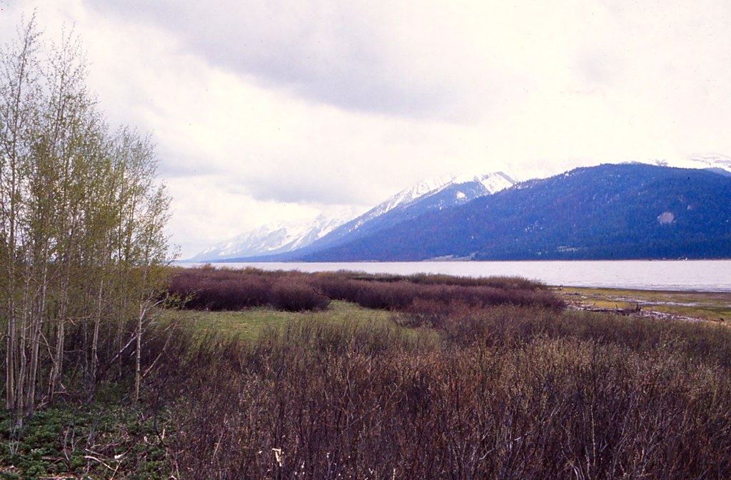
Photo: Ladycliff via Flickr (CC BY 2.0)
If your search is “How Get Grand Teton,” the first useful fact is surprisingly simple: Jackson Hole Airport sits inside Grand Teton National Park. Passengers can land within sight of the Teton Range, collect their luggage, and reach Moose in roughly 10 minutes. That convenience often comes with higher fares and fewer flight choices than larger regional airports.
Grand Teton occupies northwestern Wyoming immediately south of Yellowstone. US 89, US 191, and US 287 form the main north to south corridor, connecting Jackson, Moose, Moran Junction, Jackson Lake, and the Yellowstone boundary. The correct arrival plan depends on airfare, season, rental car availability, and which end of the park you intend to explore.
How to Get to Grand Teton National Park: Choose the Right Gateway
Begin by identifying your first overnight base rather than treating the park as a single point on a map. Jackson lies south of the park’s principal scenic corridor. Moose provides access to park headquarters, the Craig Thomas Discovery and Visitor Center, and Teton Park Road. Farther north, Moran, Signal Mountain, Colter Bay, and the Yellowstone boundary serve travelers concentrating on Jackson Lake or combining both parks.
Match the arrival point to your itinerary
Jackson works well for restaurants, groceries, lodging, and flights, but every park day begins with a drive north. Moose is about 12 road miles from central Jackson, Jenny Lake is roughly 20 miles away, and Colter Bay is approximately 40 miles north. Traffic and wildlife can make these short distances slower than expected, particularly around town, Moose Junction, and evening animal crossings.
Travelers focused on Jenny Lake, Cascade Canyon, or the Taggart Lake Trail save time by staying near the southern half of the park. Those planning sunrise at Oxbow Bend, paddling on Jackson Lake, or continuing into Yellowstone benefit from a northern base. Changing accommodations midway through a longer visit can prevent repeated drives along the same corridor.
How Get Grand Teton plans change with the season
Late spring through early autumn provides the broadest road access. Snow commonly remains at higher elevations into June, while July and August bring the heaviest traffic. September offers colder mornings, shorter daylight, and elk activity around the valley. By late autumn, interior roads begin closing to motor vehicles, and winter travel becomes concentrated on the plowed highway between Jackson and the Yellowstone area.
Teton weather changes quickly because the valley floor stands near 6,300 feet while Grand Teton rises to 13,775 feet. A warm afternoon in Jackson does not guarantee dry pavement on Togwotee Pass or Teton Pass. Review road conditions immediately before departure, particularly after an early or late season storm.
How to Get to Grand Teton National Park by Air
Jackson Hole Airport, identified by the code JAC, is the most convenient choice. Larger airports can reduce airfare or provide better schedules, but they add mountain driving, fuel costs, and potentially an extra hotel night. Compare the total journey rather than the ticket price alone, especially when rental cars must be collected and returned at the same airport.
Jackson Hole Airport provides the shortest transfer
JAC is about 7 miles north of downtown Jackson and approximately 5 miles south of Moose Junction. The terminal opens toward the Tetons, so the geography is immediately visible. From the airport access road, travelers join US 89/191/287 and can turn north for the park or south for Jackson without crossing a mountain pass.
Standing outside the terminal, you feel the valley’s scale before reaching a trail. Sagebrush covers the flat foreground, cold air drains from the mountains in the morning, and the Teton skyline rises abruptly beyond the runway. The range lacks eastern foothills, so the elevation gain appears almost vertical from the valley floor.
Compare Regional Airports for Getting to Grand Teton
Idaho Falls is the closest common alternative, reached from Jackson through Swan Valley and over Teton Pass. Salt Lake City offers the broadest selection of flights and rental vehicles but requires most of a day on the road. Bozeman can suit a Yellowstone combination trip, although the direct summer route through Yellowstone becomes unavailable to ordinary vehicle traffic during winter closures.
| Airport | Approximate distance to Moose | Typical driving time | Primary consideration |
|---|---|---|---|
| Jackson Hole, JAC | 5 miles | 10 minutes | Fastest access and no mountain pass |
| Idaho Falls, IDA | About 95 miles | About 2 hours | Teton Pass affects winter travel |
| Salt Lake City, SLC | About 290 miles | 5 to 6 hours | More flights, followed by a long drive |
| Bozeman, BZN | About 200 miles | Roughly 4 hours in favorable conditions | Best considered with a Yellowstone itinerary |
How to Get to Grand Teton National Park by Road and Scenic Route
Grand Teton has no western vehicle entrance through the Teton Range. Drivers arriving from Idaho must cross Teton Pass into Jackson, then turn north. From central Wyoming, US 26/287 approaches Moran Junction over Togwotee Pass. The northern approach enters through Yellowstone and the John D. Rockefeller Jr. Memorial Parkway.
The southern approach through Jackson
US 89/191 is the simplest year round approach from Jackson. It follows the valley north past the National Elk Refuge and the airport before reaching Moose Junction. Drivers can continue toward Moran on the main highway or turn onto Teton Park Road for Jenny Lake and the base of the mountains when that interior road is open to vehicles.
Arriving from Idaho over Teton Pass
Wyoming Highway 22 crosses 8,431 foot Teton Pass between Victor, Idaho, and Wilson, Wyoming. The road has sustained steep grades, sharp curves, and winter weather exposure. Vehicles towing trailers should descend conservatively and avoid riding the brakes. After reaching Wilson, continue through Jackson before turning north toward the park.
The eastern and northern approaches
US 26/287 crosses 9,658 foot Togwotee Pass before descending toward Moran Junction, with broad views of the Tetons appearing west of the Continental Divide. This route serves travelers coming from Dubois and central Wyoming. Snow, wind, and wildlife are meaningful hazards even when pavement remains open.
The northern route links Yellowstone’s South Entrance with Colter Bay through approximately 27 miles of the Rockefeller Parkway and northern Grand Teton. It is highly useful during the main visitor season but normally closes to regular through traffic in winter. Entrance requirements, construction restrictions, and seasonal opening dates can change, so confirm current details on the official park site before committing to this route.
Prepare the Vehicle Before Entering the Park
Services become more dispersed north of Jackson, and mobile coverage is inconsistent beneath the mountains and around Jackson Lake. A navigation app should supplement, rather than replace, an offline map. Download the relevant Wyoming and park map areas before leaving the airport or town.
A practical arrival checklist
- Fill the fuel tank: Longer sightseeing loops, wildlife delays, and side trips can consume more fuel than the map suggests.
- Download offline directions: Save routes to the accommodation, Moose, Jenny Lake, Moran Junction, and Colter Bay.
- Carry water and food: Early departures may occur before stores or food counters open.
- Pack a windshield scraper and warm layer: Frost can occur during shoulder seasons, even after a mild afternoon.
- Check the spare tire: Road shoulders can contain sharp gravel, and towing assistance may take time to arrive.
Avoid timing the drive too tightly
Add margin for bison, elk, moose, and bear activity near the road. Dawn and dusk bring limited visibility, while summer afternoons can produce queues at junctions and popular lake areas. Never stop in a travel lane for photographs. Use a designated pullout, keep wildlife at a safe distance, and remain prepared for the animal to cross unexpectedly.
How to Get Around Grand Teton National Park
Grand Teton’s principal destinations extend across more than 40 miles of valley, and trailheads are separated by long stretches of highway. A rental car provides the most reliable access to sunrise viewpoints, early trail starts, and northern sites such as Colter Bay. Travelers without a vehicle need to arrange each major transfer in advance because the park does not have a comprehensive shuttle connecting Jackson, Jenny Lake, Signal Mountain, and Jackson Lake.
Compare Options for Getting Around Grand Teton National Park
Hotel transfers, taxis, and ride services can cover the airport and Jackson, but availability drops farther inside the park. Guided wildlife tours solve the transportation problem for one outing while adding local interpretation. Bicycles work well on designated pathways near Jackson, Moose, and Jenny Lake, although distance, afternoon wind, and wildlife encounters make them unsuitable as the only transportation for many visitors.
| Option | Best use | Main limitation |
|---|---|---|
| Rental car | Multiple trailheads and sunrise stops | Parking fills early at popular sites |
| Guided tour | Wildlife viewing and first-time orientation | Fixed route and departure time |
| Bicycle | Moose, Jenny Lake, and pathway trips | Weather, distance, and limited carrying capacity |
| Taxi or ride service | Airport and Jackson transfers | Unreliable pickup coverage inside the park |
Use Teton Park Road and US 89 strategically
Teton Park Road runs closer to the mountains and reaches Jenny Lake, String Lake, Signal Mountain, and several major trailheads. US 89/191/287 follows the eastern side of the valley through Moran Junction and offers access to Snake River Overlook, Oxbow Bend, and Jackson Lake. Combining the two creates a practical sightseeing loop when connecting roads are open, reducing backtracking while covering both mountain and river landscapes.
Plan Parking Around the Day’s First Activity
Parking pressure is concentrated rather than uniform. Jenny Lake, String Lake, Lupine Meadows, and Taggart Lake can become congested on busy summer mornings, while roadside overlooks usually turn over more quickly. Build the day around the hardest parking space. Begin at the trailhead requiring several hours, then visit overlooks and shorter walks after returning to the vehicle.
Arrive early for long hikes
Lupine Meadows serves Amphitheater Lake and the Garnet Canyon approach, while the Jenny Lake area serves Hidden Falls and Cascade Canyon. These trailheads attract both short-distance sightseers and all-day hikers. An early start improves parking odds, provides cooler climbing temperatures, and leaves more time before afternoon thunderstorms develop over the range. Park only in marked areas because roadside parking can damage vegetation and obstruct emergency vehicles.
Avoid common navigation mistakes
- Do not route only to “Grand Teton National Park”: Enter the exact trailhead, overlook, lodge area, or junction into the navigation app.
- Check the destination before leaving Jackson: Jenny Lake and Jackson Lake are separate areas with substantially different drive times.
- Keep a paper map accessible: A phone may lose service before a missed turn becomes obvious.
- Watch for similarly named roads: Teton Park Road, Moose-Wilson Road, and the main US highway lead to different parts of the valley.
Build a Backup Plan for Delays and Closures
Mountain weather, collisions, construction, and wildlife can disrupt even a short drive. Keep at least one alternative that stays within the same part of the park. If Jenny Lake parking is unavailable, consider the Taggart Lake area or continue north toward Jackson Lake rather than circling repeatedly. If clouds hide the peaks, prioritize lower-elevation walks, historic districts, or wildlife viewing along the Snake River corridor.
Respond safely to changing road conditions
During snow or heavy rain, reduce speed before curves and allow extra braking distance. Shaded pavement can remain icy after sunny sections have dried. If Teton Pass becomes unsuitable, drivers approaching from Idaho may face a lengthy reroute, so delaying departure can be safer than improvising on minor roads. Carry enough clothing, food, and medication to tolerate several additional hours in the vehicle.
Protect the final travel day
Return flights from JAC deserve more margin than the short map distance suggests. A wildlife jam, road incident, or rental-car return can erase a tight schedule. Spend the final night in Jackson or the southern park area when departure is early. Travelers using distant airports should treat the transfer as a separate travel day, particularly when crossing Teton Pass or driving through Yellowstone.
Turn the Route into a Reliable Grand Teton Plan
The strongest How Get Grand Teton plan starts with three decisions: choose an airport based on total trip time, match the overnight base to the first activities, and secure transportation capable of reaching those places. JAC minimizes driving, while Idaho Falls, Salt Lake City, and Bozeman can improve flight selection at the cost of longer and more weather-sensitive transfers.
Once inside the valley, use exact destination names, begin with the most parking-sensitive trailhead, and keep an alternate activity nearby. Offline maps, a full fuel tank, extra layers, and realistic time margins address the problems travelers encounter most often. With those details settled before arrival, the roads become a useful framework for exploring Moose, Jenny Lake, Moran, and Jackson Lake rather than a daily source of uncertainty.
Want to keep exploring? Browse all our Grand Teton guides and articles for more trip-planning tips and ideas.
Gear & Essentials
Tell us about your trip and we will add what else you will want:
The basics
Worth having in the car whatever the park.
For this trip
Traveling with kids
Bringing a pet
RVing
Backcountry
Winter conditions
On the water
Photography
Accessibility
As an Amazon Associate we earn from qualifying purchases, at no extra cost to you.