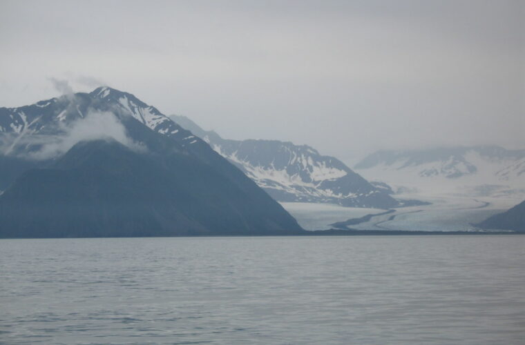
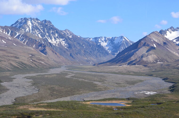
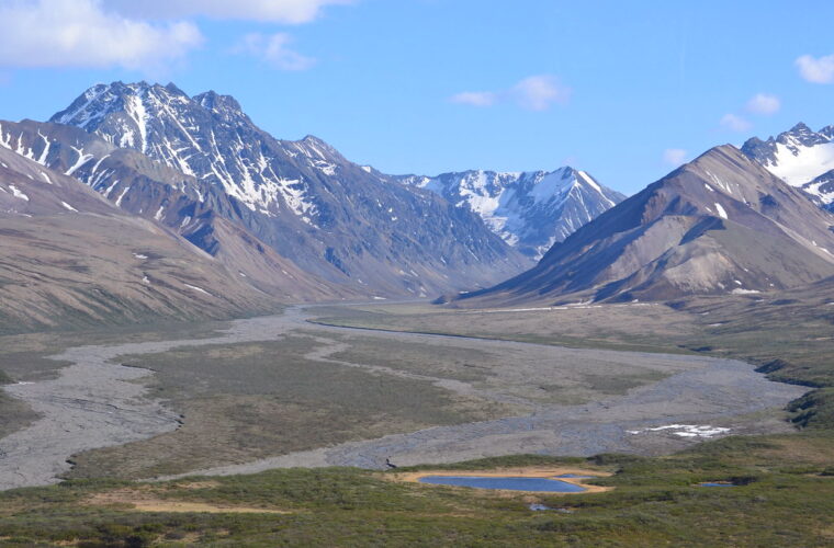
7 Best Summer Hikes in Denali National Park
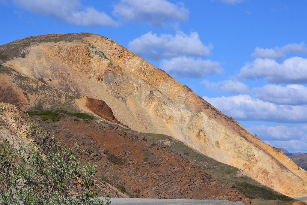
Photo: larrywkoester via Flickr (CC BY 2.0)
The Best Summer Hikes Denali visitors can choose are concentrated near the park entrance and Savage River, rather than deep along Denali Park Road. Denali has few maintained trails for a six-million-acre park. Much of its interior is roadless tundra where hikers create cross-country routes, cross unbridged streams, and navigate without signs.
For most visitors, seven established trails provide the best balance of scenery, wildlife habitat, navigation, and realistic access. They range from the 2-mile Savage River Loop to the 9.5-mile one-way Triple Lakes Trail. Timing matters as much as distance. Snowmelt, mosquitoes, daylight, fall color, bus demand, and road access all change during the short hiking season.
Comparing the 7 Best Summer Hikes in Denali National Park
Our seven selections cover three distinct landscapes. Entrance-area trails pass through white spruce forest and around kettle lakes shaped by glacial ice. Trails near Savage River climb above treeline into alpine tundra. Triple Lakes links forest, wetlands, ridges, and three long glacially formed lakes along Denali’s eastern boundary.
Distances alone can mislead here. A 4-mile tundra hike with 1,500 feet of climbing may demand more time than a longer forest trail. Exposed routes also offer little shelter from wind, rain, or sudden temperature drops. Use the figures below for initial planning, then account for photography, wildlife delays, and transportation between trailheads.
| Trail | Distance | Typical challenge | Primary landscape |
|---|---|---|---|
| Savage River Loop | About 2 miles round trip | Easy | River canyon and tundra |
| Horseshoe Lake Trail | About 2 miles round trip | Moderate descent and return climb | Lake, forest, and beaver habitat |
| McKinley Station Trail | About 3 miles round trip | Easy to moderate | Spruce forest and historic district |
| Rock Creek Trail | About 4.8 miles round trip | Moderate | Rolling forest and creek valleys |
| Savage Alpine Trail | About 4 miles one way | Strenuous, roughly 1,500 feet of gain | Alpine tundra and broad ridgelines |
| Mount Healy Overlook Trail | About 5 miles round trip | Strenuous, roughly 1,700 feet of gain | Forest, ridge, and overlook |
| Triple Lakes Trail | About 9.5 miles one way | Strenuous full-day outing | Lakes, wetlands, forest, and ridges |
Maintained paths versus open tundra
The Savage River Loop, Horseshoe Lake, McKinley Station, Rock Creek, Mount Healy, and Triple Lakes follow recognizable paths. The Savage Alpine Trail is also maintained, but its exposed slopes feel closer to Denali’s trailless backcountry. Above the spruce, low tundra vegetation leaves hikers visible to wildlife and fully exposed to weather.
Off-trail travel is legal across much of Denali, but it requires route-finding, bear awareness, and careful movement through fragile vegetation. First-time visitors should complete an established hike before considering a tundra route. Wet sedge, hidden tussocks, and braided streams make apparent shortcuts considerably harder than they look from the road.
Choosing the Best Summer Hikes in Denali by Month
Denali’s practical hiking summer runs from late May into early September, although snow can fall in every month. Lower trails usually clear before alpine ridges. Green-up advances rapidly in June, wildflowers peak at different elevations through July, and tundra shrubs can turn red by the second half of August.
Weather varies sharply within a single day. Moist air from the Gulf of Alaska collides with the Alaska Range, producing cloud, rain, and localized wind. Conditions at the park entrance can differ from those at Savage River. Denali itself rises to 20,310 feet and creates its own weather, so a clear trailhead never guarantees a mountain view.
| Period | Weather and terrain | Crowd pattern | Access and best uses |
|---|---|---|---|
| Late May to mid June | Lingering alpine snow, wet ground, cool nights, very long daylight | Generally lighter, especially early in the period | Entrance trails often become practical first; choose lower routes after checking conditions |
| Mid June through July | Green tundra, active wildflowers, frequent insects, variable rain | Highest demand for buses and lodging | Broadest hiking choice, including alpine routes when snow has melted |
| August | Cooler nights, changing tundra color, increasing chance of frost | Busy early, gradually easing later | Excellent for alpine color and longer hikes, with less daylight than June |
| Early September | Possible snow, freezing nights, short color window | Usually lower after peak summer | Good for flexible hikers prepared for weather-related access changes |
Early summer favors lower trails
Horseshoe Lake and McKinley Station are sensible early-season choices because they stay at relatively low elevations near the entrance. Snow may disappear while mud and standing water remain. Waterproof footwear helps, but hikers should stay on the constructed tread rather than widening trails around puddles.
July opens the alpine routes
By July, Mount Healy Overlook and Savage Alpine are usually among the strongest options for elevation and open views. Mosquitoes can be intense in sheltered forest and wet tundra, while exposed ridges may be windy enough to reduce insect activity. Carry repellent and a head net rather than relying on wind.
The feel of Savage Alpine
On the Savage Alpine Trail, packed earth and stone give way to springy tundra underfoot. The traffic and river sounds fade as the climb steepens, replaced by wind moving across dwarf birch and willow. From the ridge, the Savage River valley opens abruptly below, with rounded tundra slopes in the foreground and the Alaska Range forming a jagged southern horizon. There is little shelter, and the temperature can drop quickly when cloud crosses the ridge.
August brings color and colder margins
August hikers trade some daylight and warmth for red bearberry, yellow dwarf birch, and clearer views through thinning foliage. Blueberries and crowberries also attract bears, so visibility and food storage remain important. Start long routes early enough to absorb a rain delay or wildlife closure without finishing in darkness.
How Road Access Shapes a Best Summer Hikes Denali Itinerary
Denali Park Road is the organizing spine for hiking. Private vehicles generally reach the entrance area and, during the main season, the Savage River vicinity around Mile 15. Travel farther into the park typically depends on authorized buses, and road conditions can limit how far those vehicles operate. Current closures are especially important because construction and landslide work may change the practical endpoint.
Trailheads near the entrance are easier to combine without committing to a long bus journey. Horseshoe Lake, McKinley Station, Rock Creek, Mount Healy Overlook, and Triple Lakes connect with the developed entrance district or nearby transport stops. Savage River Loop and Savage Alpine require travel farther west along the park road.
Build around one transportation commitment
We recommend assigning one day to the Savage River area rather than trying to combine it with a long entrance-area trail. Savage Alpine is a one-way route between the Mountain Vista and Savage River areas, so hikers need to coordinate their direction with available transportation. Walking it eastbound generally places the steepest climbing near the start.
- Reserve park transportation before lodging choices lock the itinerary into an incompatible day.
- Keep one entrance-area hike available as a poor-weather alternative.
- Allow extra time for wildlife stops and road delays.
- Carry all required water and layers rather than depending on trailhead services.
- Check current road limits, bus reservations, fees, trail advisories, and seasonal operating details on the official park site.
Permits depend on where the hike ends
Maintained day hikes generally do not require a backcountry permit. An overnight trip beyond the developed corridors enters a different planning system, with backcountry units, food-storage rules, and route discussions. Campground reservations and bus bookings are separate from hiking access, so securing one does not automatically secure the others.
Day hikers should still treat wildlife closures as binding. A trail or surrounding area may close temporarily when bears, wolves, moose, or nesting birds are using it intensively. Denali’s entrance forests can conceal animals at close range, while open tundra provides better visibility but fewer options for moving discreetly around them.
A Practical Framework for Choosing the 7 Best Summer Hikes in Denali National Park
The right trail depends on available time, climbing tolerance, transportation, and the kind of habitat you want to experience. Families often gain more from a slow walk around Savage River or Horseshoe Lake than from pushing toward an exposed summit. Strong hikers with a full day can use Triple Lakes to see a broader ecological cross-section.
Choose by your main priority
- Short scenery: Select Savage River Loop for tundra, river views, and relatively gentle terrain.
- Wildlife habitat: Choose Horseshoe Lake for beaver activity, waterfowl, and mixed spruce forest.
- Alpine exposure: Hike Savage Alpine when wind and cloud conditions are favorable.
- Elevation near the entrance: Use Mount Healy Overlook for a sustained climb without arranging transportation to Savage River.
- Quiet forest walking: Pick Rock Creek or McKinley Station, especially when ridges are hidden by cloud.
- A full-day challenge: Plan Triple Lakes with transportation between its separated endpoints.
Match ambition to Denali conditions
Rain, low cloud, or strong ridge wind should shift the plan toward forested trails rather than cancel the day automatically. Horseshoe Lake and McKinley Station retain ecological and historical interest without distant views. Exposed hikes deserve a conservative turnaround point because wet tundra, falling temperatures, and limited shelter compound fatigue quickly.
How peak-season crowds change a Denali hiking day
Late June through early August brings the greatest competition for lodging, campgrounds, transportation seats, and parking near popular trailheads. The trails themselves rarely feel crowded by urban-park standards, but transportation bottlenecks affect start times. A missed connection can make a one-way hike impractical, while a full parking area may add walking time. Crowds also concentrate near the first overlooks. Continuing beyond the opening mile of Rock Creek or the initial Horseshoe Lake viewpoints often produces a quieter experience.
Use daylight to avoid the busiest hours
June provides close to 20 hours of usable daylight, so hikers can begin early or wait until the afternoon rush subsides. Mount Healy Overlook is usually quieter in the morning, when cooler temperatures also make its sustained ascent easier. Evening works well for McKinley Station and Horseshoe Lake, but low-angle light can make animals difficult to see in dense spruce. Maintain awareness around blind bends rather than assuming nearby voices will discourage wildlife.
Expect wildlife to interrupt the schedule
A stationary bus, clustered hikers, or temporarily blocked trail may indicate wildlife rather than congestion. Never approach an animal to recover lost time. Denali guidance calls for at least 300 yards of separation from bears and 25 yards from other wildlife, including moose. If an animal occupies the trail, retreat and allow it an escape route. Cow moose with calves can be particularly defensive in early summer, while bears become conspicuous around berry patches later in the season.
Turn reservation dates into a workable hiking plan
Transportation should anchor any day involving Savage River or a separated trail endpoint. Lodging and campground space near the entrance can disappear before travelers settle on individual hikes, but booking a room without examining transportation may leave the hardest route on the wrong day. When reservation inventories open, secure the least flexible component first. That is usually a bus seat, campsite, or limited lodging date rather than access to a maintained day trail.
Book in the order of scarcity
A practical sequence begins with fixed travel dates, followed by lodging, park transportation, and any one-way trail logistics. Place Savage Alpine and Triple Lakes on days when endpoint transportation is feasible. Entrance-area loops can fill the remaining dates because they require fewer moving parts. Rental vehicles also need early attention during the Alaska summer, especially if the trip includes the roughly 240-mile road journey between Anchorage and the Denali entrance.
Protect one day from weather
Build at least one interchangeable day into a stay of three nights or longer. Assign Mount Healy or Savage Alpine to the clearest forecast, then move Rock Creek or McKinley Station into the wettest period. Forecasts are most useful for wind, precipitation, and freezing level, not for promises of a Denali view. The 20,310-foot summit is frequently obscured even while lower ridges remain dry and suitable for hiking.
Pack for the trail category, not the calendar
The Best Summer Hikes Denali visitors attempt cross forest, wetland, and exposed tundra, so one standard daypack needs several layers. Carry a waterproof shell, insulating layer, hat, gloves, insect protection, food, and navigation backup even in July. Cotton holds moisture and becomes uncomfortable during wind or prolonged rain. Trekking poles help on the Mount Healy descent, muddy Triple Lakes slopes, and the steeper sections of Savage Alpine.
| Trail setting | Main exposure | Most useful additions |
|---|---|---|
| Entrance forest | Mud, mosquitoes, limited wildlife visibility | Head net, repellent, waterproof footwear |
| Alpine ridge | Wind, rapid cooling, little shelter | Gloves, warm layer, shell, trekking poles |
| Long point-to-point route | Fatigue, delayed transport, changing weather | Extra food, offline map, headlamp, emergency insulation |
Carry water even beside rivers and lakes
Clear-looking water can contain Giardia and other pathogens. Treatment also takes time, and some ridge sections provide no convenient source. Begin shorter hikes with enough water for the complete route. Triple Lakes hikers may carry a filter or purifier as backup, but should avoid collecting from stagnant margins where sediment clogs equipment. Cool weather suppresses thirst without reducing fluid loss during sustained climbing.
Keep bear spray immediately accessible
Bear spray belongs in a belt or chest holster, not inside a backpack. Practice removing the safety clip before entering the trail, while keeping the canister pointed away from people. Commercial airlines prohibit bear spray in checked and carry-on baggage, so travelers typically obtain it after arrival in Alaska. Food, wrappers, and scented items should remain controlled during breaks because ravens and small mammals also learn to investigate unattended packs.
Know when to turn around
Turnaround decisions should account for the slowest hiker, transportation deadline, and increasing wind rather than mileage alone. Dark cloud obscuring the next ridge, numb hands, or repeated slips on wet ground are useful thresholds. On one-way routes, continuing can appear shorter than retreating but may commit the group to a more exposed section. A conservative reversal preserves enough energy to respond calmly to wildlife or a minor injury.
Choose the hike that fits the day
Denali rewards flexible planning. Use lower forest trails when alpine snow, cloud, or wind compromises the ridges. Reserve clear, stable periods for Savage Alpine and Mount Healy, and give Triple Lakes a full day with its endpoint arrangements settled in advance. Travelers short on time can pair Horseshoe Lake with McKinley Station, while families and casual walkers can devote an unhurried outing to the Savage River Loop.
The strongest itinerary matches season, transportation, terrain, and personal ability before anyone reaches the trailhead. Secure scarce bookings first, retain a weather alternative, and carry clothing suitable for temperatures far below the entrance forecast. With those decisions made, the seven routes provide a practical cross-section of Denali, from beaver-shaped wetlands and spruce forest to open tundra beneath the Alaska Range.
Want to keep exploring? Browse all our Denali guides and articles for more trip-planning tips and ideas.
Gear & Essentials
Tell us about your trip and we will add what else you will want:
The basics
Worth having in the car whatever the park.
For this trip
Traveling with kids
Bringing a pet
RVing
Backcountry
On the water
Photography
Accessibility
As an Amazon Associate we earn from qualifying purchases, at no extra cost to you.