5 Best Fall Hikes in Denali National Park
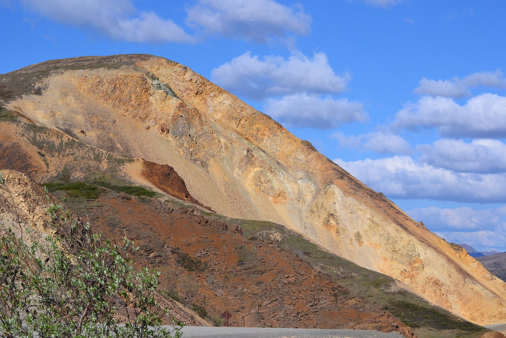
Photo: larrywkoester via Flickr (CC BY 2.0)
The best fall hikes Denali visitors seek come into focus at dawn on the Savage Alpine Trail, where frost stiffens the low blueberry plants and boots scrape across loose metamorphic rock above the Savage River. Wind moves through knee-high tundra without the shelter of trees. When clouds lift, the Alaska Range fills the southern horizon, with 20,310-foot Denali rising far beyond the braided river valleys.
That scene can occur from mid-August into early September, but fall in Denali National Park is brief and operationally complicated. Tundra color, berry-bearing shrubs, early snow, changing bus service, and shortening daylight all influence which hike makes sense. Our team uses five routes to cover the season’s main experiences: exposed alpine tundra, boreal forest, glacial landforms, wildlife habitat, and accessible river corridors.
Finding the Best Fall Hikes in Denali During a Short Season
Denali’s hiking season does not follow a fixed calendar. Autumn begins biologically before it feels cold at lower elevations. Dwarf birch and blueberry foliage often start turning red in the second half of August, while willows add yellow along streams. Color generally develops first on exposed tundra and higher slopes, then spreads through lower forest. A hard frost, windstorm, or early snowfall can compress the display into several days.
Early fall brings color without full winter conditions
From roughly mid-August through the final week of the month, daytime hiking conditions can resemble summer. Temperatures may reach the 50s Fahrenheit, although freezing mornings and cold rain remain possible. Savage Alpine Trail and Mount Healy Overlook are strong choices because their open slopes reveal the earliest tundra color. Mosquito numbers usually decline after repeated frosts, but small biting flies may persist during warm, calm periods.
Peak color favors open tundra routes
Late August into early September often produces the richest combination of red bearberry, crimson blueberry leaves, yellow willow, and green spruce. Exact timing varies by elevation and weather. The Savage River area, around Mile 15 of Denali Park Road, is particularly useful because hikers can choose the demanding Savage Alpine Trail or the gentler Savage River Loop after seeing the cloud ceiling and wind firsthand.
Late fall requires a winter mindset
By early to mid-September, snow can coat ridges while rain falls near the park entrance at approximately 1,700 feet. Trail mud freezes overnight, shaded rocks become slick, and daylight contracts quickly. Lower routes such as Horseshoe Lake and the southern portion of Triple Lakes Trail provide more shelter than alpine ridges. Moose activity also increases during the autumn rut, making generous distance especially important around brushy wetlands and forest openings.
How Fall Compares With Denali’s Other Hiking Seasons
Fall trades operational certainty for color, cooler hiking temperatures, and fewer insects. Summer provides the broadest transportation network and longest days, while winter turns maintained paths into snow travel. Spring arrives unevenly: exposed slopes may be dry while shaded forest retains deep snow or saturated ground. The practical differences matter because most trailheads sit along the entrance corridor and the first 15 miles of Denali Park Road.
A season-by-season planning table
This comparison reflects normal patterns rather than a forecast for a particular year. Snow can arrive during any month at higher elevations, and wildfire smoke can occasionally affect summer or early fall visibility.
| Season | Typical conditions | Crowd effects | Road and trail access | Best suited to |
|---|---|---|---|---|
| Spring, April through May | Lingering snow, thawing ground, cold nights, rapidly lengthening days | Very light use, with limited visitor services | Road access expands gradually as plowing and conditions permit; trails can be icy or muddy | Snow travel, bird migration, and quiet entrance-area walks |
| Summer, June through mid-August | Long daylight, variable rain, active insects, greener tundra | Highest demand for buses, lodging, and popular trailheads | Broadest seasonal access, subject to current Park Road restrictions | Long hikes, backcountry trips, and wildlife viewing deep along the road corridor |
| Fall, mid-August through early September | Frosty mornings, tundra color, fewer insects, possible ridge snow | Moderate use that declines sharply after late August | Good entrance-area access, with transportation reducing later in the season | Color, cool-weather hiking, and wildlife photography |
| Winter, October through March | Deep cold, limited daylight, snow cover, and severe wind exposure | Minimal visitation outside developed areas | Vehicle access is limited by plowing and weather; trails become unmarked snow routes | Skiing, snowshoeing, aurora viewing, and experienced winter travel |
Crowds change transportation more than trail solitude
Denali has relatively few constructed trails, yet hikers often spread out quickly once they leave a trailhead. Summer congestion is most noticeable in parking areas, buses, and entrance facilities. In fall, the operational tradeoff becomes more important: a quieter trail may coincide with reduced transportation. This particularly affects Savage Alpine Trail, which is easiest as a one-way traverse between Mountain Vista and Savage River.
Private vehicles are generally limited to the eastern section of Denali Park Road during the main visitor season, while park buses provide access farther west when road conditions and closures allow. The long-running Pretty Rocks landslide has changed access beyond the East Fork area, so bus destinations, reservation release dates, entrance fees, and seasonal service should be confirmed on the official park site before booking lodging or building a one-way hike around transportation.
5 Best Fall Hikes in Denali National Park at a Glance
These five hikes remain within or near the park’s developed eastern corridor, making them more practical when autumn transportation contracts. Distances and elevation figures should be treated as planning values because GPS readings vary, especially on steep switchbacks and beneath forest cover. None requires technical climbing, but Mount Healy and Savage Alpine expose hikers to wind, sudden snow, and limited shelter.
Best Fall Hikes Denali Route Comparison
| Hike | Approximate distance | Elevation change | Primary fall feature | Difficulty |
|---|---|---|---|---|
| Savage Alpine Trail | 4.1 miles one way | About 1,500 feet of climbing, depending on direction | Continuous tundra color and Alaska Range views | Strenuous |
| Mount Healy Overlook Trail | About 5.2 miles round trip | Approximately 1,700 feet | Open ridgeline above the Nenana River valley | Strenuous |
| Horseshoe Lake Trail | About 2 miles round trip | Approximately 250 feet | Lake reflections, birch color, and beaver habitat | Moderate |
| Savage River Loop Trail | About 2 miles round trip | Minimal overall change | River canyon, willow color, and wildlife habitat | Easy to moderate |
| Triple Lakes Trail | About 9.5 miles one way | Roughly 1,000 feet of cumulative change | Boreal forest, kettle lakes, and glacial terrain | Moderate to strenuous |
Choose by weather, color, and transportation
Use the morning cloud ceiling and wind forecast before committing to a route. Low clouds can erase the main reward on Mount Healy while leaving Horseshoe Lake atmospheric and sheltered. Strong wind makes Savage Alpine substantially colder than the entrance area. Recent rain favors the gravelly Savage River Loop over root-covered forest sections of Triple Lakes.
- For the broadest tundra color: Choose Savage Alpine Trail.
- For a steep half-day climb near the entrance: Choose Mount Healy Overlook.
- For forest color and beaver activity: Choose Horseshoe Lake.
- For limited time or uncertain weather: Choose Savage River Loop.
- For a longer forest traverse: Choose Triple Lakes Trail and arrange transportation between trailheads.
Day hiking on maintained trails generally does not require a backcountry permit. Overnight travel in Denali’s backcountry follows a separate permit system, and some itineraries depend on advance bus reservations. Carry rain protection, insulating layers, gloves, a warm hat, traction when ice is possible, bear spray where legally permitted and readily accessible, and enough food to wait through a transportation delay.
What Each Trail Feels Like in Autumn
The five routes respond differently to frost, rain, cloud cover, and shortening daylight. Alpine trails deliver the strongest color and widest views, but they lose their advantage when wind drives clouds across the ridges. Forest and river routes remain useful during marginal weather, especially when early snow leaves higher slopes slick.
Savage Alpine and Mount Healy reward clear mornings
Hike Savage Alpine from Savage River toward Mountain Vista if you prefer to tackle the steepest climbing first. The route crosses treeless tundra above the Savage River valley, where exposed metamorphic rock can hold frost after shaded ground has thawed. Dall sheep sometimes use the surrounding ridges, although binoculars are usually necessary. Mountain Vista to Savage River provides a more gradual initial ascent but ends with a steep descent that can punish knees.
Mount Healy Overlook begins in spruce forest near the entrance area and climbs through birch before reaching exposed tundra. The maintained trail ends at the overlook, about 2.6 miles from the trailhead. Ground beyond that point is rougher, unmaintained, and substantially more exposed. Turn around at the official endpoint when clouds obscure the ridge or snow covers the tread.
Horseshoe Lake and Savage River work in unsettled weather
Horseshoe Lake occupies a low basin beside the Nenana River, reached by a descent that must be regained on the return. Beaver dams, lodges, gnawed trees, and flooded margins reveal how the lake’s shape changes over time. Watch for slick roots on the forested switchbacks. Moose frequent the lake basin, so scan brushy corners before approaching and retreat if an animal blocks the trail.
At Savage River, gravel shifts underfoot while cold air drains through the narrow valley. Water noise rebounds from the rock walls, and willow branches brush the trail near the river. The scale becomes apparent where the canyon opens northward and the braided channel spreads across pale gravel bars. This enclosed terrain often feels several degrees colder than Mountain Vista, even without a major elevation difference.
Triple Lakes needs a full transportation plan
Triple Lakes crosses rolling glacial terrain between the visitor center area and the park’s southern boundary near the Parks Highway. Spruce forest limits distant views, but the trail passes three lakes, wetland edges, and elevated openings above the Nenana River. Fallen leaves can conceal roots and muddy depressions. Because this is a point-to-point hike, arrange a pickup or use two vehicles rather than depending on roadside improvisation.
Access, Reservations, and the Shrinking Autumn Day
There is no separate trail reservation window for ordinary day hikes on these five maintained routes. Planning pressure falls instead on lodging, campgrounds, and any bus needed to reach or leave a trailhead. Transportation availability can contract before hiking conditions deteriorate, so secure the ride first and treat the trail choice as flexible.
Build plans around fixed trailheads
Mount Healy and Horseshoe Lake are practical choices when staying near the park entrance because they do not require a long excursion along Denali Park Road. Savage River and Savage Alpine depend more heavily on access to the Mile 15 area. Triple Lakes requires the most coordination because its endpoints are separated by road distance as well as trail mileage.
Use daylight as a turnaround tool
Denali loses roughly six minutes of daylight per day around the beginning of September. A hike started one week later can therefore have about 40 fewer minutes of usable light. Set a turnaround time before leaving, then include a buffer for wildlife delays, photography, and slow travel over icy ground.
- Start exposed alpine hikes early, when winds are often lighter and frozen mud provides firmer footing.
- Carry a headlamp even for Horseshoe Lake or Savage River Loop.
- Allow at least one hour beyond the expected hiking time for a one-way route.
- Keep insulating layers accessible rather than buried beneath food or camera equipment.
Choose the Best Fall Hike in Denali for Your Priorities
The Best Fall Hikes Denali decision begins with exposure tolerance rather than mileage. A fit hiker may cover Savage Alpine comfortably in calm weather yet struggle when wet snow, loose rock, and strong wind arrive together. Conversely, a visitor with limited time can observe fall ecology at Horseshoe Lake without committing to an exposed ridge.
Match the route to the day
| Observed condition | Best first choice | Reason |
|---|---|---|
| Clear sky and light wind | Savage Alpine | Maximizes tundra color and Alaska Range visibility |
| Low clouds above the entrance | Horseshoe Lake | Forest, lake, and beaver habitat remain visible |
| Short weather window | Savage River Loop | Offers a compact route with straightforward navigation |
| Dry trail and a full day | Triple Lakes | Supports a longer point-to-point hike through varied terrain |
| Clear entrance area but uncertain road access | Mount Healy Overlook | Provides an alpine climb close to developed facilities |
Keep a lower route in reserve
Pair every alpine objective with a sheltered alternative. Savage Alpine pairs naturally with Savage River Loop, while Mount Healy pairs with Horseshoe Lake. This approach preserves the day when ridge conditions deteriorate. It also reduces pressure to continue upward merely because transportation, lodging, or vacation dates were arranged months earlier.
Planning Your Denali Fall Hiking Day
Late August usually provides the strongest balance of tundra color, workable daylight, and seasonal transportation. Early September can bring quieter trails and sharper color, but freezing temperatures and reduced services become increasingly influential. Choose Savage Alpine or Mount Healy for a stable forecast, then shift to Horseshoe Lake, Savage River Loop, or Triple Lakes when cloud and wind remove the benefit of elevation.
A successful itinerary leaves room for one weather-driven change. Reserve essential transportation early, carry equipment for temperatures below the trailhead forecast, and avoid committing every day to an exposed route. With that flexibility, these five hikes cover Denali’s brief autumn from crimson tundra and open ridges to spruce forest, glacial lakes, and willow-lined river habitat.
Want to keep exploring? Browse all our Denali guides and articles for more trip-planning tips and ideas.
Gear & Essentials
Tell us about your trip and we will add what else you will want:
The basics
Worth having in the car whatever the park.
For this trip
Traveling with kids
Bringing a pet
RVing
Backcountry
Winter conditions
On the water
Photography
Accessibility
As an Amazon Associate we earn from qualifying purchases, at no extra cost to you.