Grand Canyon National Park in Spring: What to Expect and What to Do
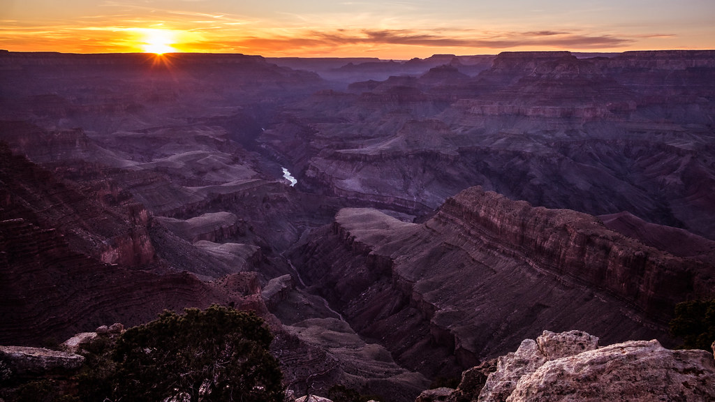
Photo: Giuseppe Milo (www.gmilo.com) via Flickr (CC BY 2.0)
At dawn in Grand Canyon National Park, Mather Point can feel wintry even in April: frost grips the paved overlook, cold air settles around the canyon rim, and the first sunlight picks out the buttes below in bands of red and cream. The Colorado River remains mostly concealed nearly a vertical mile beneath your feet. As the sun rises, the temperature changes quickly, but shaded patches of ice may linger along nearby paths.
Spring spans several distinct versions of the park. March can bring snow to the South Rim, April alternates between cold fronts and mild afternoons, and May introduces heat to the inner canyon while the rim stays comfortable. Our team uses this guide to explain those differences, including which rim is accessible, how crowds affect transportation, and when hiking conditions become demanding.
Grand Canyon National Park in Spring: What to Expect at a Glance
The canyon’s elevation range controls nearly every spring decision. Grand Canyon Village sits around 6,800 feet above sea level, while many South Rim overlooks approach 7,000 feet. The North Rim exceeds 8,000 feet in places. Phantom Ranch and the Colorado River lie near 2,400 feet, creating temperature differences of 20 to 30 degrees Fahrenheit between the rim and canyon bottom.
March, April, and May Feel Like Different Seasons
March remains transitional at the South Rim. Daytime highs commonly reach the 50s, but nights can fall into the 20s, and late snowstorms periodically cover roads and trails. April is generally milder, though wind, freezing nights, and snow remain possible. By May, South Rim afternoons often reach the 70s while temperatures beside the Colorado River can climb into the 90s.
| Period | Typical conditions | Crowd pattern | Access | Best suited to |
|---|---|---|---|---|
| March | Cold nights, possible snow and ice, mild inner canyon days | Moderate, with spikes during school breaks | South Rim open, North Rim road closed | Scenic drives, rim walks, shorter descents |
| April | Cool mornings, variable storms, increasingly warm below the rim | Busy around Easter and spring breaks | South Rim open, some shaded trails remain icy | Day hiking, viewpoints, cycling |
| May | Comfortable rim weather, hot inner canyon afternoons | High, especially late in the month | North Rim may open around midmonth, conditions permitting | Rim activities and carefully timed hikes |
Why Spring Is Ideal for a First Visit to Grand Canyon National Park
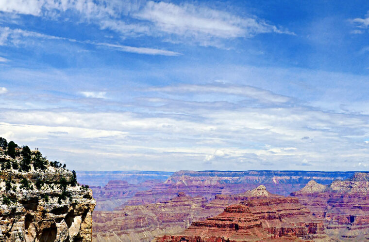
Clear air often produces long views across the 10 to 18 mile wide canyon, especially after a cold front. Snow on shaded terraces emphasizes the canyon’s horizontal rock layers, from the pale Kaibab Limestone at the rim to the dark Vishnu Basement Rocks near river level. Wildflowers begin appearing at lower elevations before blooming along the rim later in the season.
Conditions That Catch Visitors Off Guard
Wind exposure can make overlooks significantly colder than Grand Canyon Village. Trails also cross multiple climate zones within a few miles. A comfortable morning at the rim can become dangerously hot near the river, followed by a strenuous climb back into colder air. Snowmelt and freeze cycles create hard ice on the upper Bright Angel and South Kaibab trails, where traction devices may be necessary.
Choosing Between the South Rim and North Rim in Grand Canyon National Park
For most spring trips, the South Rim is the practical choice. It remains accessible from Williams and Flagstaff throughout the season, barring temporary storm disruptions. The North Rim’s higher elevation produces deeper snow, and the approach via Arizona State Route 67 generally remains closed until around May 15 or later if snow removal and infrastructure work require additional time.
Grand Canyon National Park’s South Rim
The South Rim contains the park’s largest concentration of overlooks, trailheads, lodging, and interpretive sites. Grand Canyon Village provides access to Mather Point, Yavapai Point, the Bright Angel Trail, and the western section of the Rim Trail. Desert View Drive extends about 25 miles east to Desert View, passing Grandview Point, Moran Point, Lipan Point, and Navajo Point.
Western Overlooks and Hermit Road
Hermit Road reaches viewpoints including Hopi Point, Mohave Point, Pima Point, and Hermits Rest. Private vehicle access is generally restricted during the busy season, with park transportation handling most visitor travel. This changes how quickly the area can be explored, since boarding lines and intermediate stops add time. The paved Rim Trail allows visitors to walk between several overlooks instead.
Desert View and the Eastern Entrance
Desert View is particularly useful for travelers arriving from Cameron or continuing toward Page and northern Arizona. Lipan Point offers one of the clearest rim views of the Colorado River, while Desert View Watchtower recalls ancestral Puebloan architecture through Mary Colter’s 1932 design. Driving the entire road requires considerably more time than its mileage suggests because overlooks are spaced every few miles.
When the North Rim Fits a Late Spring Trip
The North Rim receives roughly half the South Rim’s visitation and has a cooler, forested setting dominated by ponderosa pine, white fir, and aspen. Its seasonal opening should never anchor an inflexible early May itinerary. Even after the highway opens, shaded paths can retain snow and mud. Reaching it from the South Rim requires a drive of roughly 210 miles because no road crosses the canyon.
Crowds, Transportation, and Trip Timing
Spring crowds build unevenly. March and April school breaks create short periods of heavy demand, while late May begins the sustained summer pattern. The practical effects include full parking areas near Mather Point, longer waits for park buses, crowded trailheads before midmorning, and fewer available rooms in and around the park.
How to Avoid the Busiest Hours
Arriving before sunrise improves parking access and places you at the rim before tour traffic builds. Another effective approach is to enter later in the afternoon, when many day visitors begin leaving. Sunset creates its own surge at Hopi Point, Yavapai Point, and Mather Point, so a less famous overlook such as Shoshone Point or Grandview Point can provide more space.
- Use park transportation for Grand Canyon Village and Hermit Road rather than repeatedly searching for parking.
- Carry food and water so meal lines do not control the day’s schedule.
- Walk a section of the Rim Trail between viewpoints instead of boarding at every stop.
- Begin below-rim hikes early enough to avoid afternoon heat and uphill traffic.
- Allow extra driving time when entering through Tusayan during peak morning periods.
Road Access and Seasonal Transportation
South Entrance Road connects Tusayan with Grand Canyon Village, while Desert View Drive links the village to the East Entrance. Spring snow can temporarily affect either route, particularly overnight and early in the morning. Shuttle routes, private vehicle restrictions, entrance charges, and operating dates can change, so confirm current details on the official park site before departure.
Water availability also deserves attention because the park’s aging pipeline occasionally affects services on the South Rim and within the canyon. Our coverage of South Rim services and water conservation measures explains why visitors should arrive with filled containers rather than assuming every seasonal water point is operating.
Reservations and Permits to Arrange Early
Spring combines limited in-park lodging with strong demand, particularly during school holidays and around Memorial Day. Rooms inside the park and in Tusayan can fill months ahead. Staying in Williams or Flagstaff provides more choices, but adds approximately one hour or 90 minutes of driving respectively before reaching the South Entrance.
Day Visits and Overnight Accommodation
A standard scenic visit does not normally require a backcountry permit, but entrance arrangements and specific vehicle reservations can evolve. Campgrounds and in-park lodging should be booked as soon as travel dates are firm. Visitors staying outside the park should calculate sunrise departures carefully, including entrance traffic and the time needed to reach an overlook from the parking area.
Backcountry Permits Below the Rim
Camping below the rim requires a backcountry permit for designated sites such as Havasupai Gardens, Bright Angel Campground, and Cottonwood Campground. Demand for March and April can be intense because inner canyon temperatures are more manageable than in summer. Applications are handled in advance, and a flexible range of dates improves the chance of securing an itinerary.
Rim to River Plans Require More Than a Permit
The South Kaibab Trail descends about 7 miles to the Colorado River, while the Bright Angel Trail covers roughly 9.5 miles between the rim and Bright Angel Campground. Returning to the rim adds nearly 4,500 feet of elevation gain. Spring hikers must prepare for ice near the top, heat near the bottom, limited shade, and water sources that may be unavailable along portions of the route.
Match the Hike to Spring Conditions
A trail’s distance tells only part of the story. Grand Canyon routes descend first, leaving the hardest climbing for the return. Every 1,000 feet of descent also moves hikers into warmer, drier terrain. We recommend selecting a fixed turnaround point before starting and treating the estimated return time as roughly twice the descent time. Snow, mule traffic, loose rock, and crowded passing areas can slow that calculation further.
Short Descents From the South Rim
On the South Kaibab Trail, Ooh Aah Point makes a 1.8 mile round trip with about 700 feet of elevation change. Cedar Ridge extends the outing to approximately 3 miles round trip and 1,100 feet of climbing on the return. The trail has broad views but little shade and no dependable water, making an early start important during warm May weather.
What Ooh Aah Point Feels Like
The upper switchbacks crunch underfoot with gravel that can slide over hard-packed ice. After the trail rounds Yaki Point, the canyon suddenly opens on both sides of the ridge. Wind crosses the exposed path without trees to block it, while voices from hikers below carry upward through the dry air. The rim appears surprisingly high from the viewpoint, even after a descent of less than one mile.
Bright Angel and Grandview Alternatives
Bright Angel Trail provides several obvious turnaround points. The 1.5 Mile Resthouse creates a 3 mile round trip, while the 3 Mile Resthouse doubles that distance and requires about 2,100 feet of elevation gain on the return. Grandview Trail reaches Coconino Saddle in roughly 2.2 miles round trip, but its steep cobbled sections, narrower tread, and limited maintenance make it better suited to experienced hikers.
Rim Walks for Stormy or Recovery Days
The Trail of Time between Yavapai Geology Museum and Grand Canyon Village covers about 2.8 miles and uses distance to represent the canyon’s geologic timeline. Brass markers identify each million years, while samples beside the path introduce rocks exposed below. For a quieter outing, the Rim Trail west of the village connects overlooks without committing visitors to a climb from inside the canyon.
Choose the Right Part of Spring
The best spring window depends on the experience you value most. Early spring favors crisp visibility and occasional snow photography. Mid spring usually creates the broadest range of comfortable rim activities. Late spring improves the odds of North Rim access but raises heat exposure below the South Rim. The following comparison turns those tradeoffs into practical trip choices.
| Priority | Best spring window | Recommended plan | Main limitation |
|---|---|---|---|
| Snowy rim photography | March to early April | Yavapai Point, Grandview Point, Trail of Time | Icy paths and temporary road disruptions |
| Moderate day hiking | April | Ooh Aah Point or 1.5 Mile Resthouse | Large temperature swings |
| Rim walking and cycling | Late April to May | Rim Trail and Hermit Road corridor | Increasing afternoon crowds |
| North Rim scenery | Late May | Bright Angel Point and Cape Royal area when accessible | Opening dates depend on snow clearance |
| Inner canyon backpacking | March and April | Permitted corridor itinerary | Competitive permits and icy upper trails |
Build a Plan Around Your Main Priority
Travelers with one full day should concentrate on a single rim rather than spending hours relocating. Photographers benefit from an eastern overlook at sunrise, followed by Yavapai Geology Museum and a western Rim Trail walk. Families can combine the mostly level village section of the Rim Trail with Desert View Drive. Strong hikers should complete their descent early, then reserve the afternoon for viewpoints rather than scheduling another strenuous trail.
- Choose March for winter atmosphere and lower average visitation.
- Choose April for the best balance of hiking temperatures and South Rim access.
- Choose early May for comfortable rim exploration before holiday traffic increases.
- Choose late May only if North Rim access is important and your dates can remain flexible.
Allow Weather to Change the Itinerary
A spring storm should shift the day toward paved overlooks, museums, and shorter rim walks. After snow, delay a below rim start until visibility and footing can be assessed in daylight. Strong wind also matters because exposed trails such as South Kaibab offer little shelter. If temperatures near the river are forecast to become hot, shorten the descent rather than relying on the cooler reading posted for Grand Canyon Village.
Carry Gear for Two Climate Zones
Our spring day pack includes traction devices when ice is possible, gloves, a warm hat, a wind resistant layer, sun protection, food, and more water than a rim walk would require. Trekking poles improve balance on frozen steps and loose cobbles. Hikers should also keep insulating layers dry for the return, since sweat from the climb can produce rapid cooling after sunset or when clouds cover the rim.
Planning a Grand Canyon National Park Spring Visit With Confidence
Grand Canyon National Park rewards a spring plan built around elevation rather than the calendar alone. March can deliver snow and sharp visibility, April supports a wider selection of day hikes, and May shifts the emphasis toward rim activities as the inner canyon heats up. Select the rim first, choose one primary activity, and establish backup options that require less driving or elevation change.
Reserve accommodation and permitted overnight itineraries as early as your dates allow, then make daily decisions using trail surfaces, wind, and temperatures at both the rim and river. A realistic turnaround point matters more than total mileage. With that framework, spring visitors can experience the canyon’s changing light, exposed geology, and dramatic elevation range without letting crowds or rapidly changing conditions control the trip.
Want to keep exploring? Browse all our Grand Canyon guides and articles for more trip-planning tips and ideas.
Gear & Essentials
Tell us about your trip and we will add what else you will want:
The basics
Worth having in the car whatever the park.
For this trip
Traveling with kids
Bringing a pet
RVing
Backcountry
Winter conditions
On the water
Photography
Accessibility
As an Amazon Associate we earn from qualifying purchases, at no extra cost to you.