Yosemite National Park in Summer: What to Expect and What to Do
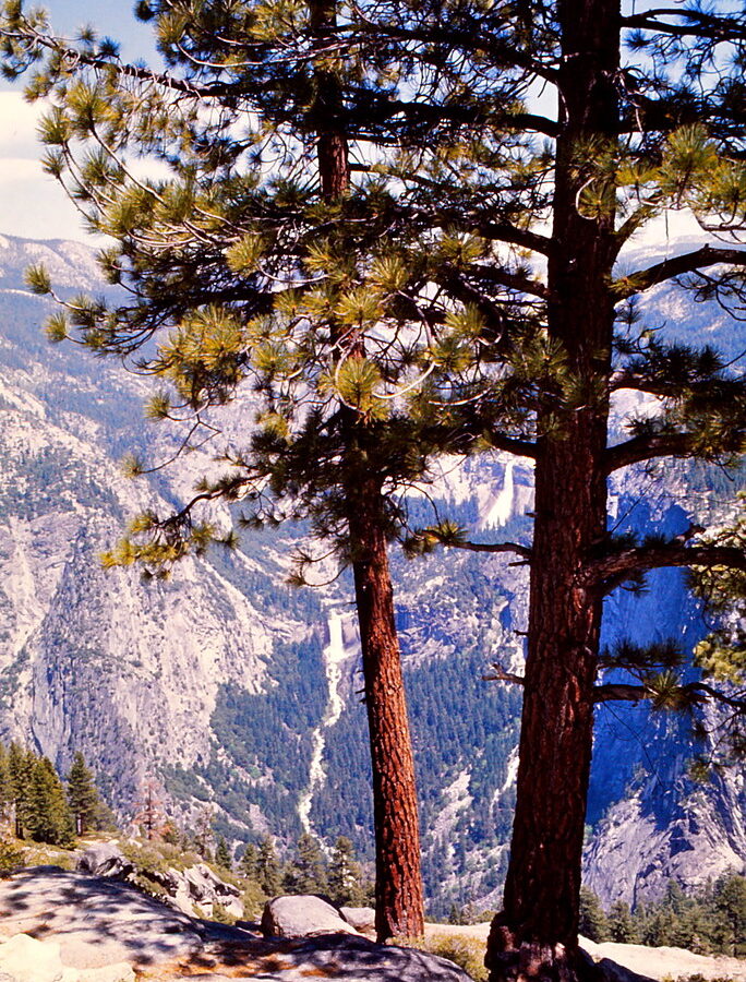
Photo: Ladycliff via Flickr (CC BY 2.0)
Our Yosemite National Park Summer advice is simple: visit in June for powerful waterfalls, July for the broadest high country access, or late August for drier trails and somewhat lighter weekday crowds. Summer brings long hiking days and access to most of the park, but it also concentrates visitors in Yosemite Valley, at Glacier Point, and around the Tioga Road trailheads.
Yosemite covers nearly 1,200 square miles of the central Sierra Nevada, yet many first visits focus on Yosemite Valley, a seven mile glacial trough at roughly 4,000 feet. El Capitan, Half Dome, Yosemite Falls, and several major trailheads rise from this compact corridor. The park extends much higher, reaching 13,114 feet at Mount Lyell, so temperature, snow cover, and trail conditions can differ dramatically within the same day.
What to Expect During a Yosemite National Park Summer Trip
Summer is Yosemite’s primary access season. Yosemite Valley and Wawona are generally reachable throughout the period, while Tioga Road and Glacier Point Road provide access to higher elevations after winter snow has been cleared. Opening dates depend on the previous winter’s snowpack, spring storms, avalanche debris, and road repairs. A late May trip and a late July trip can therefore produce entirely different choices.
Warm valleys and cool granite uplands
Yosemite Valley afternoons are commonly warm or hot, with intense sun reflected from pale granite walls. At Tuolumne Meadows, around 8,600 feet, mornings can feel close to freezing even when the Valley becomes uncomfortably warm. Temperatures decrease roughly 3 to 5 degrees Fahrenheit for every 1,000 feet of elevation gained, although wind, cloud cover, and cold air drainage create local variations.
Afternoon thunderstorms become more likely over the high country during periods of monsoonal moisture. Lightning exposure matters on Half Dome, Clouds Rest, Mount Dana, and open granite ridges. Our team recommends beginning exposed hikes around sunrise, then descending below ridgelines before clouds build. Clear morning skies do not guarantee a storm free afternoon.
Waterfalls change quickly through the season
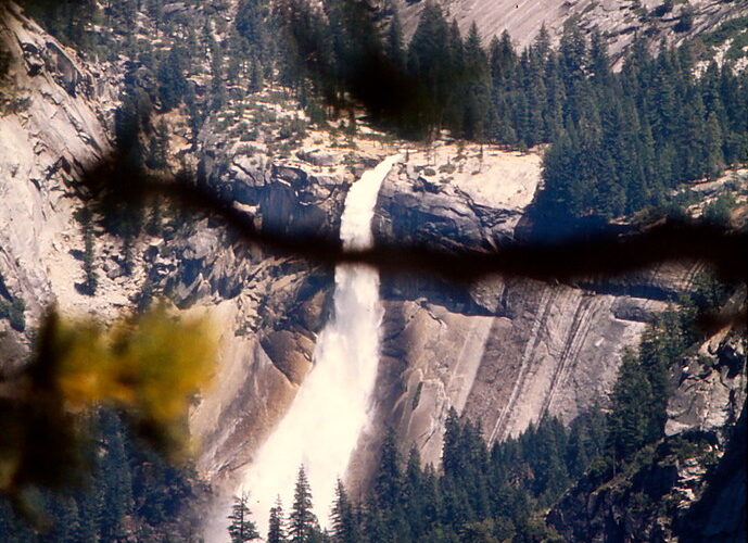
Yosemite Falls drops 2,425 feet in three major sections and usually reaches its greatest volume during spring snowmelt. It remains impressive in June after a snowy winter, but the flow often weakens substantially by August. Bridalveil Fall and Nevada Fall generally retain water longer, while smaller seasonal cascades can disappear altogether. Vernal Fall produces heavy spray along the Mist Trail early in summer, making granite steps wet and slippery.
River conditions follow the same snowmelt cycle. The Merced River may run cold, swift, and hazardous in early summer before becoming lower and calmer later. Water temperature remains a concern even on hot days. Enter only where swimming or boating is allowed, and stay away from currents above waterfalls and cascades.
Crowds affect transportation as much as scenery
Congestion becomes most noticeable from late morning through late afternoon. Yosemite Valley parking can fill, entrance stations develop long queues, and short drives may take far longer than their mileage suggests. Arriving before breakfast often matters more than choosing a supposedly quiet attraction. Once parked, visitors can walk, cycle, or use available park transportation rather than moving their vehicle between nearby stops.
- Reach major Valley trailheads early in the morning.
- Carry food and water so a full parking area does not force a change of plans.
- Group Lower Yosemite Fall, Yosemite Village, Cook’s Meadow, and the Valley Loop into one car free outing.
- Visit Glacier Point or Tuolumne Meadows on a separate day rather than combining distant regions.
- Expect the busiest conditions on summer weekends and holiday periods.
Yosemite National Park Summer Conditions: What to Expect Each Month
Summer does not arrive everywhere in Yosemite at once. Elevation controls road openings, snow cover, wildflower timing, stream crossings, and nighttime temperatures. The comparison below divides the season into useful planning periods rather than relying on calendar labels alone.
| Period | Crowds | Typical access | Water and snow | Best suited to |
|---|---|---|---|---|
| Late May to mid June | Heavy in the Valley, quieter at inaccessible high elevations | Valley and Wawona dependable, high roads may remain closed | Powerful waterfalls, cold rivers, lingering trail snow | Waterfall viewing and lower elevation hikes |
| Mid June to July | Highest overall demand | High country access expands as plowing and trail clearing finish | Snow retreats, mosquitoes increase near wet meadows | A broad mix of Valley and high country activities |
| August to early September | Busy, with some weekday easing | Most roads and trails generally accessible | Lower waterfalls, dry trails, greater smoke and fire potential | Long hikes, backpacking, and alpine scenery |
Early summer favors waterfalls and lower trails
June usually provides the strongest combination of accessible Valley trails and substantial waterfall flow. The 1.6 mile round trip to the Vernal Fall Footbridge gives a close view of the Merced River without requiring the steep climb to the top of the fall. Continuing to Vernal Fall adds wet stone steps, exposure to spray, and considerably more effort. Snow or ice may persist farther up toward Nevada Fall.
Mariposa Grove also offers lower elevation walking among giant sequoias, although lingering snow can remain after severe winters. These trees survive Sierra fires through thick bark and elevated crowns, while periodic low intensity fire opens forest gaps and prepares mineral soil for seedlings. Summer visitors may encounter evidence of prescribed fire or previous wildfires within the grove.
July opens the alpine core
By July, Tioga Road often connects Crane Flat with Tuolumne Meadows and Tioga Pass at 9,945 feet. This opens access to Tenaya Lake, Lembert Dome, Cathedral Lakes, and high country trailheads. The seven mile round trip to Cathedral Lakes climbs through lodgepole forest toward granite basins beneath Cathedral Peak, while the shorter Lembert Dome route provides a broad view across the Tuolumne River watershed.
Stand on Lembert Dome and the scale of the uplands becomes clear. Coarse granite grips underfoot, wind moves through whitebark pine and lodgepole branches, and Tuolumne Meadows spreads below as a green strip threaded by silver water. The sun feels sharp at this elevation, yet a passing cloud can drop the temperature within minutes.
Late summer brings dry trails and variable visibility
August generally provides the most predictable access to alpine routes, including trails toward Clouds Rest and Mount Dana. Water sources become less reliable away from major lakes and rivers, and Yosemite Falls may be reduced to a thin ribbon or dry sections. Hikers should carry enough treated water for exposed routes rather than assuming every mapped creek is flowing.
Wildfire smoke can arrive from fires inside or far beyond the park. Conditions may change by the hour as wind shifts, making distant views hazy even when no flames are nearby. Heat also increases the strain of exposed Valley climbs such as the Upper Yosemite Fall Trail, which gains about 2,700 feet in 3.6 miles to the rim.
Road Access, Reservations, and Summer Trip Timing
The park’s regions are separated by slow mountain roads. Driving from Yosemite Valley to Tuolumne Meadows commonly takes about 90 minutes without congestion, while Wawona and Mariposa Grove require a separate trip south. Route planning should group sights geographically. Crossing the park several times wastes hiking hours and increases exposure to entrance and parking queues.
Seasonal roads determine what you can do
Tioga Road is the critical route for Tuolumne Meadows and the eastern Sierra entrance. It closes for winter and reopens only after snow removal and safety work. Glacier Point Road provides vehicle access to the overlook above Yosemite Valley, where Half Dome, Vernal Fall, and Nevada Fall align across the Merced River canyon. When either road is closed, reaching those areas may require long hikes or an entirely different itinerary.
Permits have separate purposes and timelines
A park entry reservation, when required, controls vehicle access during specified dates or hours. It does not replace a wilderness permit, Half Dome permit, campground reservation, or lodging booking. Half Dome’s cable route requires a permit when the cables are installed, and overnight backcountry travel requires a wilderness permit tied to a starting trailhead. Application periods and release methods differ, so identify the exact permit before booking transportation.
A practical booking order
- Choose early, mid, or late summer according to waterfall flow and high country access.
- Secure lodging or a campsite inside or near the entrance best matched to your itinerary.
- Apply for Half Dome or wilderness permits if those objectives are central to the trip.
- Check whether timed vehicle entry applies to the travel dates.
- Review road status, fire conditions, and transportation operations immediately before departure.
Entrance rules, reservation systems, permit windows, shuttle operations, and road opening dates can change between summers. Confirm current details on the official park site before making nonrefundable plans, especially if Tioga Road access or a Half Dome ascent determines the success of the trip.
How Summer Crowds Affect a Day in Yosemite National Park
Visitor concentration matters more than the park’s total attendance. Yosemite Valley receives disproportionate use because several famous viewpoints, services, and trailheads occupy one narrow corridor. Tunnel View, Bridalveil Fall, Lower Yosemite Fall, and the Mist Trail can all become congested while trails beyond the first mile remain comparatively calm. Build each day around one priority trailhead, then add nearby stops that can be reached without moving the car.
Use distance to leave the busiest zones
Short paved paths attract the greatest turnover. On the Mist Trail, congestion commonly eases beyond Vernal Fall, although the climb toward Nevada Fall remains strenuous. The Valley Loop also grows quieter west of El Capitan Meadow, where forest and riverside sections separate walkers from the developed core. In the high country, hikers heading past the near shore of Tenaya Lake or beyond the first viewpoints on established trails usually find more space.
Schedule viewpoints around traffic patterns
Glacier Point is busiest around sunset, when limited parking and departing vehicles create delays. A morning visit provides clearer atmospheric conditions on many days and leaves the afternoon for trails along Glacier Point Road, such as Sentinel Dome or Taft Point. Tunnel View works well near sunrise or after dinner. Midday is better spent on a longer walk, beside the Merced River, or under forest cover rather than circulating among roadside overlooks.
How Summer Compares With Yosemite’s Other Seasons
Summer provides the broadest geographic access, but each season changes the park’s strengths. Spring emphasizes waterfalls, autumn brings cooler walking weather, and winter concentrates travel in lower elevations. The comparison helps clarify what summer access provides and what visitors give up in exchange for longer days and open high country roads.
| Season | Crowd pattern | Typical weather | Road and trail access | Best activities |
|---|---|---|---|---|
| Spring | Moderate overall, heavy near waterfalls | Cool to mild, with rain and late snow possible | Valley open, high roads commonly closed | Waterfall viewing, Valley cycling, lower trails |
| Summer | Highest, especially midday and on weekends | Hot in the Valley, cool at alpine elevations | Broadest access after seasonal roads open | High country hiking, climbing, backpacking |
| Autumn | Declines after early fall | Cooler days and freezing high country nights | Good until snow closes seasonal roads | Valley hiking, photography, dry trail travel |
| Winter | Lowest outside holidays | Cold, with snow and ice | Valley access continues, high roads closed | Snowshoeing, quiet viewpoints, winter scenery |
When a shoulder season is the better choice
Choose spring if waterfalls outrank alpine hiking. Choose autumn if comfortable Valley temperatures and reduced weekday traffic matter more than seeing peak runoff. Winter suits visitors willing to use tire chains when required and accept limited geographic access. Yosemite National Park Summer remains the strongest choice for reaching Tuolumne Meadows, Tioga Pass, and remote trailheads during one trip.
Choose Your Dates by Your Main Priority
A useful decision begins with the feature that would make the trip feel incomplete. Waterfalls, Half Dome, family walks, and backcountry travel each favor different dates and logistics. Avoid choosing solely by average temperature, because a comfortable Valley forecast says little about snowfields near 10,000 feet or afternoon lightning above the tree line.
For waterfalls, families, and first visits
June balances strong runoff with long daylight, particularly for visitors focused on Yosemite Valley. Families can combine the Lower Yosemite Fall loop, Cook’s Meadow, and sections of the Merced River without committing to a major ascent. Bring traction appropriate to wet granite on steeper routes, secure children near swift water, and expect spray around Vernal Fall to soak clothing and packs.
For alpine hiking and backpacking
Late July through August generally gives high routes more time to shed snow. Backpackers should evaluate elevation gain, exposed passes, water availability, and the location of legal campsites rather than judging a route only by mileage. Bear resistant food storage is mandatory in Yosemite’s wilderness. Mosquito pressure often peaks after snowmelt near meadows and shallow lakes, then decreases as standing water dries.
A quick decision checklist
- Pick June for runoff, accepting possible high country closures.
- Pick July for maximum daylight and broad activity options.
- Pick August for drier alpine trails and lower seasonal streams.
- Stay near the western entrances for Valley focused plans.
- Consider the eastern approach when Tioga Road and high country trailheads are the priority.
Plan a Yosemite National Park Summer Trip You Can Actually Enjoy
The most successful itinerary limits daily driving, starts major hikes early, and matches elevation to the season. Two or three nights allow a Valley day and a separate high country or Wawona day. A longer stay creates room for weather changes, recovery after strenuous hikes, and exploration beyond the busiest paved paths.
Summer’s central tradeoff is straightforward: broad access comes with heat, competition for parking, and advance planning. Select dates according to runoff or alpine access, secure the permits that apply to your objectives, and organize each day around one region. That approach turns Yosemite’s size and seasonal complexity into a manageable trip rather than a sequence of rushed stops.
Want to keep exploring? Browse all our Yosemite guides and articles for more trip-planning tips and ideas.
Gear & Essentials
Tell us about your trip and we will add what else you will want:
The basics
Worth having in the car whatever the park.
For this trip
Traveling with kids
Bringing a pet
RVing
Backcountry
On the water
Photography
Accessibility
As an Amazon Associate we earn from qualifying purchases, at no extra cost to you.