How to Get to Joshua Tree National Park: Airports, Roads and Getting Around
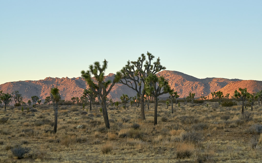
Photo: szeke via Flickr (CC BY-SA 2.0)
If you searched “How Get Joshua Tree,” the practical answer is to fly or drive to Southern California, rent a car if necessary, and enter through one of three gates. The West Entrance serves Joshua Tree village, the North Entrance serves Twentynine Palms, and the South Entrance connects directly with Interstate 10 near Cottonwood Spring.
Joshua Tree National Park covers nearly 800,000 acres where the Mojave and Colorado deserts meet. Its entrances are widely separated, public transportation does not circulate through the park, and mobile service is unreliable. Choosing the correct airport, gateway town, and entrance can save an hour or more of backtracking.
How Get Joshua Tree planning starts with choosing an entrance
The park’s three entrances connect through paved roads, but they serve different itineraries. Park Boulevard links the West and North entrances with major Mojave Desert sights such as Hidden Valley, Barker Dam, Skull Rock, and Jumbo Rocks. Pinto Basin Road runs south from Park Boulevard through lower, hotter Colorado Desert terrain to Interstate 10.
West Entrance for Joshua Tree village and the busiest sights
The West Entrance is about five miles south of Joshua Tree village on Park Boulevard. It is the most convenient gate for travelers approaching from Los Angeles, Ontario, or towns west of the park. Hidden Valley is roughly 10 miles beyond the entrance, while Keys View is reached by a separate spur road farther inside the park.
This entrance frequently develops vehicle lines on weekends, holidays, and mild spring mornings. Arriving early helps, but travelers who are staying in Twentynine Palms can often reduce delays by using the North Entrance instead. The road climbs into higher Mojave Desert terrain, where elevations around the central plateau exceed 4,000 feet.
How to Get to Joshua Tree National Park: Airports, Roads and Getting Around via Twentynine Palms
The North Entrance is reached from Twentynine Palms by following Utah Trail south. It provides direct access to Park Boulevard near the Oasis of Mara and is well positioned for Skull Rock, Split Rock, Jumbo Rocks, and the trail to Fortynine Palms Oasis. The town also places visitors near the park’s northern visitor facilities and food, fuel, and lodging outside the boundary.
South Entrance for Interstate 10 and Cottonwood
The South Entrance lies north of Interstate 10 and works best for arrivals from Palm Springs, Phoenix, and communities along the Coachella Valley. Cottonwood Spring and the nearby campground area are several miles inside the boundary. Continuing north on Pinto Basin Road requires a long, scenic climb past ocotillo flats, the Cholla Cactus Garden, and the transition into Joshua tree woodland.
How to Get to Joshua Tree National Park: Choosing the Most Practical Airport
Palm Springs International Airport is generally the closest commercial airport. Ontario can offer a broader selection of flights and rental cars without placing travelers on the far side of metropolitan Los Angeles. Los Angeles, San Diego, and Las Vegas work when airfare or a larger regional itinerary outweighs the additional driving.
How Get Joshua Tree travelers should compare airports
| Airport | Approximate drive to a useful park entrance | Best use |
|---|---|---|
| Palm Springs International | About 45 to 60 minutes to the South Entrance | Shortest airport transfer and Coachella Valley stays |
| Ontario International | About 1 hour 45 minutes to the West Entrance | Travelers approaching from the eastern Los Angeles region |
| Los Angeles International | About 2 hours 30 minutes without heavy traffic | International flights and combined coastal itineraries |
| San Diego International | About 2 hours 45 minutes | Trips combining the desert with San Diego |
| Harry Reid International in Las Vegas | About 3 hours 30 minutes | Multi park desert road trips |
These are planning estimates rather than guaranteed transfer times. Los Angeles traffic can add several hours, particularly on weekday afternoons and Friday evenings. Wind, blowing dust, construction, and crashes can also slow Interstate 10. Check live road conditions before departure rather than relying solely on the original arrival estimate.
Renting a vehicle versus using public transportation
A rental car is the most dependable option because there is no parkwide public shuttle connecting the entrances, campgrounds, trailheads, and overlooks. Local buses can reach communities in the Morongo Basin, but they do not replace transportation within the park. App based rides may be available in gateway towns, yet return pickups inside the boundary are unreliable because of distance and weak mobile coverage.
Reserve a vehicle with enough luggage space for water and sun protection. Ordinary passenger cars can reach the principal paved attractions. High clearance or four wheel drive becomes relevant for unpaved routes such as Geology Tour Road and Black Eagle Mine Road, where sand, washouts, and sharp rock can exceed a rental agreement’s permitted use.
How to Get to Joshua Tree: Road Routes from Southern California and the Southwest
Navigation apps sometimes choose an entrance based only on immediate driving time. Set the actual gate or first trailhead as the destination. “Joshua Tree” may direct the driver to the town, which remains outside the park, while a generic park search can select a visitor center rather than an entrance road.
From Los Angeles and Ontario
Follow Interstate 10 east, then take California 62 toward Yucca Valley, Joshua Tree, and Twentynine Palms. Turn south onto Park Boulevard for the West Entrance or continue east to Utah Trail for the North Entrance. The West Entrance is usually logical for Hidden Valley, Barker Dam, Keys View, and Ryan Mountain.
How to Get to Joshua Tree National Park: Airports, Roads and Getting Around from Palm Springs
From Palm Springs and the central Coachella Valley, Interstate 10 leads east to Cottonwood Springs Road and the South Entrance. Travelers staying in Desert Hot Springs may instead use local roads toward California 62 and approach the West Entrance. Compare routes against the day’s first stop, since driving through the park from south to west takes substantially longer than reaching a gate.
From Phoenix, San Diego, and Las Vegas
- From Phoenix: Follow Interstate 10 west to the South Entrance. The drive is roughly 220 miles and commonly takes about three and a half hours before stops.
- From San Diego: Routes generally connect with Interstate 10 through Riverside County or approach the Coachella Valley from the south. Allow close to three hours in ordinary conditions.
- From Las Vegas: Drive south toward the Mojave Desert, then approach Twentynine Palms through California 247 and California 62. Carry extra water because services are sparse on the desert segments.
Getting Around Joshua Tree National Park by Car
Fuel, food, and dependable mobile reception are concentrated in communities outside the boundary. Fill the tank before entering and download an offline map that includes Park Boulevard, Pinto Basin Road, Keys View Road, and named trailheads. Current fees, road closures, entrance operations, and permit requirements can change, so confirm them on the official park site before leaving the gateway town.
How Get Joshua Tree drivers can avoid common mistakes
- Enter with enough fuel to cross the park and handle an unexpected detour.
- Carry at least one gallon of drinking water per person for a full warm weather day.
- Save the return route offline before mobile service disappears.
- Do not follow navigation instructions onto unsigned dirt tracks.
- Plan around sunset, when wildlife and stopped vehicles create additional hazards.
What the main park drive feels like
On Park Boulevard, pavement threads between pale monzogranite piles that rise abruptly above sandy washes. At higher elevations, Joshua trees stand against open sky while wind moves through their stiff, bayonet shaped leaves with a dry rattling sound. The road repeatedly narrows between boulders, then opens onto broad basins where distant ridges reveal the scale of the park. Those changing sightlines explain why a short distance on the map often takes longer than expected.
Allow enough time for distances inside the park
Joshua Tree’s paved roads cover enough ground that driving can occupy a large part of the day. Posted speeds are modest, and traffic slows near trailheads, wildlife, cyclists, and boulder formations. A route that appears to require 45 minutes may take twice that once parking searches and viewpoint stops are included. For anyone still framing the search as “How Get Joshua Tree,” the missing planning step is often calculating the drive after entering the gate.
Use realistic drive estimates
| Route | Approximate distance | Driving time without stops |
|---|---|---|
| West Entrance to North Entrance | About 25 miles | 45 to 60 minutes |
| North Entrance to Cottonwood area | About 35 miles | 50 to 65 minutes |
| Cottonwood area to West Entrance | About 50 miles | 75 to 90 minutes |
| Keys View Road junction to Keys View and back | About 11 miles | 20 to 30 minutes |
These estimates cover movement rather than sightseeing. Keys View, at 5,185 feet, can easily add 30 minutes for walking and photographs after the spur road drive. Skull Rock requires less walking, but roadside congestion can delay parking. Build at least one hour of flexibility into a cross park itinerary.
Handle crowded parking areas efficiently
Visit compact lots such as Barker Dam and Hidden Valley early, then use larger roadside areas later in the day. Never create a space on vegetation or soft desert shoulders. Cryptobiotic soil crusts and shallow plant roots are easily crushed. If a lot is full, continue to another planned stop and return rather than circling repeatedly or blocking traffic.
Match the driving plan to the time available
A same day visit works best when the entrance and exit differ. Entering through West, following Park Boulevard, and leaving through North avoids retracing the central corridor. A longer traverse can continue down Pinto Basin Road to Interstate 10, but stops at Cholla Cactus Garden, Cottonwood Spring, and the changing desert plant communities make that route a full day rather than a shortcut.
Plan a focused half day
With four to five hours, remain in the higher Mojave section. Combine Hidden Valley’s one mile loop with Barker Dam’s roughly 1.1 mile loop, then choose Keys View or Skull Rock according to parking and weather. Exiting through North works well for dinner, fuel, or lodging in Twentynine Palms and eliminates the need to reverse the entire route.
Use a full day for a cross park drive
Start near Cottonwood and travel north if morning temperatures are already rising in the lower Colorado Desert. The road climbs from creosote and ocotillo country toward denser Joshua tree woodland. Carry lunch because returning to a gateway town costs substantial time. Schedule the final trail before dusk so the remaining drive occurs with usable light and fewer rushed stops.
Prepare for weather and vehicle problems
Elevation changes produce meaningful temperature differences across the park. Lower portions of Pinto Basin can exceed 100 degrees Fahrenheit during summer, while Keys View and the central plateau may be colder and windier. Winter nights commonly fall near freezing at higher campgrounds. Air conditioning, steep grades, and detours also reduce fuel economy and electric vehicle range.
Adjust for heat, wind, floods, and ice
Avoid leaving people or animals in a parked vehicle, even during a brief viewpoint stop. Strong winds can reduce visibility with blowing sand near Interstate 10. Summer thunderstorms may send water across dips and washes, while occasional winter snow or ice affects elevated roads. Never drive through flowing water when its depth and pavement condition are unknown.
Know what to do if the vehicle stops
Remain with the vehicle unless a staffed facility or occupied trailhead is clearly within safe walking distance. A car is easier for rescuers to see than a person on foot. Record the last named junction, trailhead, or mile marker passed, and use emergency calling if service appears. A satellite communicator provides additional security on quieter roads.
- Keep drinking water accessible inside the passenger compartment.
- Carry a flashlight, tire gauge, and functional spare tire equipment.
- Pack warm layers even when the gateway town feels mild.
- Start an electric vehicle day with enough range for climate control and an unplanned return route.
Build the route before entering Joshua Tree
The most efficient trip connects the airport, gateway town, first attraction, and exit gate as one continuous route. Select West for the central Mojave sights, North for Twentynine Palms access, or South for Interstate 10 and Cottonwood. Then calculate the miles inside the park, where slower roads and frequent stops matter as much as the highway approach.
Download the route, fill the tank or charge the vehicle, carry water, and place the most parking constrained trailheads early in the day. With those decisions made before mobile service fades, getting around Joshua Tree becomes straightforward and leaves enough time to experience the landscape without racing between widely separated stops.
Want to keep exploring? Browse all our Joshua Tree guides and articles for more trip-planning tips and ideas.
Gear & Essentials
Tell us about your trip and we will add what else you will want:
The basics
Worth having in the car whatever the park.
For this trip
Traveling with kids
Bringing a pet
RVing
Backcountry
Winter conditions
On the water
Photography
Accessibility
As an Amazon Associate we earn from qualifying purchases, at no extra cost to you.