5 Best Hikes in Shenandoah National Park
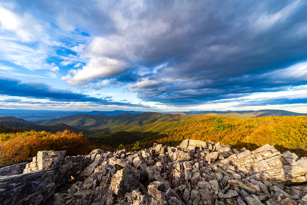
Photo: aparlette via Flickr (CC BY 2.0)
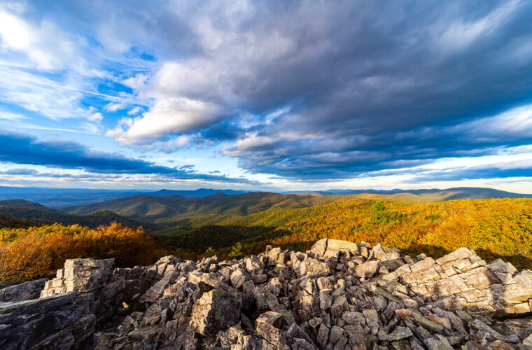
The best hikes Shenandoah National Park offers feel especially immediate at dawn on Hawksbill Summit, where cool air moves through red spruce and the first light reaches the folded Blue Ridge below. The final approach crosses rough stone before opening onto a broad overlook at 4,051 feet, the highest point in the park. On clear mornings, successive ridges fade from green to blue while ravens ride the rising air almost level with the viewpoint.
Shenandoah contains more than 500 miles of trails, including roughly 101 miles of the Appalachian Trail, but five routes capture its defining experiences particularly well: exposed granite, high ridge forests, waterfalls, rocky overlooks, and demanding canyon travel. Our team has selected hikes across different difficulty levels and park districts, with enough detail to help visitors choose routes that match their time, ability, and preferred scenery.
How the 5 Best Hikes in Shenandoah National Park Compare
Shenandoah protects a long, narrow section of Virginia’s Blue Ridge, extending roughly 70 miles from Front Royal to Rockfish Gap. Skyline Drive follows the crest for 105 miles, linking most major trailheads through four entrance areas. Driving the entire road takes about three hours without stops, although overlooks, wildlife, fog, and the 35 mph speed limit often turn it into a full day.
Three districts, one mountain corridor
The North District runs from Front Royal to Thornton Gap and includes the Compton Peak and Overall Run areas. The Central District, between Thornton Gap and Swift Run Gap, contains the greatest concentration of famous hikes, including Old Rag, Stony Man, Hawksbill, Dark Hollow Falls, and Whiteoak Canyon. The South District continues to Rockfish Gap with quieter ridges, longer Appalachian Trail sections, and fewer heavily used waterfall routes.
Mileposts increase from north to south, making them the simplest navigation tool on Skyline Drive. Thornton Gap sits near mile 31.5, the Byrd Visitor Center area near mile 51, and Swift Run Gap near mile 65. Some hikes, particularly Old Rag, begin outside the Skyline Drive corridor. Do not assume two nearby points on a map have a quick road connection, because steep ridges and limited crossings can create lengthy detours.
Elevation controls weather and trail character
The Blue Ridge rises abruptly above the Shenandoah Valley and Virginia Piedmont, with many trailheads above 3,000 feet. Temperatures along Skyline Drive can be 10 to 20 degrees Fahrenheit cooler than in surrounding lowlands. Fog frequently settles over the crest, wetting exposed rock even without steady rain. Snow and ice can linger on north facing slopes after valley roads have cleared.
Old Rag exposes approximately one billion year old granite, while other parts of the park cross ancient volcanic greenstone and metamorphic bedrock. Thin mountain soils support oak and hickory forests at lower elevations, with mountain laurel, red spruce, yellow birch, and ferns appearing in cooler settings. Spring wildflowers vary considerably by elevation, a pattern also reflected in our coverage of Shenandoah’s annual Wildflower Weekend.
Best Hikes in Shenandoah National Park at a Glance
These five routes cover distinct experiences rather than five versions of the same ridge walk. Stony Man provides the shortest path to a broad overlook. Hawksbill reaches the park’s highest summit. Dark Hollow Falls delivers a compact waterfall hike, while Whiteoak Canyon adds a longer sequence of cascades. Old Rag combines sustained climbing with the park’s most technical rock scramble.
| Hike | Typical distance | Approximate gain | Difficulty | Defining feature |
|---|---|---|---|---|
| Old Rag Circuit | 9.4 miles | 2,400 feet | Strenuous | Granite rock scramble |
| Hawksbill Loop | 2.9 miles | 860 feet | Moderate | Highest summit in the park |
| Dark Hollow Falls | 1.4 miles | 440 feet | Moderate | Seventy foot waterfall |
| Stony Man | 1.6 miles | 340 feet | Easy to moderate | Fast access to a major overlook |
| Whiteoak Canyon and Cedar Run Circuit | About 8 miles | About 2,800 feet | Strenuous | Waterfalls and steep canyon terrain |
Choose by terrain, not distance alone
Old Rag’s mileage understates its difficulty because the upper route requires squeezing through narrow openings, stepping across gaps, and using hands on polished granite. Whiteoak Canyon and Cedar Run lack that concentrated scramble, but their steep elevation change is punishing when climbed from the bottom of the circuit. Dark Hollow Falls is short, yet its return climb gains roughly 400 feet in less than a mile.
- For a first mountain hike: Choose Stony Man and allow extra time at the exposed viewpoint.
- For the highest elevation: Hike Hawksbill Loop, ideally early before summit traffic builds.
- For waterfalls with limited time: Use Dark Hollow Falls, accepting a steep return.
- For a full day challenge: Choose Old Rag or the Whiteoak Canyon and Cedar Run Circuit.
- After heavy rain: Favor ridge routes, since stream crossings and wet rocks can complicate canyon hikes.
Permits, parking, and seasonal constraints
Old Rag may require an advance day use ticket during the busiest portion of the year, in addition to park admission. Its trailhead parking area is reached from roads outside the main Skyline Drive corridor. Parking at popular central district trailheads can fill early on fall weekends, while winter weather may close sections of Skyline Drive. Confirm current fees, Old Rag ticket requirements, road status, and temporary trail closures on the official park site before departure.
Two of the Best Hikes in Shenandoah National Park for Summit Views
Old Rag and Hawksbill reveal opposite sides of Shenandoah’s mountain landscape. Old Rag is a freestanding granite massif east of the main crest, with extensive bare rock and a physically demanding ascent. Hawksbill rises directly from the Skyline Drive corridor and reaches a higher elevation with a much shorter approach. Both can be crowded, but early starts substantially improve parking, temperatures, and trail flow.
Old Rag Circuit: the park’s benchmark scramble
The standard circuit climbs the Ridge Trail toward Old Rag’s 3,284 foot summit, crosses the rock scramble, and descends using the Saddle Trail and a fire road. The scramble occupies roughly a mile of the upper mountain. Large packs catch on narrow passages, and dogs are prohibited on the principal circuit because several obstacles cannot be crossed safely by pets.
Who should attempt the scramble
Hikers should be comfortable pulling their body weight onto ledges, lowering themselves from boulders, and crossing uneven granite without fixed cables. Rain makes the rock slick, while summer heat becomes intense on exposed slabs. Carry at least two liters of water per person in mild conditions and more during hot weather. Turning around inside the scramble can be difficult when hikers are moving through confined passages in both directions.
Hawksbill Loop: the highest point in Shenandoah
The Hawksbill Loop combines the Appalachian Trail, Salamander Trail, and Lower Hawksbill Trail into a compact circuit. A clockwise approach spreads the climbing across forested switchbacks before reaching the summit observation area. The shorter Lower Hawksbill route is more direct, but it climbs steeply and can feel harder than its mileage suggests.
Reading the summit landscape
From Hawksbill, the Shenandoah Valley lies west and the Piedmont stretches east beyond the park boundary. The summit’s elevation supports a cooler forest community than lower overlooks, including red spruce and balsam fir planted during the twentieth century. Peregrine falcons and ravens may appear around the cliffs, while white tailed deer commonly browse along the wooded approach.
Waterfall routes demand careful pacing
Dark Hollow Falls and the Whiteoak Canyon with Cedar Run circuit drain the central Blue Ridge east toward the Virginia Piedmont. Their streams respond quickly to rainfall, so water volume can change substantially within a day. Spring usually brings the strongest flow, while late summer can reduce smaller cascades. Fallen leaves conceal loose stones in autumn, and shaded canyon walls preserve ice longer than exposed ridges during winter.
Dark Hollow Falls: short mileage with a steep return
The trail begins near mile 50.7 and descends beside Hogcamp Branch to the base of the 70 foot waterfall. Rock steps, roots, and damp patches make the descent slower than the distance suggests. Budget 60 to 90 minutes for the round trip, especially if the trail is busy. The Appalachian Trail crosses near the upper portion, so check signs carefully when returning toward Skyline Drive.
Where the trail becomes slippery
The lowest viewing area has uneven rock polished by spray and heavy foot traffic. Stay on the marked path rather than climbing beside the falls, where a slip can send a hiker onto submerged rock. Trekking poles help on the return ascent. Pets are prohibited on Dark Hollow Falls Trail, making another waterfall route necessary for groups traveling with dogs.
Whiteoak Canyon and Cedar Run: a full canyon circuit
From Hawksbill Gap near mile 45.6, the circuit descends Cedar Run before climbing past Whiteoak Canyon’s sequence of waterfalls. Completing it in that direction places most waterfall views on the ascent, when fatigue is highest. Reversing the circuit creates a more gradual opening descent but finishes with the steeper Cedar Run climb. Either direction includes rocky footing and stream crossings that become consequential after sustained rain.
Near Upper Whiteoak Falls, the air cools as the canyon narrows. Flat stones underfoot feel damp even beyond the spray, and the falling water muffles conversation. The climb then pulls sharply away from the stream through hardwood forest. That transition from cold gorge to warm slope explains why the route can feel harder than an exposed ridge hike with similar elevation gain.
Stony Man rewards a carefully timed visit
Stony Man rises to 4,011 feet near mile 41.7, only slightly below Hawksbill. Its summit cliffs overlook the Shenandoah Valley, Massanutten Mountain, and the town of Luray. The short route shares part of the Appalachian Trail before branching toward the viewpoint. Blue trail blazes mark the summit spur, while white blazes identify the Appalachian Trail.
Use the viewpoint without damaging the summit
The exposed ledges contain thin soil and fragile plants that recover slowly from trampling. Remain on durable rock and established paths, particularly where informal routes spread around the overlook. The cliff edge has no continuous barrier, and fog can erase depth cues within minutes. Children should remain within arm’s reach near the outer ledges.
A longer option below the cliffs
Hikers wanting more distance can connect with the Passamaquoddy Trail, which traverses below Stony Man’s western cliffs through talus and forest. This variation provides changing views without repeating the summit approach, but it adds rougher footing and additional climbing. The standard Stony Man route prohibits pets, so verify the chosen trail combination against the park’s pet restrictions before setting out.
Timing matters more than mileage
Sunset draws visitors because the ledges face west, but darkness complicates the forested return. Carry a headlamp rather than relying on a phone light, which provides poor depth perception on roots and rocks. Morning generally offers cooler temperatures and easier parking. During fall color, haze can limit long views even under clear skies, particularly on warm afternoons.
Build a hiking day around Skyline Drive
Readers comparing Best Hikes Shenandoah National options should group trailheads by milepost rather than apparent map distance. Stony Man, Whiteoak Canyon, Hawksbill, and Dark Hollow Falls all sit within the Central District, allowing one short summit and one waterfall walk in a single day. Old Rag requires a separate approach from the park’s eastern side and deserves its own day.
Carry for rapid mountain weather changes
- Water: Bring the full amount needed for the route and do not rely on untreated streams.
- Traction: Wear shoes with a defined tread for wet stone, roots, and granite slabs.
- Navigation: Carry an offline map because cellular coverage is inconsistent below the crest.
- Light: Pack a headlamp for long circuits and late overlook visits.
- Layers: Add a rain shell and insulating layer, even when the valleys are warm.
- Food storage: Keep snacks secured and never leave packs unattended around wildlife.
Protect wildlife and water
American black bears live throughout Shenandoah, although most avoid people when given space. Never approach a bear, block its travel route, or run. Back away slowly while speaking calmly. White tailed deer can also behave unpredictably near developed areas. In waterfall corridors, sunscreen, food scraps, and soap should stay out of streams because these headwaters support sensitive aquatic communities.
Choosing Among the 5 Best Hikes in Shenandoah National Park
Match the route to terrain first and mileage second. Stony Man suits a short overlook visit, Hawksbill adds a higher summit and more climbing, and Dark Hollow Falls concentrates a steep descent into a brief outing. Whiteoak Canyon with Cedar Run requires sustained endurance, while Old Rag demands confidence on exposed granite obstacles.
A strong first visit pairs one ridge hike with one stream corridor, revealing how quickly Shenandoah changes between the crest and its eastern canyons. Start early, navigate by milepost, and leave enough time for slower travel on wet rock. Those choices turn the five hikes into practical options for different days, seasons, and abilities rather than a checklist that must be completed at once.
Want to keep exploring? Browse all our Shenandoah guides and articles for more trip-planning tips and ideas.
Gear & Essentials
Tell us about your trip and we will add what else you will want:
The basics
Worth having in the car whatever the park.
For this trip
Traveling with kids
Bringing a pet
RVing
Backcountry
Winter conditions
On the water
Photography
Accessibility
As an Amazon Associate we earn from qualifying purchases, at no extra cost to you.