Visiting Shenandoah National Park with Limited Mobility: Accessible Views and Trails
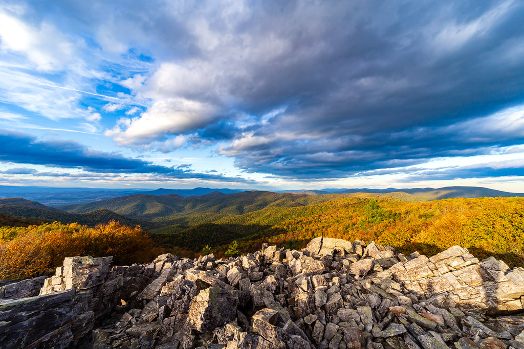
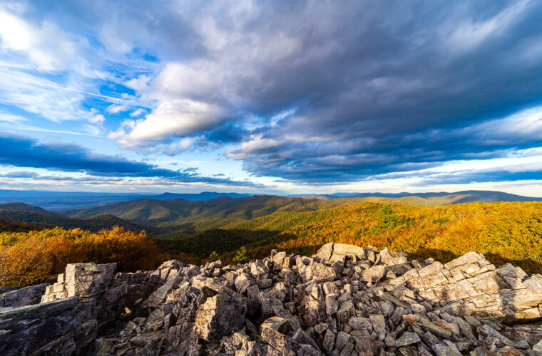
Photo: aparlette via Flickr (CC BY 2.0)
Visiting Shenandoah National Park with limited mobility is practical because many of its broadest Blue Ridge views are visible from roadside overlooks along Skyline Drive. Travelers who cannot manage steep trails can still reach mountain summits by car, watch deer at Big Meadows, examine exposed greenstone, and look across the Shenandoah Valley without leaving paved areas.
The park follows a narrow mountain crest for roughly 105 miles through Virginia. Skyline Drive links four entrances and more than 70 overlooks, but the winding road makes distances deceptive. Driving its full length requires about three hours without stops. For a lower-effort visit, our team recommends choosing one entrance and concentrating on a 20 to 40-mile segment rather than trying to cover the entire park.
How Visiting Shenandoah National Park with Limited Mobility Works
Shenandoah protects nearly 200,000 acres of forest, waterfalls, rocky summits, and former farm country. Elevations range from roughly 550 feet near the park boundary to 4,051 feet on Hawksbill, Virginia’s highest point within the park. That vertical range produces cooler temperatures along Skyline Drive and creates distinct habitats, from oak and hickory forest at lower elevations to wind-exposed mountain vegetation near the highest ridges.
Choose the Entrance Closest to Your Priority
Four entrances divide Skyline Drive into manageable sections. Front Royal provides access to the northern district. Thornton Gap, reached by US 211, enters near mile 31.5 and places visitors close to Marys Rock Tunnel, Pinnacles, and the central highlands. Swift Run Gap at US 33 meets the drive near mile 65.5. Rockfish Gap marks the southern end at mile 105, where Skyline Drive connects with the Blue Ridge Parkway.
| Entrance | Best suited to | Nearby landscape |
|---|---|---|
| Front Royal | Northern overlooks and shorter scenic outings | Shenandoah Valley views, Hogback Mountain |
| Thornton Gap | First visits and central highlights | Marys Rock Tunnel, Stony Man, Skyland |
| Swift Run Gap | Big Meadows and the central to southern corridor | Meadows, forested ridges, east-facing overlooks |
| Rockfish Gap | Southern district drives | Rocky outcrops and Blue Ridge Parkway connection |
Plan Around a Slow Mountain Road
Skyline Drive has a 35 mph speed limit and frequent curves, grades, wildlife crossings, and pullouts. Someone who tires during prolonged sitting may find one district per day more comfortable. Mobile phone coverage is inconsistent, so download maps before entering. Fuel is unavailable along most of the drive, and food, accessible restrooms, and visitor services are concentrated at developed areas rather than overlooks.
Entrance charges, operating facilities, seasonal road closures, and accessibility equipment can change. Confirm current details on the official park site, particularly if you require an accessible restroom, wheelchair-friendly lodging room, or reliably open food service at a specific stop.
Visiting Shenandoah National Park from Skyline Drive
Skyline Drive functions as a high-elevation viewing platform. Numbered mileposts begin at Front Royal and increase southward, making them more reliable than mobile navigation inside the park. Many overlooks have paved parking immediately beside the view, although pavement slopes, curb arrangements, and the distance from an accessible space to the viewing edge vary. A companion can inspect the surface before a wheelchair user transfers or unloads.
Northern Overlooks with Minimal Walking
Range View and Hogback
Range View Overlook near mile 17 looks south along a succession of Blue Ridge summits, including the rounded mass of Stony Man. Hogback Overlook near mile 21 faces west across the Shenandoah Valley toward Massanutten Mountain, a long sandstone ridge running parallel to the Blue Ridge. Hogback has an elongated pullout, which allows several viewing angles without committing to a trail.
Marys Rock Tunnel
Near Thornton Gap, Skyline Drive passes through the 670-foot Marys Rock Tunnel, completed in the 1930s by workers associated with the Civilian Conservation Corps. The tunnel cuts through granodiorite, one of Shenandoah’s ancient basement rocks. Clearance restrictions apply to tall vehicles, but standard passenger vehicles can use it. Nearby overlooks reveal how sharply the Blue Ridge rises above the Virginia Piedmont.
Central District Views Around Skyland and Big Meadows
The central district contains the park’s highest road elevations and its greatest concentration of developed stops. Thorofare Mountain Overlook near mile 40.5 looks east into a deep drainage toward Old Rag, whose exposed granite summit stands apart from the wooded ridges. Crescent Rock Overlook near mile 44 offers a westward view toward Hawksbill and the valley beyond.
At Crescent Rock, the mountain drops away almost immediately beyond the stone wall. The pavement can feel cool even when the valley is warm, and wind moves through the gap with little warning. Below, wooded folds overlap in blue and gray layers. Cars remain close behind you, but the steep open view conveys the scale of the Blue Ridge without requiring a climb over roots or loose rock.
Big Meadows as a Wildlife Stop
Big Meadows lies near mile 51 at roughly 3,500 feet. Its open grassland interrupts the surrounding forest and supports white-tailed deer, wild turkeys, groundhogs, and numerous songbirds. The meadow developed through a combination of shallow soils, past land use, grazing, and modern vegetation management. Wildlife is often easiest to see near dawn and dusk, when fog may also reduce visibility along the road.
- Scan meadow edges from developed pullouts before attempting any path.
- Use binoculars to avoid approaching deer or black bears.
- Remain on firm surfaces because meadow soil becomes soft after rain.
- Allow extra braking distance when driving at dawn or after sunset.
Accessible Views and Trails When Visiting Shenandoah National Park
Most Shenandoah trails were built across steep terrain and contain rocks, roots, water bars, and sustained grades. Popular routes such as Dark Hollow Falls, Hawksbill Summit, and Stony Man should not be assumed accessible because their distances appear short. Limberlost Trail is the park’s principal purpose-designed option for visitors using wheelchairs or other mobility aids.
Visiting Shenandoah National Park on Limberlost Trail
Limberlost is a roughly 1.3-mile loop near mile 43. Its broad, hardened surface passes through a high-elevation forest of oaks, maples, mountain laurel, and ferns. Bridges and boardwalk sections cross wet ground, while benches provide regular rest points. The loop has gentle changes in elevation compared with surrounding trails, although weather, leaf litter, and surface wear can affect rolling resistance.
The forest here reflects Shenandoah’s history as reclaimed land. American chestnuts once dominated parts of the Blue Ridge before chestnut blight altered the canopy during the early 20th century. Today, fallen trunks, standing snags, and younger hardwoods create habitat for woodpeckers, salamanders, and woodland wildflowers. Spring visitors may find trillium and violets along the margins without leaving the maintained route.
Match the Season to Your Mobility Needs
Conditions at ridge elevation can differ substantially from those in nearby towns. Spring brings wildflowers, rain, fog, and slippery leaf-covered surfaces. Summer provides the longest daylight but also humidity and afternoon thunderstorms. Autumn color commonly progresses from higher elevations toward lower slopes, while traffic and crowded pullouts can complicate transfers. Winter offers clearer long-distance views, but ice, snow, and road closures can eliminate accessible options with little notice.
Use the Southern District for Quieter Roadside Views
South of Swift Run Gap, Skyline Drive passes fewer developed areas and longer stretches of forest. This district suits travelers who prefer an unhurried drive with less competition for overlook parking. The crest gradually lowers toward Rockfish Gap, yet roadside views still reach across the Piedmont, Shenandoah Valley, and watersheds flowing toward the James River. Services are limited, so arrange meals and necessary mobility supplies before beginning this section.
Look East into Brown Mountain Country
Brown Mountain Overlook faces a rugged landscape within the federally designated wilderness of the same name. The slopes below contain traces of former mountain communities, including old homesites, roads, and cemeteries now absorbed by forest. Farther south, Doyles River and Big Run overlooks reveal deeply cut watersheds. These pullouts provide a sense of Shenandoah’s backcountry topography without requiring the steep descents used to reach waterfalls and stream valleys.
Finish with Broad Valley Vistas
Moormans River Overlook looks into the watershed supplying reservoirs near Charlottesville, while Turk Mountain Overlook faces west toward the Shenandoah Valley. Near the southern end, Calf Mountain Overlook opens east toward the Virginia Piedmont. Morning light generally favors west-facing subjects, while late afternoon light adds definition to east-facing ridges behind the viewer. Fog often lingers in hollows after rain, creating partial views even when the crest is clear.
Build an Energy-Conscious Stop Plan
Repeated vehicle transfers can require more effort than the distance traveled suggests. Divide the day into one longer outdoor stop and several pullouts where everyone can remain seated if necessary. Developed areas provide space to regroup, but parking surfaces and routes between buildings vary. When visiting Shenandoah National Park, identify the day’s highest-priority stop before adding optional overlooks.
Compare Stops by Physical Demand
| Stop type | Typical surface | Mobility demand | Best use |
|---|---|---|---|
| Roadside overlook | Pavement, sometimes sloped | Low if viewed from the vehicle | Scenery and photography |
| Visitor center area | Paved routes and building entrances | Low to moderate | Orientation and indoor rest |
| Limberlost Trail | Hardened path, bridges, boardwalk | Moderate over 1.3 miles | Forest immersion |
| Standard hiking trail | Rock, roots, steps, and grades | High | Suitable only after close evaluation |
Dickey Ridge Visitor Center near mile 4.6 and Byrd Visitor Center near Big Meadows can serve as orientation points at opposite ends of a northern or central outing. Exhibits explain Blue Ridge ecology, park creation, and the displacement of families who lived within the present boundary. Indoor stops also offer relief from ridge winds, summer heat, and sudden thunderstorms.
Prepare for Transfers and Surface Changes
Wheelchair users and travelers with balance limitations should carry equipment for both pavement and short uneven transitions. Leaves can conceal drainage channels, and loose gravel often collects at pullout edges. A compact preparation list includes:
- A lap blanket or extra layer for cooler temperatures along the crest.
- Wheel chocks for sloping parking areas.
- Trekking poles or a cane with a tip suited to wet pavement.
- Water and medication kept inside the passenger compartment.
- Binoculars that bring wildlife and distant geology closer without leaving firm ground.
Follow a Compact Central District Itinerary
The central district provides the strongest combination of high elevations, developed stops, wildlife viewing, and an accessible forest route. Entering at Thornton Gap avoids spending much of the day reaching these features. Drivers can move south through Marys Rock Tunnel, stop at selected overlooks near Skyland, and finish around Big Meadows before retracing the route or leaving through Swift Run Gap.
A Two-Hour Roadside Circuit
Begin with the tunnel and an east-facing overlook, then continue to Crescent Rock for a western panorama. Pause near Skyland, the highest developed area along Skyline Drive at approximately 3,680 feet, before proceeding to Big Meadows. This sequence samples exposed rock, forested ridges, and open meadow with little required walking. Limit the plan to three or four stops so transfers do not consume the entire visit.
A Half-Day with Limberlost
Travelers prepared for the full Limberlost loop can place it between Crescent Rock and Big Meadows. Allow time beyond normal walking calculations because benches, wildlife sightings, and bridge transitions naturally slow progress. Afterward, Big Meadows provides a low-effort final stop. If fatigue develops early, substitute a short visit near the Limberlost trailhead and devote the remaining energy to meadow viewing from developed areas.
Plan Your Visit to Shenandoah National Park Around Ability, Not Mileage
Shenandoah’s long, narrow shape rewards selective planning. Choose one entrance, one district, and one meaningful outdoor experience. Skyline Drive then connects accessible mountain scenery without forcing everyone onto steep trails. Northern valley views, the central highlands, and the quieter southern watersheds each support a complete outing on their own.
Limberlost offers the park’s clearest opportunity for sustained movement through the forest, while overlooks provide flexible alternatives when pain, weather, or fatigue changes the plan. By treating transfers, slopes, rest periods, and driving time as part of the itinerary, visitors with limited mobility can experience the Blue Ridge at a comfortable and realistic pace.
Want to keep exploring? Browse all our Shenandoah guides and articles for more trip-planning tips and ideas.
Gear & Essentials
Tell us about your trip and we will add what else you will want:
The basics
Worth having in the car whatever the park.
For this trip
Traveling with kids
Bringing a pet
RVing
Backcountry
Winter conditions
On the water
Photography
Accessibility
As an Amazon Associate we earn from qualifying purchases, at no extra cost to you.