Joshua Tree National Park in Spring: What to Expect and What to Do
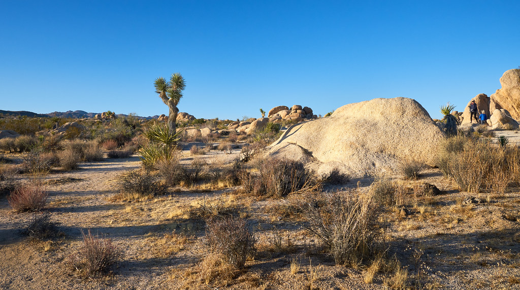
Photo: szeke via Flickr (CC BY-SA 2.0)
Joshua Tree National Park reaches from the low Colorado Desert to 5,814 foot Quail Mountain, so a spring visit can move from warm ocotillo country to cool, windy Mojave highlands in a single day. March and April usually provide the most comfortable hiking weather, while May brings stronger heat, longer daylight, and fewer visitors after the busiest spring weekends.
This guide explains how conditions change across spring, how the season compares with the rest of the year, and how crowds affect parking, camping, and trail choices. It also covers the practical differences between the park’s northern and southern landscapes, which matter when choosing hikes and estimating water needs.
Why Spring Is an Ideal Time to Visit Joshua Tree National Park
Two deserts create different spring conditions
The higher western half of Joshua Tree National Park belongs to the Mojave Desert. Joshua trees, pinyon pines, junipers, and immense monzogranite formations dominate areas around Hidden Valley, Jumbo Rocks, Keys View, and Black Rock. Much of this popular corridor sits between roughly 4,000 and 5,000 feet, keeping it considerably cooler than the park’s southern entrances and low basins.
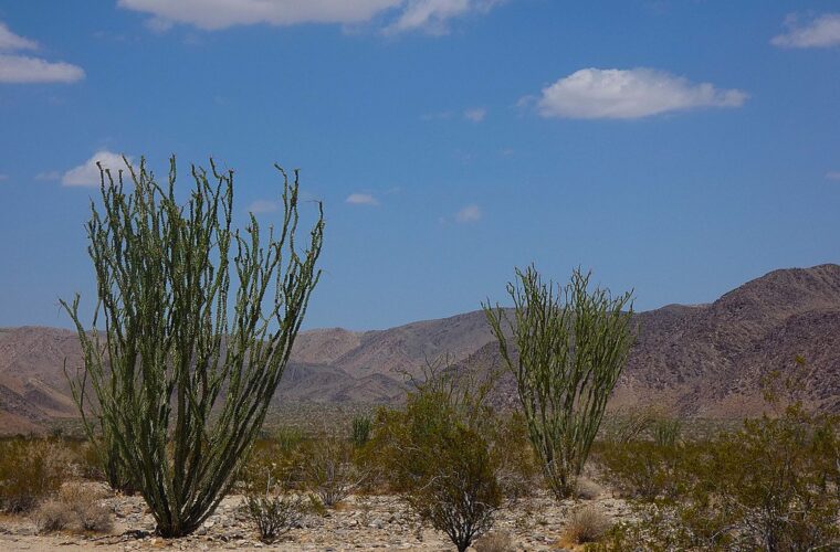
The eastern side descends into the Colorado Desert, where creosote bush, cholla, palo verde, and ocotillo replace Joshua tree woodland. Cottonwood Spring is about 3,000 feet above sea level, while the southeastern boundary falls below 1,000 feet. A pleasant afternoon near Keys View can therefore coincide with uncomfortable heat along Pinto Basin Road. Plan clothing and water for the lowest elevation on the day’s route.
What spring weather feels like
March and early April
March commonly brings mild afternoons, cold nights, and powerful wind fronts. Temperatures around the principal Mojave Desert trailheads often rise into the 60s or 70s Fahrenheit, but exposed ridges can feel much colder. Overnight frost remains possible at Black Rock and other higher sites. Rainfall is limited, although passing storms can make granite slabs slick and temporarily fill normally dry washes.
Late April and May
By late April, midday heat becomes a larger factor below the Mojave uplands. May afternoons can climb into the 90s in Pinto Basin and near the southern entrance, even when mornings around Hidden Valley remain suitable for hiking. Start exposed routes early, reserve shaded rock formations for midday, and avoid treating a comfortable parking lot temperature as evidence that lower trails will be equally cool.
Wildflowers depend on winter rainfall
Spring bloom timing varies sharply because germination depends on well spaced winter rain, soil temperature, elevation, and the absence of damaging wind. Lower Colorado Desert flowers may appear first, followed later by blooms around Joshua tree woodland. Desert dandelion, sand verbena, phacelia, lupine, brittlebush, and chuparosa are among the species visitors may encounter. Joshua trees can produce creamy flower clusters, but flowering is irregular and never guaranteed.
Stay on established paths when photographing blooms. Desert soil often carries biological crusts made from cyanobacteria, lichens, fungi, and mosses. A single footprint can damage this living surface, increasing erosion and disturbing a community that may take decades to recover.
What to Expect in Joshua Tree National Park Throughout Spring
March brings cool hiking and peak demand
March is usually the strongest choice for longer exposed hikes. The 6.5 mile Lost Horse Mine loop crosses open slopes with limited shade, while the 3 mile Ryan Mountain trail climbs roughly 1,000 feet to a 5,456 foot summit. Both become significantly harder as spring advances. Cold mornings favor sustained climbs, but gusty conditions can make summits and open saddles uncomfortable.
Spring break periods bring heavy traffic to Hidden Valley, Barker Dam, Keys View, and Skull Rock. Arriving early has practical value beyond finding a parking space. It reduces time spent driving behind slow traffic, allows hikers to use the coolest part of the day, and creates more flexibility if a preferred lot is already full.
April balances temperature and daylight
April generally offers the best compromise for visitors combining hiking, climbing, photography, and night sky viewing. The 1 mile Hidden Valley loop introduces the park’s enclosed rock landscape, while the 1.7 mile Skull Rock nature trail explores weathered granite beside Park Boulevard. Barker Dam’s 1.1 mile loop combines cultural history, boulder formations, and occasional surface water, although the reservoir can be dry.
At Jumbo Rocks, coarse sand shifts underfoot between rounded monzogranite walls. Sunlit rock radiates warmth while narrow passages hold cool air, and voices from nearby groups disappear quickly behind the boulders. Climbing a short rise opens a view across tilted slabs, scattered Joshua trees, and distant brown ridges, revealing how much larger the landscape is than it appears from Park Boulevard.
May rewards early starts
May suits travelers who prefer lighter crowds and can organize activities around heat. Begin hikes near sunrise, choose higher terrain in the Mojave zone, and use the hottest hours for scenic driving or brief roadside walks. Ryan Mountain, Lost Horse Mine, and the exposed approach to Fortynine Palms Oasis demand more conservative turnaround decisions once temperatures rise.
- Carry at least one gallon of water per person per day, with additional water for strenuous routes.
- Pack a brimmed hat, sunscreen, sunglasses, and a wind layer.
- Download maps before entering because mobile coverage is unreliable.
- Keep water, electronics, and medications out of a hot parked vehicle.
- Check footwear for cactus joints before getting back into the car.
Spring compared with the other seasons
| Season | Typical conditions | Crowd pattern | Access considerations | Best suited to |
|---|---|---|---|---|
| Spring | Mild to warm days, cold nights early in the season, increasing heat by May | Very busy on weekends and during school breaks | Main roads generally accessible, popular parking areas fill early | Hiking, climbing, wildflower searches, camping, photography |
| Summer | Extreme daytime heat, especially in the Colorado Desert | Lightest visitation | Long hikes become hazardous, heat can limit campground use | Short sunrise outings and carefully planned night sky visits |
| Autumn | Heat eases gradually, with cooler nights at higher elevations | Moderate, increasing on pleasant weekends | Good road access, fewer seasonal heat constraints by late autumn | Climbing, hiking, camping |
| Winter | Cool days, freezing nights, occasional snow at higher elevations | Moderate, with holiday surges | Ice or snow can briefly affect elevated roads and trails | Long hikes, clear views, cooler camping |
Spring Crowds, Roads, and Reservations in Joshua Tree National Park
Where congestion changes the experience
The heaviest pressure falls along Park Boulevard between the West Entrance, Hidden Valley, Jumbo Rocks, and the North Entrance. West Entrance lines can grow long on busy mornings because it receives traffic from communities west of the park. Visitors approaching from the east may find the North Entrance more efficient, depending on their route and lodging location.
Full trailhead lots can force a change of plans because roadside parking is restricted where it would damage vegetation or obstruct traffic. Build a sequence of alternatives instead of waiting near one lot. Hidden Valley can be paired with Barker Dam or Cap Rock, while Keys View is easier to substitute with a lower elevation walk if clouds or wind obscure its panorama.
Road and trail access
Park Boulevard and Pinto Basin Road form the main paved route through the park. The drive between the West Entrance and Cottonwood commonly takes about 90 minutes without stops, and scenic pullouts can easily turn it into a half day. Unpaved routes such as Geology Tour Road require closer attention to vehicle suitability, recent rain, sand, and wash conditions.
Flash flooding can damage dirt roads even when the sky overhead appears clear. Never enter a signed closed road or drive into moving water. Trail access may also change to protect wildlife, address storm damage, or support emergency operations, so check conditions before committing to a remote route.
Campgrounds and permit planning
Developed campgrounds near the central rock formations are especially desirable in March and April because they reduce morning driving and place visitors close to climbing areas and short trails. Reservable sites can fill months ahead for weekends, while any first come options require flexibility. Backcountry camping involves separate registration or permit procedures, and group activities may need additional authorization.
Joshua Tree has generally operated without a timed entry reservation, but entrance policies, campground booking windows, fees, fire rules, and backcountry procedures can change. Confirm current details on the official park site before booking transportation or lodging.
How to Plan a Spring Day in Joshua Tree National Park
A productive day uses the cool morning for sustained walking, then shifts to shorter trails or overlooks as temperatures rise. Park destinations are spread widely, and crossing between distant trailheads consumes more time than the mileage suggests. Group stops by landscape rather than trying to collect every landmark in one circuit. Carry lunch and a full water supply from the start because dependable food and water services are unavailable inside the park.
Keep a Mojave day geographically compact
For a hiking focused day, begin with the 3 mile Willow Hole route from the Boy Scout Trail area or the 4 mile West Side Loop from Black Rock. Both explore higher Joshua tree woodland without requiring a drive into Pinto Basin. Afterward, use shorter stops such as Cap Rock or Keys View. The latter overlooks the Coachella Valley and San Andreas Fault from an elevation of 5,185 feet, although haze can reduce distant visibility.
Allow a full day for Pinto Basin
Pinto Basin Road reveals the park’s transition from Mojave vegetation to lower Colorado Desert habitat. The Cholla Cactus Garden lies about 20 miles south of the Park Boulevard junction, followed farther south by Ocotillo Patch and Cottonwood Spring. Walk only on established paths around cholla. Loose segments can attach to shoes, skin, and clothing with little contact. Pack tweezers or a small comb so cactus joints can be removed without using bare fingers.
Choose the Spring Window That Matches Your Priorities
Calendar dates alone cannot guarantee comfortable weather, flowers, or quiet trails. Elevation and time of day matter as much as the month. Travelers restricted to midday sightseeing have a narrower comfort window than hikers willing to begin near sunrise. Use the following comparison to identify the period that best fits the central purpose of the trip.
A practical spring decision table
| Priority | Best spring window | Strong choices | Main tradeoff |
|---|---|---|---|
| Long exposed hikes | Early to mid March | Boy Scout Trail, Lost Horse Mine, Ryan Mountain | Cold mornings and strong wind are possible |
| Mixed hiking and climbing | Late March through April | Hidden Valley, Quail Springs, Hall of Horrors | Parking and campsites face the greatest demand |
| Wildflower searching | Varies by rainfall and elevation | Cottonwood area, Pinto Basin, higher Mojave slopes later | Bloom timing and abundance are unpredictable |
| Lower crowd levels | Weekdays in May | Higher elevation trails and sunrise walks | Heat sharply limits low desert activity |
| Night sky viewing | Moonless spring nights | Pullouts away from entrance traffic and developed areas | Wind and cold can persist after warm afternoons |
Match the plan to the length of your stay
With one day, choose either the central Mojave corridor or the Pinto Basin drive rather than combining both at a rushed pace. Two days allow one longer hike plus a separate cross park drive. A third day creates room for weather changes, climbing instruction, or a quieter route such as the Panorama Loop at Black Rock, an approximately 6.5 mile circuit with broad views toward surrounding ranges.
Prepare for Desert Hazards and Fragile Habitat
Spring’s moderate temperatures can disguise how quickly dehydration develops in dry air. Sweat evaporates before it feels heavy, and wind increases fluid loss while making the body feel cooler. Turn around before half the water supply is gone, particularly on routes without shade. Leave a route plan with someone outside the hiking party, and record the vehicle location offline before entering a wash or boulder field.
Separate heat planning from navigation
Many routes cross open granite, sandy washes, or junctions marked by low posts that become difficult to see in glare. A downloaded topographic map provides better protection than relying on mobile service. For each outing, check these essentials before leaving the pavement:
- Water allocated for the route, return drive, and an unexpected delay
- A paper or offline map showing junctions and elevation change
- A headlamp, even for a hike planned to finish before sunset
- Salty food or electrolytes for sustained exertion
- Layers suited to both exposed wind and rapid cooling after dark
Give wildlife and climbing areas room
Desert tortoises, bighorn sheep, rattlesnakes, jackrabbits, and coyotes occupy the park, although sightings are never assured. Never handle a tortoise unless directed during an immediate roadway emergency because stress can cause it to release stored bladder water. Climbers should also watch for seasonal wildlife closures and avoid disturbing nesting raptors. Granite surfaces can become slick after rain, while moisture weakens surrounding desert soils and damages access paths.
Make the Most of Spring Conditions in Joshua Tree National Park
Joshua Tree National Park rewards plans built around elevation, daylight, and realistic driving time. March favors demanding hikes, April supports the broadest mix of activities, and May works best for early starts and higher terrain. Choosing one geographic cluster each day reduces time in traffic and leaves enough flexibility to respond to wind, heat, full parking areas, or limited visibility.
Reserve scarce lodging or camping early, carry every essential into the park, and prepare alternate trailheads before arrival. A spring trip planned this way can include cool morning hiking, close study of the Mojave and Colorado deserts, and an evening beneath dark skies without forcing the day beyond safe limits.
Want to keep exploring? Browse all our Joshua Tree guides and articles for more trip-planning tips and ideas.
Gear & Essentials
Tell us about your trip and we will add what else you will want:
The basics
Worth having in the car whatever the park.
For this trip
Traveling with kids
Bringing a pet
RVing
Backcountry
Winter conditions
On the water
Photography
Accessibility
As an Amazon Associate we earn from qualifying purchases, at no extra cost to you.